Na vodici, Šilo (Krk) Beach, Croatia
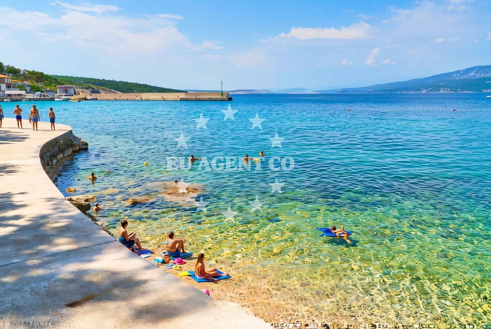
About this beach
Na vodici, Šilo (Krk)
Beach: Na vodici
Location: Šilo (Krk)
Characteristics and facilities
Concrete / stone slabs
280 m
Restaurant / snack bar
Caffe bar / Drinks stand
Natural shade
Beach character
The beach’s surface consists of concrete and stone slabs, a characteristic that reflects its utilitarian design. This type of shoreline is uncommon in Croatia’s more tourist-focused areas, suggesting Na vodici may serve a local or transient purpose rather than a recreational one. The beach’s length of 280 meters is modest, and its features are limited to the listed facilities. Natural shade is available, likely provided by nearby vegetation or structures, though the exact source is not specified in the catalog.Swimming and shore
Swimming conditions at Na vodici are not explicitly described in the catalog, but the Adriatic Sea’s general characteristics apply here. The surrounding waters of Krk are typically clear and warm during the summer months, though the beach’s concrete/stone surface may affect the swimming experience. The shore is short and lacks sandy areas, which could make it less ideal for families with young children but suitable for those seeking a straightforward access point to the sea.Facilities and activities
Facilities at Na vodici are minimal but functional. A restaurant and snack bar are present, offering basic sustenance options for visitors. A drinks stand and cafe bar provide additional refreshments, though the catalog does not specify whether these operate seasonally or year-round. There are no explicit mentions of showers, restrooms, or parking, which aligns with the beach’s low-key profile. Activities are not listed in the catalog, but the presence of a restaurant and bar suggests it may cater to short stays or passing visitors.Access and location
Na vodici Beach is situated in Šilo, a village on the island of Krk. Krk itself is a popular destination in the Adriatic, known for its historic sites, vineyards, and proximity to the mainland. The beach’s coordinates (45.146944, 14.665778) place it along the northern coast of Krk, an area that includes several marinas and anchorages. While the catalog does not specify road access or parking details, Šilo’s location on Krk means visitors can reach the beach via the island’s road network, which connects to the mainland through a bridge.What to expect
Expect a straightforward shoreline at Na vodici Beach, with a concrete/stone surface and a short length of 280 meters. The beach is equipped with a restaurant, snack bar, and drinks stand, making it a practical option for visitors who prioritize basic amenities over luxury. Natural shade is available, though the beach lacks additional features such as umbrellas, loungers, or recreational equipment. The area is likely to be less crowded than more developed beaches on Krk, reflecting its utilitarian nature.Practical tips
Bring a towel and water shoes, as the concrete/stone surface may be uncomfortable for prolonged sunbathing. The restaurant and cafe are ideal for quick meals or drinks, but plan accordingly if you require more extensive dining options. The beach’s proximity to Šilo’s road network makes it accessible for those exploring Krk’s northern coast.Exploring the coast by yacht
For yacht charter guests, Na vodici Beach lies within the sailing area of Krk, an island renowned for its scenic routes and historic ports. The nearby town of Krk (not to be confused with the island) has a marina that serves as a common base for Adriatic charters. Euro-Agent’s yacht search page can help locate motor yachts or sailboats operating in this region, with bases in nearby marinas such as those in Krk town or the mainland’s Rijeka. The beach’s location offers a convenient landing point for sailors exploring the northern Adriatic, though it is not marked as an anchorage or formal docking site.Regional Context: Krk Island and the Adriatic
Krk is one of the largest islands in the Adriatic, with a mix of natural beauty and cultural heritage. The island’s northern coast, where Na vodici is located, is less developed than the southern areas, which include the town of Krk and its marina. The region is part of the Kvarner Gulf, a sailing hotspot with routes to islands like Cres, Lošinj, and Rab. Yacht charter guests may find Na vodici useful as a reference point for navigating these waters, though it is not a primary anchorage.Anchorages in the surrounding area
- Anchorage — silo — krk — 0.4 NM from beach
- Anchorage — krk — 1.2 NM from beach
- Anchorage — krk — 1.5 NM from beach
- Anchorage — risika — krk — 2.5 NM from beach
- Klimno — krk — 2.6 NM from beach
- Anchorage — krk — 2.7 NM from beach
- Anchorage — dramalj — 2.7 NM from beach
- Anchorage — krk — 2.8 NM from beach
Distances are straight-line geographic distances, not sailing routes.
Mooring buoys in the surrounding area
Mooring buoys in Crikvenica and Selce, close to Šilo Beach on Krk.
- Buoy field — crikvenica — 1.8 NM from beach
- Jetty — selce — 2.2 NM from beach
- Buoy field — selce — 2.3 NM from beach
- Jetty — selce — 2.3 NM from beach
- Buoy field — selce — 2.3 NM from beach
Distances are straight-line geographic distances, not sailing routes.
Marine fuel stations
- Fuel station — crikvenica — 1.8 NM from beach
- INA — novi vinodolski — 5.3 NM from beach
- Flash — krk — 8.4 NM from beach
- Ina — krk — 8.4 NM from beach
Distances are straight-line geographic distances, not sailing routes.
Harbours in the surrounding area
- Šilo — silo — krk — 0.1 NM from beach
- Crikvenica — 1.8 NM from beach
- Klimno — krk — 2.0 NM from beach
- Podvorska — crikvenica — 2.2 NM from beach
- Selce — 2.3 NM from beach
- Čižići — cizici — krk — 2.9 NM from beach
Distances are straight-line geographic distances, not sailing routes.
Marinas in the surrounding area
Marinas in Šilo and Novi Vinodolski, situated near Šilo Beach on Krk.
- Šilo — silo — krk — 0.2 NM from beach
- Marina Novi — novi vinodolski — 5.3 NM from beach
- Omišalj Docks — omisalj — krk — 6.1 NM from beach
- Mitan Marina — novi vinodolski — 6.2 NM from beach
- Marina Punat — krk — 7.2 NM from beach
Distances are straight-line geographic distances, not sailing routes.
Restaurants near the beach
Restaurants in Silo and Crikvenica, providing dining options close to Na vodici Beach.
- Restaurant — silo — krk — 0.1 NM from beach
- Restaurant — silo — krk — 0.1 NM from beach
- Restaurant — silo — krk — 0.1 NM from beach
- Tamaris — crikvenica — 1.9 NM from beach
- Restaurant — crikvenica — 1.9 NM from beach
- Oleander — klimno — krk — 2.0 NM from beach
- Val — klimno — krk — 2.0 NM from beach
Distances are straight-line geographic distances, not sailing routes.
Navigation guides for the surrounding area
Navigation guides for areas around Šilo, including Uvala Stipanja and Crikvenica.
- Uvala Stipanja {Silo) — 0.4 NM from beach
- Crikvenica — 1.9 NM from beach
- Se Ice — 2.5 NM from beach
- Uvala Sv. Marak — 2.5 NM from beach
- Uvala Siana — 2.6 NM from beach
Distances are straight-line geographic distances, not sailing routes.
Yachts from nearby departure bases
Yachts departing from Crikvenica and Vinodolski Novi Marina, offering access to Šilo Beach.
Sailing yachts
- Hanse 458 (DELTA) — Vinodolski Novi Marina — 5.3 NM from departure base to beach
- Hanse 418 (NIKE) — Vinodolski Novi Marina — 5.3 NM from departure base to beach
- Bavaria C38 (Valhalla) — Vinodolski Novi Marina — 5.3 NM from departure base to beach
- Elan 40 Impression (VALHALLA) — Vinodolski Novi Marina — 5.3 NM from departure base to beach
Catamarans
- Lagoon 380 (Queen Mia) — Vinodolski Novi Marina — 5.3 NM from departure base to beach
- Lagoon 40 (Paco) — Vinodolski Novi Marina — 5.3 NM from departure base to beach
- Aventura 34 (Marlon) — Vinodolski Novi Marina — 5.3 NM from departure base to beach
Motor boats
- Barracuda 590 (Barracuda 12) — Crikvenica City Port — 1.9 NM from departure base to beach
- Barracuda 590 (Solta) — Crikvenica City Port — 1.9 NM from departure base to beach
- Adriana 36 (Gaja) — Vinodolski Novi Marina — 5.3 NM from departure base to beach
Distances are straight-line geographic distances, not sailing routes.