Mutogras 3, Podstrana - Mutogras Beach, Croatia
About this beach
Mutogras 3, Podstrana - Mutogras
Beach: Mutogras 3
Location: Podstrana - Mutogras
Characteristics and facilities
Gravel, concrete / stone slabs
200 m
Beach character
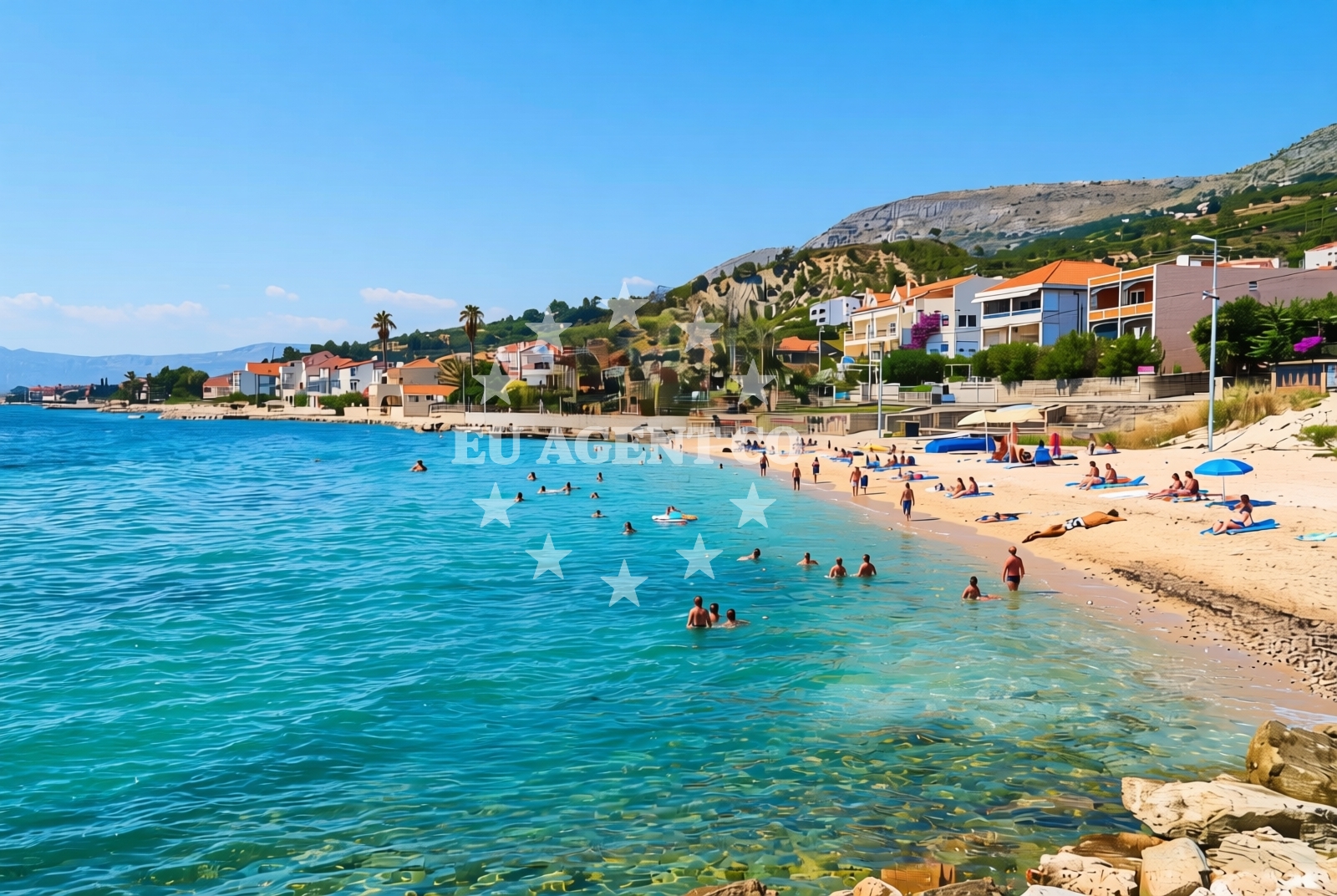
The beach's surface consists of gravel and concrete/stone slabs, a feature that reflects its utilitarian design. This makes it more suitable for brief stops or access rather than extended relaxation. The beach's modest length—approximately 200 meters—means it lacks the expansive appeal of larger coastal stretches in the region. However, its location in Podstrana, a village known for its proximity to the Split archipelago, positions it as a potential waypoint for those navigating the area by boat or road.Swimming and shore
Swimming conditions at Mutogras 3 are not specifically detailed in available records, but the Adriatic Sea's general characteristics apply here. The shoreline's rocky and gravelly nature suggests limited direct access to the water for swimming, though the surrounding coastline in Podstrana offers more conventional beaches for aquatic activities. The beach itself appears to serve more as a transitional or access point rather than a primary recreational shoreline.Facilities and activities
No specific facilities are documented for Mutogras 3. The absence of structured amenities aligns with its description as a short, utilitarian stretch of coastline. Activities are not explicitly listed, but the beach's location in Podstrana—a village with connections to the Split-Dalmatia region—suggests that nearby towns may offer additional recreational opportunities, from hiking to cultural sites.Access and location
Mutogras 3 is located in Podstrana, a coastal village on the island of Brač, part of Split-Dalmatia County. The beach's coordinates (43.466315, 16.578664) place it along the southern Adriatic coast, near the popular tourist destinations of Hvar and Split. Access is likely via local roads connecting to Podstrana, which itself is reachable by ferry from Split or by road from the mainland. The beach's proximity to the Split archipelago makes it a potentially useful reference point for sailors navigating the region.What to expect
Expect a short, gravel-and-concrete-slab shoreline at Mutogras 3, suitable for brief stops rather than extended beach days. The beach's practical design suggests it may serve as an access point for nearby areas rather than a primary recreational site. Its location in Podstrana, near the Split archipelago, means it could be useful for visitors exploring the region by car or yacht, though it lacks the amenities of more developed coastal spots.Practical tips
Given the beach's gravel and concrete surfaces, consider bringing appropriate footwear for walking. While no facilities are documented here, Podstrana itself offers basic amenities for visitors. Those arriving by yacht may find the beach's position along the Dalmatian coast useful for orientation, though it is not a designated anchorage or marina.Exploring the coast by yacht
For yacht charter guests, Mutogras 3's location in Podstrana provides a reference point along the southern Adriatic coast. The Split-Dalmatia region is a popular sailing area, with routes connecting to Hvar, Vis, and the mainland. While the beach itself is not a marina or anchorage, nearby ports in Podstrana and Split offer docking options for motor yachts and sailboats. Charterers navigating the area may use Mutogras 3 as a visual marker when approaching the coast.Regional Context
Podstrana, where Mutogras 3 is located, is part of the island of Brač, known for its limestone landscapes and connection to the famous Stonči Beach. The village serves as a gateway to the Split archipelago, with ferry routes linking to Hvar and the mainland. The surrounding coastline features a mix of pebble beaches, cliffs, and bays, reflecting the Adriatic's diverse geography.Anchorages in the surrounding area
Anchorages in Brac and near Split offer nearby mooring options.
- Anchorage — supetar — brac — 5.2 NM from beach
- Anchorage — splitska — brac — 5.3 NM from beach
- Anchorage — postira — brac — 5.7 NM from beach
- Anchorage — split — 6.7 NM from beach
- Anchorage — postira — brac — 6.9 NM from beach
- Uvala Likva — sutivan — brac — 6.9 NM from beach
- Konopjikova — postira — brac — 7.5 NM from beach
- Stipanska — brac — 8.1 NM from beach
Distances are straight-line geographic distances, not sailing routes.
Mooring buoys in the surrounding area
- Jetty — podstrana — 0.6 NM from beach
- Promenade — split — 6.9 NM from beach
- Quay — postira — brac — 7.5 NM from beach
- Nautical Anchorage Bobovišća — bobovisce — brac — 8.5 NM from beach
- Nautical Anchorage Bobovišća — bobovisce — brac — 8.6 NM from beach
Distances are straight-line geographic distances, not sailing routes.
Marine fuel stations
Fuel stations in Split and surrounding regions ensure refueling options for vessels.
- Ina — split — 6.8 NM from beach
- Ina — split — 7.2 NM from beach
- Flash — kastel gomilica — 8.9 NM from beach
- Ina — milna brac — 10.2 NM from beach
Distances are straight-line geographic distances, not sailing routes.
Harbours in the surrounding area
- Krilo — jesenice — 1.0 NM from beach
- Sumpetar — dugi rat — 2.3 NM from beach
- Clubharbour Podstrana — 2.9 NM from beach
- Dugi Rat — 3.0 NM from beach
- Stobreč — stobrec — 3.1 NM from beach
- Supetar — brac — 5.0 NM from beach
Distances are straight-line geographic distances, not sailing routes.
Marinas in the surrounding area
- Marina Lav — podstrana — 2.3 NM from beach
- ACI Marina Split — 6.8 NM from beach
- Marina Kaštela — marina kastela — kastel gomilica — 9.1 NM from beach
- ACI Marina Milna — milna brac — 10.2 NM from beach
- Marina Vlaška — milna brac — 10.2 NM from beach
Distances are straight-line geographic distances, not sailing routes.
Restaurants near the beach
Restaurants in Podstrana and Supetar offer dining options near the beach.
- Leonis — podstrana — 2.3 NM from beach
- Skampino — podstrana — 2.4 NM from beach
- Fabio — podstrana — 2.5 NM from beach
- Mala Kate — supetar — brac — 5.0 NM from beach
Distances are straight-line geographic distances, not sailing routes.
Navigation guides for the surrounding area
Navigation guides in Dugi Rat and surrounding areas assist with local sailing routes.
- Kairos — 2.3 NM from beach
- Dugi Rat (Uvala Orisac) — 3.2 NM from beach
- Pomorsko Sportsko Drustvo (PSD) Zenta (Uvala Zenta) — 5.4 NM from beach
- Omis — 5.5 NM from beach
- Uvala Spliska (Splitska) — 5.5 NM from beach
Distances are straight-line geographic distances, not sailing routes.
Yachts from nearby departure bases
Yachts departing from Dugi Rat and Sumpetar provide access to the beach area.
Sailing yachts
- Jeanneau 53 (Win Win) — Podstrana Marina Lav — 2.3 NM from departure base to beach
Catamarans
- Lagoon 450 Fly (Falco) — Sumpetar Port — 2.2 NM from departure base to beach
Motor yachts
- Ferretti 450 (Lady Esmeralda) — Podstrana Marina Lav — 2.3 NM from departure base to beach
- Azimut 55 (Amparito IV) — Podstrana Marina Lav — 2.3 NM from departure base to beach
- Prestige 590 Fly — Podstrana Marina Lav — 2.3 NM from departure base to beach
Gulets / Cruisers
- Gulet cruiser (AGORA) — Dugi Rat Luka Krilo — 1.0 NM from departure base to beach
- Gulet (Cataleya) — Sumpetar Port — 2.2 NM from departure base to beach
- Gulet (Altair) — Sumpetar Port — 2.2 NM from departure base to beach
Motor boats
- Libeccio 13.5 (no Name) — Podstrana Marina Lav — 2.3 NM from departure base to beach
- Princess 42 (Touche) — Podstrana Marina Lav — 2.3 NM from departure base to beach
Distances are straight-line geographic distances, not sailing routes.