Mudri Dolac, Vrbanj (Hvar) Beach, Croatia
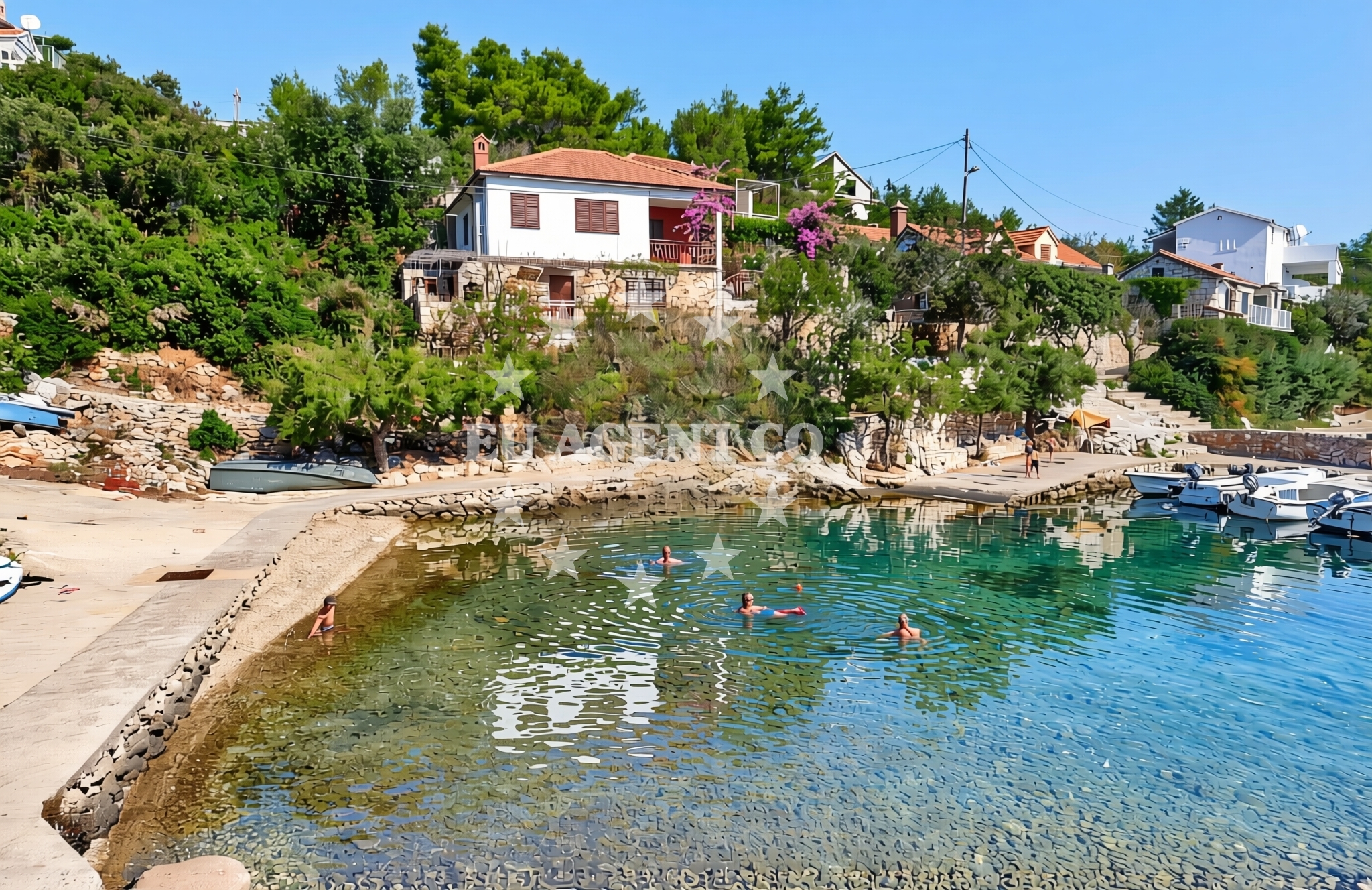
Mudri Dolac Beach lies along the eastern coast of the island of Hvar, near the village of Vrbanj. This shoreline is characterized by its gravel and stone slabs, forming a rugged yet accessible stretch of coast. While not a typical sandy beach, its natural composition offers a unique setting for those seeking a more rugged coastal experience. The beach's proximity to Hvar Town, a historic and vibrant hub, makes it a convenient stop for visitors exploring the island's cultural and natural highlights.
About this beach
Mudri Dolac, Vrbanj (Hvar)
Beach: Mudri Dolac
Location: Vrbanj (Hvar)
Characteristics and facilities
Gravel, concrete / stone slabs
Beach character
The beach's surface consists primarily of gravel and concrete/stone slabs, creating a firm and uneven terrain. This makes it more suitable for walking or short explorations than for sunbathing or prolonged relaxation. The rocky nature of the shoreline suggests that swimming may be limited to certain areas, though no specific details about water conditions are available in the catalog. The beach's simplicity reflects its role as a natural coastal feature rather than a developed tourist destination.
Swimming and shore
While the beach's gravelly and rocky composition may limit swimming opportunities, the surrounding waters of Hvar are known for their clarity and mild temperatures during the summer months. The shore itself offers minimal amenities, with no structures or facilities listed in the authoritative data. Visitors should expect a raw, unaltered coastal environment, ideal for those seeking a quiet interlude away from more crowded beaches.
Facilities and activities
No specific facilities are documented for Mudri Dolac Beach itself. However, the nearby village of Vrbanj and the larger town of Hvar offer a range of services, including restaurants, shops, and marinas. These can be accessed via local roads or by boat, depending on the visitor's mode of arrival. The beach's immediate surroundings appear to be focused on natural coastal access rather than recreational amenities.
Access and location
Located in the village of Vrbanj on the island of Hvar, the beach is part of a broader coastal network that connects to Hvar Town and other nearby settlements. The area is accessible by road, with Vrbanj lying approximately 12 kilometers northeast of Hvar's main town. The beach's coordinates (43.201618° N, 16.661681° E) place it in a region known for its scenic routes and historical significance, including the nearby ancient Roman site of Stari Grad.
What to expect
Visitors to Mudri Dolac Beach should prepare for a rugged, unspoiled shoreline composed of gravel and stone. The beach lacks developed facilities, making it more suited for casual exploration than for extended stays. Its location near Vrbanj and Hvar Town offers the potential for combining a visit with cultural or culinary experiences in these areas. The beach's appeal lies in its natural character, providing a contrast to the more polished tourist beaches of the region.
Practical tips
Given the beach's gravelly terrain, sturdy footwear is recommended for walking along the shore. Visitors should be mindful of the lack of amenities and plan accordingly. Those interested in swimming should check local conditions before entering the water, as the beach's rocky nature may affect access to the sea.
Exploring the coast by yacht
The island of Hvar is a popular destination for yacht charter guests, with its clear waters, scenic coastlines, and proximity to other Dalmatian islands. While Mudri Dolac Beach itself is not a marina or anchorage, the surrounding area offers opportunities for sailors to explore nearby bays and coves. Yacht charter guests may find the region appealing for its combination of natural beauty and cultural landmarks, including Hvar Town's historic harbor and the Stari Grad Plain, a UNESCO World Heritage Site.
Hvar's Cultural and Nautical Significance
The island of Hvar, where Mudri Dolac Beach is located, has a rich history dating back to ancient times. It was a key center of Greek and Roman influence, and its medieval town of Hvar is renowned for its well-preserved architecture and vibrant cultural scene. For yacht charter guests, the island's position in the Adriatic makes it a strategic base for exploring the region's islands, including Brac, Vis, and the Pelješac Peninsula. The local maritime traditions and festivals, such as the Hvar Summer Festival, further enhance the island's appeal to visitors seeking both relaxation and cultural immersion.
Anchorages in the surrounding area
Anchorages in the surrounding area include Uvala Basina and several others near Vrbanj and Hvar.
- Uvala Basina — vrbanj — hvar — 0.2 NM from beach
- Anchorage — hvar — 0.7 NM from beach
- Anchorage — hvar — 0.8 NM from beach
- Anchorage — vrboska — hvar — 0.9 NM from beach
- Anchorage — hvar — 1.2 NM from beach
- Anchorage — hvar — 1.5 NM from beach
- Anchorage — hvar — 1.8 NM from beach
- Anchorage — vrboska — hvar — 1.8 NM from beach
Distances are straight-line geographic distances, not sailing routes.
Mooring buoys in the surrounding area
Mooring buoys in the surrounding area feature a jetty in Vrbanj and buoy fields in Stari Grad and Bol.
- Jetty — vrbanj — hvar — 0.0 NM from beach
- Jetty — vrbanj — hvar — 0.1 NM from beach
- Quay — hvar — 1.5 NM from beach
- Buoy field — stari grad — hvar — 3.1 NM from beach
- Buoy field — bol — brac — 3.5 NM from beach
Distances are straight-line geographic distances, not sailing routes.
Marine fuel stations
- Ina — vrboska — hvar — 1.4 NM from beach
- Fuel station — bol — brac — 3.5 NM from beach
- Fuel station — hvar — 9.8 NM from beach
- Fuel station — sumartin — brac — 10.2 NM from beach
Distances are straight-line geographic distances, not sailing routes.
Harbours in the surrounding area
- Vrboska — hvar — 1.3 NM from beach
- Port Jelsa — hvar — 2.8 NM from beach
- Stari Grad — hvar — 3.2 NM from beach
- Bol — brac — 3.6 NM from beach
- Marina Bilo Idro — sveta nedjelja — hvar — 5.2 NM from beach
- Pučišća harbour — pucisca — brac — 9.3 NM from beach
Distances are straight-line geographic distances, not sailing routes.
Marinas in the surrounding area
- ACI Marina Vrboska — hvar — 1.5 NM from beach
- ACI Marina Palmižana — aci marina palmizana — st klement — 12.0 NM from beach
- ACI Marina Milna — milna brac — 12.0 NM from beach
- Marina Milna Kanarija — milna brac — 12.1 NM from beach
- Marina Vlaška — milna brac — 12.4 NM from beach
Distances are straight-line geographic distances, not sailing routes.
Restaurants near the beach
Restaurants near the beach are clustered in Vrboska, with one additional option in Jelsa.
- Tavern Lavcevic — vrboska — hvar — 1.2 NM from beach
- Konoba Lem — vrboska — hvar — 1.2 NM from beach
- Restaurant Pizzeria Skojic — vrboska — hvar — 1.3 NM from beach
- Trica Gardelin — vrboska — hvar — 1.3 NM from beach
- Bonaca — vrboska — hvar — 1.5 NM from beach
- Restoran Luka — vrboska — hvar — 1.5 NM from beach
- Restaurant Murvica — jelsa — hvar — 2.7 NM from beach
Distances are straight-line geographic distances, not sailing routes.
Navigation guides for the surrounding area
Navigation guides for the surrounding area cover locations such as Uvala Basina, Vrboska, and Jelsa.
- Uvala Basina — 0.4 NM from beach
- Vrboska — 1.6 NM from beach
- Otocic Zecevo — 1.7 NM from beach
- Jelsa — 2.8 NM from beach
- Luka Vlaska — 3.2 NM from beach
Distances are straight-line geographic distances, not sailing routes.
Yachts from nearby departure bases
Yachts from nearby departure bases include those based in Milna Marina Vlaška and Sumpetar Port.
Sailing yachts
- Hanse 505 (AVALON) — Milna Marina Vlaška — 12.4 NM from departure base to beach
- Hanse 388 (BANJO) — Milna Marina Vlaška — 12.4 NM from departure base to beach
- Bavaria 46 Cruiser (MO) — Milna Marina Vlaška — 12.4 NM from departure base to beach
- Hanse 455 (AURUM 1) — Milna Marina Vlaška — 12.4 NM from departure base to beach
Catamarans
- Lagoon 450 Fly (Falco) — Sumpetar Port — 15.0 NM from departure base to beach
Gulets / Cruisers
- Gulet (Trebenna) — Omiš City Port — 14.5 NM from departure base to beach
- Gulet (Primorac) — Omiš City Port — 14.5 NM from departure base to beach
- Gulet (PATRONICE) — Omiš City Port — 14.7 NM from departure base to beach
- Gulet (Cataleya) — Sumpetar Port — 15.0 NM from departure base to beach
- Gulet (Altair) — Sumpetar Port — 15.0 NM from departure base to beach
Distances are straight-line geographic distances, not sailing routes.