Mrtvaška Beach, Veli Lošinj, Croatia
Mrtvaška Beach is a gravel and rocky shoreline located on the northern coast of Veli Lošinj, an island in the Adriatic Sea. Situated within the municipality of Lošinj, the beach forms part of a rugged coastline characterized by natural rock formations and minimal coastal development. Its position on the island's western shore places it within reach of the broader Kvarner Gulf, where the Adriatic Sea meets the Istrian Peninsula. While not a traditional sandy beach, Mrtvaška offers a unique coastal experience shaped by the island's geological features.
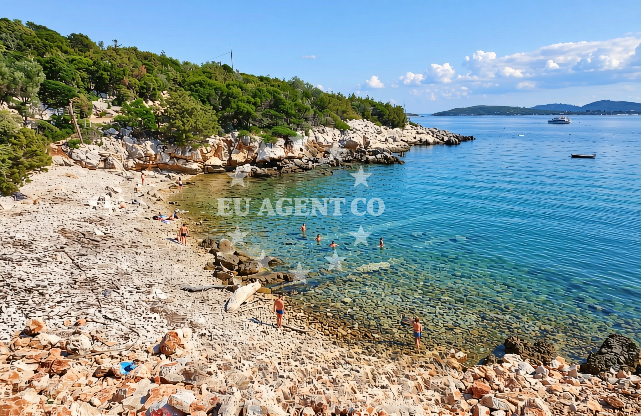
About this beach
Mrtvaška, Veli Lošinj (Lošinj)
Beach: Mrtvaška
Location: Veli Lošinj (Lošinj)
Characteristics and facilities
Gravel, rocks
Beach character
The beach consists primarily of gravel and exposed rock surfaces, reflecting the island's karstic terrain. The shoreline lacks sand, making it distinct from many other Adriatic beaches. The rocky composition creates a natural habitat for marine life, with tide pools and crevices that support diverse ecosystems. During low tide, the beach reveals a network of shallow, rocky channels that extend into the sea. The area is relatively undeveloped, with no permanent structures or facilities along the shore, preserving its natural character.
Swimming and shore
Swimming conditions at Mrtvaška Beach are influenced by the rocky and gravelly seabed. The shoreline's uneven topography makes it less suitable for swimming compared to sandy beaches, though the shallow waters may appeal to visitors seeking a more adventurous coastal experience. The beach's natural features create sheltered pockets where water is calmer, but swimmers should exercise caution due to the uneven seabed. The rocky shore also provides opportunities for exploring tide pools and observing marine biodiversity.
Facilities and activities
No permanent facilities or amenities are listed for Mrtvaška Beach. The absence of infrastructure aligns with its undeveloped nature, which prioritizes preservation of the natural landscape. Visitors are advised to bring their own equipment for any activities, as there are no designated areas for sports, dining, or shelter. The beach's character makes it more suited for nature observation, photography, and short walks along the coastline rather than recreational activities requiring infrastructure.
Access and location
Access to Mrtvaška Beach is via local roads on Veli Lošinj, which connects to the main island roads network. The beach lies on the western shore of the island, approximately 3 kilometers from the town of Lošinj. The island's road system provides connectivity to other coastal areas, including the popular resort of Mali Lošinj and the ferry port of Lošinj. The beach's location within the Kvarner Gulf places it within a sailing region that includes the islands of Cres, Lošinj, and the Istrian coast.
What to expect
Visitors to Mrtvaška Beach should expect a rugged, undeveloped shoreline composed of gravel and rock. The beach lacks traditional amenities but offers a chance to experience the natural geography of Veli Lošinj. The rocky terrain creates a unique environment for exploring tide pools and observing marine life. The area is best suited for those seeking a quiet, unspoiled coastal experience rather than a conventional beach day. The absence of facilities means visitors should plan accordingly, bringing necessary supplies for their stay.
Practical tips
Given the beach's rocky nature, visitors should wear sturdy footwear for walking along the shore. Sun protection is essential, as the lack of shade means exposure to direct sunlight. The beach's natural character makes it ideal for short visits, with limited space for extended stays. Those interested in exploring the area should be mindful of tide changes, as the rocky channels may become submerged during high tide.
Exploring the coast by yacht
For yacht charter guests, Mrtvaška Beach lies within a sailing region that includes the islands of the Kvarner Gulf and the northern Adriatic coast. The proximity to Lošinj's marinas, such as the Lošinj Marina, provides convenient access for boats exploring the area. The rocky coastline offers natural anchorage opportunities in sheltered coves, though navigational care is required due to the uneven seabed. The surrounding waters are part of a popular sailing route that connects the Istrian Peninsula with the islands of Cres and the mainland coast.
Geological Significance
The gravel and rocky composition of Mrtvaška Beach reflects the geological processes that shaped Veli Lošinj's coastline. The island's karstic terrain, formed by limestone erosion, contributes to the beach's unique character. The exposed rock surfaces and gravel deposits are remnants of ancient marine and terrestrial environments, offering insights into the region's geological history. This natural heritage makes the beach a point of interest for those studying coastal geomorphology.
Anchorages in the surrounding area
Anchorages in the surrounding area include options near St. Petar and Veli Lošinj.
- Anchorage — st petar — 0.7 NM from beach
- Plijeski — veli losinj — 1.2 NM from beach
- Balvanida — veli losinj — 1.5 NM from beach
- Anchorage — male orjule — 1.6 NM from beach
- Anchorage — veli losinj — 1.6 NM from beach
- Anchorage — ilovik — 2.4 NM from beach
- Anchorage — ilovik — 2.4 NM from beach
- Anchorage — veli losinj — 2.5 NM from beach
Distances are straight-line geographic distances, not sailing routes.
Mooring buoys in the surrounding area
Mooring buoys in the surrounding area are located near Ilovik and Veli Lošinj.
- Buoy field Ilovik — 1.3 NM from beach
- Buoy field — ilovik — 1.3 NM from beach
- Buoy field Balvanida — veli losinj — 1.4 NM from beach
- Jetty — veli losinj — 1.5 NM from beach
- Krivica buoy field — veli losinj — 2.1 NM from beach
Distances are straight-line geographic distances, not sailing routes.
Marine fuel stations
Marine fuel stations are situated in Mali Lošinj and Rab.
- Ina — mali losinj — 4.4 NM from beach
- Adria Oil — mali losinj — 5.2 NM from beach
- Tifon — nerezine — losinj — 13.0 NM from beach
- Ina — rab — 19.4 NM from beach
Distances are straight-line geographic distances, not sailing routes.
Harbours in the surrounding area
Harbours in the surrounding area include Harbour Ilovik and facilities in Veli Lošinj and Mali Lošinj.
- Harbour Ilovik — 1.3 NM from beach
- Rovenska — veli losinj — 2.7 NM from beach
- Rovenska — veli losinj — 2.7 NM from beach
- Sveti Martin — mali losinj — 4.0 NM from beach
- Mali Lošinj — mali losinj — 4.4 NM from beach
- Za Osirom — cunski — losinj — 8.2 NM from beach
Distances are straight-line geographic distances, not sailing routes.
Marinas in the surrounding area
Marinas in the surrounding area are located in Mali Lošinj and Pag.
- Y/C Marina Mali Lošinj — mali losinj — 4.9 NM from beach
- Marina Lošinj — mali losinj — 5.1 NM from beach
- Marina Nerezine — losinj — 12.1 NM from beach
- ACI Marina Šimuni — simuni — pag — 18.1 NM from beach
- ACI Marina Rab — 19.4 NM from beach
Distances are straight-line geographic distances, not sailing routes.
Restaurants near the beach
Restaurants near the beach are found in Ilovik and Veli Lošinj.
- Konoba "Oliva" — ilovik — 1.2 NM from beach
- Amico — ilovik — 1.3 NM from beach
- Porto — ilovik — 1.4 NM from beach
- Dalmatinka — ilovik — 1.4 NM from beach
- Konoba Panino — ilovik — 1.4 NM from beach
- Balvanida — veli losinj — 1.6 NM from beach
- Sirius — veli losinj — 2.7 NM from beach
Distances are straight-line geographic distances, not sailing routes.
Navigation guides for the surrounding area
Navigation guides for the surrounding area cover locations such as Otok Llovik and Mali Lošinj.
- Otok llovik and Otok Sv. Petar — 1.4 NM from beach
- OtociCi Orjule — 1.6 NM from beach
- Luka Sv. Martin — 3.9 NM from beach
- Mali Losinj — 4.5 NM from beach
- Uvala Artaturi — 7.7 NM from beach
Distances are straight-line geographic distances, not sailing routes.
Yachts from nearby departure bases
Sailing yachts
- Sun Odyssey 349 (Nara) — Mali Lošinj — 4.9 NM from departure base to beach
- Elan 45 Impression (Jackpot) — Mali Lošinj — 4.9 NM from departure base to beach
- Sunsail 38 (Islanders) — Mali Lošinj — 4.9 NM from departure base to beach
- Dufour 412 Grand large (Eva) — Mali Lošinj — 4.9 NM from departure base to beach
- Elan 40 Impression (Laali) — Mali Lošinj — 4.9 NM from departure base to beach
Motor boats
- Galeon Galia 630 blue — Mali Lošinj — 4.9 NM from departure base to beach
- Galeon Galia 630 — Mali Lošinj — 4.9 NM from departure base to beach
- Barracuda 530 RIB (Hvar) — Mali Lošinj — 4.9 NM from departure base to beach
- Atlantic Sun Cruiser 730 — Mali Lošinj — 4.9 NM from departure base to beach
- Atlantic Marine Sun Cruiser 690 — Mali Lošinj — 4.9 NM from departure base to beach
Distances are straight-line geographic distances, not sailing routes.