Most, Stupa Beach, Croatia
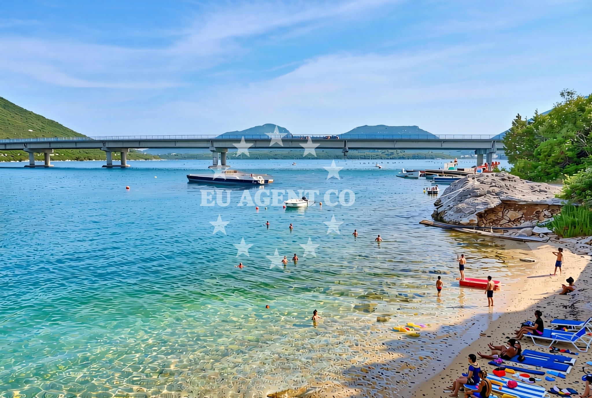
About this beach
Most, Stupa
Beach: Most
Location: Stupa
Characteristics and facilities
Gravel, concrete / stone slabs
150 m
Beach character
Stupa Beach is defined by its natural composition of gravel and stone slabs, which extend along the shoreline. The beach's length of 150 meters provides a modest stretch for visitors, though the absence of sand or fine gravel may influence its appeal. The terrain is likely uneven, requiring sturdy footwear for traversal. The beach's direct adjacency to the sea offers unobstructed views of the Adriatic, with the potential for calm waters depending on seasonal conditions and local currents.Swimming and shore
Swimming is possible from Stupa Beach, though the gravelly shoreline may make entry into the water less comfortable for some. The shore's rocky and concrete features suggest limited areas for sunbathing or relaxation, with visitors likely needing to seek sheltered spots or bring their own seating. The beach's orientation and surrounding topography may influence wave patterns, though specific details about water depth or safety are not documented in the beach's authoritative records.Facilities and activities
No formal facilities are listed for Stupa Beach itself, including amenities such as showers, toilets, or parking. Visitors should assume the beach lacks infrastructure and plan accordingly. The area around Most may offer services in the town center, but the beach's immediate vicinity does not include structured amenities. Activities associated with the beach are not explicitly documented, though the broader region of Most is known for its coastal hiking trails and historic sites.Access and location
Stupa Beach is located in the town of Most, a coastal settlement in Croatia's Split-Dalmatia County. The beach's coordinates (42.869302° N, 17.698398° E) place it near the central Adriatic, with the town of Most serving as a reference point. Access to the beach is likely via local roads connecting to the town, though specific details about parking or pedestrian access are not provided in the beach's records. The surrounding area includes the broader Dalmatian coast, a region with a network of marinas and sailing routes.What to expect
Stupa Beach offers a straightforward coastal experience centered on its natural shoreline and proximity to Most. Visitors should expect a gravelly and rocky beach without formal amenities, making it suitable for those seeking a rustic shoreline. The beach's length and orientation provide direct access to the Adriatic Sea, though the lack of facilities means visitors should bring their own provisions. The surrounding area of Most, a historic town, may offer additional attractions, including cultural sites and local dining options.Practical tips
Given the beach's gravelly terrain, visitors are advised to wear sturdy footwear for walking along the shoreline. Sun protection and hydration are recommended, as there are no shaded areas or facilities on-site. Those seeking amenities should consider visiting the town of Most, which may offer services such as restaurants, shops, and accommodations.Exploring the coast by yacht
Stupa Beach lies within the Adriatic sailing region, a popular destination for yacht charters. The surrounding waters of Most and the Dalmatian coast are known for their scenic routes, historic ports, and opportunities for exploring nearby islands. For those interested in yacht charter experiences, Euro-Agent offers access to motor yachts and sailboats operating in this area. Potential itineraries may include visits to nearby marinas, anchorages, and cultural landmarks along the coast. For availability and bookings, visitors can use the Euro-Agent Yacht Search tool.Historic Context of Most
The town of Most, where Stupa Beach is located, has a history dating back to Roman times. It was a significant settlement along the Adriatic trade routes and later became part of the Kingdom of Croatia. Today, Most retains elements of its past, with historic buildings and churches reflecting its medieval heritage. The beach's proximity to these sites offers visitors a chance to combine coastal relaxation with cultural exploration.Anchorages in the surrounding area
Anchorages in the surrounding area include options near Mali Ston and Broce, offering convenient mooring spots within a few nautical miles.
- Anchorage — mali ston — 1.3 NM from beach
- Anchorage — prapratno — 3.4 NM from beach
- Anchorage — broce — 4.1 NM from beach
- Ribnja — broce — 4.2 NM from beach
- Anchorage — broce — 4.4 NM from beach
- Anchorage — broce — 4.9 NM from beach
- Anchorage — broce — 6.2 NM from beach
- Anchorage — olipa — 7.0 NM from beach
Distances are straight-line geographic distances, not sailing routes.
Mooring buoys in the surrounding area
- Quay — prapratno — 3.4 NM from beach
- Quay — kobas — 4.4 NM from beach
- Lukas Taverna jetty — kobas — 4.4 NM from beach
- Konoba Nico jetty — kobas — 4.4 NM from beach
- Brijesta — 7.7 NM from beach
Distances are straight-line geographic distances, not sailing routes.
Marine fuel stations
- Fuel station — sobra — mljet — 8.5 NM from beach
- Fuel station — ploce — 15.9 NM from beach
- Ina — dubrovnik — 21.0 NM from beach
- Ina — dubrovnik — 22.3 NM from beach
Distances are straight-line geographic distances, not sailing routes.
Harbours in the surrounding area
Harbours in the surrounding area include Hodilje and Mali Ston, situated within a short nautical distance of the beach.
- Hodilje — 0.8 NM from beach
- Mali Ston — 1.3 NM from beach
- Ston — 2.1 NM from beach
- Prapranto Ferry Harbour — prapratno — 3.6 NM from beach
- Doli — 5.6 NM from beach
- Okuklje — mljet — 8.7 NM from beach
Distances are straight-line geographic distances, not sailing routes.
Marinas in the surrounding area
- ACI Marina Slano — 9.9 NM from beach
- Marina Frapa Dubrovnik — 21.1 NM from beach
- ACI Marina Dubrovnik — 22.3 NM from beach
- Marina Lumbarda — korcula — 23.4 NM from beach
- ACI Marina Korčula — korcula — 25.3 NM from beach
Distances are straight-line geographic distances, not sailing routes.
Restaurants near the beach
Restaurants near the beach include Bota Sare in Mali Ston and dining options in Prapratno and Kobas.
- Bota Sare — mali ston — 1.4 NM from beach
- Restaurant — prapratno — 3.2 NM from beach
- Gastro Mare — kobas — 4.4 NM from beach
- Luka's Taverna — lukas taverna — kobas — 4.4 NM from beach
- Nico — kobas — 4.4 NM from beach
Distances are straight-line geographic distances, not sailing routes.
Navigation guides for the surrounding area
Navigation guides for the surrounding area include Uvala Bistrina and Hodilje, located near the beach.
- Uvala Bistrina — 0.5 NM from beach
- Hodilje — 0.7 NM from beach
- Luka — 0.7 NM from beach
- Uvala Bjejvica — 1.3 NM from beach
- Mali Ston — 1.5 NM from beach
Distances are straight-line geographic distances, not sailing routes.
Yachts from nearby departure bases
Yachts from nearby departure bases include options departing from Slano ACI Marina, situated approximately ten nautical miles from the beach.
Sailing yachts
- Oceanis 45 (Cancan) — Slano ACI Marina — 9.9 NM from departure base to beach
- Elan 50 Impression (Timeless) — Slano ACI Marina — 9.9 NM from departure base to beach
- Elan 45 Impression (Skyfall) — Slano ACI Marina — 9.9 NM from departure base to beach
- Oceanis 45 (Mambo 1) — Slano ACI Marina — 9.9 NM from departure base to beach
- Oceanis 45 (Soul) — Slano ACI Marina — 9.9 NM from departure base to beach
Catamarans
- MY 37 (Jam) — Slano ACI Marina — 9.9 NM from departure base to beach
- Helia 44 (Lounge) — Slano ACI Marina — 9.9 NM from departure base to beach
- Lagoon 450 Flybridge (ANJA I) — Slano ACI Marina — 9.9 NM from departure base to beach
- Astrea 42 (Wave) — Slano ACI Marina — 9.9 NM from departure base to beach
- Lagoon 50 (TWIN JOY) — Slano ACI Marina — 9.9 NM from departure base to beach
Distances are straight-line geographic distances, not sailing routes.