Močila istok, Jesenice Beach, Croatia
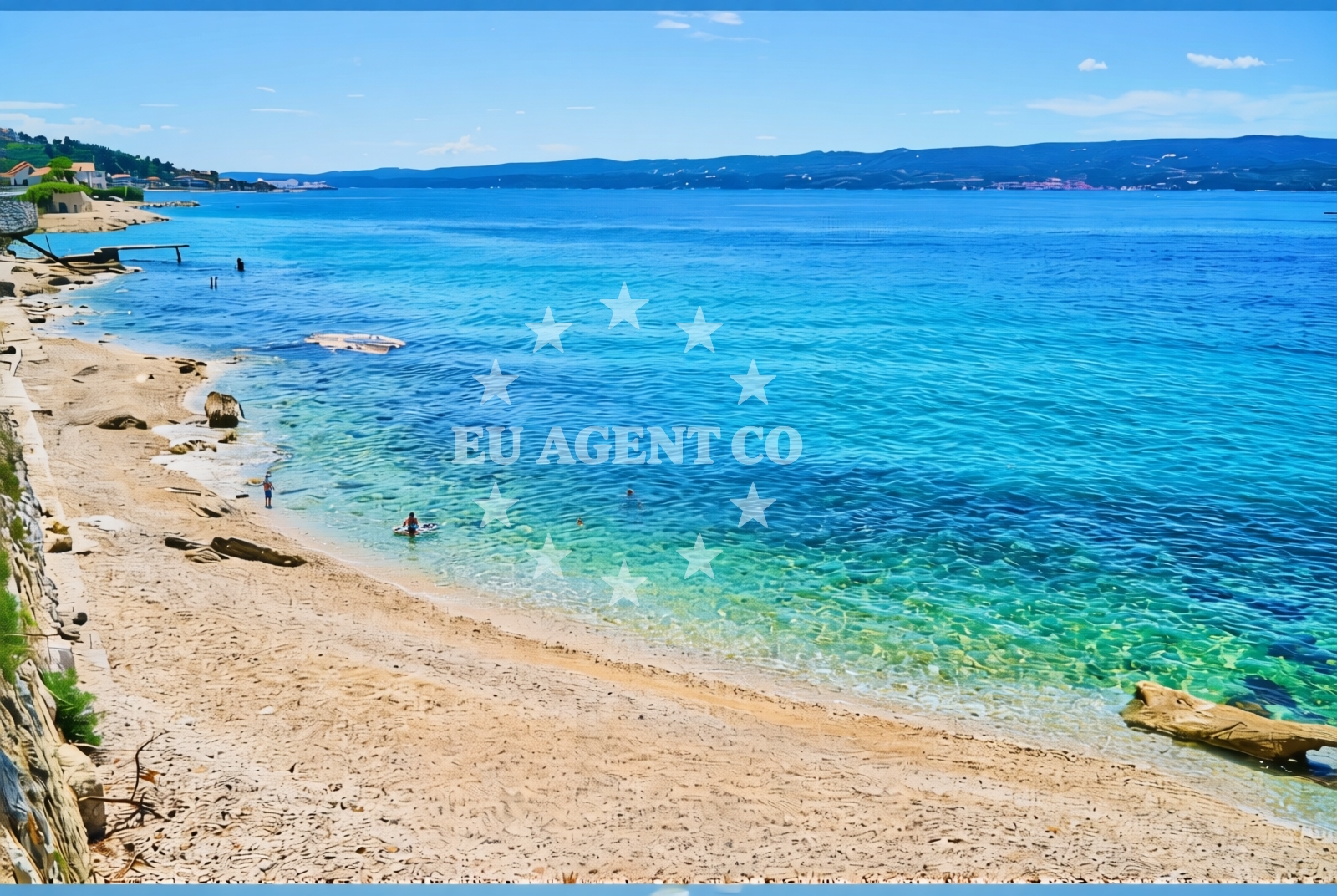
About this beach
Močila istok, Jesenice
Beach: Močila istok
Location: Jesenice
Characteristics and facilities
Gravel
90 m
Beach character
The beach consists entirely of gravel, a feature that distinguishes it from the more common sandy or pebbled shorelines found in other parts of the region. The 90-meter length provides a linear, open expanse that is more suited to casual walking or vehicle access than to swimming or sunbathing. Gravel beaches are typical in certain parts of the Adriatic, often forming where rocky substrates are exposed or where wave action has shaped the shore over time.Swimming and shore
Swimming conditions at Močila istok are not explicitly documented in the beach's authoritative records. The gravel substrate may create uneven or unstable footing along the shoreline, which could affect the comfort of wading or entering the water. Visitors should be mindful of the terrain when approaching the sea, as the gravel may shift underfoot or contain uneven surfaces.Facilities and activities
No specific facilities are listed for Močila istok, Jesenice Beach. The absence of structured amenities such as restrooms, showers, or seating suggests that the beach operates with minimal intervention, maintaining its natural state. There are no explicitly recorded activities associated with the beach, though its location along the Adriatic coast implies potential for coastal exploration, photography, or short walks along the shore.Access and location
Located in the settlement of Jesenice, Močila istok lies within a region characterized by a mix of coastal and inland terrain. The beach's coordinates (43.456249, 16.615257) place it near the broader Adriatic coastline, which is known for its sailing opportunities and scenic routes. The gravel access path suggests that the beach is reachable by vehicle, though specific road details or parking information are not included in the beach's records.What to expect
Visitors to Močila istok, Jesenice Beach should expect a straightforward, low-impact coastal environment. The gravel shoreline is the defining feature, offering a surface that is more suited to walking or light vehicle access than to traditional beach activities. The beach's length of 90 meters provides a modest but continuous stretch of shoreline. While no facilities are explicitly documented, the surrounding area's coastal character may support additional exploration, particularly for those interested in the broader Adriatic landscape.Practical tips
Given the gravel composition, visitors may want to consider appropriate footwear for walking along the beach. The absence of listed facilities means there are no restrooms, showers, or seating available on-site. Those planning to visit should be prepared for a natural, undeveloped setting with minimal infrastructure.Exploring the coast by yacht
The Adriatic coast near Jesenice offers a range of sailing opportunities, with nearby anchorages and marinas accessible to yachts. While Močila istok itself is not marked as a formal anchorage or marina, its location along the coastline may provide a vantage point for sailors exploring the region. Yacht charter guests navigating the Adriatic may find the surrounding waters suitable for short cruises, with nearby settlements offering potential stops for provisioning or shore excursions.Regional Context and Coastal Exploration
Jesenice is part of a coastal region with a history of maritime activity, though specific historical details are not included in the beach's records. The Adriatic Sea in this area is known for its clear waters and varied coastal topography, which can support both sailing and land-based exploration. Nearby settlements may offer additional points of interest for visitors, though specific details would require further local investigation.Anchorages in the surrounding area
Anchorages in Brac and Split are near Močila istok, Jesenice Beach.
- Anchorage — splitska — brac — 4.7 NM from beach
- Anchorage — postira — brac — 4.8 NM from beach
- Anchorage — supetar — brac — 5.5 NM from beach
- Anchorage — postira — brac — 5.6 NM from beach
- Konopjikova — postira — brac — 6.1 NM from beach
- Uvala Likva — sutivan — brac — 7.9 NM from beach
- Anchorage — split — 8.4 NM from beach
- Stiniva — brac — 9.0 NM from beach
Distances are straight-line geographic distances, not sailing routes.
Mooring buoys in the surrounding area
Mooring buoys in Podstrana, Postira, and Split are near Močila istok, Jesenice Beach.
- Jetty — podstrana — 2.3 NM from beach
- Quay — postira — brac — 6.1 NM from beach
- Promenade — split — 8.6 NM from beach
- Nautical Anchorage Bobovišća — bobovisce — brac — 9.1 NM from beach
- Nautical Anchorage Bobovišća — bobovisce — brac — 9.3 NM from beach
Distances are straight-line geographic distances, not sailing routes.
Marine fuel stations
Marine fuel stations in Split and Kastel Gomilica are near Močila istok, Jesenice Beach.
- Ina — split — 8.5 NM from beach
- Ina — split — 8.9 NM from beach
- Flash — kastel gomilica — 10.5 NM from beach
- Ina — milna brac — 10.8 NM from beach
Distances are straight-line geographic distances, not sailing routes.
Harbours in the surrounding area
Harbors in Sumpetar, Krilo, and Dugi Rat are near Močila istok, Jesenice Beach.
- Sumpetar — dugi rat — 0.6 NM from beach
- Krilo — jesenice — 0.7 NM from beach
- Dugi Rat — 1.3 NM from beach
- Omiš — omis — 3.5 NM from beach
- Clubharbour Podstrana — 4.5 NM from beach
- Splitska — brac — 4.7 NM from beach
Distances are straight-line geographic distances, not sailing routes.
Marinas in the surrounding area
Marinas in Podstrana, Split, and Milna Brac are near Močila istok, Jesenice Beach.
- Marina Lav — podstrana — 4.0 NM from beach
- ACI Marina Split — 8.5 NM from beach
- ACI Marina Milna — milna brac — 10.7 NM from beach
- Marina Kaštela — marina kastela — kastel gomilica — 10.7 NM from beach
- Marina Milna Kanarija — milna brac — 10.8 NM from beach
Distances are straight-line geographic distances, not sailing routes.
Restaurants near the beach
Restaurants in Omiš, Podstrana, and Postira offer dining options near Močila istok, Jesenice Beach.
- Konoba Milo — omis — 3.5 NM from beach
- Leonis — podstrana — 4.0 NM from beach
- Skampino — podstrana — 4.0 NM from beach
- Fabio — podstrana — 4.1 NM from beach
- Galija — postira — brac — 4.7 NM from beach
- Vala — splitska — brac — 4.9 NM from beach
- Mala Kate — supetar — brac — 5.0 NM from beach
Distances are straight-line geographic distances, not sailing routes.
Navigation guides for the surrounding area
Navigation guides for Dugi Rat, Omis, and Kairos are near Močila istok, Jesenice Beach.
- Dugi Rat (Uvala Orisac) — 1.5 NM from beach
- Omis — 3.8 NM from beach
- Kairos — 3.9 NM from beach
- Uvala Spliska (Splitska) — 4.8 NM from beach
- Postire — 4.8 NM from beach
Distances are straight-line geographic distances, not sailing routes.
Yachts from nearby departure bases
Yachts departing from Sumpetar Port, Dugi Rat, and Omiš City Port are near Močila istok, Jesenice Beach.
Sailing yachts
- Jeanneau 53 (Win Win) — Podstrana Marina Lav — 4.0 NM from departure base to beach
Catamarans
- Lagoon 450 Fly (Falco) — Sumpetar Port — 0.5 NM from departure base to beach
Motor yachts
- Princess 62 (Sassy) — Podstrana Marina Lav — 4.0 NM from departure base to beach
Gulets / Cruisers
- Gulet (Cataleya) — Sumpetar Port — 0.5 NM from departure base to beach
- Gulet (Altair) — Sumpetar Port — 0.5 NM from departure base to beach
- Gulet cruiser (AGORA) — Dugi Rat Luka Krilo — 0.7 NM from departure base to beach
- Gulet (PATRONICE) — Omiš City Port — 3.4 NM from departure base to beach
- Gulet (Trebenna) — Omiš City Port — 3.5 NM from departure base to beach
- Gulet (Primorac) — Omiš City Port — 3.5 NM from departure base to beach
Motor boats
- Cranchi 43 Sport Top (Chiara) — Podstrana Marina Lav — 4.0 NM from departure base to beach
Distances are straight-line geographic distances, not sailing routes.