Mirca (Brač): Beaches and Coves, Croatia
Mirca (Brač) is a cluster of seven beaches and coves nestled along the eastern coast of Brač, one of the largest and most historically significant islands in the Adriatic Sea. Known for its rugged limestone cliffs, crystal-clear waters, and unspoiled natural beauty, this area offers a glimpse into the traditional character of the Dalmatian coast. While specific details about individual beaches are limited, the broader region of Brač is celebrated for its dramatic landscapes, rich maritime heritage, and proximity to some of the Adriatic's most iconic sailing routes.
About this beach
Mirca (Brač): beaches and coves
Beach character
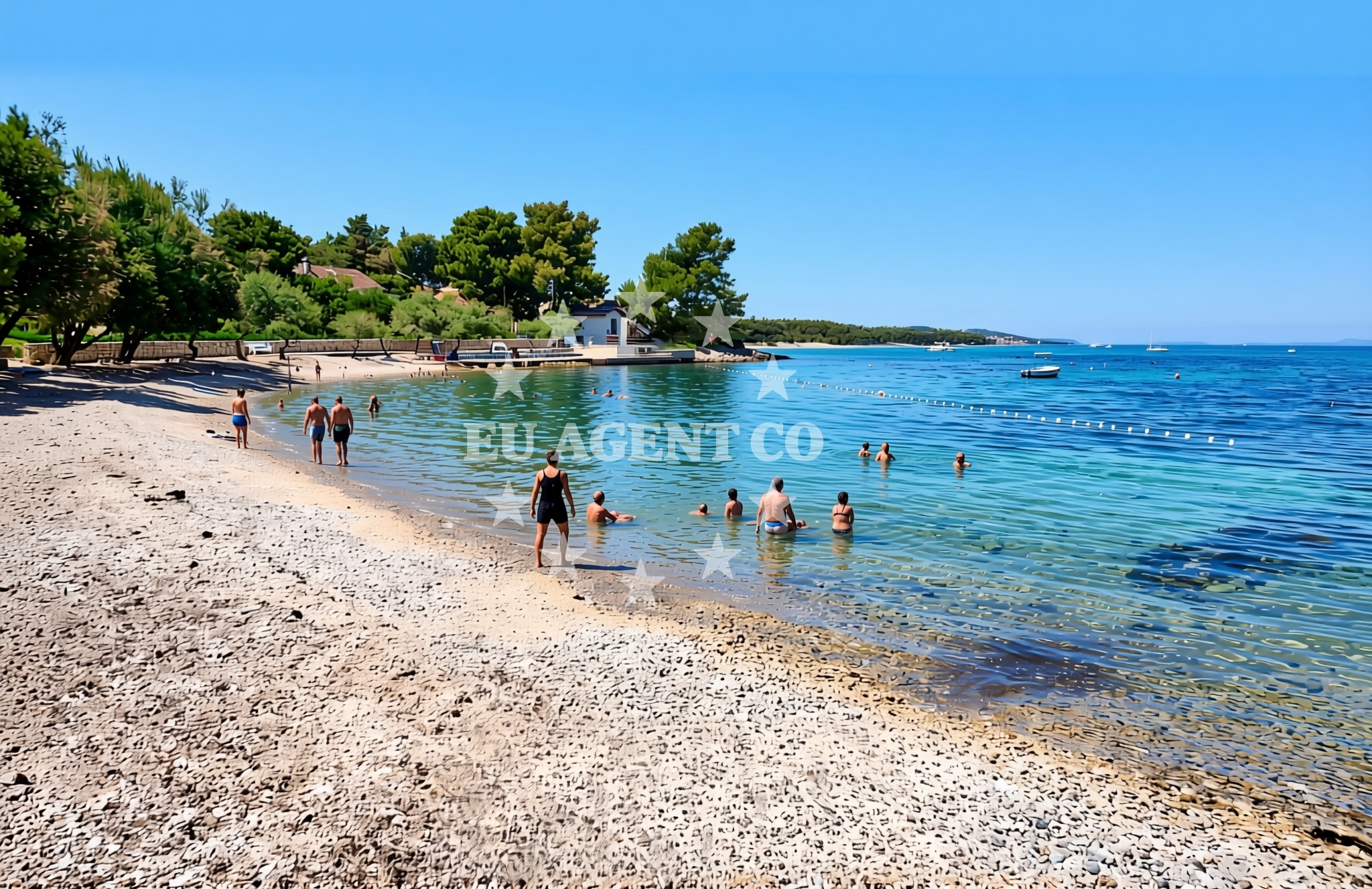
The beaches and coves of Mirca are typical of Brač's eastern coastline, where pebbled shores and shallow, turquoise waters meet steep limestone formations. The area is less developed than Brač's more famous resorts, preserving a sense of tranquility and authenticity. The island's geology, shaped by ancient sea erosion, creates a dramatic contrast between the dark rocks and the bright blue sea. Visitors can expect a mix of sheltered bays and more exposed stretches, with the latter offering opportunities for snorkeling and water sports in the open Adriatic.
Swimming and shore
The waters around Mirca are generally calm and inviting, though conditions can vary depending on the specific cove and time of year. The shallower areas near the shore are ideal for swimming, while the more open sections appeal to experienced swimmers and sailors. The pebbled beaches provide a natural contrast to the soft sands of Brač's western coast, and the lack of extensive infrastructure ensures a more rustic experience. The surrounding cliffs offer vantage points for observing the sea and the island's rugged topography.
Facilities and activities
There are no formal facilities listed for the beaches of Mirca, reflecting the area's undeveloped character. However, the broader region of Brač offers a range of amenities, including restaurants, accommodations, and marinas in nearby towns like Supetar and Bol. Activities in the area are centered around the natural environment, with opportunities for hiking along the island's trails, exploring traditional villages, and enjoying the sea from the cliffs. The absence of commercialized amenities makes Mirca an appealing destination for those seeking solitude and a connection to the island's natural and cultural heritage.
Access and location
Mirca is located on the eastern coast of Brač, approximately 15 kilometers from the island's main town of Supetar. The area is accessible by car via local roads that wind through the island's interior, offering panoramic views of the Adriatic. For visitors arriving by sea, Brač's marinas in Supetar and Bol provide convenient docking points for yachts and motorboats. The island's position in the central Adriatic makes it a popular stop for sailors exploring the Dalmatian coast, with routes extending to nearby islands such as Hvar, Vis, and the Pelješac Peninsula.
What to expect
Visitors to Mirca (Brač) can expect a serene, low-key experience that contrasts with the more tourist-focused areas of the island. The beaches and coves are best suited for those seeking privacy and a connection to the natural landscape. The lack of formal facilities means that visitors should come prepared with their own provisions, though nearby villages offer basic services. The area's appeal lies in its unspoiled beauty and the opportunity to explore Brač's traditional character, from its historic stone houses to its vineyards and olive groves. The surrounding waters are a highlight, with the Adriatic's clarity and depth offering a striking contrast to the island's dramatic coastline.
Practical tips
Given the remote nature of Mirca's beaches, visitors should plan for limited amenities and consider bringing water, snacks, and sun protection. Parking in the area may be limited, so arriving early is advisable. The best times to visit are during the shoulder seasons (April-May and September-October) when the weather is pleasant and crowds are minimal. For those arriving by sea, anchoring in nearby bays or using the marinas in Supetar or Bol provides access to the area without disrupting its natural tranquility.
Exploring the coast by yacht
The waters around Brač, including the Mirca region, are a favored area for yacht charter guests exploring the central Adriatic. The island's position between the Pelješac Peninsula and the Hvar Islands makes it a strategic waypoint for sailing routes that include the famous Blue Cave, the island of Vis, and the historic town of Korčula. Charter yachts often anchor in the sheltered bays of Brač's eastern coast, where the combination of clear waters, scenic cliffs, and proximity to other Dalmatian destinations creates an ideal sailing environment. For those interested in exploring the area by sea, the marinas of Supetar and Bol offer convenient bases for day trips or longer stays.
Cultural and Historical Context
Brač has a long history of maritime activity, with evidence of ancient Roman settlements and medieval fishing communities still visible in the island's landscape. The Mirca region, like much of Brač, is characterized by traditional stone houses and terraced vineyards, reflecting the island's agricultural heritage. The nearby village of Šipovo, known for its historic stone church, offers a glimpse into Brač's cultural past. Visitors interested in history can explore the island's archaeological sites and museums in Supetar, which provide insights into Brač's role in the Adriatic's maritime trade networks.
Anchorages in the surrounding area
Anchorages in the surrounding area include Supetar, Sutivan, and Bobovisce.
- Anchorage — supetar — brac — 0.7 NM from beach
- Uvala Likva — sutivan — brac — 2.8 NM from beach
- Bobovišća — bobovisce — brac — 3.2 NM from beach
- Stiniva — brac — 3.2 NM from beach
- Anchorage — splitska — brac — 3.4 NM from beach
- Stipanska — brac — 3.5 NM from beach
- Anchorage — postira — brac — 4.3 NM from beach
- Anchorage — brac — 5.2 NM from beach
Distances are straight-line geographic distances, not sailing routes.
Mooring buoys in the surrounding area
Mooring buoys in the surrounding area are found in Bobovisce and Milna Brac.
- Nautical Anchorage Bobovišća — bobovisce — brac — 3.1 NM from beach
- Nautical Anchorage Bobovišća — bobovisce — brac — 3.2 NM from beach
- Buoy — milna brac — 5.2 NM from beach
- Konoba Lucice buoys — milna brac — 5.2 NM from beach
- Konoba Familja buoys — milna brac — 5.3 NM from beach
Distances are straight-line geographic distances, not sailing routes.
Marine fuel stations
Marine fuel stations are located in Milna Brac, Split, and Bol.
- Ina — milna brac — 4.6 NM from beach
- Ina — split — 8.6 NM from beach
- Fuel station — bol — brac — 9.1 NM from beach
- Ina — split — 9.2 NM from beach
Distances are straight-line geographic distances, not sailing routes.
Harbours in the surrounding area
Harbours in the surrounding area include Pod Mirca, Supetar, and Sutivan.
- Pod Mirca — brac — 0.4 NM from beach
- Supetar — brac — 1.5 NM from beach
- Sutivan — brac — 2.0 NM from beach
- Bobovišće — bobovisce — brac — 3.1 NM from beach
- Splitska — brac — 3.6 NM from beach
- Milna — milna brac — 4.4 NM from beach
Distances are straight-line geographic distances, not sailing routes.
Marinas in the surrounding area
Marinas in the surrounding area include ACI Marina Milna and Marina Milna Kanarija.
- ACI Marina Milna — milna brac — 4.5 NM from beach
- Marina Milna Kanarija — milna brac — 4.6 NM from beach
- Marina Vlaška — milna brac — 4.6 NM from beach
- Marina Lav — podstrana — 6.9 NM from beach
- ACI Marina Split — 8.5 NM from beach
Distances are straight-line geographic distances, not sailing routes.
Restaurants near the beach
Restaurants near the beach include Mate in Mirca and Neven in Supetar.
- Mate — mirca — brac — 0.4 NM from beach
- Neven — supetar — brac — 1.2 NM from beach
- Lukin — supetar — brac — 1.4 NM from beach
- Vinotoka — supetar — brac — 1.4 NM from beach
- Mala Kate — supetar — brac — 1.5 NM from beach
- Bracera — sutivan — 1.9 NM from beach
- Miki — sutivan — brac — 1.9 NM from beach
Distances are straight-line geographic distances, not sailing routes.
Navigation guides for the surrounding area
Navigation guides for the surrounding area cover locations like Sutivan and Uvala Stipanska.
- Sutivan — 1.8 NM from beach
- Uvala Stipanska — 3.3 NM from beach
- Uvala Spliska (Splitska) — 3.7 NM from beach
- Luka Milna — 4.4 NM from beach
- Postire — 4.8 NM from beach
Distances are straight-line geographic distances, not sailing routes.
Yachts from nearby departure bases
Yachts from nearby departure bases include those based in Milna Marina Vlaška and Sumpetar Port.
Sailing yachts
- Hanse 455 (AURUM 1) — Milna Marina Vlaška — 4.6 NM from departure base to beach
- Hanse 505 (AVALON) — Milna Marina Vlaška — 4.6 NM from departure base to beach
- Bavaria 46 Cruiser (MO) — Milna Marina Vlaška — 4.6 NM from departure base to beach
- Hanse 388 (BANJO) — Milna Marina Vlaška — 4.6 NM from departure base to beach
- Jeanneau 53 (Win Win) — Podstrana Marina Lav — 6.9 NM from departure base to beach
Catamarans
- Lagoon 450 Fly (Falco) — Sumpetar Port — 6.3 NM from departure base to beach
Motor yachts
- Azimut Magellano 66 (AVA II) — Podstrana Marina Lav — 6.9 NM from departure base to beach
Gulets / Cruisers
- Gulet cruiser (AGORA) — Dugi Rat Luka Krilo — 6.0 NM from departure base to beach
- Gulet (Altair) — Sumpetar Port — 6.3 NM from departure base to beach
- Gulet (Cataleya) — Sumpetar Port — 6.3 NM from departure base to beach
Distances are straight-line geographic distances, not sailing routes.