Milo moje, Drvenik (Gradac) Beach, Croatia
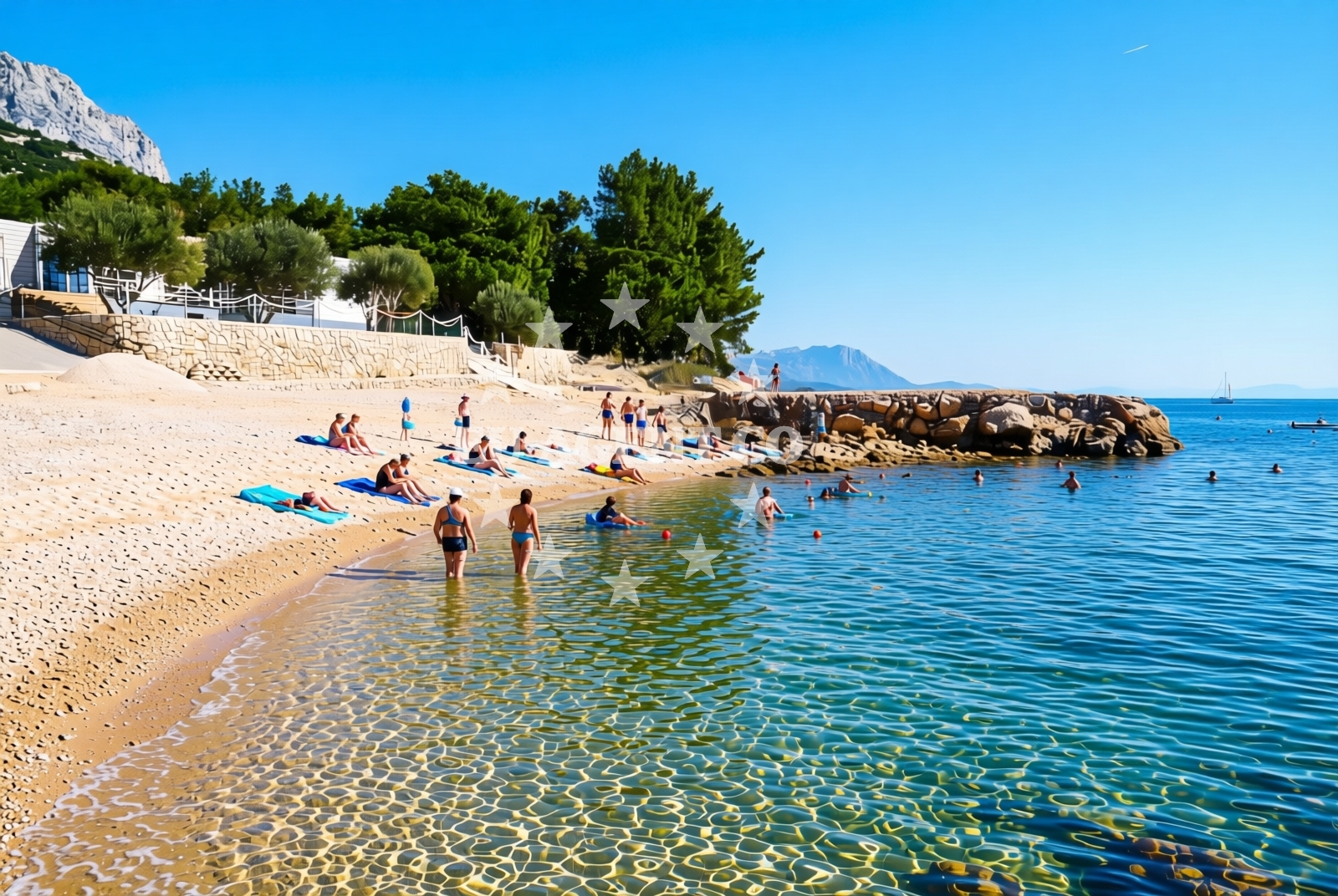
About this beach
Milo moje, Drvenik (Gradac)
Beach: Milo moje
Location: Drvenik (Gradac)
Characteristics and facilities
Gravel, rocks
80 m
Natural shade
Beach character
The beach is composed primarily of gravel and rocky outcrops, creating a terrain that is more suited to walking or exploring than traditional sand-based activities. The 80-meter length offers a compact shoreline, with natural shade provided by the surrounding rock formations and vegetation. This lack of artificial infrastructure means the beach retains a wild, untouched character, appealing to visitors looking for a quiet, secluded spot away from crowded tourist areas. The gravel surface may require sturdy footwear for safe navigation, particularly during wet conditions.Swimming and shore
While the beach’s rocky composition makes it less ideal for swimming, the nearby waters of the Adriatic Sea are known for their clarity and moderate temperatures during the summer months. The shore itself is a mix of loose gravel and stable rock, with no designated swimming areas or lifeguard services. Visitors should be mindful of the terrain when approaching the water’s edge, as the uneven surface can make footing unpredictable. The natural shade from the rocks provides intermittent relief from direct sunlight, though sun protection is still recommended for extended stays.Facilities and activities
The beach lacks formal amenities such as restrooms, showers, or parking facilities, reflecting its minimal development. Activities are limited to walking along the shore, exploring the rocky terrain, and enjoying the scenic coastal views. The absence of commercial infrastructure means the area is best suited for those seeking solitude and a connection with the natural landscape. Nearby Drvenik (Gradac) offers basic village services, including local shops and accommodations, for visitors wishing to extend their stay.Access and location
Milo moje, Drvenik (Gradac) Beach is located in the village of Drvenik (Gradac), part of the Šibenik-Knin County in southern Croatia. The area is accessible by road from nearby towns such as Drvenik and Šibenik, with the beach lying within a few kilometers of the main coastal route. The surrounding region is characterized by rugged coastlines, limestone cliffs, and a network of smaller islands and islets, typical of the Adriatic’s Dalmatian coast. The beach’s proximity to the mainland makes it a potential starting point for short sailing excursions into the nearby islands, though no marinas or docking facilities are present at the beach itself.What to expect
Milo moje, Drvenik (Gradac) Beach is a remote, naturally formed shoreline that caters to visitors seeking a tranquil, undeveloped coastal experience. The gravel and rock composition creates a landscape that is more suited to exploration than relaxation, with the beach’s primary appeal lying in its scenic setting and isolation. The absence of modern amenities means the area is best for those comfortable with minimal infrastructure. The natural shade from the rocks offers occasional respite from the sun, but visitors should prepare for exposure to the elements. The beach’s location within the broader Adriatic coastline provides opportunities for nearby sightseeing, including visits to the nearby town of Drvenik and the historic Šibenik area.Practical tips
Visitors should wear sturdy, non-slip footwear to navigate the gravel and rocky terrain safely. Sunscreen and a hat are advisable, as natural shade is limited. The beach’s lack of facilities means visitors should bring their own supplies, including water and snacks. Parking options near the beach are not specified in the catalog, so arriving by car may require exploring nearby roads for available spaces.Exploring the coast by yacht
For yacht charter guests, the Milo moje, Drvenik (Gradac) area is part of the broader Šibenik-Knin sailing region, known for its sheltered bays, clear waters, and proximity to cultural landmarks such as the Šibenik Cathedral. While the beach itself is not a marina or anchorage, the surrounding coast offers several designated sailing areas and harbors accessible via the Euro-Agent Yacht Search platform. Charter yachts may use nearby ports in Drvenik or Šibenik as bases for exploring the region’s islands, including the Krka National Park and the islands of Šolta and Čiovo.Regional Context and Nearby Attractions
The beach lies within a region rich in natural and cultural heritage. The nearby town of Drvenik is a small fishing village with a historic harbor, while Šibenik, approximately 20 kilometers to the northeast, is a UNESCO-listed city renowned for its medieval architecture and proximity to Krka National Park. The area’s limestone cliffs and caves, such as the famous Škrip Cave, are popular with visitors and can be accessed via short boat trips from nearby harbors.Anchorages in the surrounding area
Anchorages near Milo moje, Drvenik (Gradac) Beach include Drvenik and Sucuraj, offering nearby mooring options.
- Anchorage — drvenik — 2.0 NM from beach
- Anchorage — sucuraj — hvar — 2.8 NM from beach
- Anchorage — sucuraj — hvar — 3.4 NM from beach
- Anchorage — sucuraj — hvar — 3.4 NM from beach
- Anchorage — sucuraj — hvar — 3.9 NM from beach
- Anchorage — selca kod bogomolja — hvar — 4.1 NM from beach
- Anchorage — selca kod bogomolja — hvar — 4.1 NM from beach
- Anchorage — selca kod bogomolja — hvar — 4.8 NM from beach
Distances are straight-line geographic distances, not sailing routes.
Mooring buoys in the surrounding area
Mooring buoys in the vicinity feature Drvenik Ferry Dock and Konoba Gambo buoys in Selca kod Bogomolja.
- Drvenik - Ferry dock — drvenik ferry dock — 2.0 NM from beach
- Jetty — sucuraj — hvar — 2.7 NM from beach
- Kraj - Soline — kraj soline — drasnice — 5.3 NM from beach
- Konoba Gambo buoys — selca kod bogomolja — hvar — 5.6 NM from beach
- Brist — 5.8 NM from beach
Distances are straight-line geographic distances, not sailing routes.
Marine fuel stations
- Ina — makarska — 11.3 NM from beach
- Fuel station — ploce — 12.2 NM from beach
- Fuel station — korcula — 13.1 NM from beach
- Fuel station — sumartin — brac — 16.7 NM from beach
Distances are straight-line geographic distances, not sailing routes.
Harbours in the surrounding area
- Drvenik — 1.9 NM from beach
- Živogošće — zivogosce — 2.4 NM from beach
- Sućuraj — sucuraj — hvar — 2.7 NM from beach
- Igrane — 3.3 NM from beach
- Zaostrog — 3.6 NM from beach
- Drašnice — drasnice — 5.1 NM from beach
Distances are straight-line geographic distances, not sailing routes.
Marinas in the surrounding area
Marinas in Tučepi, Korčula, and Baška Voda offer berthing facilities further from Milo moje, Drvenik (Gradac) Beach.
- Marina Tučepi — marina tucepi — 8.7 NM from beach
- ACI Marina Korčula — korcula — 12.9 NM from beach
- Marina Ramova — krvavica — 13.6 NM from beach
- Marina Lumbarda — korcula — 14.7 NM from beach
- Marina Baška Voda — marina baska voda — 16.1 NM from beach
Distances are straight-line geographic distances, not sailing routes.
Restaurants near the beach
Restaurants in Sucuraj, such as Riblji Restoran and Mlaska, are situated near the beach with short navigation distances.
- Restaurant — sucuraj — hvar — 2.7 NM from beach
- Riblji Restoran — sucuraj — hvar — 2.7 NM from beach
- Mlaska — sucuraj — hvar — 3.4 NM from beach
Distances are straight-line geographic distances, not sailing routes.
Navigation guides for the surrounding area
Navigation guides for Uvala Drvenik (Donja Vala) and nearby areas assist in planning routes to and from the beach.
- Uvala Drvenik (Donja Vala) — 2.2 NM from beach
- OTOK HVAR — 2.6 NM from beach
- Podgora — 7.0 NM from beach
- Gradac — 7.3 NM from beach
- Uvala Kozja — 7.5 NM from beach
Distances are straight-line geographic distances, not sailing routes.
Yachts from nearby departure bases
Sailing yachts
- Bavaria 40 Cruiser (LADY BUTTERFLY) — Tučepi Port — 8.7 NM from departure base to beach
- Elan 40 Impression (Karleta) — Ploče City Port — 12.1 NM from departure base to beach
- Sun Odyssey 349 (Visnjica) — Ploče City Port — 12.1 NM from departure base to beach
- More 55 (MRS. ROBINSON) — Ploče City Port — 12.1 NM from departure base to beach
Catamarans
- Lagoon 450 Fly (Alba Mouse) — Ploče City Port — 12.1 NM from departure base to beach
Motor yachts
- Princess V53 (Chablis) — Makarska Port — 11.1 NM from departure base to beach
Motor boats
- Jeanneau NC 37 (Black Pearl) — Makarska Port — 11.1 NM from departure base to beach
- Galeon 430 Skydeck (BELLAGIO) — Makarska Port — 11.1 NM from departure base to beach
- Jeanneau NC 37 (Black Pearl) — Makarska Port — 11.1 NM from departure base to beach
- Galeon 430 Skydeck (Bellagio) — Makarska Port — 11.1 NM from departure base to beach
Distances are straight-line geographic distances, not sailing routes.