Miletići zapad, Rtina Beach, Croatia
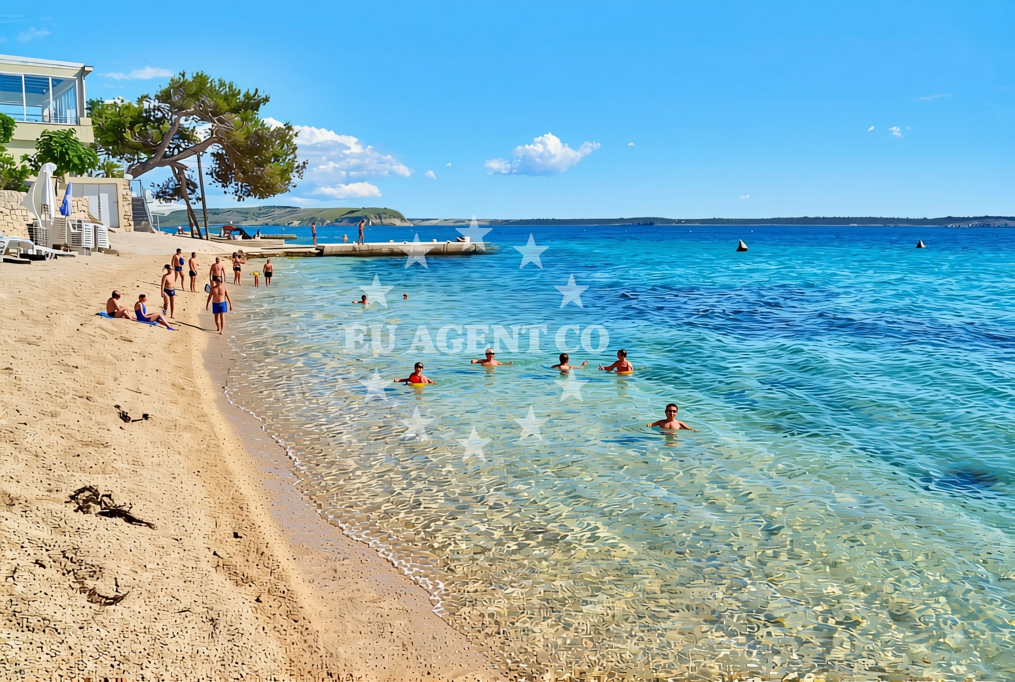
About this beach
Miletići zapad, Rtina
Beach: Miletići zapad
Location: Rtina
Characteristics and facilities
Gravel, concrete / stone slabs
130 m
Restaurant / snack bar
Caffe bar / Drinks stand
shower
Beach character
The beach's surface consists of gravel and concrete/stone slabs, which may appeal to those seeking a more rugged coastal experience. Its relatively short length (130 meters) suggests it is a small, intimate stretch of coastline. The beach is equipped with a restaurant/snack bar, a caffe bar/drinks stand, and a shower facility, catering to basic visitor needs. The absence of detailed natural features in the catalog means the beach's ecological or geological character remains less defined, though its location in the Brodarica area implies proximity to the broader Adriatic landscape.Swimming and shore
The beach's gravel and stone slab composition may influence swimming conditions, though specific water quality or depth details are not provided in the catalog. Visitors should consider the surface type when planning access, as it may not be ideal for those seeking soft sand. The shore's immediate surroundings are not described in detail, leaving its broader natural context to regional knowledge about the Dalmatian coast.Facilities and activities
Basic amenities include a restaurant/snack bar, a caffe bar/drinks stand, and a shower. No specific activities are listed in the catalog, and no rental services or organized programs are mentioned. The facilities appear limited to serving immediate visitor needs, with no indication of extended infrastructure such as parking, toilets, or lifeguard services.Access and location
Situated in Miletići, a village within Brodarica municipality, the beach is positioned along the eastern Adriatic coast. Its coordinates (44.312293, 15.272279) place it near the broader Dalmatian region, which is known for its rugged coastline, historic towns, and sailing opportunities. The beach's access via gravel and concrete paths may require visitors to consider footwear and mobility when planning a visit.What to expect
Visitors should anticipate a beach with a gravel and stone-slab surface, suitable for those comfortable with non-sandy shorelines. The available amenities—restaurant, cafe, and shower—provide minimal but functional services. The beach's small size and lack of detailed natural descriptions suggest it may serve more as a local access point than a major tourist destination. Its location in Brodarica, a region with a rich maritime history, offers potential for exploring nearby cultural sites or sailing routes.Practical tips
Consider bringing sturdy footwear for the gravel and concrete paths. The beach's facilities are limited to basic services, so visitors may want to plan accordingly. The area's proximity to the Dalmatian coast suggests opportunities for nearby exploration, though specific details about transportation or additional attractions are not provided in the catalog.Exploring the coast by yacht
The Dalmatian coast, where Miletići zapad is located, is a well-known sailing region in the Adriatic. While the beach itself is not described as an anchorage or marina, the broader area offers yacht charter opportunities. The Brodarica region, with its coastal villages and historic sites, may appeal to sailors seeking a mix of natural beauty and cultural landmarks. For those interested in yacht charter, the Euro-Agent Yacht Search page provides tools to explore available vessels and routes in this part of Croatia.Regional Context and Brodarica's Appeal
Brodarica municipality, home to Miletići, is part of the Split-Dalmatia County, a region characterized by its medieval towns, olive groves, and coastal villages. The area's maritime history is evident in its ports and historic shipyards, though specific details about local attractions are not detailed in the catalog. Visitors may find value in exploring nearby towns such as Split or the islands of Brač and Hvar, which are accessible via ferry routes from the mainland.Anchorages in the surrounding area
Anchorages near Miletići zapad, Rtina Beach include rtina, tribanj, and vrsi.
- Anchorage — rtina — 1.7 NM from beach
- Anchorage — rtina — 2.1 NM from beach
- Anchorage — vlasici — pag — 2.4 NM from beach
- Anchorage — tribanj — 3.1 NM from beach
- Anchorage — vrsi — 3.2 NM from beach
- Anchorage — ljubac — 3.5 NM from beach
- Anchorage — smokvica — 3.5 NM from beach
- Anchorage — ljubac — 3.9 NM from beach
Distances are straight-line geographic distances, not sailing routes.
Mooring buoys in the surrounding area
Mooring buoys in the vicinity include ljubac jetty and sibuljina point.
- Jetty — ljubac — 3.3 NM from beach
- Šibuljina Point — sibuljina point — 3.3 NM from beach
- Vir — 8.1 NM from beach
- Punta Skala — petrcane — 9.0 NM from beach
- Jetty — zadar — 11.3 NM from beach
Distances are straight-line geographic distances, not sailing routes.
Marine fuel stations
Fuel stations nearby include Ina in Zadar and Ina in Preko.
- Ina — zadar — 11.8 NM from beach
- Ina — preko — ugljan — 14.5 NM from beach
- Fuel station — sukosan — 15.6 NM from beach
- Ina — zaglav — dugi otok — 22.5 NM from beach
Distances are straight-line geographic distances, not sailing routes.
Harbours in the surrounding area
Harbours in the area include Miškovići on Pag and the port of Nin.
- Miškovići — miskovici — pag — 2.4 NM from beach
- Ražanac — razanac — 3.6 NM from beach
- Mulo — nin — 4.1 NM from beach
- Nin — 5.6 NM from beach
- Starigrad Paklenica — 7.2 NM from beach
- Privlaka — 7.2 NM from beach
Distances are straight-line geographic distances, not sailing routes.
Marinas in the surrounding area
Marinas near the beach include Marina Borik in Zadar and Marina Zadar.
- Marina Borik — zadar — 11.3 NM from beach
- Vitrenjak Zadar — 11.4 NM from beach
- Marina Zadar — 11.8 NM from beach
- Olive Island Marina — sutomiscica — ugljan — 13.7 NM from beach
- Marina Preko — ugljan — 14.3 NM from beach
Distances are straight-line geographic distances, not sailing routes.
Navigation guides for the surrounding area
Navigation guides cover areas like KrusCica and Otok Pag.
- KrusCica and Uvala KrusCica Duboka — 3.0 NM from beach
- VELESITSKI KANAL (S) — 3.8 NM from beach
- OTOK PAG — 6.7 NM from beach
- Privlaka — 7.1 NM from beach
- Starigrad-Paklenica {Velebitski Kanai) — 7.4 NM from beach
Distances are straight-line geographic distances, not sailing routes.
Yachts from nearby departure bases
Sailing yachts
- Oceanis 46.1 (Antonela M.) — Zadar Marina Borik — 11.3 NM from departure base to beach
- Bavaria C42 (Dna) — Zadar Marina Borik — 11.3 NM from departure base to beach
Catamarans
- Sunreef 60 (SINATA) — Zadar Marina Borik — 11.3 NM from departure base to beach
- Leopard 50 (Solaia) — Zadar Marina Borik — 11.3 NM from departure base to beach
Motor yachts
- Prestige 550 Fly (Floria) — Zadar Marina Borik — 11.3 NM from departure base to beach
Motor boats
- Merry Fisher 895 — Povljana Marina — 7.5 NM from departure base to beach
- Rancraft RM19 (Daycruiser) — Zadar Diklo Port — 10.1 NM from departure base to beach
- Rancraft RS Cinque.5 — Zadar Diklo Port — 10.1 NM from departure base to beach
- Rancraft RM21 (Dugi otok) — Zadar Diklo Port — 10.1 NM from departure base to beach
- Antares 9 OB (M & N) — Zadar Marina Borik — 11.3 NM from departure base to beach
Distances are straight-line geographic distances, not sailing routes.