Mastrinka Zapad Beach, Croatia
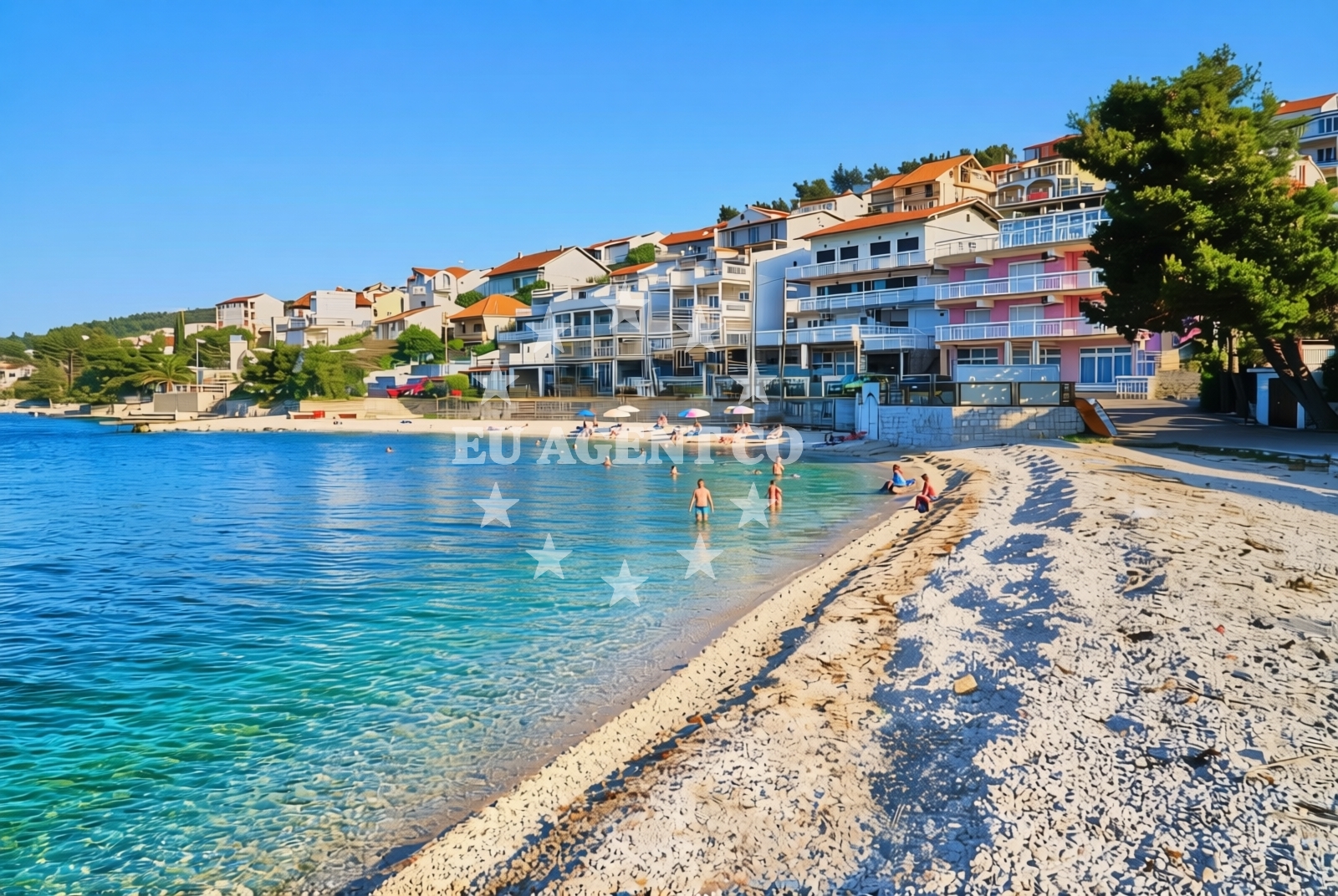
About this beach
Mastrinka zapad, Mastrinka (Čiovo)
Beach: Mastrinka zapad
Location: Mastrinka (Čiovo)
Characteristics and facilities
Gravel, concrete / stone slabs
180 m
Natural shade
Beach character
The beach surface consists of gravel and concrete/stone slabs, creating a distinct contrast to typical sandy shores. While not ideal for sunbathing, the natural shade provided by the surrounding terrain offers respite from direct sunlight. The beach's length of 180 meters provides a moderate stretch for exploration, with the rocky composition suggesting limited areas for water access.Swimming and shore
The gravel and stone slab composition makes this beach more suitable for walking and exploring the shoreline than for swimming. The natural shade from the surrounding terrain creates microclimates that may offer cooler conditions during peak hours. Visitors should note the rocky nature of the beach when considering water access points.Facilities and activities
No specific facilities are documented for this beach. The absence of structured amenities suggests a more natural, undeveloped shoreline experience. The beach's characteristics make it well-suited for coastal walking and exploration rather than water-based activities.Access and location
Situated on the Čiovo Peninsula, this beach is part of the broader Split-Dalmatia region. The area is known for its rugged coastline and historic significance, with Split's ancient city walls visible across the bay. The beach's location offers proximity to both the city of Split and the wider Adriatic sailing routes that characterize the Dalmatian coast.What to expect
Visitors should prepare for a beach experience defined by its gravel and stone slab surface, which contrasts with traditional sandy shores. The 180-meter length provides a moderate stretch for exploration, with natural shade available from the surrounding terrain. This beach is best suited for those seeking a more rugged coastal experience rather than traditional sunbathing opportunities.Practical tips
Comfortable footwear is recommended due to the gravel and stone slab surface. The natural shade can provide relief during peak sunlight hours, but visitors should still bring sun protection. The beach's rocky nature suggests limited direct water access points.Exploring the coast by yacht
As part of the Čiovo Peninsula, this beach lies within a region popular with sailors exploring the Adriatic coast. The nearby Split marina and the broader Dalmatian coastline offer numerous anchorage options for yachts. While not a primary marina location, the beach's proximity to sailing routes makes it a potential stop for those exploring the Split area.Regional Context
The Čiovo Peninsula, where this beach is located, has historical significance dating back to Roman times. The area is characterized by its dramatic cliffs and clear waters, with Split's cityscape visible across the bay. The peninsula is a popular base for exploring the Adriatic coast, with several marinas and anchorages available for yachts.Anchorages in the surrounding area
Anchorages in the surrounding area include options in Ciovo and Trogir, with proximity to the beach.
- Anchorage — ciovo — 1.4 NM from beach
- Anchorage — trogir — 1.7 NM from beach
- Movrarštica — okrug gornji — ciovo — 2.0 NM from beach
- Anchorage — okrug gornji — ciovo — 2.2 NM from beach
- Anchorage — ciovo — 2.4 NM from beach
- Anchorage — ciovo — 2.4 NM from beach
- Anchorage — ciovo — 2.5 NM from beach
- Anchorage — ciovo — 2.7 NM from beach
Distances are straight-line geographic distances, not sailing routes.
Mooring buoys in the surrounding area
Mooring buoys in the surrounding area feature jetty locations in Ciovo, Trogir, and Split.
- Jetty — ciovo — 1.3 NM from beach
- Jetty — trogir — 2.3 NM from beach
- Resnik — split — 2.3 NM from beach
- Hotel Palace — split — 3.9 NM from beach
- Jetty — drvenik veli — 6.2 NM from beach
Distances are straight-line geographic distances, not sailing routes.
Marine fuel stations
- Ina — trogir — 1.4 NM from beach
- B-Max — b max — trogir — 1.8 NM from beach
- Flash — kastel gomilica — 5.8 NM from beach
- Ina — split — 6.5 NM from beach
Distances are straight-line geographic distances, not sailing routes.
Harbours in the surrounding area
Harbours in the surrounding area include Arbanija, Divulje, and Trogir Harbour, close to the beach.
- Arbanija — okrug gornji — ciovo — 0.9 NM from beach
- Divulje — trogir — 1.0 NM from beach
- Trogir Harbour — 1.2 NM from beach
- Toče — okrug gornji — ciovo — 1.4 NM from beach
- Seget Donji — trogir — 2.3 NM from beach
- Slatine — ciovo — 2.8 NM from beach
Distances are straight-line geographic distances, not sailing routes.
Marinas in the surrounding area
- ACI Marina Trogir — 1.3 NM from beach
- Marina Trogir — 1.5 NM from beach
- Marina Baotić — marina baotic — trogir — 2.0 NM from beach
- Marina Kaštela — marina kastela — kastel gomilica — 5.7 NM from beach
- ACI Marina Split — 6.6 NM from beach
Distances are straight-line geographic distances, not sailing routes.
Restaurants near the beach
Restaurants near the beach are concentrated in Trogir, offering dining options within short distances.
- Konoba Mlinice — trogir — 0.9 NM from beach
- Vanjaka — trogir — 1.2 NM from beach
- Capo — trogir — 1.2 NM from beach
- Calebotta — trogir — 1.2 NM from beach
- Marijana — trogir — 1.2 NM from beach
- Konoba TRS — trogir — 1.2 NM from beach
- Trattoria Antica — trogir — 1.2 NM from beach
Distances are straight-line geographic distances, not sailing routes.
Navigation guides for the surrounding area
Navigation guides for the surrounding area cover Trogir, Seget, and nearby coastal points.
- Trogir — 1.1 NM from beach
- Uvala Movarstica — 1.4 NM from beach
- Uvala Razetinovac — 2.0 NM from beach
- Seget — 2.0 NM from beach
- Uvala Duga — 2.1 NM from beach
Distances are straight-line geographic distances, not sailing routes.
Yachts from nearby departure bases
Motor yachts
- Alena 58 (MORNING LIGHT) — Trogir PŠU Banj — 1.0 NM from departure base to beach
Motor boats
- Sun Sport 845 (SUN SPORT 845) — Trogir PŠU Banj — 1.0 NM from departure base to beach
- Eolo 650 (Nadir Narine) — Trogir PŠU Banj — 1.0 NM from departure base to beach
- Saxdor 320 GTO — Trogir PŠU Banj — 1.0 NM from departure base to beach
- Cap Camarat 5.5 WA S2 — Trogir PŠU Banj — 1.0 NM from departure base to beach
- Baracuda 20 (BARACUDA 20) — Trogir PŠU Banj — 1.0 NM from departure base to beach
- Cap Camarat 5.5 WA S2 — Trogir PŠU Banj — 1.0 NM from departure base to beach
- Motorboat (Bura 8.0) — Trogir Park Žudika — 1.2 NM from departure base to beach
- Voyager 21 (Ranieri 21) — Trogir Park Žudika — 1.2 NM from departure base to beach
- Axopar 28 T-Top (Igrane) — Trogir Park Žudika — 1.2 NM from departure base to beach
Distances are straight-line geographic distances, not sailing routes.