Maslinica, Nečujam (Šolta) Beach, Croatia
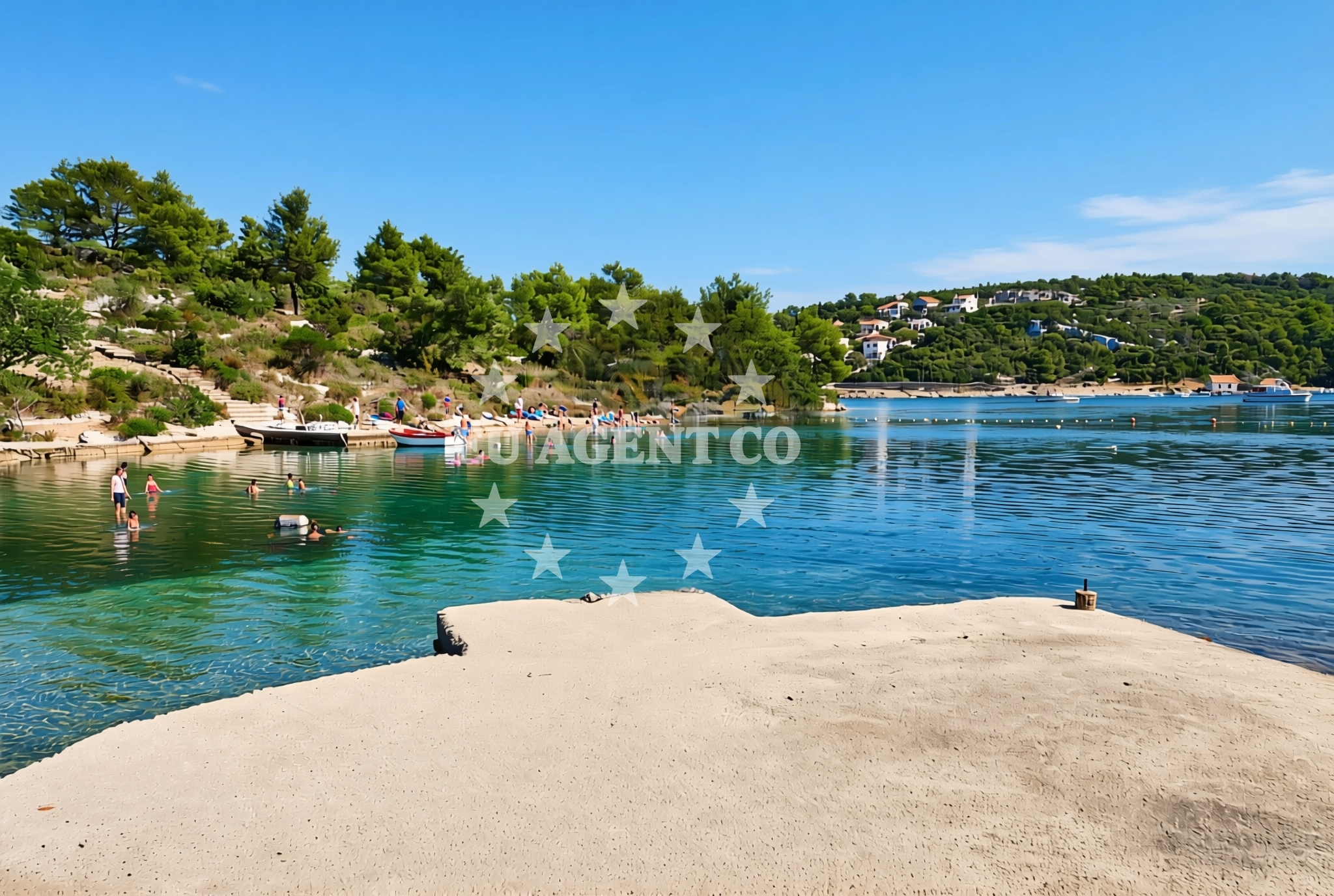
Maslinica Beach on the island of Šolta lies within the broader Dalmatian coast, a region shaped by millennia of maritime activity and Venetian influence. Located near the village of Nečujam, the beach is part of Šolta's rugged eastern coastline, where limestone cliffs meet the Adriatic Sea. The shoreline consists of gravel, concrete slabs, and rocky outcrops, forming a landscape distinct from the pebbled beaches more commonly found along Croatia's coast. This characteristically uneven terrain makes it a less conventional choice for sunbathing but offers a striking contrast to the island's more developed western shores.
About this beach
Maslinica, Nečujam (Šolta)
Beach: Maslinica
Location: Nečujam (Šolta)
Characteristics and facilities
Gravel, concrete / stone slabs, rocks
Beach character
The beach's composition of gravel and stone reflects Šolta's geological history as part of the Dinaric karst region. While not ideal for swimming due to the uneven surface, the area provides a unique vantage point for observing the island's natural contours. The lack of traditional sand or fine pebbles means visitors should expect a more rugged experience compared to Croatia's popular tourist beaches. The shoreline extends along a narrow strip between the sea and the island's interior, with limited space for relaxation beyond the immediate coastal zone.
Swimming and shore
Swimming conditions at Maslinica are influenced by the rocky terrain and the proximity to the open Adriatic. The beach lacks designated swimming areas or lifeguard services, and the uneven seabed makes it unsuitable for young children or those seeking calm waters. The surrounding waters are part of the broader Split-Brac-Hvar sailing triangle, a region known for its consistent currents and occasional strong winds. While the beach itself is not a primary swimming destination, the nearby village of Nečujam offers more conventional coastal access points with safer bathing conditions.
Facilities and activities
No formal facilities are listed for Maslinica Beach, consistent with its status as a more remote shoreline on Šolta. The absence of amenities such as showers, changing rooms, or parking aligns with the beach's character as a natural coastal feature rather than a developed tourist destination. The area's primary appeal lies in its unspoiled setting and connection to Šolta's broader cultural and historical context, including its vineyards and traditional stone architecture.
Access and location
Reaching Maslinica requires navigating Šolta's narrow coastal roads, which wind through the island's interior before descending to the shoreline. The beach is located near the easternmost point of Šolta, approximately 12 kilometers from the island's main village of Šolta. Visitors arriving by car should be prepared for limited parking options, as the area lacks dedicated visitor lots. The beach's proximity to the Split mainland makes it accessible to those exploring the central Dalmatian coast, with ferries and catamarans regularly connecting Šolta to Split's marina and port facilities.
What to expect
Visitors to Maslinica should expect a beach experience centered on natural landscapes rather than conventional amenities. The gravel and rocky shoreline offers a stark contrast to Croatia's more polished coastal offerings, making it an appealing destination for those seeking a more authentic encounter with the Adriatic. The beach's location on Šolta provides opportunities to explore the island's vineyards, traditional architecture, and maritime history, though the immediate shoreline lacks facilities for extended stays. The area's connection to the Split-Brac-Hvar sailing route means it may be of interest to yacht charter guests passing through the region.
Practical tips
Due to the beach's rocky terrain, visitors should wear sturdy footwear for walking along the shoreline. Sun protection is essential given the exposed position of the beach, and those planning to explore Šolta's interior should consider visiting nearby villages for more comprehensive amenities. The lack of formal facilities means visitors should bring their own supplies for any extended stay along the coast.
Exploring the coast by yacht
The waters surrounding Šolta are part of the Adriatic's most active sailing regions, with routes connecting to Split, Brač, and Hvar. Yacht charter guests navigating this area may find Maslinica's location useful as a reference point for exploring Šolta's eastern coastline. The island's proximity to Split's marina makes it a common stop for vessels traveling between the mainland and the central Dalmatian islands. While Maslinica itself is not an anchorage, the broader Šolta region offers several safe mooring options for yachts, particularly near the island's western shores and in the vicinity of the village of Šolta.
Šolta's Cultural and Historical Context
Šolta's history as a Venetian-controlled island dates back to the 13th century, leaving behind a legacy of fortified villages and maritime traditions. The island's vineyards, particularly those producing the Plavac Mali grape, are a notable feature of the local economy. Visitors exploring the area may wish to visit the Šolta village, where traditional stone houses and olive groves provide insight into the island's rural character. The island's role in the Adriatic's sailing history is reflected in its numerous anchorages and the presence of yacht charter companies operating in the region.
Anchorages in the surrounding area
Anchorages in Necujam and Rogac, Solta, offering nearby mooring options.
- Anchorage — necujam — solta — 0.0 NM from beach
- Anchorage — necujam — solta — 0.2 NM from beach
- Anchorage — necujam — solta — 0.2 NM from beach
- Anchorage — necujam — solta — 0.5 NM from beach
- Anchorage — rogac — solta — 0.8 NM from beach
- Anchorage — rogac — solta — 1.2 NM from beach
- Anchorage — solta — 1.3 NM from beach
- Anchorage — solta — 1.4 NM from beach
Distances are straight-line geographic distances, not sailing routes.
Mooring buoys in the surrounding area
Mooring buoys at Necujam and Rogac, Solta, with restaurant-linked facilities.
- Jetty — necujam — solta — 0.6 NM from beach
- Pasarela restaurant jetty — rogac — solta — 0.8 NM from beach
- Resturant Sveti Petar bouy — necujam — solta — 0.9 NM from beach
- Lonely Paradise restaurant buoys — solta — 1.2 NM from beach
- Buoy field — solta — 1.2 NM from beach
Distances are straight-line geographic distances, not sailing routes.
Marine fuel stations
Fuel stations in Rogac, Solta, and distant locations like Milna Brac and Trogir.
- Fuel station — rogac — solta — 0.9 NM from beach
- Ina — milna brac — 6.7 NM from beach
- Ina — trogir — 8.3 NM from beach
- B-Max — b max — trogir — 8.6 NM from beach
Distances are straight-line geographic distances, not sailing routes.
Harbours in the surrounding area
Harbors in Rogac, Stomorska, and farther locations such as Milna Brac and Ciovo.
- Rogač — rogac — solta — 0.9 NM from beach
- Stomorska — solta — 2.0 NM from beach
- Milna — milna brac — 6.8 NM from beach
- Bobovišće — bobovisce — brac — 6.9 NM from beach
- Slatine — ciovo — 7.1 NM from beach
- Toče — okrug gornji — ciovo — 7.1 NM from beach
Distances are straight-line geographic distances, not sailing routes.
Marinas in the surrounding area
Marinas in Maslinica, Solta, and distant options on Brac and Trogir.
- Marina Martinis Marchi — maslinica — solta — 4.6 NM from beach
- Marina Vlaška — milna brac — 6.5 NM from beach
- Marina Milna Kanarija — milna brac — 6.7 NM from beach
- ACI Marina Milna — milna brac — 6.9 NM from beach
- Marina Trogir — 8.3 NM from beach
Distances are straight-line geographic distances, not sailing routes.
Restaurants near the beach
Restaurants in Necujam and Rogac, Solta, with direct beach proximity.
- Konoba Mareta — necujam — solta — 0.2 NM from beach
- Restaurant Punta — necujam — solta — 0.5 NM from beach
- Stara Kuća — rogac — solta — 0.7 NM from beach
- Pasarela — rogac — solta — 0.8 NM from beach
- Sveti Petar — necujam — solta — 0.9 NM from beach
- Villa Solta — rogac — 1.0 NM from beach
- Lero — solta — 1.2 NM from beach
Distances are straight-line geographic distances, not sailing routes.
Navigation guides for the surrounding area
Navigation guides for Necujam, Rogac, and surrounding Solta landmarks.
- Uvala Necujam — 0.6 NM from beach
- Rogac — 0.7 NM from beach
- Uvala Tatinja — 1.3 NM from beach
- Stomorska — 2.0 NM from beach
- Uvala Donja Krusica — 2.3 NM from beach
Distances are straight-line geographic distances, not sailing routes.
Yachts from nearby departure bases
Yachts departing from Šolta Rogač, a base near the beach, offering sail and catamaran options.
Sailing yachts
- Sun Odyssey 449 (Port Royal) — Šolta Rogač — 0.9 NM from departure base to beach
- Cyclades 39.3 (Pharos) — Šolta Rogač — 0.9 NM from departure base to beach
- Cyclades 43.4 (Himalaya) — Šolta Rogač — 0.9 NM from departure base to beach
- Oceanis 50 Family (Mississippi) — Šolta Rogač — 0.9 NM from departure base to beach
- Oceanis 46.1 (Everest) — Šolta Rogač — 0.9 NM from departure base to beach
Catamarans
- Lagoon 450 Flybridge (Samogon) — Šolta Rogač — 0.9 NM from departure base to beach
- Lagoon 450 (Madagascar) — Šolta Rogač — 0.9 NM from departure base to beach
- Lagoon 400 (Greenland) — Šolta Rogač — 0.9 NM from departure base to beach
- Lagoon 42 (Galapagos) — Šolta Rogač — 0.9 NM from departure base to beach
- Lagoon 40 (Solentia) — Šolta Rogač — 0.9 NM from departure base to beach
Distances are straight-line geographic distances, not sailing routes.