Maslenska glava, Stinica Beach, Croatia
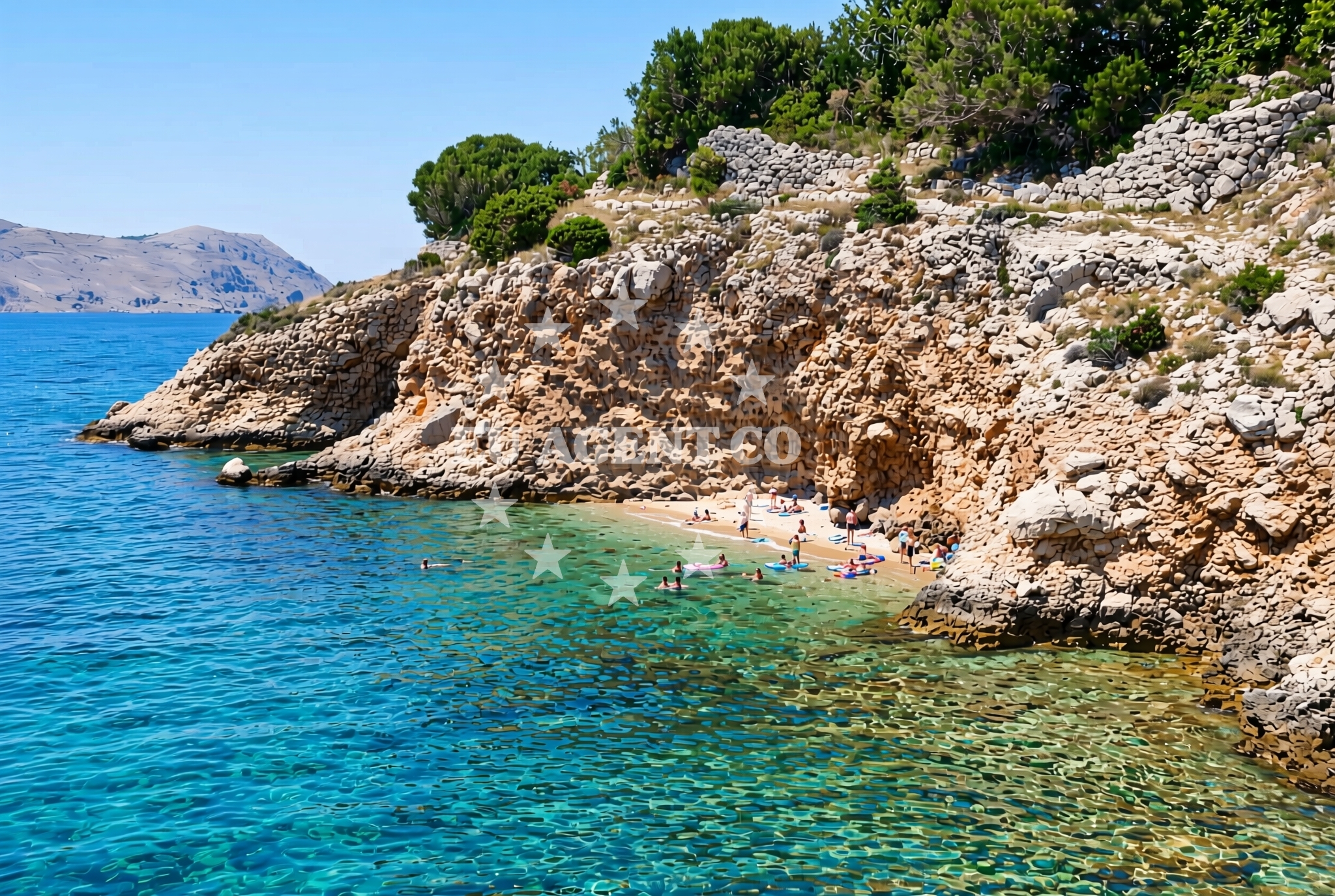
About this beach
Maslenska glava, Stinica
Beach: Maslenska glava
Location: Stinica
Characteristics and facilities
Gravel
Beach character
The beach is characterized by its gravel composition, a feature that shapes both its aesthetic and practical use. Gravel shores are common in coastal areas with strong wave action or rocky substrates, and this beach reflects those natural conditions. The texture of the gravel can vary, with some areas featuring smoother stones and others more angular, creating a tactile contrast for visitors. This type of beach is less common in tourist-heavy regions, making it a point of interest for those curious about geological coastal formations.Swimming and shore
Swimming is not typically the primary activity here due to the gravelly nature of the shore. The beach’s characteristics make it more suited for walking, photography, or simply observing the interplay between land and sea. The shoreline’s uneven surface may pose challenges for those unaccustomed to such terrain, but it also offers a unique vantage point for watching waves break against the gravel. The beach’s orientation and exposure to the open sea contribute to its dynamic character, with conditions influenced by prevailing winds and tides.Facilities and activities
Facilities at Maslenska glava, Stinica Beach are minimal, as the area is not developed for mass tourism. There are no official amenities such as restrooms, showers, or lifeguard services. The lack of infrastructure aligns with its status as a natural, undeveloped site. Activities are limited to passive enjoyment of the landscape, though the beach’s location may appeal to hikers, geology enthusiasts, or those interested in coastal photography. The surrounding region, however, offers more structured recreational options, including nearby villages and maritime routes.Access and location
Access to the beach is via local roads leading to Maslenska glava, a coastal settlement in Croatia. The exact route may require navigation through rural or semi-rural areas, reflecting the beach’s relative isolation from major tourist hubs. The coordinates (44.713001, 14.892241) place it in a region that is part of the broader Adriatic coastline, near areas with established maritime traditions. Visitors should consider local transportation options or arrange for a vehicle to reach the site, as public transit may be limited.What to expect
Visitors to Maslenska glava, Stinica Beach should expect a landscape shaped by natural geological processes rather than curated tourist amenities. The gravelly shore offers a stark contrast to the sandy beaches more commonly found along the Adriatic. The area’s undeveloped nature means there are no facilities such as parking, restrooms, or designated picnic zones. However, the beach’s raw character provides an opportunity to experience a less-visited part of Croatia’s coastline. The surrounding region, while not densely populated, is part of a maritime corridor that connects to other coastal settlements and sailing routes.Practical tips
Wear sturdy footwear to navigate the gravel terrain comfortably. Sun protection is advisable, as the lack of shade may increase exposure to sunlight. Be mindful of tide conditions, as the beach’s character can change with rising or falling water levels. The area’s remoteness means it is best suited for visitors seeking solitude rather than convenience.Exploring the coast by yacht
The beach’s location places it within a sailing region that extends along Croatia’s eastern Adriatic coast. While the beach itself is not a marina or anchorage, the surrounding waters are part of a broader sailing network that includes nearby ports and harbors. Euro-Agent’s yacht charter services can facilitate exploration of this area, allowing visitors to experience the same coastline from the water. For those interested in combining land and sea, the region offers opportunities to transition between coastal walks and yacht-based excursions.Regional Context and Coastal Orientation
Maslenska glava is part of a coastal stretch that runs parallel to the Dalmatian coast, a region known for its dramatic cliffs and historic maritime routes. The area’s geography influences local sailing patterns, with currents and wind conditions shaping the experience for yachts. Nearby settlements provide access to cultural sites, traditional cuisine, and other natural attractions, though the beach itself remains a quieter, more introspective destination.Anchorages in the surrounding area
Anchorages near Jablanac and Rab offer convenient stops for yachts exploring the surrounding waters.
- Zavratnica — jablanac — 0.9 NM from beach
- Mag — misnjak — rab — 1.3 NM from beach
- Anchorage — stinica — 1.3 NM from beach
- Anchorage — veli vranjak — 2.1 NM from beach
- Anchorage — rab — 2.5 NM from beach
- Anchorage — rab — 3.1 NM from beach
- Anchorage — veli vranjak — 3.2 NM from beach
- Anchorage — bacvica — 5.3 NM from beach
Distances are straight-line geographic distances, not sailing routes.
Mooring buoys in the surrounding area
- Konoba Stina — jablanac — 1.4 NM from beach
- Jetty — rab — 2.6 NM from beach
- Kaštel — barbat — rab — 3.7 NM from beach
- Jetty — barbat — rab — 3.8 NM from beach
- Sveti Stjepan — barbat — rab — 4.2 NM from beach
Distances are straight-line geographic distances, not sailing routes.
Marine fuel stations
Fuel stations in Rab and Mali Losinj support refueling for vessels traveling to and from the beach area.
- Ina — rab — 6.2 NM from beach
- Adria Oil — mali losinj — 21.2 NM from beach
- Ina — mali losinj — 21.3 NM from beach
- Tifon — nerezine — losinj — 21.3 NM from beach
Distances are straight-line geographic distances, not sailing routes.
Harbours in the surrounding area
- Mala Stinica — 0.4 NM from beach
- Jablanac — 0.5 NM from beach
- Mišnjak — misnjak — rab — 1.4 NM from beach
- Pičuljan dock — barbat — rab — 4.4 NM from beach
- Starigrad — starigrad senj — 5.1 NM from beach
- Hafen Rab — 6.1 NM from beach
Distances are straight-line geographic distances, not sailing routes.
Marinas in the surrounding area
Marinas in Rab and Supetarska Draga provide bases for yachts navigating the region around the beach.
- ACI Marina Rab — 6.1 NM from beach
- ACI Marina Supetarska Draga — rab — 8.9 NM from beach
- ACI Marina Šimuni — simuni — pag — 14.8 NM from beach
- Y/C Marina Mali Lošinj — mali losinj — 21.1 NM from beach
- Marina Lošinj — mali losinj — 21.2 NM from beach
Distances are straight-line geographic distances, not sailing routes.
Restaurants near the beach
Restaurants at Konoba Stina and Barbat offer dining options for visitors near the beach.
- Konoba Stina — jablanac — 1.4 NM from beach
- Leut — barbat — rab — 3.8 NM from beach
- Mama — barbat — rab — 3.9 NM from beach
- Barbat — rab — 4.2 NM from beach
Distances are straight-line geographic distances, not sailing routes.
Navigation guides for the surrounding area
Navigation guides for Jablanac and Uvala Stinica assist in planning routes to the beach and surrounding areas.
- Jablanac — 0.6 NM from beach
- Uvala Stinica — 0.7 NM from beach
- Uvala Zavratnica — 0.9 NM from beach
- Uvala Misnjak — 1.1 NM from beach
- Rab — 6.0 NM from beach
Distances are straight-line geographic distances, not sailing routes.
Yachts from nearby departure bases
Yachts departing from Rab ACI Marina and Novalja provide access to the beach and nearby waters.
Sailing yachts
- First 45 (Egeria) — Šimuni Kolan ACI Marina — 14.7 NM from departure base to beach
- Elan 50 Impression (Vuschi) — Mali Lošinj — 21.0 NM from departure base to beach
- Sun Odyssey 349 (Nara) — Mali Lošinj — 21.0 NM from departure base to beach
- Bavaria 37 Cruiser (Alani) — Mali Lošinj — 21.0 NM from departure base to beach
Motor yachts
- Absolute 50 Fly (Acrobat) — Rab ACI Marina — 6.1 NM from departure base to beach
Motor boats
- Balt 818 Titanium (Valentina) — Novalja — 9.4 NM from departure base to beach
- Balt 818 Titanium (Valentina 2) — Novalja — 9.4 NM from departure base to beach
- BWA Sport 22GT (BWA ) — Pag City Port — 17.5 NM from departure base to beach
- Galeon Galia 630 (287670ML) — Mali Lošinj — 21.0 NM from departure base to beach
- Atlantic Sun Cruiser 730 — Mali Lošinj — 21.0 NM from departure base to beach
Distances are straight-line geographic distances, not sailing routes.