Maris Beach - Beach Information & Yacht Charter Context, Croatia
Maris Beach, located in Peroj on Croatia’s Adriatic coast, is a 920-meter-long cove characterized by its natural shade and smooth depth gradient. Situated at coordinates 44.98724°N, 13.75622°E, the beach offers a unique combination of rocky terrain and family-friendly conditions, making it a destination for divers, campers, and naturists.
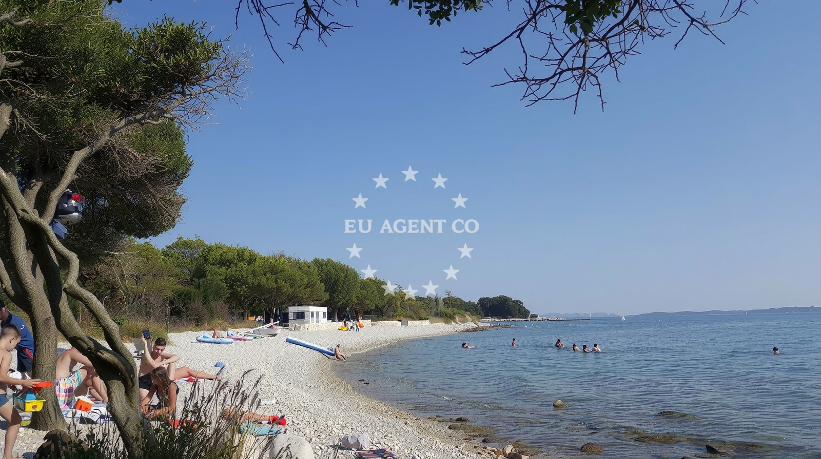
Beach character
The beach’s landscape features natural shade from surrounding cliffs, with a seabed primarily composed of large boulders. This creates a textured underwater environment suitable for snorkeling and diving but may pose challenges for those seeking sandy areas. The depth increases smoothly, offering a gentle slope ideal for children and non-swimmers. The beach is explicitly marked as popular with naturists and pet-friendly, though visitors are advised to follow designated area signs.
Swimming and shore
Swimming conditions are generally safe due to the gradual depth increase, though the boulder-strewn seabed may make standing difficult for some. The shore is composed of boulders and rocky outcrops, which provide natural seating but lack traditional sand. This terrain is less suitable for sunbathing but offers a rugged, scenic setting for those seeking a more adventurous beach experience.
Facilities and activities
Maris Beach does not have formal amenities like showers or restrooms. However, its natural features support activities such as surfing, kayaking, snorkeling, and water-based entertainment. The beach’s popularity with campers is notable, though no facilities are provided for wild camping. The area is explicitly noted as accommodating dogs, with nudist zones available.
Access and location
Access to Maris Beach is via Fažanska Street, Peroj, a coastal village in Croatia’s Split-Dalmatia County. The beach lies within a region known for its rugged coastline and sailing opportunities. Nearby, the Adriatic Sea offers routes to islands like Hvar and Brač, with marinas in Split and Bol providing yacht charter bases for exploring the area.
What to expect
Expect a rugged, natural beach with boulders dominating both shore and seabed. The area is well-suited for water sports enthusiasts and those seeking a less conventional beach setting. Families with children will benefit from the gradual depth increase, while naturists and campers will find the beach accommodating. Visitors should be prepared for the absence of formal facilities and the need to follow signage for designated zones.
Practical tips
Bring sturdy footwear for navigating the rocky shoreline. Sun protection is essential due to the lack of shaded seating areas beyond natural cliffs. For those camping, ensure compliance with local regulations and use designated zones. The beach’s popularity with dogs means waste disposal should be managed responsibly.
Exploring the coast by yacht
Maris Beach lies within a sailing region offering access to the Central Dalmatian Coast. Yacht charter guests may consider bases in Split or Bol for exploring nearby islands and anchorages. The Adriatic’s clear waters and sheltered coves make this area ideal for motorboat and sailing yacht excursions, with routes extending to Hvar, Vis, and the Pelješac Peninsula.
Regional Context & Sailing Proximity
Peroj is part of the Split-Našice municipality, a region with a rich maritime history. The nearby town of Split offers yacht charter services and marinas, while the islands of Hvar and Brač provide scenic sailing routes. The beach’s location makes it a convenient stop for sailors exploring the Adriatic’s eastern coast.
Anchorages in the surrounding area
Anchorages in the surrounding area include locations near Maric, Barbariga, and Rovinj.
- Anchorage — maric — 0.2 NM from beach
- UV. Sveti Benedikt — uv sveti benedikt — barbariga — 0.9 NM from beach
- Anchorage — peroj — 2.2 NM from beach
- Anchorage — rovinj — 2.9 NM from beach
- Anchorage — rovinj — 4.2 NM from beach
- Anchorage — veli brijun — 4.3 NM from beach
- Anchorage — rovinj — 4.8 NM from beach
- Anchorage — valbandon — 5.3 NM from beach
Distances are straight-line geographic distances, not sailing routes.
Mooring buoys in the surrounding area
Mooring buoys in the surrounding area are situated near Barbariga and Veli Brijun.
- Jetty — barbariga — 0.8 NM from beach
- Jetty — veli brijun — 3.1 NM from beach
- Jetty — veli brijun — 3.1 NM from beach
- Buoy field — mali brijun — 3.2 NM from beach
- Gospodarski Gat — veli brijun — 3.9 NM from beach
Distances are straight-line geographic distances, not sailing routes.
Marine fuel stations
Marine fuel stations are located in Rovinj, Pula, and Vrsar.
- Ina — rovinj — 7.8 NM from beach
- Ina — pula — 7.9 NM from beach
- Flash — pula — 9.7 NM from beach
- Crodux — vrsar — 11.7 NM from beach
Distances are straight-line geographic distances, not sailing routes.
Harbours in the surrounding area
Harbours in the surrounding area include Fazana, Marina Brijuni, and Valbandon.
- Fažana — fazana — 4.1 NM from beach
- Marina Brijuni — veli brijun — 4.2 NM from beach
- Veštar — vestar — rovinj — 4.8 NM from beach
- Valbandon — 5.0 NM from beach
- Salbuni — pula — 5.7 NM from beach
- Sveti Andrija — rovinj — 7.0 NM from beach
Distances are straight-line geographic distances, not sailing routes.
Marinas in the surrounding area
Marinas in the surrounding area are found in Pula, Rovinj, and Valbandon.
- Marina Polesana — pula — 7.2 NM from beach
- ACI Marina Rovinj — 7.4 NM from beach
- ACI Marina Pula — 7.8 NM from beach
- Marina Veruda — pula — 9.4 NM from beach
- Marina Bunarina — pula — 9.5 NM from beach
Distances are straight-line geographic distances, not sailing routes.
Restaurants near the beach
Restaurants near the beach include establishments in Pula, Fazana, and Veli Brijun.
- Ulika — pula — 3.6 NM from beach
- Alla Beccaccia — fazana — 4.0 NM from beach
- Restaurant Galija — veli brijun — 4.3 NM from beach
- Hotel / Restaurant Neptun — hotel restaurant neptun — veli brijun — 4.3 NM from beach
Distances are straight-line geographic distances, not sailing routes.
Navigation guides for the surrounding area
Navigation guides for the surrounding area cover locations like Limski Kanai and ZALJEV RASA.
- Limski Kanai — 10.6 NM from beach
- Luka Budava — 11.9 NM from beach
- Medulin and Pomer — 12.7 NM from beach
- ZALJEV RASA — 13.9 NM from beach
Distances are straight-line geographic distances, not sailing routes.
Yachts from nearby departure bases
Sailing yachts
- Oceanis 45 (Phantom) — Pula Tehnomont Marina Veruda — 5.0 NM from departure base to beach
Catamarans
- Lucia 40 (Luna Rossa II) — Pula Tehnomont Marina Veruda — 5.0 NM from departure base to beach
Motor boats
- Quicksilver 605 Sundeck (Unije) — Pula Fažana — 5.0 NM from departure base to beach
- Orizzonti Calipso 620 (Calipso) — Pula Fažana — 5.0 NM from departure base to beach
- Atlantic Marine 670 (Ave) — Pula Fažana — 5.0 NM from departure base to beach
- Atlantic 750 (Atlantic Marine) — Pula Fažana — 5.0 NM from departure base to beach
- Orizzonti Calipso 620 (Calipso) — Pula Fažana — 5.0 NM from departure base to beach
- Viga Luxury 650 (Viga) — Pula Fažana — 5.0 NM from departure base to beach
- Orizzonti Andromeda — Pula Fažana — 5.0 NM from departure base to beach
- Orizzonti Andromeda II — Pula Fažana — 5.0 NM from departure base to beach
Distances are straight-line geographic distances, not sailing routes.