Marina, Vir (Vir) Beach, Croatia
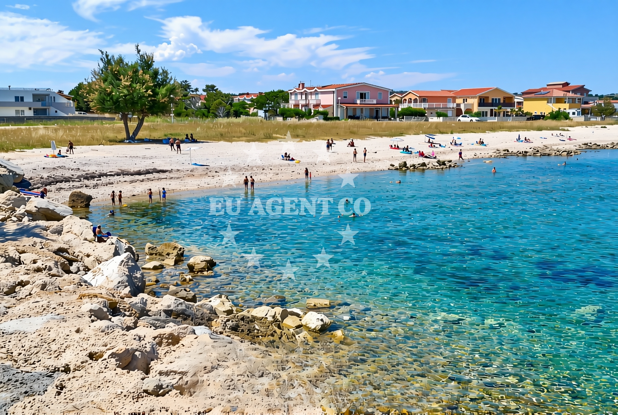
Marina, Vir (Vir) Beach lies along the Adriatic coast of Croatia, offering a unique shoreline composed of gravel, concrete slabs, and rocky outcrops. Stretching 260 meters along the shore, this beach is part of the broader Vir settlement, a historic location on the island of Vir. While the beach itself lacks traditional sand, its proximity to maritime infrastructure and natural coastal features makes it a point of interest for those exploring the region's waters.
About this beach
Marina, Vir (Vir)
Beach: Marina
Location: Vir (Vir)
Characteristics and facilities
Gravel, concrete / stone slabs, rocks
260 m
Beach character
The beach's surface consists primarily of gravel, concrete slabs, and exposed rock formations, reflecting its function as a marina-associated shoreline. These characteristics make it more suitable for boat access and mooring than recreational sunbathing. The beach's orientation and terrain suggest it serves as a transitional zone between land and sea, with potential for short walks along the shore. The absence of detailed natural features in the catalog indicates a focus on functional rather than recreational use.
Swimming and shore
Swimming conditions at Marina, Vir Beach are not explicitly documented in the catalog. The rocky and gravelly shoreline may limit direct water access for swimmers, though the adjacent open waters of the Adriatic likely offer opportunities for boating and water activities. The beach's proximity to Vir's maritime infrastructure suggests it may be used for launching small craft or accessing nearby anchorages.
Facilities and activities
No specific facilities or activities are listed in the catalog for this beach. Its primary function appears to be as a marina-associated shoreline rather than a recreational beach. Visitors should expect minimal amenities, with no mention of showers, restrooms, or seating. The beach's characteristics align more with maritime operations than leisure activities, though the surrounding area of Vir may offer broader coastal experiences.
Access and location
Located in Marina, Vir (Vir), this beach is part of the Adriatic coastline near the island of Vir. Coordinates (44.309634, 15.086647) place it within the broader Dalmatian coast region, known for its historic maritime settlements and sailing routes. The beach's proximity to Vir's marina infrastructure suggests it may be used for boat mooring or as a point of embarkation for coastal excursions.
What to expect
Visitors to Marina, Vir Beach should expect a shoreline dominated by gravel, concrete slabs, and rocky terrain. The beach's 260-meter length provides limited space for recreational use, with its primary function appearing to support maritime activities. The absence of detailed facility information indicates minimal amenities, though the surrounding Vir settlement may offer additional services for visitors exploring the area.
Practical tips
Given the beach's functional nature, visitors should prioritize maritime-related activities over recreational use. Those planning to explore the area may find nearby settlements like Vir or nearby islands more suitable for extended stays. For detailed sailing information, the Euro-Agent yacht search platform provides resources for chartering vessels in the region.
Exploring the coast by yacht
The Adriatic coast near Vir is a well-established sailing region, with numerous anchorages and marinas along the Dalmatian coast. Charter guests exploring this area may find opportunities to visit nearby islands, historical sites, and coastal towns. For those interested in yacht charter options in the region, the Euro-Agent yacht search page offers detailed information on available vessels and sailing routes.
Historical Context of Vir
The island of Vir has long been associated with maritime activity, serving as a strategic location for sailors and traders. Its proximity to the mainland and natural harbor features made it a significant stop along historic Adriatic routes. While the beach itself may not have historical significance, the broader settlement of Vir reflects centuries of coastal habitation and maritime trade.
Anchorages in the surrounding area
- Anchorage — vir — 0.2 NM from beach
- Anchorage — vir — 0.8 NM from beach
- Anchorage — vir — 1.3 NM from beach
- Anchorage — lozice — vir — 1.4 NM from beach
- Anchorage — vir — 1.7 NM from beach
- Anchorage — povljana — pag — 1.9 NM from beach
- Anchorage — lozice — vir — 2.4 NM from beach
- Anchorage — vir — 2.4 NM from beach
Distances are straight-line geographic distances, not sailing routes.
Mooring buoys in the surrounding area
- Vir — 0.8 NM from beach
- Punta Skala — petrcane — 7.5 NM from beach
- Jetty — ljubac — 9.4 NM from beach
- Buoy field — muline — ugljan — 10.2 NM from beach
- Jetty — ugljan — 10.3 NM from beach
Distances are straight-line geographic distances, not sailing routes.
Marine fuel stations
- Ina — zadar — 13.0 NM from beach
- Ina — preko — ugljan — 14.7 NM from beach
- Fuel station — sukosan — 17.9 NM from beach
- Ina — zaglav — dugi otok — 21.8 NM from beach
Distances are straight-line geographic distances, not sailing routes.
Harbours in the surrounding area
- Povljana — pag — 2.2 NM from beach
- Privlaka — 3.0 NM from beach
- Košljun — kosljun pag — 5.2 NM from beach
- Nin — 5.6 NM from beach
- Mulo — nin — 6.1 NM from beach
- Miškovići — miskovici — pag — 6.3 NM from beach
Distances are straight-line geographic distances, not sailing routes.
Marinas in the surrounding area
Marinas in the surrounding area include ACI Marina Šimuni — simuni — pag and Marina Borik — zadar, located at greater distances from the beach.
- ACI Marina Šimuni — simuni — pag — 11.2 NM from beach
- Marina Borik — zadar — 12.0 NM from beach
- Vitrenjak Zadar — 12.3 NM from beach
- Marina Zadar — 13.0 NM from beach
- Olive Island Marina — sutomiscica — ugljan — 13.3 NM from beach
Distances are straight-line geographic distances, not sailing routes.
Restaurants near the beach
Restaurants near the beach include Restaurant — vir and Viranka, located in proximity to the beach.
- Restaurant — vir — 0.6 NM from beach
- Viranka — 0.6 NM from beach
- Monica — vir — 0.7 NM from beach
- Restaurant — vir — 0.8 NM from beach
- Grill Marion — vir — 1.2 NM from beach
- Restaurant — vir — 1.7 NM from beach
- Lanterna — povljana — pag — 2.5 NM from beach
Distances are straight-line geographic distances, not sailing routes.
Navigation guides for the surrounding area
- OTOK PAG — 1.4 NM from beach
- Privlaka — 3.1 NM from beach
- Luka Jazi — 10.2 NM from beach
- Uvala Bliznica — 10.2 NM from beach
- Muline — 10.2 NM from beach
Distances are straight-line geographic distances, not sailing routes.
Yachts from nearby departure bases
Sailing yachts
- First 45 (Egeria) — Šimuni Kolan ACI Marina — 11.3 NM from departure base to beach
- Dufour 460 (Proizd) — Zadar Marina Borik — 12.0 NM from departure base to beach
Catamarans
- Sunreef 60 (SINATA) — Zadar Marina Borik — 12.0 NM from departure base to beach
Motor yachts
- Ferretti 780 (TESORO) — Zadar Marina Borik — 12.0 NM from departure base to beach
Motor boats
- Merry Fisher 895 — Povljana Marina — 2.4 NM from departure base to beach
- BWA Sport 22GT (BWA ) — Pag City Port — 8.2 NM from departure base to beach
- Rancraft RM19 (Daycruiser) — Zadar Diklo Port — 10.7 NM from departure base to beach
- Rancraft RM21 (Dugi otok) — Zadar Diklo Port — 10.7 NM from departure base to beach
- Rancraft RS Cinque.5 — Zadar Diklo Port — 10.7 NM from departure base to beach
- Merry Fisher 895 — Zadar Marina Borik — 12.0 NM from departure base to beach
Distances are straight-line geographic distances, not sailing routes.