Marić Zapad, Peroj Beach, Croatia
About this beach
Marić zapad, Peroj
Beach: Marić zapad
Location: Peroj
Characteristics and facilities
Gravel, rocks
350 m
Beach character
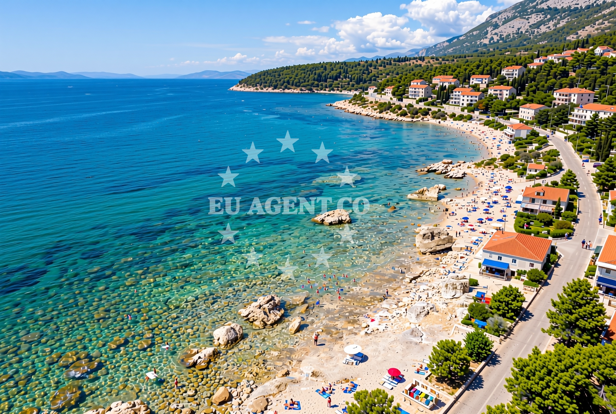
The beach's surface is composed of gravel and rocks, offering a stable but uneven walking surface. This terrain makes it particularly suitable for activities such as walking, exploring coastal rock formations, and photography. The beach's length of 350 meters provides a moderate stretch for visitors to enjoy, though its composition limits traditional sand-based activities like sunbathing or building sandcastles. The absence of structured amenities means the beach retains a raw, unaltered character typical of many natural Croatian shorelines.Swimming and shore
Due to its gravel and rocky composition, swimming is not the primary activity at Marić Zapad, Peroj Beach. The shoreline's uneven surface makes it more practical for walking along the water's edge or exploring tidal pools and rock crevices. The beach's proximity to the Adriatic Sea ensures clear visibility of the surrounding waters, though the lack of designated swimming areas means visitors should exercise caution when entering the sea.Facilities and activities
No official facilities are listed for Marić Zapad, Peroj Beach. The absence of structured amenities means visitors should plan accordingly, bringing personal items such as water, snacks, and appropriate footwear for the gravel and rocky terrain. The beach's natural character makes it ideal for activities like coastal hiking, geological observation, and photography, though it is not equipped for organized sports or large gatherings.Access and location
Marić Zapad, Peroj Beach is situated in the coastal town of Peroj, a small settlement on the Adriatic coast of Croatia. Its coordinates (44.985623, 13.752839) place it within a region known for its rugged coastline and historic maritime connections. The beach is accessible via local roads leading to Peroj, though specific parking details are not provided in the catalog. Visitors are advised to follow local signage and respect any informal access guidelines.What to expect
Visitors to Marić Zapad, Peroj Beach should expect a natural shoreline composed of gravel and rocks, with no formal amenities or services. The beach's 350-meter length offers a modest stretch for exploration, with the terrain favoring walking and photography over traditional beach activities. The area's rugged character aligns with the broader Adriatic coastline, which features similar unaltered shorelines in many parts of Croatia. The beach's location in Peroj places it within a region historically connected to maritime traditions, though modern infrastructure is limited to basic coastal access.Practical tips
For visitors planning to explore Marić Zapad, Peroj Beach, consider the following: 1. Wear sturdy footwear to navigate the gravel and rocky terrain comfortably. 2. Bring water and snacks, as no refreshments are available on-site. 3. Arrive early to avoid crowds, as the beach's natural character may attract fewer visitors than more developed coastal areas. 4. Respect the shoreline's raw condition by avoiding activities that could damage the gravel or rock formations.Exploring the coast by yacht
Marić Zapad, Peroj Beach lies within a sailing region of the Adriatic Sea, offering opportunities for yacht charter guests exploring Croatia's eastern coast. While the beach itself is not a designated anchorage, its location near Peroj places it within proximity to marinas and harbors that cater to motor yachts and sailboats. Charter guests navigating the area may find the surrounding coastline particularly appealing for its mix of rugged shorelines and historic coastal settlements, though specific sailing routes and distances would require consultation with Euro-Agent's Yacht Search platform for detailed planning.Regional Context and Coastal Features
Peroj is part of the broader Dubrovnik-Neretva County, an area known for its medieval fortifications, vineyards, and dramatic coastal landscapes. The region's coast features a mix of pebbly and rocky beaches, with Marić Zapad representing a typical example of this terrain. Nearby, the town of Cavtat offers more developed coastal amenities, while the islands of Mljet and Šipan provide additional sailing and exploration opportunities for yacht charter guests.Anchorages in the surrounding area
Anchorages in the surrounding area include options near Maric, Barbariga, and Rovinj.
- Anchorage — maric — 0.2 NM from beach
- UV. Sveti Benedikt — uv sveti benedikt — barbariga — 0.8 NM from beach
- Anchorage — peroj — 2.2 NM from beach
- Anchorage — rovinj — 2.9 NM from beach
- Anchorage — rovinj — 4.2 NM from beach
- Anchorage — veli brijun — 4.2 NM from beach
- Anchorage — rovinj — 4.8 NM from beach
- Anchorage — valbandon — 5.3 NM from beach
Distances are straight-line geographic distances, not sailing routes.
Mooring buoys in the surrounding area
- Jetty — barbariga — 0.6 NM from beach
- Jetty — veli brijun — 3.0 NM from beach
- Jetty — veli brijun — 3.0 NM from beach
- Buoy field — mali brijun — 3.1 NM from beach
- Gospodarski Gat — veli brijun — 3.8 NM from beach
Distances are straight-line geographic distances, not sailing routes.
Marine fuel stations
Marine fuel stations are located in Rovinj, Pula, and Vrsar.
- Ina — rovinj — 7.8 NM from beach
- Ina — pula — 7.9 NM from beach
- Flash — pula — 9.7 NM from beach
- Crodux — vrsar — 11.7 NM from beach
Distances are straight-line geographic distances, not sailing routes.
Harbours in the surrounding area
Harbours in the surrounding area include Fazana, Veli Brijun, and Valbandon.
- Fažana — fazana — 4.1 NM from beach
- Marina Brijuni — veli brijun — 4.1 NM from beach
- Veštar — vestar — rovinj — 4.8 NM from beach
- Valbandon — 5.0 NM from beach
- Salbuni — pula — 5.7 NM from beach
- Sveti Andrija — rovinj — 7.0 NM from beach
Distances are straight-line geographic distances, not sailing routes.
Marinas in the surrounding area
Marinas in the surrounding area are found in Pula, Rovinj, and Pula's Marina Veruda.
- Marina Polesana — pula — 7.2 NM from beach
- ACI Marina Rovinj — 7.4 NM from beach
- ACI Marina Pula — 7.8 NM from beach
- Marina Veruda — pula — 9.4 NM from beach
- Marina Bunarina — pula — 9.5 NM from beach
Distances are straight-line geographic distances, not sailing routes.
Restaurants near the beach
Restaurants near the beach include options in Pula, Fazana, and Veli Brijun.
- Ulika — pula — 3.6 NM from beach
- Alla Beccaccia — fazana — 4.0 NM from beach
- Restaurant Galija — veli brijun — 4.2 NM from beach
- Hotel / Restaurant Neptun — hotel restaurant neptun — veli brijun — 4.2 NM from beach
Distances are straight-line geographic distances, not sailing routes.
Navigation guides for the surrounding area
Navigation guides for the surrounding area cover locations like Limski Kanai and ZALJEV RASA.
- Limski Kanai — 10.6 NM from beach
- Luka Budava — 12.0 NM from beach
- Medulin and Pomer — 12.7 NM from beach
- ZALJEV RASA — 14.0 NM from beach
Distances are straight-line geographic distances, not sailing routes.
Yachts from nearby departure bases
Sailing yachts
- Sun Odyssey 419 (Mira) — Pula Tehnomont Marina Veruda — 5.0 NM from departure base to beach
Catamarans
- Lucia 40 (Makohela) — Pula Tehnomont Marina Veruda — 5.0 NM from departure base to beach
Motor boats
- Atlantic 750 (Atlantic Marine) — Pula Fažana — 5.0 NM from departure base to beach
- Orizzonti Calipso 620 (Calipso) — Pula Fažana — 5.0 NM from departure base to beach
- Quicksilver 605 Sundeck (Unije) — Pula Fažana — 5.0 NM from departure base to beach
- Atlantic Marine 670 (Ave) — Pula Fažana — 5.0 NM from departure base to beach
- Orizzonti Calipso 620 (Calipso) — Pula Fažana — 5.0 NM from departure base to beach
- Viga Luxury 650 (Viga) — Pula Fažana — 5.0 NM from departure base to beach
- Orizzonti Andromeda — Pula Fažana — 5.0 NM from departure base to beach
- Orizzonti Andromeda II — Pula Fažana — 5.0 NM from departure base to beach
Distances are straight-line geographic distances, not sailing routes.