Mama, Barbat na Rabu (Rab) Beach, Croatia
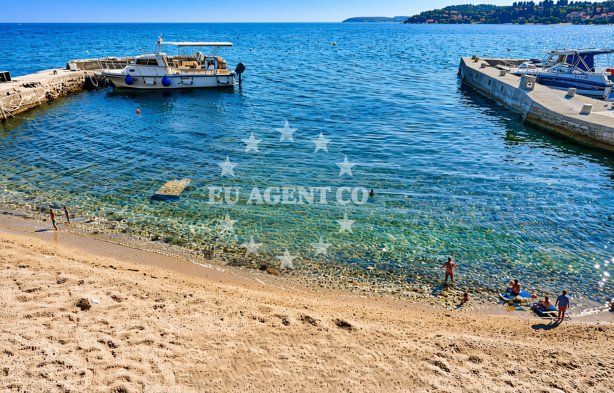
Mama, Barbat na Rabu (Rab) Beach lies on the northern coast of the island of Rab, part of the Central Dalmatian Islands. This gravel beach is positioned within the village of Barbat, a quiet coastal settlement known for its traditional stone houses and proximity to the island's historic town center. The beach's location offers a blend of natural coastline and local amenities, making it a convenient stop for visitors exploring the Rab region.
About this beach
Mama, Barbat na Rabu (Rab)
Beach: Mama
Location: Barbat na Rabu (Rab)
Characteristics and facilities
Gravel
Restaurant / snack bar
Caffe bar / Drinks stand
Beach character
The beach is characterized by its gravel substrate, which extends along the shoreline in a relatively narrow strip. This type of beach is common along Rab's northern coast, where rocky formations and shallow waters create a unique coastal landscape. The gravel provides a stable surface for walking and is often used by locals for casual strolls. While the beach does not feature sand, its natural composition aligns with the geological profile of the area, which includes limestone cliffs and pebbly shorelines.
Swimming and shore
The shallow, clear waters near the beach are suitable for swimming, though the gravel substrate may make wading less comfortable for some. The shoreline is relatively flat, with no significant elevation changes, and the beach itself is not enclosed by headlands or rock formations. The adjacent waters are part of the broader Rab coastal zone, known for its generally calm conditions during the summer months.
Facilities and activities
The beach is equipped with basic facilities, including a restaurant/snack bar and a caffe bar/drinks stand. These on-site options provide visitors with the ability to enjoy meals or refreshments without leaving the immediate area. The presence of these amenities suggests the beach is a regular destination for both local residents and tourists seeking a relaxed coastal experience. No additional recreational activities or structured programs are listed in the beach's catalog details.
Access and location
Located within the village of Barbat on the island of Rab, the beach is accessible via local roads that connect to the island's main thoroughfares. Rab itself is reachable by ferry from the mainland, with services departing from the port of Rab (on the island) and the mainland town of Sibenik. The beach's proximity to the village center means visitors can easily combine a visit with exploring Barbat's traditional architecture and local shops. The coordinates (44.733042, 14.804521) place it in a region of the island that is less densely developed compared to the southern coast.
What to expect
Visitors to Mama, Barbat na Rabu (Rab) Beach should expect a gravel shoreline with minimal infrastructure beyond the on-site dining options. The beach is not marked as particularly secluded, and its accessibility via local roads suggests it may be used by both locals and tourists. The presence of a restaurant and caffe bar indicates it is a functional beach for those seeking a casual meal or drink while enjoying the coastal setting. The area's general character is reflective of Rab's northern coastline, which prioritizes natural landscapes over extensive tourism development.
Practical tips
Given the gravel surface, visitors may want to wear comfortable footwear for walking along the shore. The on-site dining options are ideal for those looking to avoid carrying food or drinks from elsewhere. As with many beaches on the island, it is advisable to bring sunscreen and a hat for sun protection, especially during the peak summer months.
Exploring the coast by yacht
The beach's location on the island of Rab places it within a well-established sailing region of the Adriatic. Rab is a popular stop for charter yachts exploring the northern Dalmatian coast, with the island's marina in the town of Rab serving as a common base for trips to nearby islands like Vis and Hvar. While the beach itself is not a designated anchorage, its proximity to the island's main marina and the surrounding sailing routes make it a convenient reference point for sailors navigating the area. For those considering yacht charter in the region, the Euro-Agent Yacht Search page provides detailed information on available vessels and sailing itineraries.
Regional Context: Rab Island and the Adriatic Sailing Route
Rab Island, where this beach is located, is part of a sailing corridor that connects the mainland to the islands of the central Dalmatian archipelago. The island's position near the entrance to the Kvarner Gulf makes it a strategic point for both short-day trips and longer voyages. The surrounding waters are known for their clear visibility and generally mild conditions, though sailors should be mindful of local currents and wind patterns. The island's marina in Rab town is a key hub for charter yachts, offering services such as fueling, provisioning, and maintenance.
Anchorages in the surrounding area
Anchorages in the surrounding area, including those near Rab and Misnjak.
- Anchorage — rab — 1.1 NM from beach
- Anchorage — rab — 2.1 NM from beach
- Mag — misnjak — rab — 2.6 NM from beach
- Anchorage — rab — 2.9 NM from beach
- Anchorage — rab — 3.0 NM from beach
- Anchorage — rab — 3.3 NM from beach
- Anchorage — suha punta — rab — 3.4 NM from beach
- Anchorage — suha punta — rab — 3.6 NM from beach
Distances are straight-line geographic distances, not sailing routes.
Mooring buoys in the surrounding area
Mooring buoys in the surrounding area, such as those at Barbat and Banjol.
- Jetty — barbat — rab — 0.1 NM from beach
- Sveti Stjepan — barbat — rab — 0.3 NM from beach
- Kaštel — barbat — rab — 0.3 NM from beach
- Banjol — rab — 1.2 NM from beach
- Jetty — rab — 1.9 NM from beach
Distances are straight-line geographic distances, not sailing routes.
Marine fuel stations
Marine fuel stations in Rab and nearby areas like Mali Lošinj.
- Ina — rab — 2.3 NM from beach
- Tifon — nerezine — losinj — 17.8 NM from beach
- Adria Oil — mali losinj — 18.7 NM from beach
- Ina — mali losinj — 18.9 NM from beach
Distances are straight-line geographic distances, not sailing routes.
Harbours in the surrounding area
Harbours in the surrounding area, including Pičuljan dock in Barbat and Hafen Rab.
- Pičuljan dock — barbat — rab — 0.5 NM from beach
- Hafen Rab — 2.2 NM from beach
- Mišnjak — misnjak — rab — 3.0 NM from beach
- Mala Stinica — 3.8 NM from beach
- Veli Žal — suha punta — rab — 3.8 NM from beach
- Tovarnele — pag — 3.8 NM from beach
Distances are straight-line geographic distances, not sailing routes.
Marinas in the surrounding area
Marinas in the surrounding area, such as ACI Marina Rab and ACI Marina Supetarska Draga.
- ACI Marina Rab — 2.3 NM from beach
- ACI Marina Supetarska Draga — rab — 5.4 NM from beach
- ACI Marina Šimuni — simuni — pag — 17.0 NM from beach
- Marina Nerezine — losinj — 17.9 NM from beach
- Y/C Marina Mali Lošinj — mali losinj — 18.6 NM from beach
Distances are straight-line geographic distances, not sailing routes.
Restaurants near the beach
Restaurants near the beach, including Mama and Leut in Barbat, and others in Rab.
- Mama — barbat — rab — 0.0 NM from beach
- Leut — barbat — rab — 0.1 NM from beach
- Barbat — rab — 0.3 NM from beach
- Santa Maria — rab — 2.2 NM from beach
- Tapas Bar Kampanel — rab — 2.3 NM from beach
- Paradiso — rab — 2.3 NM from beach
- Labirint — rab — 2.3 NM from beach
Distances are straight-line geographic distances, not sailing routes.
Navigation guides for the surrounding area
Navigation guides for the surrounding area, covering Rab and nearby locations like Uvala Misnjak.
- Rab — 2.2 NM from beach
- Uvala Sv. Fumija — 2.9 NM from beach
- Uvala Misnjak — 3.1 NM from beach
- Uvala Stinica — 4.0 NM from beach
- Jablanac — 4.4 NM from beach
Distances are straight-line geographic distances, not sailing routes.
Yachts from nearby departure bases
Yachts from nearby departure bases, including Rab ACI Marina and Novalja.
Sailing yachts
- First 45 (Egeria) — Šimuni Kolan ACI Marina — 16.9 NM from departure base to beach
- Bavaria 37 Cruiser (Alani) — Mali Lošinj — 18.6 NM from departure base to beach
- Sun Odyssey 349 (Nara) — Mali Lošinj — 18.6 NM from departure base to beach
- Dufour 412 Grand large (Eva) — Mali Lošinj — 18.6 NM from departure base to beach
Motor yachts
- Absolute 50 Fly (Acrobat) — Rab ACI Marina — 2.3 NM from departure base to beach
Motor boats
- Balt 818 Titanium (Valentina) — Novalja — 11.1 NM from departure base to beach
- Balt 818 Titanium (Valentina 2) — Novalja — 11.1 NM from departure base to beach
- Galeon Galia 700 — Mali Lošinj — 18.6 NM from departure base to beach
- Invictus 200FX (1255ML) — Mali Lošinj — 18.6 NM from departure base to beach
- Barracuda 530 RIB (Hvar) — Mali Lošinj — 18.6 NM from departure base to beach
Distances are straight-line geographic distances, not sailing routes.