Mali Rat Zapad, Dugi Rat Beach, Croatia
Mali Rat Zapad, part of the larger Dugi Rat area on the Adriatic coast of Croatia, is a gravel beach stretching approximately 350 meters. Situated in a region known for its scenic coastline and maritime heritage, this beach offers a quiet stretch of shoreline with basic amenities. Its proximity to the village of Dugi Rat and the broader Mali Rat area makes it a convenient stop for visitors exploring the northern Dalmatian coast.
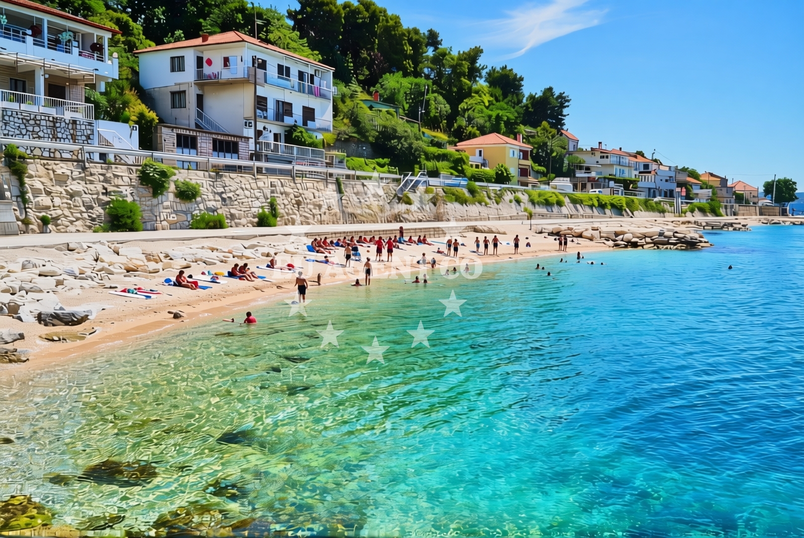
About this beach
Mali rat zapad, Dugi Rat
Beach: Mali rat zapad
Location: Dugi Rat
Characteristics and facilities
Gravel
350 m
Restaurant / snack bar
Caffe bar / Drinks stand
Beach character
The beach is composed of gravel, a characteristic common to many shores along the Adriatic’s rocky coastline. While not ideal for swimming, the gravel provides a stable surface for walking or sunbathing. The beach is relatively short, measuring around 350 meters, and lacks extensive facilities beyond a restaurant/snack bar and a café/bar/drinks stand. These amenities suggest it is a modest spot for casual visits rather than a major tourist hub.
Swimming and shore
Due to its gravel composition, Mali Rat Zapad is not suited for swimming. The shoreline is uneven, making it more practical for walking or sightseeing than for water activities. The beach’s orientation and surrounding geography likely contribute to its rocky character, typical of this part of the Adriatic. Visitors should consider nearby coves or beaches for swimming if water activities are a priority.
Facilities and activities
The beach includes a restaurant/snack bar and a café/bar/drinks stand, offering basic refreshments for visitors. These facilities are likely seasonal and may operate on a limited schedule. No specific activities are listed in the beach’s catalog, but the area’s coastal setting suggests opportunities for hiking, photography, or exploring nearby villages. The absence of structured amenities or programs indicates a low-key, self-directed experience.
Access and location
Mali Rat Zapad is located within the Dugi Rat area, a part of the Mali Rat peninsula on the Adriatic Sea. The beach is accessible via local roads connecting to the village of Dugi Rat and the broader Mali Rat region. Its position near the coast makes it a potential waypoint for those traveling along the northern Dalmatian coast, though it is not directly adjacent to major towns or transportation hubs. The area’s maritime history and proximity to the sea highlight its connection to Croatia’s nautical traditions.
What to expect
Visitors to Mali Rat Zapad should expect a gravel beach with limited facilities, ideal for a brief stop rather than extended stays. The beach’s amenities—such as the restaurant/snack bar and café—suggest it caters to casual visitors. The area’s natural setting, with its rocky shoreline and coastal views, may appeal to those seeking a quiet, unobtrusive beach experience. The beach’s location within the Dugi Rat and Mali Rat regions offers opportunities to explore nearby villages, islands, and sailing routes.
Practical tips
Bring sturdy footwear for the gravel surface, and check the operating hours of the restaurant/snack bar and café before visiting. The beach’s modest size and facilities make it best suited for short stays. Consider combining a visit with exploration of the surrounding Dugi Rat area or nearby coastal towns for a more comprehensive experience.
Exploring the coast by yacht
The Mali Rat and Dugi Rat regions are part of the Adriatic’s popular sailing routes, known for their clear waters, scenic anchorages, and proximity to historic ports. Yacht charter guests exploring this area may find the beach’s location useful as a reference point for navigating between islands and coastal towns. Nearby marinas and anchorages, such as those in the village of Dugi Rat or along the Mali Rat peninsula, provide options for docking or mooring. The region’s sailing appeal, combined with its cultural and natural attractions, makes it a compelling destination for charter travelers.
Regional Context and Nearby Exploration
The Dugi Rat and Mali Rat areas are part of the northern Dalmatian coast, a region rich in history, culture, and natural beauty. Nearby villages and towns, such as Supetar and Bol, offer additional amenities, restaurants, and cultural sites. The area’s proximity to the islands of Hvar and Brac makes it a convenient base for island-hopping excursions. Visitors may also explore the nearby Pakleni Islands or the town of Split, which is a short drive or boat ride away.
Anchorages in the surrounding area
Anchorages in the surrounding area include options near Postira and Splitska on Brac, offering nearby stops for mooring.
- Anchorage — postira — brac — 4.3 NM from beach
- Anchorage — splitska — brac — 4.4 NM from beach
- Anchorage — postira — brac — 5.0 NM from beach
- Konopjikova — postira — brac — 5.5 NM from beach
- Anchorage — supetar — brac — 5.5 NM from beach
- Uvala Likva — sutivan — brac — 8.1 NM from beach
- Anchorage — split — 9.1 NM from beach
- Stiniva — brac — 9.2 NM from beach
Distances are straight-line geographic distances, not sailing routes.
Mooring buoys in the surrounding area
Mooring buoys in the surrounding area feature jetties in Podstrana and quays near Postira on Brac.
- Jetty — podstrana — 3.0 NM from beach
- Quay — postira — brac — 5.5 NM from beach
- Promenade — split — 9.2 NM from beach
- Nautical Anchorage Bobovišća — bobovisce — brac — 9.3 NM from beach
- Nautical Anchorage Bobovišća — bobovisce — brac — 9.4 NM from beach
Distances are straight-line geographic distances, not sailing routes.
Marine fuel stations
- Ina — split — 9.2 NM from beach
- Ina — split — 9.6 NM from beach
- Ina — milna brac — 10.9 NM from beach
- Flash — kastel gomilica — 11.2 NM from beach
Distances are straight-line geographic distances, not sailing routes.
Harbours in the surrounding area
Harbours in the surrounding area include Sumpetar and Dugi Rat, located in close proximity to the beach.
- Sumpetar — dugi rat — 0.1 NM from beach
- Dugi Rat — 0.6 NM from beach
- Krilo — jesenice — 1.4 NM from beach
- Omiš — omis — 2.9 NM from beach
- Postira — brac — 4.3 NM from beach
- Splitska — brac — 4.4 NM from beach
Distances are straight-line geographic distances, not sailing routes.
Marinas in the surrounding area
- Marina Lav — podstrana — 4.7 NM from beach
- ACI Marina Split — 9.2 NM from beach
- ACI Marina Milna — milna brac — 10.8 NM from beach
- Marina Milna Kanarija — milna brac — 10.8 NM from beach
- Marina Vlaška — milna brac — 10.9 NM from beach
Distances are straight-line geographic distances, not sailing routes.
Restaurants near the beach
Restaurants near the beach include Konoba Milo in Omis and Galija in Postira, offering dining options in the vicinity.
- Konoba Milo — omis — 2.9 NM from beach
- Galija — postira — brac — 4.3 NM from beach
- Vala — splitska — brac — 4.5 NM from beach
- Leonis — podstrana — 4.7 NM from beach
- Skampino — podstrana — 4.7 NM from beach
- Fabio — podstrana — 4.8 NM from beach
- Mala Kate — supetar — brac — 4.9 NM from beach
Distances are straight-line geographic distances, not sailing routes.
Navigation guides for the surrounding area
Navigation guides for the surrounding area include Dugi Rat and Omis, providing route information for the region.
- Dugi Rat (Uvala Orisac) — 0.8 NM from beach
- Omis — 3.2 NM from beach
- Postire — 4.3 NM from beach
- Uvala Spliska (Splitska) — 4.4 NM from beach
- Kairos — 4.6 NM from beach
Distances are straight-line geographic distances, not sailing routes.
Yachts from nearby departure bases
Yachts from nearby departure bases include vessels based in Sumpetar Port and Omiš City Port, offering options for charter.
Sailing yachts
- Jeanneau 53 (Win Win) — Podstrana Marina Lav — 4.7 NM from departure base to beach
Catamarans
- Lagoon 450 Fly (Falco) — Sumpetar Port — 0.2 NM from departure base to beach
Motor yachts
- Ferretti 500 (Anna) — Podstrana Marina Lav — 4.7 NM from departure base to beach
Gulets / Cruisers
- Gulet (Altair) — Sumpetar Port — 0.2 NM from departure base to beach
- Gulet (Cataleya) — Sumpetar Port — 0.2 NM from departure base to beach
- Gulet cruiser (AGORA) — Dugi Rat Luka Krilo — 1.4 NM from departure base to beach
- Gulet (PATRONICE) — Omiš City Port — 2.8 NM from departure base to beach
- Gulet (Primorac) — Omiš City Port — 2.9 NM from departure base to beach
- Gulet (Trebenna) — Omiš City Port — 2.9 NM from departure base to beach
Motor boats
- Cranchi 43 Sport Top (Chiara) — Podstrana Marina Lav — 4.7 NM from departure base to beach
Distances are straight-line geographic distances, not sailing routes.