Mali most, Goveđari (Mljet) Beach, Croatia
5 photos
About this beach
Mali most, Goveđari (Mljet)
Beach: Mali most
Location: Goveđari (Mljet)
Characteristics and facilities
Gravel
50 m
Natural shade
Beach character
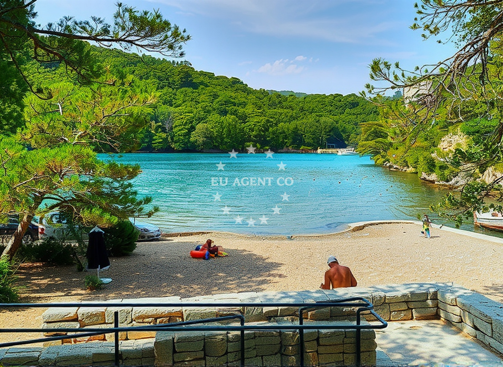
The beach consists of gravel, a feature that distinguishes it from the more common sandy shores of the Adriatic. While this may not appeal to all visitors, it creates a unique environment for those looking to explore the coastline’s natural state. The 50-meter length provides a modest but intimate setting, ideal for solitary walks or small group gatherings. Natural shade is available along parts of the shore, likely from overhanging rock formations or sparse vegetation, offering limited relief from the sun during peak hours. The absence of structured amenities means the beach remains free from commercialization, preserving its authenticity.Swimming and shore
Swimming conditions at Mali most, Goveđari (Mljet) Beach depend on the gravel’s texture and the surrounding water clarity. The gravel may make wading uncomfortable for some, though it could provide a stable surface for those entering the sea. The beach’s location on the island of Mljet, which is surrounded by clear waters, suggests the sea here is likely clean and suitable for swimming. However, the lack of lifeguards or marked swimming zones means visitors should exercise caution, particularly in areas where the gravel transitions into deeper water.Facilities and activities
There are no formal facilities at the beach, such as showers, restrooms, or changing rooms. This aligns with the beach’s character as a natural, undeveloped site. Activities are limited to passive recreation, such as walking along the shore or enjoying the scenery. The gravel surface may make it unsuitable for sunbathing, but it offers a unique vantage point for observing the surrounding landscape, including the Mljet National Park’s pine forests and the Adriatic Sea’s horizon.Access and location
Mali most, Goveđari (Mljet) Beach is accessible via the island of Mljet, which is reachable by ferry from the mainland town of Polače on the Pelješac Peninsula. The beach lies near the Goveđari village, a small settlement that serves as a gateway to the island’s historical sites. Visitors arriving by car can park in nearby lots in Polače or use the ferry terminal’s parking facilities. The beach’s remote location within the island’s natural reserves means it is less frequented than other coastal spots, making it a peaceful destination for those seeking solitude.What to expect
Visitors to Mali most, Goveđari (Mljet) Beach should expect a raw, unaltered shoreline that contrasts with the more developed beaches of the Adriatic. The gravel surface and lack of amenities make it a destination for those prioritizing natural immersion over convenience. The beach’s proximity to Mljet National Park and its historical sites offers opportunities for exploration beyond the shore. The area’s limited infrastructure means it is best suited for day visits rather than extended stays.Practical tips
Wear sturdy footwear to navigate the gravel shoreline comfortably. Sunscreen is essential, as natural shade is limited to specific areas. Arrive early to avoid crowds, as the beach’s seclusion means it can be unexpectedly busy during peak travel seasons. Consider combining a visit with a tour of Mljet National Park or a boat trip around the island for a more comprehensive experience.Exploring the coast by yacht
For yacht charter guests, the island of Mljet and its surrounding waters present a compelling sailing destination. The Adriatic’s calm seas and the island’s protected bays make it ideal for motor yachts and sailing boats. Nearby marinas, such as those in Polače and the island’s own docking facilities, provide convenient bases for exploring the region. The proximity to the Mljet National Park also offers opportunities for anchoring in sheltered coves, combining yacht travel with access to the island’s natural and cultural landmarks.Historical Context of Goveđari
The Goveđari area is historically significant as the site of the Battle of Goveđari in 1851, a pivotal event in the history of the Dubrovnik Republic. The village retains traces of this past, with remnants of old fortifications and a museum dedicated to the region’s heritage. This historical layer adds depth to the beach’s appeal, making it a destination for those interested in the Adriatic’s past.Anchorages in the surrounding area
- Anchorage — pomena — mljet — 0.6 NM from beach
- Lokve — pomena — mljet — 0.9 NM from beach
- Polače — polace — mljet — 1.2 NM from beach
- Kobrava - Polace — mljet — 3.0 NM from beach
- Anchorage — zuljana — 7.5 NM from beach
- Anchorage — zuljana — 7.9 NM from beach
- Anchorage — trstenik — 8.2 NM from beach
- Anchorage — trstenik — 8.3 NM from beach
Distances are straight-line geographic distances, not sailing routes.
Mooring buoys in the surrounding area
- Konoba Ribar quay — pomena — mljet — 0.5 NM from beach
- Quay — pomena — mljet — 0.5 NM from beach
- Buoy — pomena — mljet — 0.7 NM from beach
- Buoy field — polace — mljet — 1.2 NM from beach
- Restaurant Antika quay — polace — mljet — 1.2 NM from beach
Distances are straight-line geographic distances, not sailing routes.
Marine fuel stations
- Fuel station — sobra — mljet — 12.2 NM from beach
- Fuel station — korcula — 13.6 NM from beach
- Fuel station — ploce — 16.6 NM from beach
- Ina — ubli — lastovo — 23.3 NM from beach
Distances are straight-line geographic distances, not sailing routes.
Harbours in the surrounding area
- Pomena — mljet — 0.5 NM from beach
- Polače — polace — mljet — 1.2 NM from beach
- Kozarica — mljet — 5.0 NM from beach
- Žuljana — zuljana — 7.9 NM from beach
- Trstenik — 8.3 NM from beach
- Drače — drace — 9.8 NM from beach
Distances are straight-line geographic distances, not sailing routes.
Marinas in the surrounding area
- Marina Lumbarda — korcula — 11.6 NM from beach
- ACI Marina Korčula — korcula — 14.2 NM from beach
- Marina Solitudo — lastovo — 23.3 NM from beach
- ACI Marina Slano — 23.7 NM from beach
Distances are straight-line geographic distances, not sailing routes.
Restaurants near the beach
- Restaurant — pomena — mljet — 0.4 NM from beach
- Konoba Dalmatino — pomena — mljet — 0.4 NM from beach
- Kiko — pomena — mljet — 0.4 NM from beach
- Pizzeria - caffe Jeguljica — pomena — mljet — 0.4 NM from beach
- Forca — pomena — mljet — 0.4 NM from beach
- Nine — pomena — mljet — 0.5 NM from beach
- Konoba Pomena — mljet — 0.5 NM from beach
Distances are straight-line geographic distances, not sailing routes.
Navigation guides for the surrounding area
- Pomena — 0.4 NM from beach
- Luka Polace — 1.3 NM from beach
- Kozarica — 5.2 NM from beach
- Trstenik — 8.3 NM from beach
- Lumbarda — 11.4 NM from beach
Distances are straight-line geographic distances, not sailing routes.
Yachts from nearby departure bases
Sailing yachts
- Elan 40 Impression (Karleta) — Ploče City Port — 16.5 NM from departure base to beach
- Sun Odyssey 419 (Luka Ploce) — Ploče City Port — 16.5 NM from departure base to beach
- Elan 514 Impression (Cesarica III) — Ploče City Port — 16.5 NM from departure base to beach
- Sun Odyssey 349 (Visnjica) — Ploče City Port — 16.5 NM from departure base to beach
- Salona 44 (SAMOA) — Ploče City Port — 16.5 NM from departure base to beach
- More 55 (MRS. ROBINSON) — Ploče City Port — 16.5 NM from departure base to beach
- Sun Odyssey 349 (Porto Tolero) — Ploče City Port — 16.5 NM from departure base to beach
- Elan 50 Impression (Timeless) — Slano ACI Marina — 23.7 NM from departure base to beach
Catamarans
- Lagoon 450 Fly (Alba Mouse) — Ploče City Port — 16.5 NM from departure base to beach
- Lagoon 40 (MARINERO) — Slano ACI Marina — 23.7 NM from departure base to beach
Distances are straight-line geographic distances, not sailing routes.