Mali Črvanj zapad, Zastražišće (Hvar) Beach, Croatia
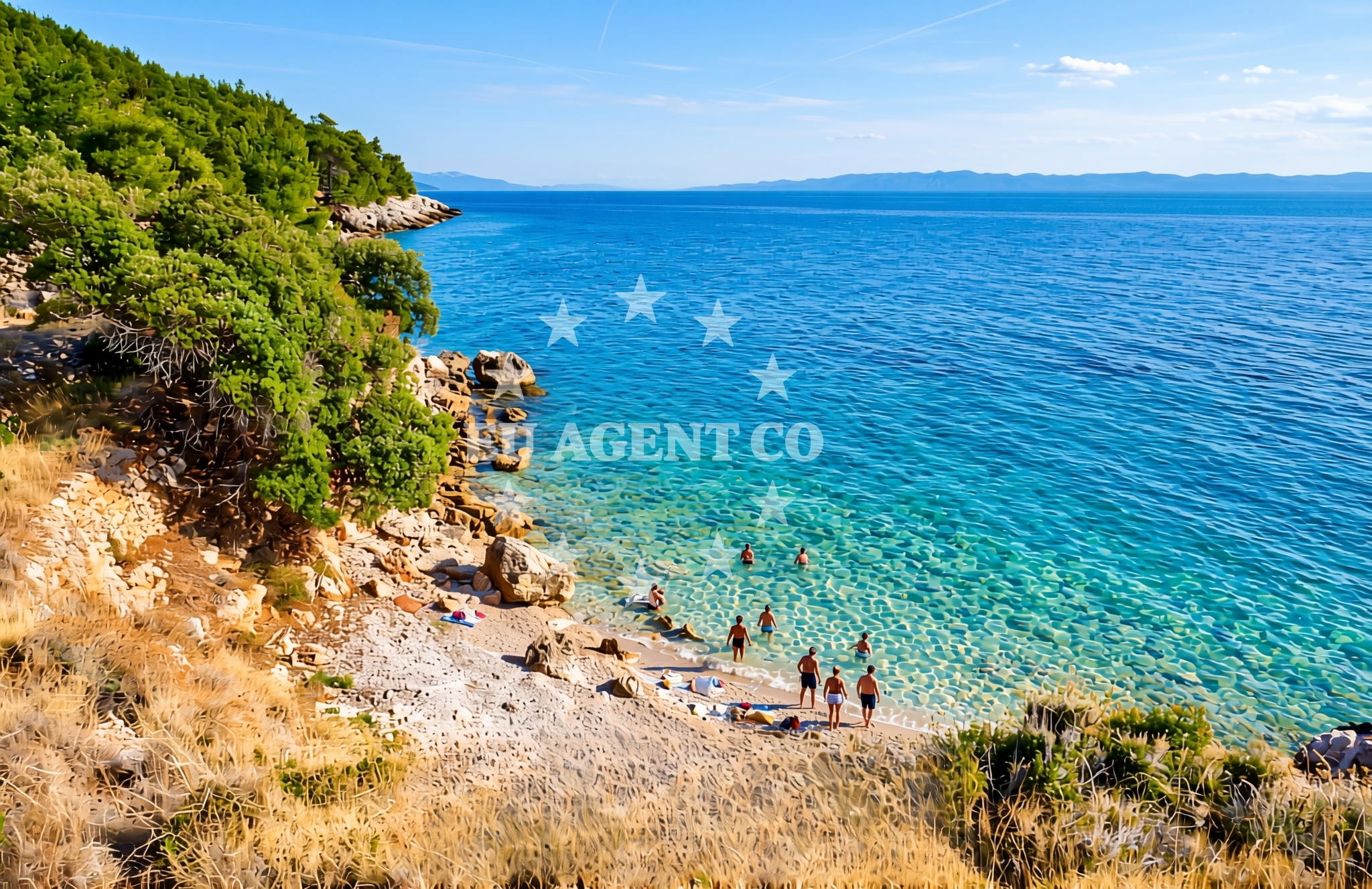
Mali Črvanj zapad, located in Zastražišće on the island of Hvar, is a shoreline characterized by gravel and rocky terrain. This beach offers a stark contrast to the sandy coves typical of the Adriatic, providing a rugged coastal experience that reflects the natural contours of the Hvar coastline. Its position on the southern coast of Hvar places it within reach of the island's historic towns, vineyards, and sailing routes that define the region.
About this beach
Mali Črvanj zapad, Zastražišće (Hvar)
Beach: Mali Črvanj zapad
Location: Zastražišće (Hvar)
Characteristics and facilities
Gravel, rocks
Beach character
The beach's gravel and rock composition shapes its use and appeal. The terrain is firm underfoot, making it suitable for walking or short hikes along the shore. The absence of sand means the beach is less likely to be crowded during peak seasons, offering a more secluded experience compared to other Hvar beaches. The rocky outcrops may provide natural shade during midday, though visitors should be mindful of uneven surfaces when exploring the shoreline.
Swimming and shore
While the beach's gravel and rock features make it less ideal for traditional swimming, the adjacent waters are part of the clear, sheltered seas typical of the Hvar coast. The rocky shoreline may create calmer pockets of water near the shore, though swimmers should exercise caution around uneven terrain. The beach's character is more suited to those seeking a coastal walk or a vantage point to observe the surrounding sea and islands.
Facilities and activities
No formal facilities or structured activities are listed for this beach. Its natural features dominate the experience, with no amenities such as showers, restrooms, or seating reported. The beach's gravel and rock composition may limit recreational use beyond walking or photography. Visitors are advised to bring their own supplies, as there are no on-site services or retail options.
Access and location
Mali Črvanj zapad is situated in Zastražišće, a coastal area on the island of Hvar. The beach is accessible via local roads that connect to Hvar's main settlements, including the town of Hvar itself, which is approximately 10 kilometers to the east. The surrounding area is part of the broader Hvar coast, known for its vineyards, historic sites, and proximity to the Pakleni Islands. The beach's location makes it a potential stop for those exploring the southern Hvar coastline by land or sea.
What to expect
Visitors to Mali Črvanj zapad should expect a rugged, gravelly shoreline with rocky outcrops. The beach is not suited for sunbathing or swimming but offers a unique perspective of the Hvar coast. The area is likely to be quiet, with few visitors during the day. The beach's natural features provide opportunities for coastal walks and photography, particularly during early morning or late afternoon when the light enhances the rocky landscape.
Practical tips
Wear sturdy footwear to navigate the gravel and rocky terrain comfortably. The beach is best visited during off-peak hours to avoid midday heat and ensure a more enjoyable experience. Due to the lack of facilities, bring water, snacks, and any necessary items for a self-sufficient visit. The beach's position on Hvar's southern coast means it is accessible to those exploring the island by car or boat.
Exploring the coast by yacht
For yacht charter guests, the proximity of Mali Črvanj zapad to Hvar's southern coast offers a strategic vantage point for exploring the island and surrounding waters. The area is within reach of Hvar's marinas, including the Hvar Town Marina, which serves as a hub for Adriatic sailing. Charter yachts may anchor in nearby bays or use the beach as a reference point for navigating the Hvar coastline, which is renowned for its clear waters and scenic routes to the Pakleni Islands.
Historical and Cultural Context of Hvar
The island of Hvar, where Mali Črvanj zapad is located, has a rich history dating back to ancient times. It was a significant center of Greek and Roman culture before becoming part of the Venetian Republic. The island's medieval town of Hvar, a UNESCO-protected site, is known for its well-preserved architecture, including the Hvar Fortress and the Cathedral of St. Stephen. The surrounding vineyards produce renowned wines, such as Plavac Mali, which are a staple of the region's gastronomy.
Anchorages in the surrounding area
Anchorages in the surrounding area of Hvar, including Dugi Dolac and Pokrivenik.
- Anchorage — hvar — 0.8 NM from beach
- Anchorage — dugi dolac — hvar — 1.5 NM from beach
- Anchorage — dugi dolac — hvar — 1.7 NM from beach
- Anchorage — dugi dolac — hvar — 2.0 NM from beach
- Anchorage — pokrivenik — hvar — 2.1 NM from beach
- Anchorage — pokrivenik — hvar — 2.2 NM from beach
- Anchorage — dugi dolac — hvar — 2.4 NM from beach
- Anchorage — pokrivenik — hvar — 2.4 NM from beach
Distances are straight-line geographic distances, not sailing routes.
Mooring buoys in the surrounding area
- Restaurant Preza quay — pokrivenik — hvar — 2.2 NM from beach
- Jetty — velika stiniva — hvar — 3.1 NM from beach
- Quay — hvar — 4.2 NM from beach
- Quay — bogomolje — hvar — 6.8 NM from beach
- Konoba Mostir buoys — scedro — 7.0 NM from beach
Distances are straight-line geographic distances, not sailing routes.
Marine fuel stations
- Ina — vrboska — hvar — 9.0 NM from beach
- Fuel station — sumartin — brac — 10.1 NM from beach
- Ina — vela luka — korcula — 11.4 NM from beach
- Fuel station — bol — brac — 12.4 NM from beach
Distances are straight-line geographic distances, not sailing routes.
Harbours in the surrounding area
Harbours in Jelsa on Hvar and Loviste in the south-dalmatia region, nearby to the beach.
- Port Jelsa — hvar — 7.8 NM from beach
- Lovište — loviste — 9.1 NM from beach
- Vrboska — hvar — 9.1 NM from beach
- Prigradica — korcula — 9.4 NM from beach
- Sumartin — brac — 10.0 NM from beach
- Račišće — racisce — korcula — 11.0 NM from beach
Distances are straight-line geographic distances, not sailing routes.
Marinas in the surrounding area
- ACI Marina Vrboska — hvar — 9.0 NM from beach
- Marina Korkyra — vela luka — korcula — 11.6 NM from beach
- Marina Tučepi — marina tucepi — 12.2 NM from beach
- Marina Ramova — krvavica — 13.4 NM from beach
- Marina Baška Voda — marina baska voda — 14.8 NM from beach
Distances are straight-line geographic distances, not sailing routes.
Restaurants near the beach
Restaurants in Pokrivenik and Pakomina, providing dining options close to the beach.
- Restaurant Timun — pokrivenik — hvar — 2.3 NM from beach
- Pakomina — hvar — 4.2 NM from beach
- Konoba Humac — hvar — 4.9 NM from beach
Distances are straight-line geographic distances, not sailing routes.
Navigation guides for the surrounding area
Navigation guides for areas like Uvala Pokrivenik and Jelsa, aiding route planning near the beach.
- Uvala Pokrivenik — 2.2 NM from beach
- Uvala Manastir — 6.7 NM from beach
- Luka Lovisce — 7.0 NM from beach
- Zavala (Pitavska Plaza) — 7.1 NM from beach
- Jelsa — 7.6 NM from beach
Distances are straight-line geographic distances, not sailing routes.
Yachts from nearby departure bases
Yachts departing from Tučepi and Makarska, with bases located in the central-dalmatia and south-dalmatia regions.
Sailing yachts
- Bavaria 40 Cruiser (LADY BUTTERFLY) — Tučepi Port — 12.2 NM from departure base to beach
- Elan 45 Impression (" MONACO ") — Baška Voda — 14.8 NM from departure base to beach
- Bavaria Cruiser 37 (AURORA) — Baška Voda — 14.8 NM from departure base to beach
Catamarans
- Lagoon 450 (LAMANTIN) — Baška Voda — 14.8 NM from departure base to beach
Motor yachts
- Princess V53 (Chablis) — Makarska Port — 12.5 NM from departure base to beach
- Canados 86 (Karisma) — Baška Voda — 14.8 NM from departure base to beach
Motor boats
- Galeon 430 Skydeck (Bellagio) — Makarska Port — 12.5 NM from departure base to beach
- Jeanneau NC 37 (Black Pearl) — Makarska Port — 12.5 NM from departure base to beach
- Galeon 430 Skydeck (BELLAGIO) — Makarska Port — 12.5 NM from departure base to beach
- Jeanneau NC 37 (Black Pearl) — Makarska Port — 12.5 NM from departure base to beach
Distances are straight-line geographic distances, not sailing routes.