Mali Črvanj istok, Zastražišće (Hvar) Beach, Croatia
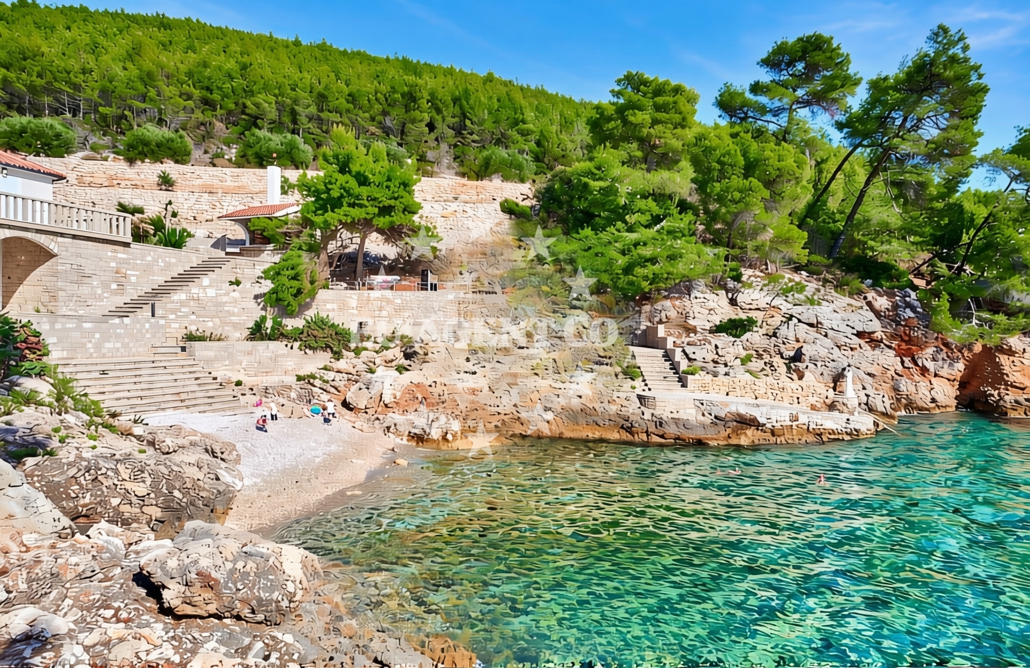
Mali Črvanj istok, located in Zastražišće on the island of Hvar, is a shoreline characterized by its pebble and gravel composition. This beach lies along the southern Adriatic coast, where the island’s rugged terrain meets the sea. While not a traditional sandy beach, its rocky shoreline offers a distinct coastal experience, ideal for those seeking a more rugged, natural setting. The area is part of Hvar’s broader coastline, which is renowned for its dramatic cliffs, clear waters, and proximity to historic settlements.
About this beach
Mali Črvanj istok, Zastražišće (Hvar)
Beach: Mali Črvanj istok
Location: Zastražišće (Hvar)
Characteristics and facilities
Pebbles, gravel
Beach character
The beach’s surface is composed primarily of pebbles and gravel, creating a firm, uneven texture underfoot. This makes it less suitable for sunbathing on soft sand but offers a stable base for walking along the shore. The lack of fine sand means it is not typically used for swimming, though the surrounding waters are known for their clarity and gentle currents. The beach’s rocky nature may appeal to visitors looking for a more rugged, less developed shoreline, with minimal artificial infrastructure.
Swimming and shore
Swimming from Mali Črvanj istok is not recommended due to the pebble-strewn shoreline, which can make entry into the water uncomfortable. However, the nearby waters are part of the Adriatic’s famed sailing routes, with calm conditions often found in the sheltered bays of Hvar. The shore itself is marked by rocky outcrops and sparse vegetation, typical of the island’s coastal geography. Visitors may find the area appealing for its natural, unspoiled character, though care should be taken when navigating the uneven terrain.
Facilities and activities
There are no formal facilities listed for Mali Črvanj istok, reflecting its relatively undeveloped nature. Activities are limited to walking along the shore or exploring the surrounding landscape. The nearby island of Hvar offers a range of cultural and historical attractions, including the town of Hvar itself, which is accessible via a short drive or boat ride. The area’s proximity to the Adriatic’s sailing routes also makes it a potential stop for yachts exploring the region.
Access and location
Mali Črvanj istok is situated in Zastražišće, a coastal area on the island of Hvar. Access to the beach is likely via local roads connecting to the broader Hvar network, though specific details on parking or nearby settlements are not provided in the catalog. The beach lies within a region that is well-connected to other parts of the island, with Hvar town and Split on the mainland reachable by ferry or car. Its location makes it a convenient waypoint for those exploring the island’s eastern coast.
What to expect
Visitors to Mali Črvanj istok should expect a natural, undeveloped shoreline with pebbles and gravel dominating the beach. The area is best suited for those seeking a tranquil, less crowded environment, though facilities such as parking, restrooms, or refreshments are not available. The surrounding landscape offers views of the Adriatic Sea and the island’s rugged coastline. Due to the absence of formal amenities, visitors are advised to bring their own supplies and prepare for a rustic experience.
Practical tips
Given the beach’s rocky surface, sturdy footwear is recommended for walking along the shore. Sun protection and hydration are essential, as shade and shelter are limited. Visitors should also be mindful of the terrain when entering or exiting the water. The area’s remote nature means it is less likely to be crowded, making it an ideal spot for solitude and reflection.
Exploring the coast by yacht
The beach’s location on Hvar places it within one of the Adriatic’s most popular sailing regions. Yacht charter guests exploring the island’s eastern coast may find Mali Črvanj istok a convenient anchorage point, with nearby marinas in Hvar town and other settlements offering docking options. The surrounding waters are known for their scenic beauty, with opportunities for sailing, snorkeling, and exploring hidden coves. For those seeking a break from the helm, the beach’s proximity to Hvar’s cultural sites provides a balance between maritime adventure and land-based exploration.
Historical and Cultural Context of Hvar
The island of Hvar has a rich history dating back to ancient times, with influences from Greek, Roman, and Venetian civilizations. The town of Hvar, located just a short distance from Mali Črvanj istok, is a UNESCO-protected site known for its well-preserved medieval architecture, bustling harbor, and vibrant cultural scene. Visitors to the area may also explore nearby landmarks such as the ancient Greek temple of Poseidon on the island of Vis or the Roman ruins of Split on the mainland.
Anchorages in the surrounding area
Anchorages in the surrounding area include options near Pokrivenik and Dugi Dolac, offering proximity to the beach.
- Anchorage — hvar — 0.8 NM from beach
- Anchorage — dugi dolac — hvar — 1.4 NM from beach
- Anchorage — dugi dolac — hvar — 1.6 NM from beach
- Anchorage — dugi dolac — hvar — 1.9 NM from beach
- Anchorage — pokrivenik — hvar — 2.1 NM from beach
- Anchorage — pokrivenik — hvar — 2.2 NM from beach
- Anchorage — dugi dolac — hvar — 2.3 NM from beach
- Anchorage — pokrivenik — hvar — 2.4 NM from beach
Distances are straight-line geographic distances, not sailing routes.
Mooring buoys in the surrounding area
Mooring buoys in the surrounding area feature locations such as Restaurant Preza quay in Pokrivenik and Jetty Velika Stiniva.
- Restaurant Preza quay — pokrivenik — hvar — 2.2 NM from beach
- Jetty — velika stiniva — hvar — 3.1 NM from beach
- Quay — hvar — 4.1 NM from beach
- Quay — bogomolje — hvar — 6.8 NM from beach
- Konoba Mostir buoys — scedro — 7.0 NM from beach
Distances are straight-line geographic distances, not sailing routes.
Marine fuel stations
Marine fuel stations are situated in Vrboska, Sumartin, and Vela Luka, with distances ranging from 9 to 12 nautical miles.
- Ina — vrboska — hvar — 9.1 NM from beach
- Fuel station — sumartin — brac — 10.1 NM from beach
- Ina — vela luka — korcula — 11.5 NM from beach
- Fuel station — bol — brac — 12.5 NM from beach
Distances are straight-line geographic distances, not sailing routes.
Harbours in the surrounding area
- Port Jelsa — hvar — 7.8 NM from beach
- Lovište — loviste — 9.0 NM from beach
- Vrboska — hvar — 9.1 NM from beach
- Prigradica — korcula — 9.4 NM from beach
- Sumartin — brac — 10.0 NM from beach
- Račišće — racisce — korcula — 11.0 NM from beach
Distances are straight-line geographic distances, not sailing routes.
Marinas in the surrounding area
Marinas in the surrounding area include ACI Marina Vrboska and Marina Tučepi, located at distances from 9 to 15 nautical miles.
- ACI Marina Vrboska — hvar — 9.0 NM from beach
- Marina Korkyra — vela luka — korcula — 11.6 NM from beach
- Marina Tučepi — marina tucepi — 12.2 NM from beach
- Marina Ramova — krvavica — 13.4 NM from beach
- Marina Baška Voda — marina baska voda — 14.8 NM from beach
Distances are straight-line geographic distances, not sailing routes.
Restaurants near the beach
Restaurants near the beach include Restaurant Timun in Pokrivenik and Konoba Humac, offering dining options within 5 nautical miles.
- Restaurant Timun — pokrivenik — hvar — 2.3 NM from beach
- Pakomina — hvar — 4.1 NM from beach
- Konoba Humac — hvar — 4.9 NM from beach
Distances are straight-line geographic distances, not sailing routes.
Navigation guides for the surrounding area
Navigation guides for the surrounding area include Uvala Pokrivenik and Jelsa, assisting with route planning near the beach.
- Uvala Pokrivenik — 2.2 NM from beach
- Uvala Manastir — 6.7 NM from beach
- Luka Lovisce — 7.0 NM from beach
- Zavala (Pitavska Plaza) — 7.2 NM from beach
- Jelsa — 7.7 NM from beach
Distances are straight-line geographic distances, not sailing routes.
Yachts from nearby departure bases
Sailing yachts
- Bavaria 40 Cruiser (LADY BUTTERFLY) — Tučepi Port — 12.2 NM from departure base to beach
- Bavaria 44 (Infinity) — Baška Voda — 14.8 NM from departure base to beach
- Elan 384 Impression (Lissa) — Baška Voda — 14.8 NM from departure base to beach
Catamarans
- Lagoon 450 (LAMANTIN) — Baška Voda — 14.8 NM from departure base to beach
Motor yachts
- Princess V53 (Chablis) — Makarska Port — 12.4 NM from departure base to beach
- Canados 86 (Karisma) — Baška Voda — 14.8 NM from departure base to beach
Motor boats
- Galeon 430 Skydeck (BELLAGIO) — Makarska Port — 12.4 NM from departure base to beach
- Jeanneau NC 37 (Black Pearl) — Makarska Port — 12.4 NM from departure base to beach
- Jeanneau NC 37 (Black Pearl) — Makarska Port — 12.4 NM from departure base to beach
- Galeon 430 Skydeck (Bellagio) — Makarska Port — 12.4 NM from departure base to beach
Distances are straight-line geographic distances, not sailing routes.