Maletinac istok, Vrčići (Pag) Beach, Croatia
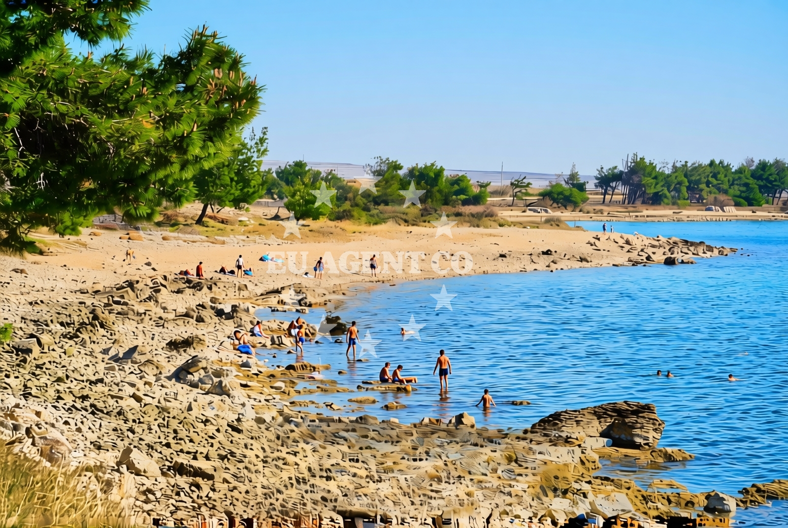
About this beach
Maletinac istok, Vrčići (Pag)
Beach: Maletinac istok
Location: Vrčići (Pag)
Characteristics and facilities
Gravel, rocks
230 m
Beach character
The beach consists primarily of gravel and rocky outcrops, creating a terrain that is more suited for walking than sunbathing. The 230-meter length offers a secluded experience, with minimal infrastructure to preserve its natural character. The absence of sand makes it distinct from other beaches on Pag, though the area’s proximity to the sea ensures easy access to swimming and water activities. The rocky formations may pose challenges for young children, but they also create natural pools and tidal variations that attract adventurous visitors.Swimming and shore
Swimming conditions at Maletinac istok depend on tidal patterns and wave action, which can make the shoreline less predictable than sandy beaches. The gravel and rocks create a rugged edge to the water’s edge, with deeper sections forming natural coves. While the beach lacks designated swimming areas, the surrounding waters of Pag are generally calm, making it a viable spot for snorkeling or kayaking. The rocky terrain also offers opportunities for exploring tidal pools and observing marine life.Facilities and activities
The beach lacks formal amenities such as showers, restrooms, or umbrellas, reflecting its undeveloped nature. No structured activities are listed, but the area’s natural features support informal pursuits like rock climbing, beachcombing, and photography. The absence of commercial facilities means visitors should bring their own supplies, though the nearby village of Vrčići provides basic services for those seeking essentials.Access and location
Maletinac istok is accessible via local roads connecting to Vrčići, a small village on Pag’s northern coast. The beach’s location on the island’s less-traveled eastern side means it is typically quieter than Pag’s more famous stretches like Zlatni Rat. Visitors arriving by car should note that parking options are limited, with the nearest spaces located in Vrčići. The beach’s proximity to the sea ensures easy access to the water, though the gravel path to the shore may require sturdy footwear.What to expect
Expect a rugged, undeveloped shoreline composed of gravel and rocks, ideal for those seeking a tranquil escape from busier beaches. The 230-meter stretch offers a secluded experience, with minimal infrastructure to maintain its natural character. While the beach lacks amenities, its location on Pag’s northern coast provides opportunities for exploring the island’s historic salt pans and nearby villages. The surrounding waters are generally calm, supporting activities like snorkeling and kayaking, though swimmers should be mindful of tidal conditions.Practical tips
Bring sturdy shoes for navigating the gravel and rocky terrain. Sun protection is essential, as the lack of shade means exposure to direct sunlight. Consider visiting during off-peak hours to avoid crowds, and check local tide tables for optimal swimming conditions. The nearby village of Vrčići offers basic services for supplies.Exploring the coast by yacht
For yacht charter guests exploring the Adriatic, Pag’s coastline offers a mix of sheltered bays and open waters, with Maletinac istok situated near the island’s northern sailing routes. The beach’s proximity to the sea makes it a potential stop for sailors seeking a quiet anchorage, though formal marinas are limited on this part of the coast. The surrounding waters are part of Croatia’s popular sailing region, with routes connecting to nearby islands like Murter and the mainland town of Zadar.Historical Context of Pag’s Coast
Pag’s coastline has long been shaped by its salt industry, with the island’s salt pans dating back to Roman times. The village of Vrčići, near Maletinac istok, reflects this heritage, with traditional stone buildings and a focus on sustainable practices. The island’s rugged terrain and limited development make it a haven for those seeking a slower pace of life.Anchorages in the surrounding area
Anchorages near Kosljun-Pag and Povljana lie within 2.5 nautical miles of Maletinac istok, Vrčići (Pag) Beach.
- Mlinica — kosljun pag — 0.3 NM from beach
- Anchorage — kosljun pag — 2.0 NM from beach
- Anchorage — povljana — pag — 2.5 NM from beach
- Tihovac — kosljun pag — 2.6 NM from beach
- Anchorage — povljana — pag — 3.2 NM from beach
- Anchorage — proboj — pag — 3.6 NM from beach
- Dinjiška — dinjiska — pag — 3.8 NM from beach
- Anchorage — lozice — vir — 4.3 NM from beach
Distances are straight-line geographic distances, not sailing routes.
Mooring buoys in the surrounding area
Mooring buoys in Vir and Simuni are situated up to 10 nautical miles from Maletinac istok, Vrčići (Pag) Beach.
- Vir — 5.1 NM from beach
- Jetty — simuni — pag — 7.9 NM from beach
- Šibuljina Point — sibuljina point — 10.0 NM from beach
- Jetty — zubovici — pag — 10.2 NM from beach
- Jetty — zubovici — pag — 10.3 NM from beach
Distances are straight-line geographic distances, not sailing routes.
Marine fuel stations
Marine fuel stations in Zadar and Ugljan are located 16 to 25 nautical miles from Maletinac istok, Vrčići (Pag) Beach.
- Ina — zadar — 16.5 NM from beach
- Ina — preko — ugljan — 18.5 NM from beach
- Fuel station — sukosan — 21.2 NM from beach
- Ina — zaglav — dugi otok — 25.9 NM from beach
Distances are straight-line geographic distances, not sailing routes.
Harbours in the surrounding area
Harbours in Kosljun-Pag and Povljana are within 5 nautical miles of Maletinac istok, Vrčići (Pag) Beach.
- Košljun — kosljun pag — 1.8 NM from beach
- Povljana — pag — 2.2 NM from beach
- Pag — 4.7 NM from beach
- Lukovo Šugarje — lukovo sugarje — rudelici — 4.9 NM from beach
- Miškovići — miskovici — pag — 5.5 NM from beach
- Privlaka — 6.9 NM from beach
Distances are straight-line geographic distances, not sailing routes.
Marinas in the surrounding area
Marinas in Šimuni and Zadar are positioned 8 to 17 nautical miles from Maletinac istok, Vrčići (Pag) Beach.
- ACI Marina Šimuni — simuni — pag — 8.7 NM from beach
- Marina Borik — zadar — 15.6 NM from beach
- Vitrenjak Zadar — 15.8 NM from beach
- Marina Zadar — 16.4 NM from beach
- Olive Island Marina — sutomiscica — ugljan — 17.3 NM from beach
Distances are straight-line geographic distances, not sailing routes.
Restaurants near the beach
Restaurants in Povljana and Pag are located 1.9 to 4.6 nautical miles from Maletinac istok, Vrčići (Pag) Beach.
- Villa Kaštel — povljana — pag — 1.9 NM from beach
- Nirvana — povljana — pag — 2.0 NM from beach
- Lanterna — povljana — pag — 2.0 NM from beach
- Mornar — povljana — pag — 2.0 NM from beach
- Konoba Bile — pag — 4.6 NM from beach
- Dubrava — pag — 4.6 NM from beach
- Restaurant — vir — 4.9 NM from beach
Distances are straight-line geographic distances, not sailing routes.
Navigation guides for the surrounding area
Navigation guides for Otok Pag and Privlaka are situated 3.8 to 11 nautical miles from Maletinac istok, Vrčići (Pag) Beach.
- OTOK PAG — 3.8 NM from beach
- Uvala Bliznica — 5.8 NM from beach
- Privlaka — 6.9 NM from beach
- KrusCica and Uvala KrusCica Duboka — 9.1 NM from beach
- VELESITSKI KANAL (S) — 11.3 NM from beach
Distances are straight-line geographic distances, not sailing routes.
Yachts from nearby departure bases
Yachts departing from Povljana Marina and Pag City Port are based 2 to 4.6 nautical miles from Maletinac istok, Vrčići (Pag) Beach.
Sailing yachts
- First 45 (Egeria) — Šimuni Kolan ACI Marina — 8.8 NM from departure base to beach
- Bavaria Cruiser 37 (Porec) — Zadar Marina Borik — 15.6 NM from departure base to beach
Catamarans
- Leopard 50 (Solaia) — Zadar Marina Borik — 15.6 NM from departure base to beach
Motor boats
- Merry Fisher 895 — Povljana Marina — 2.0 NM from departure base to beach
- BWA Sport 22GT (BWA ) — Pag City Port — 4.7 NM from departure base to beach
- Rancraft RM21 (Dugi otok) — Zadar Diklo Port — 14.2 NM from departure base to beach
- Rancraft RS Cinque.5 — Zadar Diklo Port — 14.2 NM from departure base to beach
- Rancraft RM19 (Daycruiser) — Zadar Diklo Port — 14.2 NM from departure base to beach
- Balt 818 Titanium (Valentina) — Novalja — 14.5 NM from departure base to beach
- Balt 818 Titanium (Valentina 2) — Novalja — 14.5 NM from departure base to beach
Distances are straight-line geographic distances, not sailing routes.