Mala Slatina Zapad, Vir Beach, Croatia
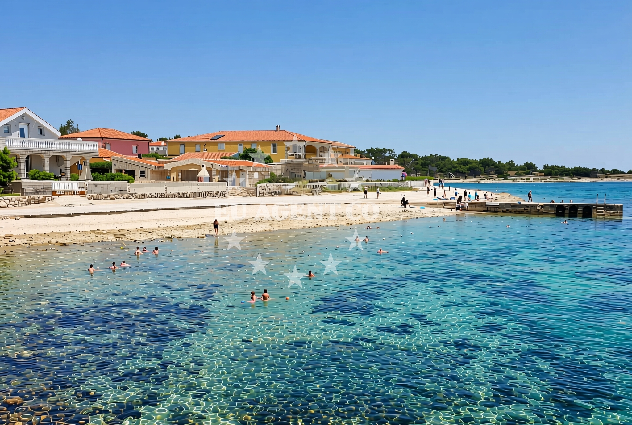
Mala Slatina Zapad is a 110-meter-long shore located on the island of Vir, part of the Adriatic coast of Croatia. Unlike typical sandy beaches, this stretch of coastline features a mix of gravel and concrete/stone slabs, creating a distinctive landscape that contrasts with the region's more common pebble and sand shores. Its position on Vir, a small island in the Adriatic Sea, places it within a sailing area known for its natural beauty and maritime heritage.
About this beach
Mala Slatina zapad, Vir (Vir)
Beach: Mala Slatina zapad
Location: Vir (Vir)
Characteristics and facilities
Gravel, concrete / stone slabs
110 m
Beach character
The beach's surface consists of gravel and concrete/stone slabs, a configuration that makes it unlike many of Croatia's more conventional pebble or sandy shores. At 110 meters in length, it is a relatively short stretch of coastline, likely suited for those seeking a quiet, less crowded environment. The absence of listed facilities in the catalog suggests this is a natural, unembellished shore, potentially ideal for those looking to experience a more rustic coastal setting.
Swimming and shore
The rocky and gravelly composition of the shore may present challenges for swimmers seeking easy water access. The beach's characteristics suggest it is not a typical swimming destination, though the Adriatic Sea's generally mild temperatures make it a viable option for those prepared for a more rugged shoreline experience. The lack of detailed water depth information in the catalog means swimmers should approach with caution, particularly near the rocky sections.
Facilities and activities
No specific facilities are listed for Mala Slatina Zapad in the catalog, indicating this is likely an undeveloped or minimally maintained shore. The absence of amenities such as showers, restrooms, or parking suggests visitors should plan accordingly. While no structured activities are mentioned, the beach's location on Vir—a historically significant island—may offer opportunities for cultural exploration or hiking in the surrounding area.
Access and location
Located on the island of Vir, this beach is part of a region that has long been a focal point for Adriatic maritime activity. Vir itself is a small island in the Adriatic Sea, situated near the coast of Dalmatia. Its position makes it a potential stop for sailors exploring the broader Adriatic coastline, though the lack of detailed access information in the catalog means visitors should consider local transportation options or nearby ports for arrival.
What to expect
Visitors to Mala Slatina Zapad should expect a shore defined by gravel and stone slabs, a configuration that sets it apart from Croatia's more common pebble or sandy beaches. The 110-meter length offers a modest stretch of coastline, likely suited for those seeking solitude or a less commercialized experience. The absence of listed facilities means visitors should bring necessary provisions, though the natural setting may appeal to those looking for a raw, unaltered coastal environment.
Practical tips
Given the beach's gravel and stone composition, visitors may want to wear appropriate footwear for comfort. The lack of detailed facilities in the catalog suggests self-sufficiency is key. Those planning to visit should also consider the broader context of Vir's maritime history and its potential as a base for exploring nearby Adriatic islands.
Exploring the coast by yacht
The Adriatic Sea, where Vir is located, is a popular sailing destination known for its clear waters and scenic coastlines. While Mala Slatina Zapad itself is not marked as an anchorage or marina in the catalog, its position on Vir places it within a region that attracts yacht charter guests. Sailors exploring the area may find opportunities to dock at nearby ports or anchorages, though specific details about local marinas or sailing routes are not included in the beach's catalog data.
Historical and Cultural Context of Vir
The island of Vir has historical significance as a strategic point in the Adriatic, with records of its use dating back to ancient times. Its proximity to the mainland and position in the sea made it a valuable location for maritime trade and defense. Today, the island remains a quiet, sparsely populated area, offering a glimpse into Croatia's coastal heritage.
Anchorages in the surrounding area
Anchorages in the surrounding area of Vir, including nearby locations like Lozice and Povljana.
- Anchorage — vir — 0.5 NM from beach
- Anchorage — vir — 0.9 NM from beach
- Anchorage — lozice — vir — 1.2 NM from beach
- Anchorage — vir — 1.4 NM from beach
- Anchorage — vir — 1.9 NM from beach
- Anchorage — povljana — pag — 1.9 NM from beach
- Anchorage — lozice — vir — 2.1 NM from beach
- Anchorage — vir — 2.3 NM from beach
Distances are straight-line geographic distances, not sailing routes.
Mooring buoys in the surrounding area
Mooring buoys in the surrounding area, including Vir and locations such as Punta Skala and Ljubac.
- Vir — 0.8 NM from beach
- Punta Skala — petrcane — 7.6 NM from beach
- Jetty — ljubac — 9.6 NM from beach
- Buoy field — muline — ugljan — 10.2 NM from beach
- Jetty — simuni — pag — 10.3 NM from beach
Distances are straight-line geographic distances, not sailing routes.
Marine fuel stations
Marine fuel stations in nearby regions, including Zadar and Ugljan.
- Ina — zadar — 13.2 NM from beach
- Ina — preko — ugljan — 14.9 NM from beach
- Fuel station — sukosan — 18.0 NM from beach
- Ina — zaglav — dugi otok — 21.9 NM from beach
Distances are straight-line geographic distances, not sailing routes.
Harbours in the surrounding area
Harbors in the surrounding area, including Povljana and Privlaka, located in Vir and nearby regions.
- Povljana — pag — 2.2 NM from beach
- Privlaka — 3.1 NM from beach
- Košljun — kosljun pag — 5.1 NM from beach
- Nin — 5.8 NM from beach
- Mulo — nin — 6.4 NM from beach
- Miškovići — miskovici — pag — 6.4 NM from beach
Distances are straight-line geographic distances, not sailing routes.
Marinas in the surrounding area
- ACI Marina Šimuni — simuni — pag — 11.0 NM from beach
- Marina Borik — zadar — 12.2 NM from beach
- Vitrenjak Zadar — 12.5 NM from beach
- Marina Zadar — 13.1 NM from beach
- Olive Island Marina — sutomiscica — ugljan — 13.5 NM from beach
Distances are straight-line geographic distances, not sailing routes.
Restaurants near the beach
Restaurants near the beach, including local options in Vir and nearby areas like Povljana.
- Restaurant — vir — 0.6 NM from beach
- Viranka — 0.7 NM from beach
- Monica — vir — 0.8 NM from beach
- Restaurant — vir — 0.9 NM from beach
- Grill Marion — vir — 1.4 NM from beach
- Restaurant — vir — 1.9 NM from beach
- Lanterna — povljana — pag — 2.4 NM from beach
Distances are straight-line geographic distances, not sailing routes.
Navigation guides for the surrounding area
Navigation guides for surrounding areas, including Otok Pag and Privlaka, aiding in local sailing routes.
- OTOK PAG — 1.5 NM from beach
- Privlaka — 3.2 NM from beach
- Luka Jazi — 10.0 NM from beach
- Uvala Bliznica — 10.2 NM from beach
- Muline — 10.3 NM from beach
Distances are straight-line geographic distances, not sailing routes.
Yachts from nearby departure bases
Yachts departing from nearby bases such as Povljana Marina and Zadar Diklo Port, offering various boat types for charter.
Sailing yachts
- First 45 (Egeria) — Šimuni Kolan ACI Marina — 11.1 NM from departure base to beach
- Oceanis 46.1 (Sevid) — Zadar Marina Borik — 12.2 NM from departure base to beach
Catamarans
- Leopard 50 (Solaia) — Zadar Marina Borik — 12.2 NM from departure base to beach
Motor yachts
- Prestige 460 (ADUDU 2) — Zadar Marina Borik — 12.2 NM from departure base to beach
Motor boats
- Merry Fisher 895 — Povljana Marina — 2.4 NM from departure base to beach
- BWA Sport 22GT (BWA ) — Pag City Port — 8.1 NM from departure base to beach
- Rancraft RM19 (Daycruiser) — Zadar Diklo Port — 10.9 NM from departure base to beach
- Rancraft RM21 (Dugi otok) — Zadar Diklo Port — 10.9 NM from departure base to beach
- Rancraft RS Cinque.5 — Zadar Diklo Port — 10.9 NM from departure base to beach
- Merry Fisher 1095 (Pepa) — Zadar Marina Borik — 12.2 NM from departure base to beach
Distances are straight-line geographic distances, not sailing routes.