Mala Slatina istok, Vir (Vir) Beach, Croatia
About this beach
Mala Slatina istok, Vir (Vir)
Beach: Mala Slatina istok
Location: Vir (Vir)
Characteristics and facilities
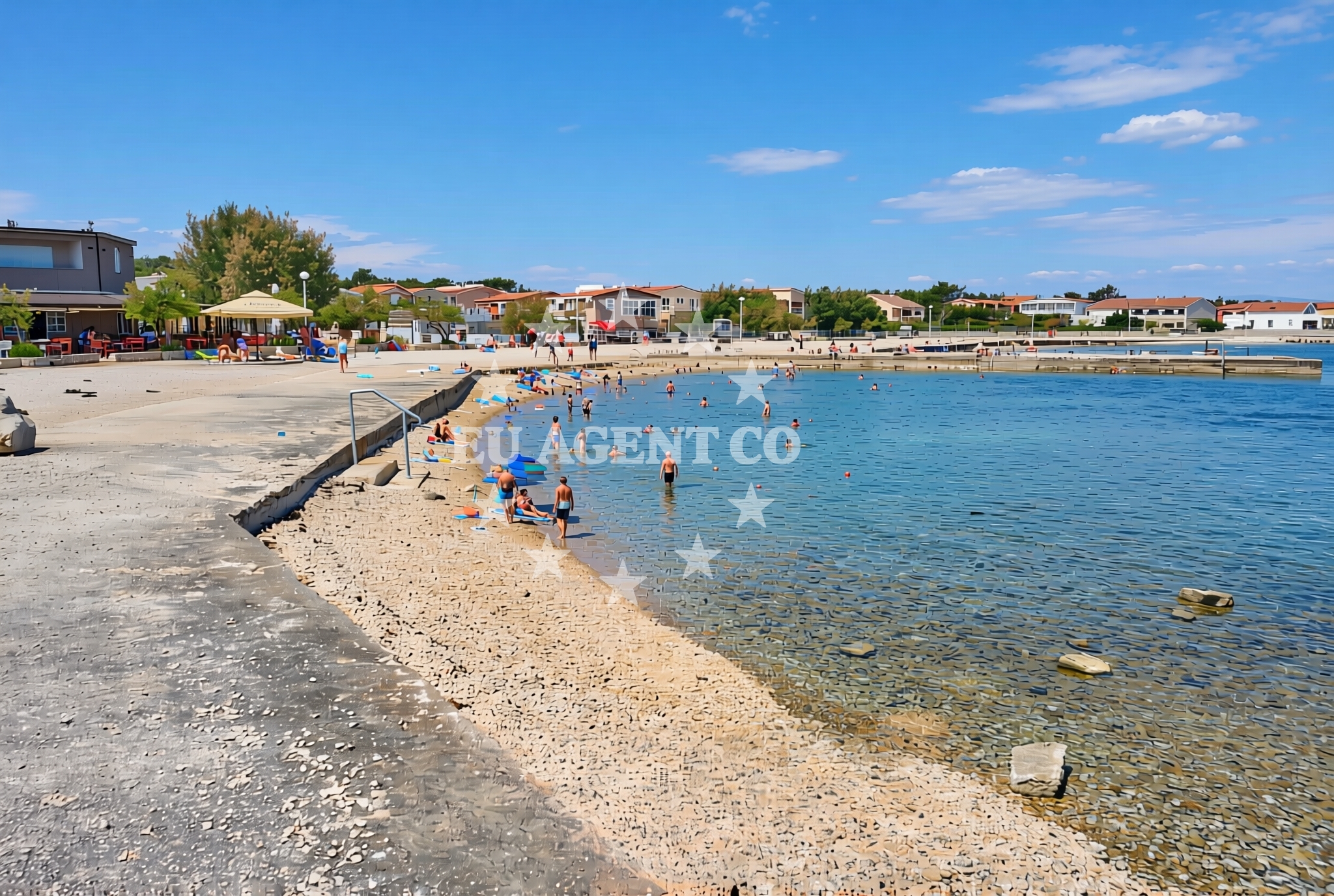
Sand, gravel, concrete / stone slabs
300 m
Restaurant / snack bar
Caffe bar / Drinks stand
Beach character
The beach’s composition reflects a transitional shoreline, with sand and gravel giving way to more rugged concrete and stone slabs. This mix suggests a dynamic coastal environment shaped by wave action and geological formations. While the beach lacks the fine sand of some Mediterranean shores, its varied texture offers a tactile contrast for visitors. The absence of detailed natural features in the catalog implies that the beach’s character is defined more by its immediate surroundings than by unique geological phenomena.Swimming and shore
Swimming conditions at Mala Slatina istok are influenced by its proximity to the open Adriatic. The beach’s orientation and the absence of specific depth data mean that swimmers should exercise caution, particularly during stronger currents. The shore itself is accessible along a 300-meter stretch, though the lack of structured amenities like showers or changing facilities suggests a more informal use pattern. The beach’s alignment with the coastline may offer partial shelter from prevailing winds, though this is not explicitly confirmed in the catalog.Facilities and activities
Basic facilities include a restaurant, snack bar, and drinks stand, indicating that the beach caters to visitors seeking light meals or beverages. These amenities are likely concentrated near the shoreline, serving both beachgoers and those arriving by boat. The absence of structured activities or rental services in the catalog suggests that the beach functions more as a passive recreational space than a hub for organized water sports or events.Access and location
Mala Slatina istok is situated on Vir, an island in the Adriatic Sea known for its historical significance and scenic coastal routes. The beach’s location places it within reach of the broader Dalmatian Coast, a region popular with yacht charter guests. While no specific access roads or parking details are provided in the catalog, the island’s infrastructure typically includes marinas and roads connecting to nearby settlements like Supetar on Brac Island. This positioning makes it a potential stop for sailors exploring the islands of the central Dalmatian archipelago.What to expect
Visitors to Mala Slatina istok should expect a beach that prioritizes accessibility over luxury. The mix of sand, gravel, and stone slabs creates a varied walking surface, while the nearby food and drink options provide convenience for those spending time on the shore. The beach’s orientation along the coastline may offer partial protection from wind, though swimmers should remain aware of ocean conditions. Its location on Vir places it within a network of islands and coastal towns that are frequently visited by yacht charter guests, making it a practical stop for those exploring the region.Practical tips
Given the beach’s mix of surfaces, consider wearing appropriate footwear for walking along the shore. The availability of food and drink services suggests that visitors should plan for these amenities if seeking refreshments during their time at the beach.Exploring the coast by yacht
For yacht charter guests, Mala Slatina istok’s location on Vir offers a strategic position within the Dalmatian Coast. The island is part of a sailing route that connects the Adriatic’s northern and southern regions, with nearby anchorages and marinas on Brac, Hvar, and the mainland. Charter yachts often use Vir as a midpoint for exploring the islands of the central Dalmatian archipelago, with its proximity to Supetar and the Brac coastline providing easy access to further destinations.Historical and Cultural Context of Vir
Vir has long been a significant location in the Adriatic, with historical ties to the Austro-Hungarian Empire and its role as a naval station. Today, the island retains a quiet charm, with its coastal villages and maritime traditions reflecting its past. This historical layer adds depth to the experience of visiting Mala Slatina istok, as the beach is part of a landscape shaped by centuries of human and natural interaction.Anchorages in the surrounding area
Anchorages in the surrounding area include options near Vir and Lozice.
- Anchorage — vir — 0.4 NM from beach
- Anchorage — vir — 0.9 NM from beach
- Anchorage — lozice — vir — 1.3 NM from beach
- Anchorage — vir — 1.3 NM from beach
- Anchorage — vir — 1.9 NM from beach
- Anchorage — povljana — pag — 2.0 NM from beach
- Anchorage — lozice — vir — 2.2 NM from beach
- Anchorage — vir — 2.3 NM from beach
Distances are straight-line geographic distances, not sailing routes.
Mooring buoys in the surrounding area
- Vir — 0.8 NM from beach
- Punta Skala — petrcane — 7.6 NM from beach
- Jetty — ljubac — 9.5 NM from beach
- Buoy field — muline — ugljan — 10.2 NM from beach
- Jetty — molat — 10.3 NM from beach
Distances are straight-line geographic distances, not sailing routes.
Marine fuel stations
Marine fuel stations are located in Zadar, Preko, and Sukosan.
- Ina — zadar — 13.1 NM from beach
- Ina — preko — ugljan — 14.8 NM from beach
- Fuel station — sukosan — 18.0 NM from beach
- Ina — zaglav — dugi otok — 21.8 NM from beach
Distances are straight-line geographic distances, not sailing routes.
Harbours in the surrounding area
Harbours in the surrounding area include Povljana, Privlaka, and Nin.
- Povljana — pag — 2.2 NM from beach
- Privlaka — 3.1 NM from beach
- Košljun — kosljun pag — 5.1 NM from beach
- Nin — 5.7 NM from beach
- Mulo — nin — 6.3 NM from beach
- Miškovići — miskovici — pag — 6.4 NM from beach
Distances are straight-line geographic distances, not sailing routes.
Marinas in the surrounding area
Marinas in the surrounding area are situated in Pag, Zadar, and Ugljan.
- ACI Marina Šimuni — simuni — pag — 11.1 NM from beach
- Marina Borik — zadar — 12.1 NM from beach
- Vitrenjak Zadar — 12.4 NM from beach
- Marina Zadar — 13.1 NM from beach
- Olive Island Marina — sutomiscica — ugljan — 13.4 NM from beach
Distances are straight-line geographic distances, not sailing routes.
Restaurants near the beach
Restaurants near the beach include options in Vir and Povljana.
- Restaurant — vir — 0.6 NM from beach
- Viranka — 0.6 NM from beach
- Monica — vir — 0.8 NM from beach
- Restaurant — vir — 0.9 NM from beach
- Grill Marion — vir — 1.3 NM from beach
- Restaurant — vir — 1.9 NM from beach
- Lanterna — povljana — pag — 2.5 NM from beach
Distances are straight-line geographic distances, not sailing routes.
Navigation guides for the surrounding area
Navigation guides for the surrounding area cover Otok Pag, Privlaka, and Muline.
- OTOK PAG — 1.5 NM from beach
- Privlaka — 3.2 NM from beach
- Luka Jazi — 10.0 NM from beach
- Uvala Bliznica — 10.2 NM from beach
- Muline — 10.2 NM from beach
Distances are straight-line geographic distances, not sailing routes.
Yachts from nearby departure bases
Yachts from nearby departure bases include those in Povljana Marina and Pag City Port.
Sailing yachts
- First 45 (Egeria) — Šimuni Kolan ACI Marina — 11.2 NM from departure base to beach
- Oceanis 46.1 (Sevid) — Zadar Marina Borik — 12.1 NM from departure base to beach
Catamarans
- Leopard 50 (Solaia) — Zadar Marina Borik — 12.1 NM from departure base to beach
Motor yachts
- Ferretti 780 (TESORO) — Zadar Marina Borik — 12.1 NM from departure base to beach
Motor boats
- Merry Fisher 895 — Povljana Marina — 2.4 NM from departure base to beach
- BWA Sport 22GT (BWA ) — Pag City Port — 8.2 NM from departure base to beach
- Rancraft RM19 (Daycruiser) — Zadar Diklo Port — 10.8 NM from departure base to beach
- Rancraft RS Cinque.5 — Zadar Diklo Port — 10.8 NM from departure base to beach
- Rancraft RM21 (Dugi otok) — Zadar Diklo Port — 10.8 NM from departure base to beach
- Axopar 37 T Top TT — Zadar Marina Borik — 12.1 NM from departure base to beach
Distances are straight-line geographic distances, not sailing routes.