Mala Pritiscina Beach, Croatia
Beach character
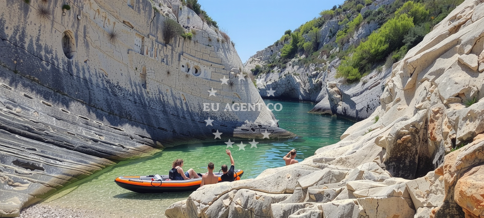
The beach's defining characteristic is its geological context. Beige pebbles cover the shoreline, transitioning to boulders beneath the water's surface. This composition creates a textured walking experience along the shore, though the pebbles are generally manageable for casual visitors. The beach is flanked by steep cliffs and a narrow gorge, which contributes to its sheltered feel despite its small size. The surrounding landscape features a mix of rocky outcrops and sparse vegetation, with distant views of the island of Vis and the broader Pelješac Peninsula. The water depth increases gradually from the shore, with the sea floor composed of boulders that become more pronounced as one moves away from the beach.Swimming and shore
Swimming conditions at Mala Pritiscina depend on the tide and weather patterns. The gradual increase in depth allows for safe wading, though the pebbled shore may make entry uncomfortable for some. The beach's orientation within a gorge means it receives limited direct sunlight during midday, creating cooler conditions compared to more exposed coastal areas. The sea floor's boulder composition creates natural underwater formations that may interest snorkelers, though no formal diving sites are marked. The beach's sheltered position within the gorge also means it tends to have calmer waters than adjacent open coastlines.Facilities and activities
Mala Pritiscina Beach lacks formal facilities such as showers, restrooms, or parking areas. The absence of infrastructure aligns with its character as a natural, minimally developed site. However, the beach is associated with a specific activity: cliff diving. The cliffs surrounding the gorge provide natural vantage points for this activity, though no formal jumping platforms or safety equipment are present. Visitors should approach this activity with caution, considering the depth and underwater terrain. The beach's recommendation for hikers stems from its proximity to trails that connect to the broader Komiža region and the island of Vis.Access and location
The beach is accessible via Gurnji put 37, a local road that connects to Komiža's main settlement. This road provides vehicular access to the beach, though parking spaces are not formally designated. The beach's location within a gorge creates a somewhat secluded atmosphere, with the approach involving a short walk along the gorge's edge. From Komiža, the beach serves as a starting point for exploring the surrounding area, including the nearby village of Šipovo and the island of Vis. The beach's coordinates (43.00892, 16.1097) place it within the broader sailing region of the Pelješac Peninsula, a known area for yacht charters and coastal exploration.What to expect
Visitors should expect a beach experience centered on natural landscapes rather than modern amenities. The beige pebble shoreline and surrounding cliffs create a rugged, unspoiled environment. The beach's orientation within a gorge means it offers natural shade during peak hours, though the lack of formal seating or shelters requires visitors to bring their own provisions. The recommended activity of cliff diving is possible from the surrounding cliffs, but no safety infrastructure is present. The beach's moderate crowd index during high season suggests it will be less congested than major tourist beaches in the region. Its proximity to Komiža allows for easy access to local services, restaurants, and accommodations.Practical tips
Wear sturdy footwear for walking on the pebbled shoreline. The beach's gorge location means it can be cooler than adjacent open beaches. For cliff diving, ensure proper safety precautions are taken. Visit during early morning or late afternoon for more comfortable temperatures and fewer crowds.Exploring the coast by yacht
Mala Pritiscina's location in the Komiža area places it within a popular sailing region of the Adriatic. Yacht charter guests exploring the Pelješac Peninsula and Vis archipelago may find this beach as a natural stop for hiking or anchoring nearby. While the beach itself is not a formal marina or anchorage, its proximity to Komiža's harbor and the broader sailing routes between Vis and the mainland make it a potentially useful reference point for charters navigating the area. The surrounding cliffs and gorge also create a distinctive coastal feature that may be of interest to sailors mapping the region.Regional Context and Hiking Opportunities
The beach's location within a gorge connects to a network of hiking trails in the Komiža region. These trails extend toward the village of Šipovo and the island of Vis, offering panoramic views of the Adriatic. The rugged terrain surrounding Mala Pritiscina is part of a larger geological formation that includes limestone ridges and deep ravines, characteristic of the Dalmatian coast. This landscape is also a key feature for visitors interested in exploring the natural geography of the Pelješac Peninsula.Anchorages in the surrounding area
- Anchorage — komiza — vis — 2.3 NM from beach
- Stiniva — vis — 2.8 NM from beach
- Uvala Knezice — komiza — vis — 3.0 NM from beach
- Anchorage — vis — 3.2 NM from beach
- Anchorage — vis — 3.4 NM from beach
- Anchorage — komiza — vis — 4.0 NM from beach
- Anchorage — vis — 4.2 NM from beach
- Anchorage — bisevo — 4.4 NM from beach
Distances are straight-line geographic distances, not sailing routes.
Mooring buoys in the surrounding area
- Lucka Uprava buoys, Komiza — vis — 2.5 NM from beach
- Komiza Buoy field — vis — 2.5 NM from beach
- Quay — vis — 3.5 NM from beach
- Buoy field Diamond Restaurant Bar — vis — 4.6 NM from beach
- Konoba Dalmatino buoys — vis — 4.6 NM from beach
Distances are straight-line geographic distances, not sailing routes.
Marine fuel stations
Marine fuel stations are situated in Vis and at greater distances on Brac and Solta.
- Petrol station Ina — vis — 4.7 NM from beach
- Fuel station — hvar — 17.4 NM from beach
- Ina — milna brac — 24.0 NM from beach
- Fuel station — rogac — solta — 24.7 NM from beach
Distances are straight-line geographic distances, not sailing routes.
Harbours in the surrounding area
- Komiža — komiza — vis — 2.3 NM from beach
- Luka — vis — 4.5 NM from beach
- Kut — vis — 4.9 NM from beach
- Rogačić — vis — 5.2 NM from beach
Distances are straight-line geographic distances, not sailing routes.
Marinas in the surrounding area
Marinas in the surrounding area are found in St Klement, Solta, and Brac.
- ACI Marina Palmižana — aci marina palmizana — st klement — 15.5 NM from beach
- Marina Martinis Marchi — maslinica — solta — 23.7 NM from beach
- Marina Milna Kanarija — milna brac — 24.1 NM from beach
- Marina Vlaška — milna brac — 24.1 NM from beach
- ACI Marina Milna — milna brac — 24.1 NM from beach
Distances are straight-line geographic distances, not sailing routes.
Restaurants near the beach
Restaurants near the beach include options in Podhumlje and other parts of Vis.
- Konoba Pesa — podhumlje — vis — 1.0 NM from beach
- Konoba Darko — vis — 1.7 NM from beach
- Pol Murvu — vis — 2.0 NM from beach
- Roki's — rokis — vis — 2.3 NM from beach
- Pizzeria Charly — komiza — vis — 2.3 NM from beach
- Pizzeria Hum — komiza — vis — 2.3 NM from beach
- Fabrika — komiza — vis — 2.3 NM from beach
Distances are straight-line geographic distances, not sailing routes.
Navigation guides for the surrounding area
Navigation guides cover areas such as Komiža and Soline, providing routes around the Vis region.
- Komiža — 2.3 NM from beach
- Uvala Stoncica — 7.0 NM from beach
- Luka Soline — 14.5 NM from beach
- Uvala Tarsce — 14.9 NM from beach
- Uvala Stari Stani — 15.0 NM from beach
Distances are straight-line geographic distances, not sailing routes.
Yachts from nearby departure bases
Yachts from nearby departure bases include sail boats and catamarans based in Milna and Šolta Rogač.
Sailing yachts
- Hanse 505 (AVALON) — Milna Marina Vlaška — 24.1 NM from departure base to beach
- Bavaria 46 Cruiser (MO) — Milna Marina Vlaška — 24.1 NM from departure base to beach
- Hanse 455 (AURUM 1) — Milna Marina Vlaška — 24.1 NM from departure base to beach
- Hanse 388 (BANJO) — Milna Marina Vlaška — 24.1 NM from departure base to beach
- Cyclades 50.5 (Orinoco) — Šolta Rogač — 24.6 NM from departure base to beach
- Sun Odyssey 449 (Tortuga) — Šolta Rogač — 24.6 NM from departure base to beach
- Cyclades 43.4 (Niagara) — Šolta Rogač — 24.6 NM from departure base to beach
Catamarans
- Lagoon 42 (Galapagos) — Šolta Rogač — 24.6 NM from departure base to beach
- Lagoon 450 Flybridge (Samogon) — Šolta Rogač — 24.6 NM from departure base to beach
- Lagoon 40 (Solentia) — Šolta Rogač — 24.6 NM from departure base to beach
Distances are straight-line geographic distances, not sailing routes.