Macel, Pučišća (Brač) Beach, Croatia
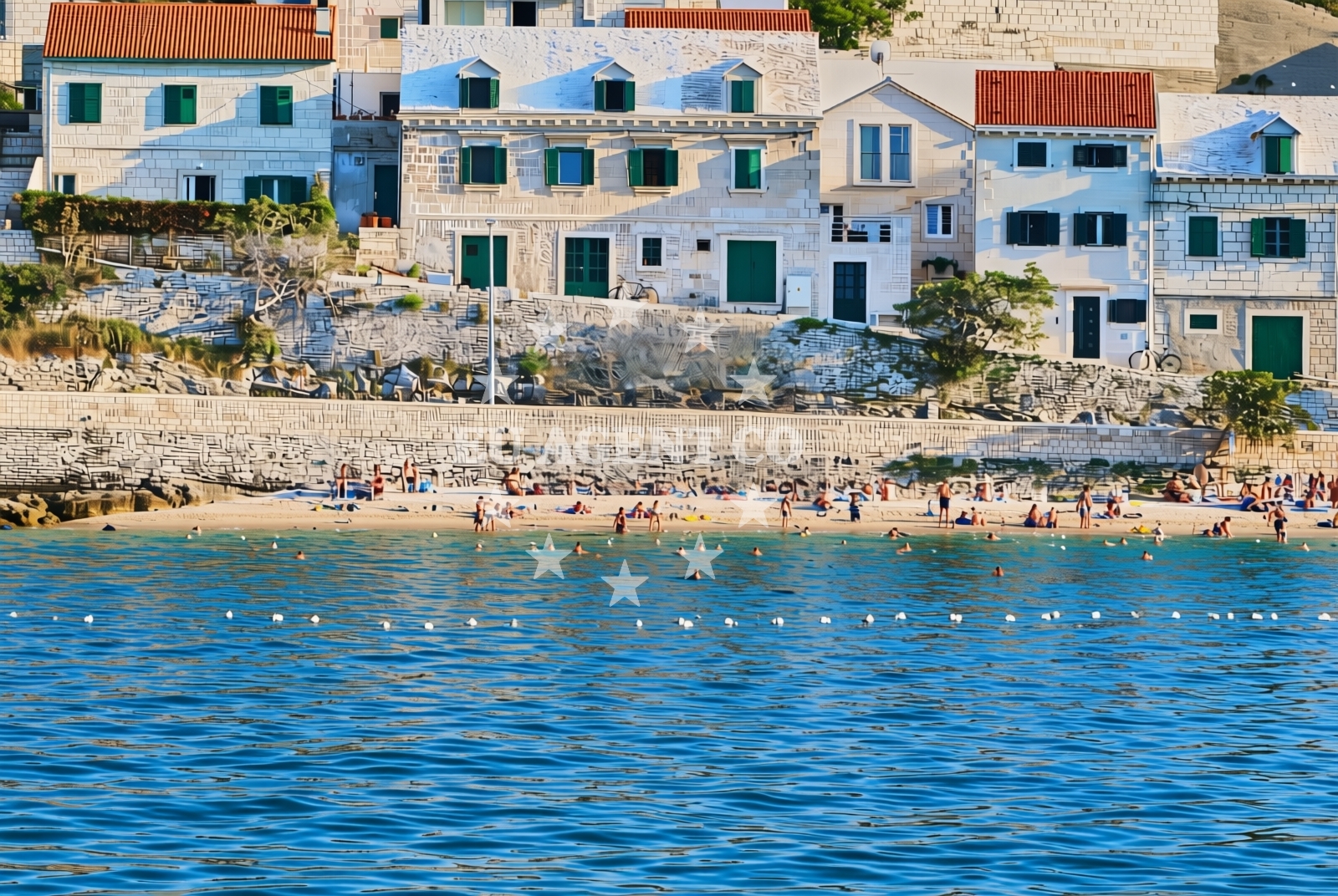
About this beach
Macel, Pučišća (Brač)
Beach: Macel
Location: Pučišća (Brač)
Characteristics and facilities
Gravel, concrete / stone slabs
250 m
Natural shade
shower
Beach character
The beach's surface is primarily gravel and stone slabs, creating a rugged yet accessible shoreline. The 250-meter stretch offers a linear beach profile, with no indication of sand or fine-grained sediment. Natural shade is present, likely provided by coastal vegetation or topographical features. A shower facility is available, though details about its location or accessibility are not specified in the catalog.Swimming and shore
While the beach does not explicitly mention swimming conditions, the gravel and stone slab composition suggests the shoreline may be less ideal for barefoot swimming. The absence of detailed water quality information means visitors should consider local conditions and potential roughness of the seabed near the shore.Facilities and activities
The beach includes a shower facility, which is a key amenity for visitors. No other structured facilities or activities are listed in the catalog. The lack of explicit activity labels means recreational options are not detailed, though the beach's location on Brač may offer proximity to broader coastal activities.Access and location
Macel, Pučišća (Brač) Beach is situated on the island of Brač, part of the Split-Dalmatia County in Croatia. The coordinates place it near the central-southern portion of Brač, a region known for its limestone cliffs and marine landscapes. The beach's proximity to the Adriatic Sea positions it within a sailing area popular with motor and sail yachts exploring the Dalmatian Coast.What to expect
Visitors should expect a gravel and stone slab shoreline with a 250-meter stretch. Natural shade and a shower facility are available, though specific details about their placement or usability are not provided. The beach does not appear to have structured amenities beyond these features. Its location on Brač, a well-known sailing destination, may offer opportunities for coastal exploration or yacht-based visits to the area.Practical tips
The gravel and stone slabs may make walking along the shore less comfortable for those preferring softer surfaces. The shower facility should be used as needed, though its exact location is unspecified. Visitors are advised to check local conditions for water safety and accessibility, as the beach's features are described in a general manner.Exploring the coast by yacht
Brač is a key island in the Adriatic's sailing network, with its coastline offering a mix of sheltered bays and open waters. While Macel, Pučišća (Brač) Beach itself is not noted as an anchorage or marina, the surrounding area is frequented by yachts exploring the Dalmatian Coast. For those chartering a yacht, the nearby sailing routes and coastal towns of Brač provide opportunities for land-based excursions and anchoring in more protected areas.Regional Context: Brač and the Dalmatian Coast
Brač, where this beach is located, is renowned for its limestone landscapes, vineyards, and clear waters. The island is a hub for sailing, with marinas in towns like Supetar and Bol serving as common bases for yacht charters. The surrounding waters are part of a larger network of Adriatic sailing routes, connecting to islands like Hvar, Vis, and the mainland near Split. Visitors to Macel may find the beach's proximity to these sailing centers advantageous for combining land and sea activities.Anchorages in the surrounding area
Anchorages near Povlja and Postira on Brač offer nearby mooring options.
- Konopjikova — postira — brac — 2.7 NM from beach
- Tri luke — povlja — brac — 2.7 NM from beach
- Anchorage — povlja — brac — 3.4 NM from beach
- Anchorage — postira — brac — 3.4 NM from beach
- Anchorage — povlja — brac — 3.5 NM from beach
- Anchorage — povlja — brac — 3.9 NM from beach
- Anchorage — povlja — brac — 4.2 NM from beach
- Anchorage — povlja — brac — 4.2 NM from beach
Distances are straight-line geographic distances, not sailing routes.
Mooring buoys in the surrounding area
- Restaurant Pipo buoys — povlja — brac — 2.5 NM from beach
- Restaurant Pipo jetty — povlja — brac — 2.6 NM from beach
- Quay — postira — brac — 2.7 NM from beach
- Konoba Rojen jetty — povlja — brac — 2.7 NM from beach
- Buoy field — bol — brac — 6.3 NM from beach
Distances are straight-line geographic distances, not sailing routes.
Marine fuel stations
Fuel stations in Bol, Sumartin, and nearby areas supply marine fuel for vessels traveling to the beach.
- Fuel station — bol — brac — 6.4 NM from beach
- Fuel station — sumartin — brac — 6.6 NM from beach
- Ina — vrboska — hvar — 10.5 NM from beach
- Ina — makarska — 12.6 NM from beach
Distances are straight-line geographic distances, not sailing routes.
Harbours in the surrounding area
Pučišća harbour is situated near the beach, offering a nearby port for vessels.
- Pučišća harbour — pucisca — brac — 0.1 NM from beach
- Mimice — 4.6 NM from beach
- Postira — brac — 5.1 NM from beach
- Omiš — omis — 6.0 NM from beach
- Splitska — brac — 6.0 NM from beach
- Pisak — 6.2 NM from beach
Distances are straight-line geographic distances, not sailing routes.
Marinas in the surrounding area
- Marina Baška Voda — marina baska voda — 9.2 NM from beach
- ACI Marina Vrboska — hvar — 10.5 NM from beach
- Marina Ramova — krvavica — 10.8 NM from beach
- Marina Lav — podstrana — 12.2 NM from beach
- ACI Marina Milna — milna brac — 12.7 NM from beach
Distances are straight-line geographic distances, not sailing routes.
Restaurants near the beach
Restaurants such as Pizzeria Marin and Lado in Pučišća are located in close proximity to the beach.
- Pizzeria Marin — pucisca — brac — 0.1 NM from beach
- Lado — pucisca — brac — 0.2 NM from beach
- Hideaway Pipo — povlja — brac — 2.6 NM from beach
- Konoba Rojen — povlja — brac — 2.7 NM from beach
- Restaurant — postira — brac — 3.3 NM from beach
- Kala — povlja — brac — 4.4 NM from beach
- Stara Uljara — povlja — brac — 4.5 NM from beach
Distances are straight-line geographic distances, not sailing routes.
Navigation guides for the surrounding area
Navigation guides for Pucisca and Uvala Luka assist in planning routes around the area.
- Pucisca — 0.3 NM from beach
- Uvala Luka — 2.9 NM from beach
- Mi mice — 4.6 NM from beach
- Postire — 4.9 NM from beach
- Omis — 5.8 NM from beach
Distances are straight-line geographic distances, not sailing routes.
Yachts from nearby departure bases
Sailing yachts
- Elan Impression 40 (KARLETA) — Baška Voda Port — 9.1 NM from departure base to beach
- Oceanis 331 (Aloha) — Baška Voda — 9.2 NM from departure base to beach
Catamarans
- Lagoon 450 Fly (Falco) — Sumpetar Port — 7.9 NM from departure base to beach
Gulets / Cruisers
- Gulet (Trebenna) — Omiš City Port — 5.9 NM from departure base to beach
- Gulet (Primorac) — Omiš City Port — 5.9 NM from departure base to beach
- Gulet (PATRONICE) — Omiš City Port — 6.1 NM from departure base to beach
- Gulet (Cataleya) — Sumpetar Port — 7.9 NM from departure base to beach
- Gulet (Altair) — Sumpetar Port — 7.9 NM from departure base to beach
- Gulet cruiser (AGORA) — Dugi Rat Luka Krilo — 9.0 NM from departure base to beach
Motor boats
- Pearl Sea 31 Hard Top (Aero) — Baška Voda Port — 9.1 NM from departure base to beach
Distances are straight-line geographic distances, not sailing routes.