Lungo mare, Mandre (Pag) Beach, Croatia
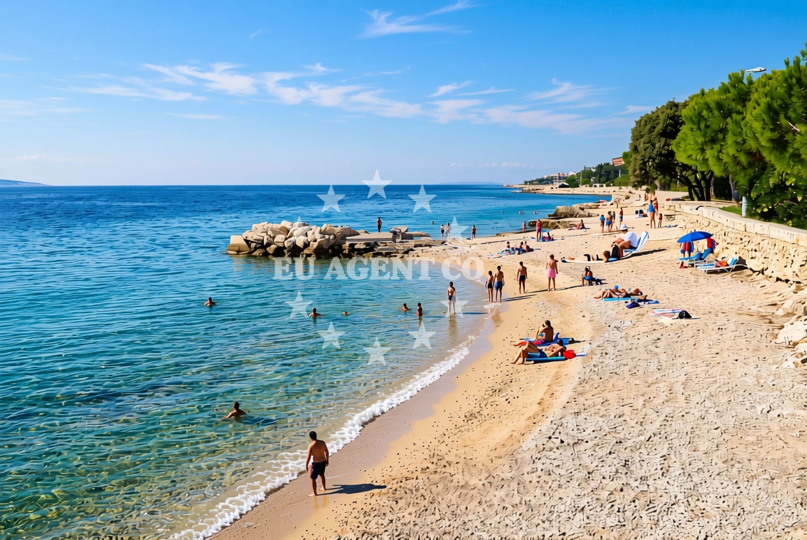
Lungo mare, Mandre (Pag) Beach lies along the eastern coast of Pag, an island in the Adriatic Sea known for its rugged terrain, pine forests, and historic stone villages. This beach stretches approximately 300 meters along a shoreline composed of gravel, concrete slabs, and rocky outcrops. Its natural shade, provided by the island's topography, offers respite from the sun. While the beach lacks formal amenities, its proximity to Pag's cultural and natural attractions makes it a destination for those seeking a raw, unspoiled coastal experience.
About this beach
Lungo mare, Mandre (Pag)
Beach: Lungo mare
Location: Mandre (Pag)
Characteristics and facilities
Gravel, concrete / stone slabs, rocks
300 m
Natural shade
Beach character
The beach's surface is a mix of gravel, concrete slabs, and exposed rock, reflecting Pag's geological character. The shoreline is uneven, with scattered boulders and areas of compacted stone. Natural shade is available in parts of the beach, likely due to the island's elevation and vegetation. The water clarity is typical of the Adriatic, though the rocky substrate may make swimming conditions variable. This beach is not suited for those seeking sandy shores but appeals to visitors interested in the island's authentic coastal landscapes.
Swimming and shore
Swimming conditions at Lungo mare are influenced by the rocky and gravelly seabed. The shoreline's uneven terrain may make entry and exit challenging, particularly for young children or those unaccustomed to such environments. The water is likely clear and cool, as is common along Pag's coast, but the lack of sandy areas means there are no designated swimming zones. The beach's natural features make it more suitable for short dips or exploration of the shoreline's rocky formations.
Facilities and activities
No formal facilities are listed for Lungo mare, Mandre (Pag) Beach. The absence of amenities such as showers, restrooms, or lifeguard services aligns with the beach's character as a more remote and naturalistic site. Activities associated with the beach are not explicitly documented, but the surrounding area of Pag offers opportunities for hiking, cycling, and visiting the island's lavender fields and medieval villages. The beach itself is best experienced as a place to observe the Adriatic's rocky coastlines and enjoy the natural shade provided by Pag's terrain.
Access and location
Lungo mare is located in the Mandre area of Pag, an island in Croatia's northern Adriatic. The nearest major settlement is Pag town, accessible by ferry from Zadar or other mainland ports. The beach's coordinates (44.4728° N, 14.9245° E) place it near the island's eastern coast, where the shoreline transitions from rocky to more sandy in some areas. Visitors arriving by car would need to use the island's road network, which connects Pag's villages and coastal points. The beach's accessibility is limited by its remote location, making it a destination for those seeking solitude over convenience.
What to expect
Expect a beach defined by its gravel, concrete slabs, and rocky formations, with natural shade available in certain areas. The shoreline is not suitable for sunbathing on sand but offers opportunities to explore the Adriatic's rocky coastlines. The beach's remoteness means there are no formal amenities, and visitors should plan accordingly. The surrounding area of Pag provides cultural and natural attractions, but the beach itself is best experienced as a raw, unspoiled stretch of coastline.
Practical tips
Wear sturdy footwear to navigate the gravel and rocky terrain. Bring water, as there are no facilities for purchase or refill. The natural shade can be a benefit during peak sun hours, but sun protection is still recommended. Arrive early to secure a spot, as the beach's accessibility may lead to occasional congestion during peak season.
Exploring the coast by yacht
The Adriatic Sea, where Pag is located, is a popular sailing destination, with its clear waters and sheltered bays. Yacht charter guests exploring the region may find Lungo mare's proximity to Pag's coastline useful for anchoring or short excursions. The island's marinas, such as those in Pag town, provide access to the surrounding waters, making it a hub for sailors navigating the northern Adriatic. While the beach itself is not a marina or anchorage, its location offers a vantage point for observing the area's maritime activity and natural beauty.
Historical and Cultural Context of Pag
Pag's history dates back to ancient times, with evidence of Roman settlements and medieval fortifications. The island's stone villages, such as Šibenik and Kamenjak, reflect its long-standing connection to maritime traditions. Local cuisine features Pag's famous cheese, produced from sheep grazing on the island's limestone pastures. The beach's location near these cultural sites makes it a convenient stop for those exploring Pag's heritage.
Anchorages in the surrounding area
Anchorages near Mandre and Pag offer nearby mooring options.
- Anchorage — mandre — pag — 1.7 NM from beach
- Anchorage — mandre — pag — 1.8 NM from beach
- Anchorage — maun — 2.1 NM from beach
- Potcrkvine — maun — 2.2 NM from beach
- Anchorage — mandre — pag — 2.5 NM from beach
- Anchorage — maun — 2.6 NM from beach
- Anchorage — skrda — 3.4 NM from beach
- Anchorage — maun — 4.3 NM from beach
Distances are straight-line geographic distances, not sailing routes.
Mooring buoys in the surrounding area
- Jetty — simuni — pag — 2.0 NM from beach
- Jetty — zubovici — pag — 3.7 NM from beach
- Jetty — zubovici — pag — 3.8 NM from beach
- Buoy field — novalja — pag — 5.6 NM from beach
- Buoy field Slatinica — olib — 7.7 NM from beach
Distances are straight-line geographic distances, not sailing routes.
Marine fuel stations
Marine fuel stations in Rab and Losinj serve as refueling points for vessels traveling further afield.
- Ina — rab — 18.5 NM from beach
- Ina — mali losinj — 20.1 NM from beach
- Adria Oil — mali losinj — 20.6 NM from beach
- Ina — zadar — 25.0 NM from beach
Distances are straight-line geographic distances, not sailing routes.
Harbours in the surrounding area
Harbors in Novalja and Pag offer convenient access points for boats exploring the region.
- Novalja — pag — 5.4 NM from beach
- Pag — 5.6 NM from beach
- Žigljen — zigljen — pag — 6.6 NM from beach
- Karlobag — 7.0 NM from beach
- Stara Novalja — pag — 7.7 NM from beach
- Prizna — 8.0 NM from beach
Distances are straight-line geographic distances, not sailing routes.
Marinas in the surrounding area
- ACI Marina Šimuni — simuni — pag — 1.3 NM from beach
- ACI Marina Rab — 18.4 NM from beach
- Marina Veli Rat — dugi otok — 20.0 NM from beach
- Y/C Marina Mali Lošinj — mali losinj — 20.3 NM from beach
- Marina Lošinj — mali losinj — 20.5 NM from beach
Distances are straight-line geographic distances, not sailing routes.
Restaurants near the beach
Restaurants in Simuni and Novalja offer dining options close to the beach.
- Maestral — simuni — pag — 1.3 NM from beach
- Ribarska Koliba Šimuni — simuni — pag — 1.5 NM from beach
- Bistro Šimuni — simuni — pag — 1.5 NM from beach
- Didova Kuča — simuni — pag — 1.5 NM from beach
- Pizzeria Villa Olea — simuni — pag — 1.6 NM from beach
- Margarita — novalja — pag — 4.8 NM from beach
- Restaurant — novalja — pag — 4.9 NM from beach
Distances are straight-line geographic distances, not sailing routes.
Navigation guides for the surrounding area
Navigation guides for Caska and Novalja assist in planning routes around the area.
- Caska — 4.4 NM from beach
- Novalja — 5.2 NM from beach
- Uvala Prizna — 8.0 NM from beach
- Luka Olib — 8.3 NM from beach
- Uvala Bliznica — 9.2 NM from beach
Distances are straight-line geographic distances, not sailing routes.
Yachts from nearby departure bases
Yachts departing from Šimuni and Novalja provide access to the surrounding waters.
Sailing yachts
- First 45 (Egeria) — Šimuni Kolan ACI Marina — 1.3 NM from departure base to beach
- Sun Odyssey 32i (Cikat) — Mali Lošinj — 20.3 NM from departure base to beach
- Bavaria 46 Cruiser (DEA) — Mali Lošinj — 20.3 NM from departure base to beach
Motor yachts
- Absolute 50 Fly (Acrobat) — Rab ACI Marina — 18.4 NM from departure base to beach
Motor boats
- Balt 818 Titanium (Valentina) — Novalja — 5.3 NM from departure base to beach
- Balt 818 Titanium (Valentina 2) — Novalja — 5.3 NM from departure base to beach
- BWA Sport 22GT (BWA ) — Pag City Port — 5.8 NM from departure base to beach
- Merry Fisher 895 — Povljana Marina — 10.8 NM from departure base to beach
- Merry Fisher 795 (Posejdon) — Mali Lošinj — 20.3 NM from departure base to beach
- Galeon Galia 630 (287670ML) — Mali Lošinj — 20.3 NM from departure base to beach
Distances are straight-line geographic distances, not sailing routes.