Lungo Mare Istop, Mandre (Pag) Beach, Croatia
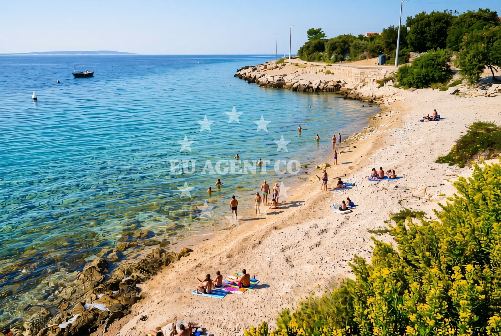
About this beach
Lungo mare istok, Mandre (Pag)
Beach: Lungo mare istok
Location: Mandre (Pag)
Characteristics and facilities
Gravel, concrete / stone slabs
50 m
Beach character
The beach's surface composition reflects Pag's famous 'Pag stone,' a dense limestone known for its durability and use in local architecture. The gravel and stone slabs create a firm walking surface, though swimmers should note that the immediate shoreline is not sandy. The beach's short length and rocky character make it more suitable for leisurely strolls than extended sunbathing. The area's natural features are complemented by the island's broader landscape, which includes wind-swept plains, traditional stone houses, and the iconic Škrip mountain range visible in the distance.Swimming and shore
While the beach itself lacks sandy shores, the adjacent Adriatic waters offer clear visibility typical of the Dalmatian coast. The rocky shoreline creates natural pools in some areas, which may provide sheltered swimming spots during low tide. Visitors should be mindful of the uneven terrain when entering the water. The beach's orientation toward the southeast means it receives direct sunlight throughout the day, with minimal natural shade from surrounding features.Facilities and activities
No formal amenities are listed for this beach, reflecting its more natural, undeveloped character. The lack of structured facilities aligns with Pag's tradition of preserving its coastal landscapes. Activities are limited to walking along the shore and exploring the surrounding area, which includes the island's historic sites and the nearby village of Mandre. The beach's location makes it a potential starting point for hiking trails that lead inland toward Pag's interior.Access and location
The beach is accessible via local roads connecting Mandre to Pag's main settlements. Its position on the island's southeastern coast places it within reach of other notable sites, including the Roman ruins of Imota and the coastal town of Nošpara. The nearest major port for yacht charter operations is Zadar, approximately 50 nautical miles northeast, though smaller marinas on the island's northern coast may offer closer access points for sailors exploring the area.What to expect
Visitors should prepare for a beach experience defined by its rocky terrain and limited amenities. The gravel surface is suitable for walking but may be uncomfortable for prolonged sunbathing. The beach's orientation provides consistent sunlight, making it ideal for daytime visits. Those seeking more traditional beach facilities may want to explore Pag's other shores, such as the sandy beaches near the village of Murviki. The area's natural character makes it particularly appealing to visitors interested in the island's geological and cultural heritage.Practical tips
Wear sturdy footwear for walking on the gravel and stone surfaces. Check tide times before visiting, as the rocky shoreline may create temporary pools during low tide. The beach's proximity to Mandre means local accommodations and restaurants are available in the village, though amenities are more limited compared to Pag's larger towns.Exploring the coast by yacht
For yacht charter guests, the beach's location on Pag Island offers a strategic vantage point for exploring the Dalmatian Coast. The island's sheltered waters and proximity to the Zadar archipelago make it a common stop for sailors navigating the Adriatic. Charter yachts may anchor in nearby bays such as Brela or Vela Luka (on the island of Brač) for easier access to this area. The clear waters and relatively calm conditions around Pag make it an attractive region for both motor and sailing yachts, with opportunities to explore the wider Adriatic sailing routes.Pag's Unique Geology
The beach's gravel and stone composition is a direct result of Pag's famous limestone geology. The island's 'Pag stone' has been used for centuries in local construction, giving the area its distinctive architectural character. This same rock formation contributes to the beach's firm surface and the island's resistance to erosion.Historical Context
Mandre's location on Pag Island places it within a region with deep historical roots. The island was inhabited by the Illyrians before Roman times, and remnants of ancient settlements can still be found in the surrounding area. This historical context adds depth to visits to the beach and the broader island.Anchorages in the surrounding area
Anchorages in Mandre and Maun on Pag offer nearby options for mooring within a few nautical miles of the beach.
- Anchorage — mandre — pag — 1.9 NM from beach
- Anchorage — mandre — pag — 2.0 NM from beach
- Anchorage — maun — 2.2 NM from beach
- Potcrkvine — maun — 2.3 NM from beach
- Anchorage — maun — 2.5 NM from beach
- Anchorage — mandre — pag — 2.7 NM from beach
- Anchorage — skrda — 3.7 NM from beach
- Anchorage — maun — 4.0 NM from beach
Distances are straight-line geographic distances, not sailing routes.
Mooring buoys in the surrounding area
- Jetty — simuni — pag — 1.7 NM from beach
- Jetty — zubovici — pag — 3.7 NM from beach
- Jetty — zubovici — pag — 3.8 NM from beach
- Buoy field — novalja — pag — 5.9 NM from beach
- Buoy field Slatinica — olib — 7.7 NM from beach
Distances are straight-line geographic distances, not sailing routes.
Marine fuel stations
Marine fuel stations in Rab and Mali Losinj serve as distant refueling options for vessels traveling to the beach.
- Ina — rab — 18.7 NM from beach
- Ina — mali losinj — 20.3 NM from beach
- Adria Oil — mali losinj — 20.8 NM from beach
- Ina — zadar — 24.7 NM from beach
Distances are straight-line geographic distances, not sailing routes.
Harbours in the surrounding area
Harbors in Pag and Novalja on Pag offer nearby port facilities within a short distance from the beach.
- Pag — 5.4 NM from beach
- Novalja — pag — 5.6 NM from beach
- Žigljen — zigljen — pag — 6.7 NM from beach
- Karlobag — 6.9 NM from beach
- Košljun — kosljun pag — 7.8 NM from beach
- Stara Novalja — pag — 7.9 NM from beach
Distances are straight-line geographic distances, not sailing routes.
Marinas in the surrounding area
ACI Marina Šimuni on Pag is a close marina located just over a nautical mile from the beach.
- ACI Marina Šimuni — simuni — pag — 1.1 NM from beach
- ACI Marina Rab — 18.7 NM from beach
- Marina Veli Rat — dugi otok — 19.9 NM from beach
- Y/C Marina Mali Lošinj — mali losinj — 20.5 NM from beach
- Marina Lošinj — mali losinj — 20.8 NM from beach
Distances are straight-line geographic distances, not sailing routes.
Restaurants near the beach
- Maestral — simuni — pag — 1.0 NM from beach
- Ribarska Koliba Šimuni — simuni — pag — 1.2 NM from beach
- Bistro Šimuni — simuni — pag — 1.2 NM from beach
- Didova Kuča — simuni — pag — 1.3 NM from beach
- Pizzeria Villa Olea — simuni — pag — 1.4 NM from beach
Distances are straight-line geographic distances, not sailing routes.
Navigation guides for the surrounding area
Navigation guides for Caska and Novalja assist with route planning in the surrounding coastal areas.
- Caska — 4.6 NM from beach
- Novalja — 5.4 NM from beach
- Uvala Prizna — 8.1 NM from beach
- Luka Olib — 8.3 NM from beach
- Uvala Bliznica — 8.9 NM from beach
Distances are straight-line geographic distances, not sailing routes.
Yachts from nearby departure bases
Yachts departing from Šimuni and Pag offer direct access to the beach with bases located within a few nautical miles.
Sailing yachts
- First 45 (Egeria) — Šimuni Kolan ACI Marina — 1.1 NM from departure base to beach
- Elan 40 Impression (Laali) — Mali Lošinj — 20.6 NM from departure base to beach
- First 31.7 (Ruta) — Mali Lošinj — 20.6 NM from departure base to beach
Motor yachts
- Absolute 50 Fly (Acrobat) — Rab ACI Marina — 18.7 NM from departure base to beach
Motor boats
- BWA Sport 22GT (BWA ) — Pag City Port — 5.5 NM from departure base to beach
- Balt 818 Titanium (Valentina 2) — Novalja — 5.6 NM from departure base to beach
- Balt 818 Titanium (Valentina) — Novalja — 5.6 NM from departure base to beach
- Merry Fisher 895 — Povljana Marina — 10.5 NM from departure base to beach
- Galeon Galia 630 (Kali) — Mali Lošinj — 20.6 NM from departure base to beach
- Galeon Galia 630 — Mali Lošinj — 20.6 NM from departure base to beach
Distances are straight-line geographic distances, not sailing routes.