Luka stonska jug, Luka (Ston) Beach, Croatia
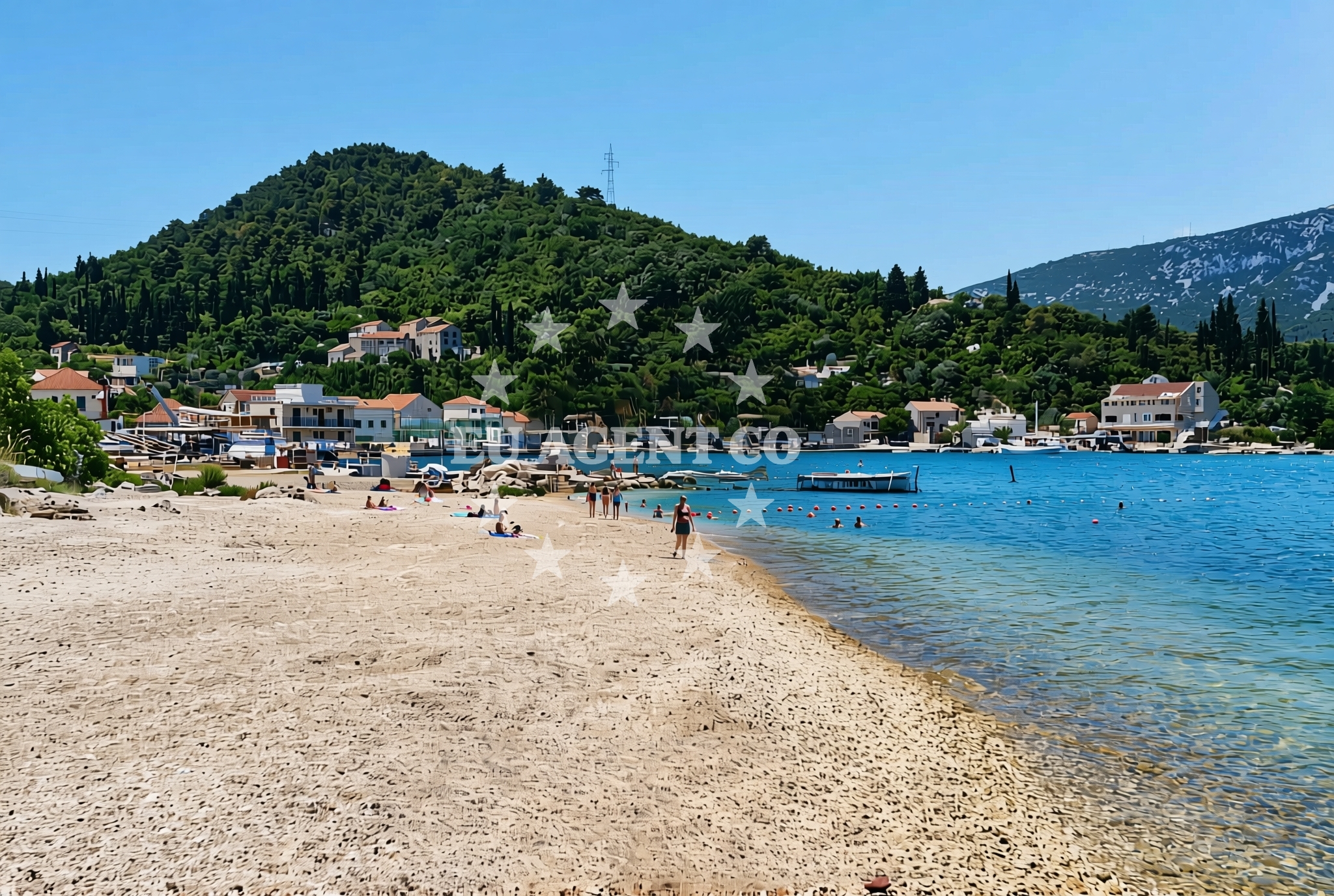
Luka stonska jug, Luka (Ston) Beach is a gravel shore located in the town of Ston on the Pelješac Peninsula in Croatia. Stretching approximately 50 meters along the Adriatic coast, this beach offers a straightforward shoreline experience with minimal natural features. Its proximity to Ston, a historic settlement known for its medieval walls and vineyards, provides visitors with opportunities to explore cultural and gastronomic landmarks nearby.
About this beach
Luka stonska jug, Luka (Ston)
Beach: Luka stonska jug
Location: Luka (Ston)
Characteristics and facilities
Gravel
50 m
Beach character
The beach consists of gravel, which defines its texture and accessibility. While it lacks the soft sand typical of many coastal areas, the gravel composition makes it suitable for walking and leisurely strolls. The beach's short length means it is not ideal for extended sunbathing but can serve as a quiet spot for reflection or as a starting point for coastal exploration. The surrounding landscape likely features the rugged terrain characteristic of the Pelješac Peninsula, with views of the Adriatic Sea and potential sightlines toward nearby islands like Šipan and Hvar.
Swimming and shore
Swimming conditions at Luka stonska jug are not explicitly detailed in available records, but the gravel shoreline suggests it may not be a primary destination for water sports or deep-water swimming. The beach's modest size and lack of dedicated facilities mean it is more suited to casual visitors seeking a simple coastal experience rather than those prioritizing aquatic activities. The shore's flatness could allow for easy access to the water's edge, though the gravel may make prolonged immersion less comfortable.
Facilities and activities
No specific facilities or amenities are listed for Luka stonska jug Beach itself. Visitors should expect a basic, unadorned shoreline without services such as showers, restrooms, or seating. However, the nearby town of Ston offers a range of services, including restaurants, shops, and accommodations. Ston's historical significance as a fortified settlement also means there are cultural attractions to explore, such as the Ston City Walls and the nearby Pelješac Bridge, which connects the peninsula to the mainland.
Access and location
Luka stonska jug is situated within the town of Ston, a coastal municipality on the Pelješac Peninsula. The beach's exact coordinates (42.861707° N, 17.681965° E) place it near the southern tip of the peninsula, close to the mouth of the Ston Channel. Travelers arriving by road can reach Ston via the A1 motorway, which links Dubrovnik to Split. For those arriving by sea, the nearby port of Ston offers access to the Adriatic, though the beach itself does not function as a formal marina or anchorage.
What to expect
Visitors to Luka stonska jug should prepare for a straightforward beach experience defined by its gravel composition and modest size. The shoreline is best suited for short walks or as a scenic vantage point rather than for sunbathing or water-based recreation. The beach's proximity to Ston means that much of the visitor experience will revolve around the town's offerings, including its historic sites, vineyards, and culinary scene. The area's strategic location on the Pelješac Peninsula also makes it a convenient base for exploring the broader Adriatic coastline.
Practical tips
Given the gravel surface, visitors may want to wear sturdy footwear for comfort. While the beach itself lacks facilities, Ston's town center provides access to dining, shopping, and accommodations. Those interested in sailing or yacht charter services may find the surrounding area appealing, with opportunities to explore the Adriatic's islands and coastal routes from nearby marinas.
Exploring the coast by yacht
The Pelješac Peninsula, where Luka stonska jug is located, is a popular region for yacht chartering in the Adriatic. The area's sheltered waters, proximity to islands like Šipan and Hvar, and the presence of marinas in nearby towns such as Ston and Dubrovnik make it an attractive destination for sailors. Charter guests can use the peninsula as a base to explore the broader Dalmatian coast, with routes extending to the Elafiti Islands, the Bay of Kotor, and the central Adriatic. While Luka stonska jug itself is not a formal anchorage, its location near Ston provides access to the region's sailing infrastructure.
Historical Context of Ston
The town of Ston, near which Luka stonska jug is located, is one of the oldest continuously inhabited towns in Croatia. Its medieval walls, built in the 13th and 14th centuries, are among the longest and best-preserved in Europe. The area was historically significant as a defensive stronghold and a center for trade, with its position controlling access to the Adriatic. Today, Ston's legacy is reflected in its museums, archaeological sites, and wine production, which dates back to Roman times.
Anchorages in the surrounding area
Anchorages in the surrounding area include options near Mali Ston and Prapratno.
- Anchorage — mali ston — 1.3 NM from beach
- Anchorage — prapratno — 2.8 NM from beach
- Anchorage — broce — 3.7 NM from beach
- Ribnja — broce — 4.0 NM from beach
- Anchorage — broce — 4.4 NM from beach
- Anchorage — broce — 4.9 NM from beach
- Anchorage — broce — 6.1 NM from beach
- Anchorage — olipa — 7.0 NM from beach
Distances are straight-line geographic distances, not sailing routes.
Mooring buoys in the surrounding area
Mooring buoys in the surrounding area include quays near Prapratno and Kobas.
- Quay — prapratno — 2.8 NM from beach
- Quay — kobas — 4.4 NM from beach
- Lukas Taverna jetty — kobas — 4.4 NM from beach
- Konoba Nico jetty — kobas — 4.4 NM from beach
- Brijesta — 7.1 NM from beach
Distances are straight-line geographic distances, not sailing routes.
Marine fuel stations
- Fuel station — sobra — mljet — 7.9 NM from beach
- Fuel station — ploce — 15.8 NM from beach
- Ina — dubrovnik — 21.3 NM from beach
- Ina — dubrovnik — 22.7 NM from beach
Distances are straight-line geographic distances, not sailing routes.
Harbours in the surrounding area
Harbours in the surrounding area include Hodilje and Mali Ston, located nearby.
- Hodilje — 0.4 NM from beach
- Mali Ston — 1.3 NM from beach
- Ston — 1.8 NM from beach
- Prapranto Ferry Harbour — prapratno — 3.0 NM from beach
- Doli — 5.9 NM from beach
- Okuklje — mljet — 8.1 NM from beach
Distances are straight-line geographic distances, not sailing routes.
Marinas in the surrounding area
- ACI Marina Slano — 10.3 NM from beach
- Marina Frapa Dubrovnik — 21.4 NM from beach
- ACI Marina Dubrovnik — 22.6 NM from beach
- Marina Lumbarda — korcula — 22.7 NM from beach
- ACI Marina Korčula — korcula — 24.7 NM from beach
Distances are straight-line geographic distances, not sailing routes.
Restaurants near the beach
Restaurants near the beach include Bota Sare in Mali Ston and Lukas Taverna in Kobas.
- Bota Sare — mali ston — 1.3 NM from beach
- Restaurant — prapratno — 2.6 NM from beach
- Gastro Mare — kobas — 4.4 NM from beach
- Luka's Taverna — lukas taverna — kobas — 4.4 NM from beach
- Nico — kobas — 4.4 NM from beach
Distances are straight-line geographic distances, not sailing routes.
Navigation guides for the surrounding area
Navigation guides for the surrounding area include Luka and Hodilje, close to the beach.
- Luka — 0.1 NM from beach
- Hodilje — 0.5 NM from beach
- Uvala Bjejvica — 0.7 NM from beach
- Uvala Bistrina — 1.3 NM from beach
- Mali Ston — 1.5 NM from beach
Distances are straight-line geographic distances, not sailing routes.
Yachts from nearby departure bases
Yachts from nearby departure bases include sail boats and catamarans based at Slano ACI Marina.
Sailing yachts
- Elan 50 Impression (Timeless) — Slano ACI Marina — 10.3 NM from departure base to beach
- Oceanis 45 (Cancan) — Slano ACI Marina — 10.3 NM from departure base to beach
- Elan 45 Impression (Skyfall) — Slano ACI Marina — 10.3 NM from departure base to beach
- Oceanis 45 (Soul) — Slano ACI Marina — 10.3 NM from departure base to beach
- Oceanis 45 (Mambo 1) — Slano ACI Marina — 10.3 NM from departure base to beach
Catamarans
- Lagoon 40 (SAILOR MOON) — Slano ACI Marina — 10.3 NM from departure base to beach
- Lagoon 50 (TWIN JOY) — Slano ACI Marina — 10.3 NM from departure base to beach
- Lagoon 40 (MARINERO) — Slano ACI Marina — 10.3 NM from departure base to beach
- Lagoon 40 (SUNLIGHT) — Slano ACI Marina — 10.3 NM from departure base to beach
- Lagoon 42 (ALMA SOFIA) — Slano ACI Marina — 10.3 NM from departure base to beach
Distances are straight-line geographic distances, not sailing routes.