Luka, Rogač (Šolta) Beach: A Gravel and Rock Shoreline with Coastal Amenities, Croatia
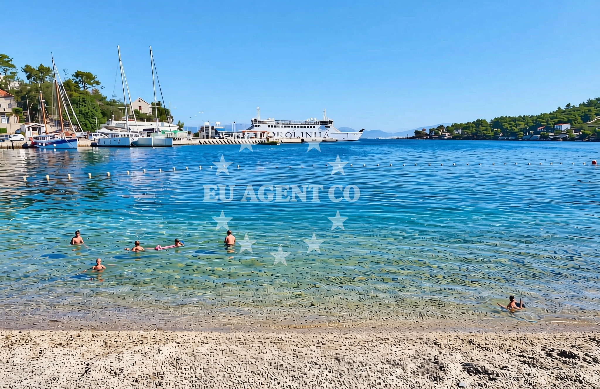
About this beach
Luka, Rogač (Šolta)
Beach: Luka
Location: Rogač (Šolta)
Characteristics and facilities
Gravel, rocks
80 m
Restaurant / snack bar
Caffe bar / Drinks stand
Beach character
The beach's defining feature is its gravel and rock composition, creating a terrain that is more suited for walking than swimming. The 80-meter length offers a compact space for visitors to relax, though the rocky surface may require sturdy footwear. The absence of sand makes this a unique spot for those interested in exploring the island's less conventional coastal landscapes. The shoreline is relatively unspoiled, with minimal artificial development, preserving its natural character.Swimming and shore
Swimming conditions at Luka, Rogač (Šolta) Beach are not explicitly detailed in available records, but the rocky terrain suggests that the area may be more suitable for wading or exploring the shoreline than for deep-water swimming. The beach's proximity to the sea allows for easy access to the water's edge, though the gravel and rock substrate may make it less ideal for sunbathing. The adjacent restaurant and snack bar provide convenient refreshment options for visitors spending time along the shore.Facilities and activities
On-site facilities include a restaurant and snack bar, offering meals and drinks for visitors. While no structured activities are listed, the beach's natural setting makes it a potential spot for leisurely walks, photography, and picnics. The lack of additional amenities means the focus is on enjoying the coastal environment rather than participating in organized events or water sports.Access and location
Located in Luka, part of Rogač on Šolta Island, the beach is situated within a region known for its maritime history and scenic islands. Šolta itself is a small island in the Adriatic Sea, positioned between the larger islands of Brač and Hvar. The area is accessible via ferry routes from Split and other nearby coastal towns, making it a convenient stop for travelers exploring the Dalmatian coast.What to expect
Visitors to Luka, Rogač (Šolta) Beach should expect a rugged, gravelly shoreline that contrasts with the region's more typical sandy beaches. The beach is compact, with a restaurant and snack bar providing on-site dining. The natural terrain may appeal to those seeking a quieter, less developed coastal experience. The area's proximity to Šolta's broader landscape, including its vineyards and historic sites, offers opportunities for further exploration beyond the beach itself.Practical tips
Given the beach's gravel and rock surface, visitors may want to wear sturdy footwear. The on-site restaurant and snack bar are ideal for meals, but availability of specific items should be confirmed in advance. The beach's location on Šolta Island means it is part of a larger network of coastal attractions, including nearby villages and maritime routes.Exploring the coast by yacht
For visitors interested in yacht charter, the surrounding Adriatic coast offers extensive sailing opportunities. Šolta Island is part of a region with well-established yacht bases and marinas, making it a convenient starting point for exploring the Dalmatian coast. Charter yachts can easily navigate to nearby islands such as Brač, Hvar, and Vis, as well as the mainland ports of Split and Dubrovnik. The beach's location provides a scenic vantage point for those arriving by boat, though it is not marked as a formal anchorage or marina.Šolta Island's Coastal Landscape
Šolta Island is characterized by its rugged coastline, vineyards, and historic villages, offering a blend of natural beauty and cultural heritage. The island's maritime connections have historically influenced its economy, with fishing and boat-building traditions still evident in local communities. Visitors can explore Šolta's interior by car or bike, with the beach serving as a gateway to the island's broader attractions.Anchorages in the surrounding area
- Anchorage — rogac — solta — 0.1 NM from beach
- Anchorage — rogac — solta — 0.3 NM from beach
- Anchorage — necujam — solta — 0.7 NM from beach
- Anchorage — necujam — solta — 0.8 NM from beach
- Anchorage — necujam — solta — 0.9 NM from beach
- Anchorage — necujam — solta — 1.0 NM from beach
- Anchorage — solta — 1.5 NM from beach
- Anchorage — solta — 1.6 NM from beach
Distances are straight-line geographic distances, not sailing routes.
Mooring buoys in the surrounding area
Mooring buoys near the beach include Pasarela restaurant jetty and Restaurant Sveti Petar bouy in Necujam.
- Pasarela restaurant jetty — rogac — solta — 0.1 NM from beach
- Resturant Sveti Petar bouy — necujam — solta — 1.2 NM from beach
- Jetty — necujam — solta — 1.3 NM from beach
- Lonely Paradise restaurant buoys — solta — 1.5 NM from beach
- Krušica Donja — donja krusica — solta — 1.7 NM from beach
Distances are straight-line geographic distances, not sailing routes.
Marine fuel stations
Fuel stations in the area include one in Rogac and others in Trogir and Milna, Brac.
- Fuel station — rogac — solta — 0.1 NM from beach
- Ina — trogir — 7.5 NM from beach
- Ina — milna brac — 7.5 NM from beach
- B-Max — b max — trogir — 7.7 NM from beach
Distances are straight-line geographic distances, not sailing routes.
Harbours in the surrounding area
- Rogač — rogac — solta — 0.0 NM from beach
- Stomorska — solta — 2.7 NM from beach
- Toče — okrug gornji — ciovo — 6.3 NM from beach
- Slatine — ciovo — 6.5 NM from beach
- Arbanija — okrug gornji — ciovo — 7.1 NM from beach
- Trogir Harbour — 7.5 NM from beach
Distances are straight-line geographic distances, not sailing routes.
Marinas in the surrounding area
Marinas near the beach include Marina Martinis Marchi in Maslinica and Marina Trogir.
- Marina Martinis Marchi — maslinica — solta — 4.1 NM from beach
- Marina Vlaška — milna brac — 7.3 NM from beach
- Marina Trogir — 7.5 NM from beach
- ACI Marina Trogir — 7.5 NM from beach
- Marina Milna Kanarija — milna brac — 7.5 NM from beach
Distances are straight-line geographic distances, not sailing routes.
Restaurants near the beach
Restaurants near the beach include Pasarela, Stara Kuća, and Villa Solta in Rogac.
- Pasarela — rogac — solta — 0.1 NM from beach
- Stara Kuća — rogac — solta — 0.2 NM from beach
- Villa Solta — rogac — 0.2 NM from beach
- Konoba Mareta — necujam — solta — 1.0 NM from beach
- Restaurant Punta — necujam — solta — 1.1 NM from beach
- Sveti Petar — necujam — solta — 1.2 NM from beach
- Lonely Paradise — solta — 1.5 NM from beach
Distances are straight-line geographic distances, not sailing routes.
Navigation guides for the surrounding area
Navigation guides cover areas like Rogac, Uvala Necujam, and Stomorska for route planning.
- Rogac — 0.3 NM from beach
- Uvala Necujam — 1.0 NM from beach
- Uvala Donja Krusica — 1.5 NM from beach
- Uvala Tatinja — 1.8 NM from beach
- Stomorska — 2.8 NM from beach
Distances are straight-line geographic distances, not sailing routes.
Yachts from nearby departure bases
Yachts departing from Šolta Rogač include models like Cyclades 50.5, Lagoon 42, and Sun Odyssey 349.
Sailing yachts
- Cyclades 50.5 (Orinoco) — Šolta Rogač — 0.0 NM from departure base to beach
- Sun Odyssey 349 (Siberia) — Šolta Rogač — 0.0 NM from departure base to beach
- Cyclades 43.4 (Himalaya) — Šolta Rogač — 0.0 NM from departure base to beach
- Sun Odyssey 449 (Port Royal) — Šolta Rogač — 0.0 NM from departure base to beach
- Cyclades 39.3 (Pharos) — Šolta Rogač — 0.0 NM from departure base to beach
Catamarans
- Lagoon 42 (Galapagos) — Šolta Rogač — 0.0 NM from departure base to beach
- Lagoon 450 Flybridge (Samogon) — Šolta Rogač — 0.0 NM from departure base to beach
- Lagoon 40 (Solentia) — Šolta Rogač — 0.0 NM from departure base to beach
- Lagoon 450 (Madagascar) — Šolta Rogač — 0.0 NM from departure base to beach
- Lagoon 400 (Greenland) — Šolta Rogač — 0.0 NM from departure base to beach
Distances are straight-line geographic distances, not sailing routes.