Luka Prižba, Blato (Korčula) Beach, Croatia
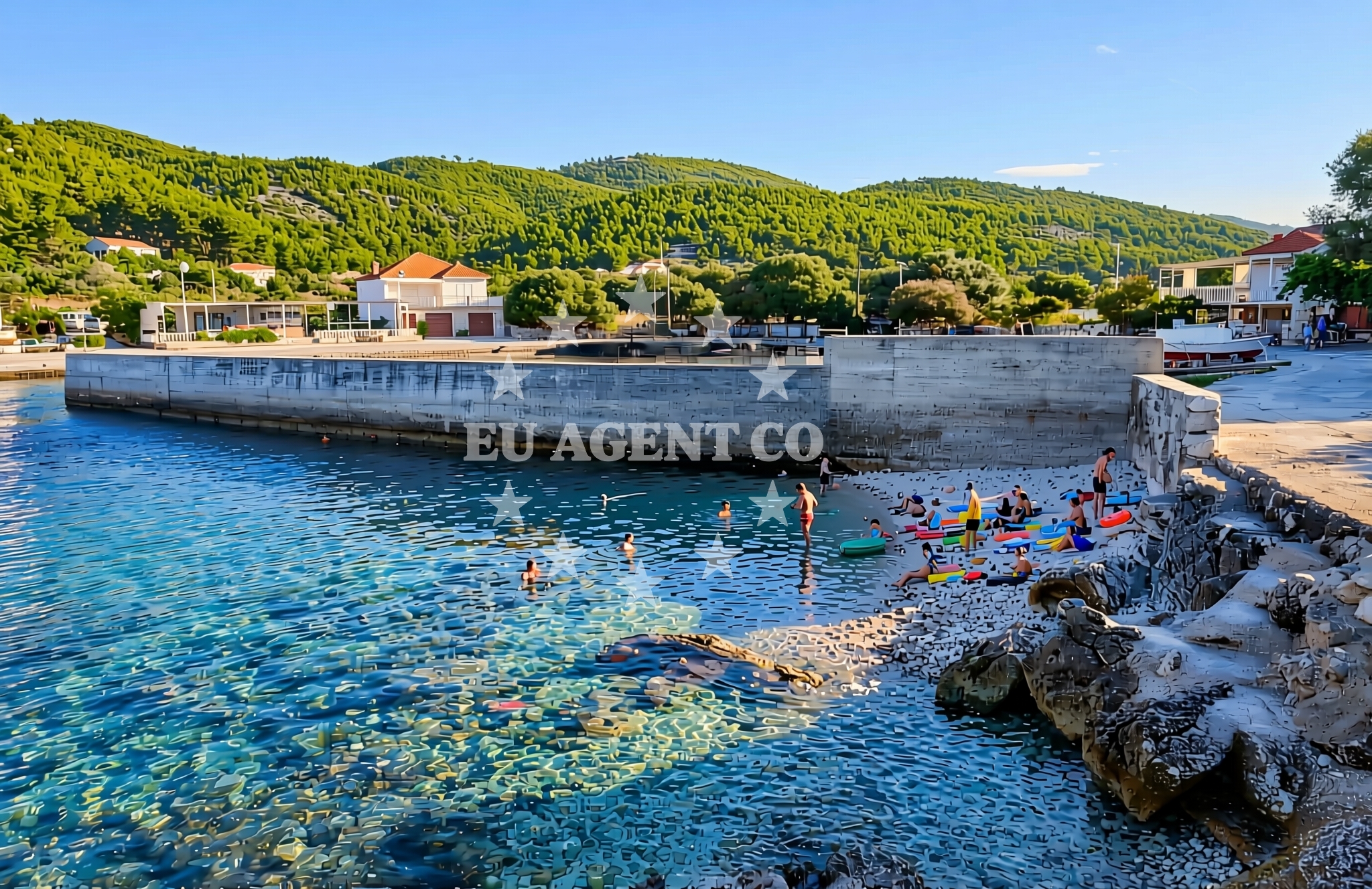
Luka Prižba, located in Blato on the island of Korčula, is a shoreline defined by gravel and rocky terrain. This beach offers a stark contrast to the sandy stretches found elsewhere on the island, presenting a more rugged coastline that reflects the natural contours of the Dalmatian Adriatic. While not ideal for swimming, its unique character makes it a point of interest for those exploring the Blato area, which is known for its historical significance and proximity to Korčula Town, a UNESCO-protected medieval settlement.
About this beach
Luka Prižba, Blato (Korčula)
Beach: Luka Prižba
Location: Blato (Korčula)
Characteristics and facilities
Gravel, rocks
Beach character
The beach’s surface is composed primarily of gravel and rocks, creating a landscape that is more suited to walking or casual exploration than sunbathing. This natural composition is typical of the Blato region, where the coastline is shaped by centuries of erosion and maritime activity. The absence of artificial structures or amenities means visitors encounter an unaltered stretch of the Adriatic, offering a glimpse into the geological and historical layers of the area. The beach’s position near the village of Blato, a historic hub for shipbuilding and fishing, adds to its cultural resonance.
Swimming and shore
Swimming is not recommended at Luka Prižba due to the rocky seabed and uneven shoreline. However, the beach is well-suited for walking along the shore, where visitors can observe the interplay of sea and land. The gravel and rock formations create microhabitats for marine life, making it a spot of interest for nature observers. The beach’s proximity to the open sea means it is subject to tidal changes, which can affect accessibility during low tide.
Facilities and activities
No facilities or structured activities are listed for Luka Prižba. Its remote nature means there are no lifeguard services, showers, or changing rooms. Visitors should be self-sufficient, as the beach lacks commercial infrastructure. The surrounding Blato area, however, offers access to local amenities in the village, including traditional restaurants and small shops. For those interested in broader exploration, the nearby Korčula Town provides cultural and historical sites, including the iconic Korčula Town Fortress and the Cathedral of Saint Mark.
Access and location
Luka Prižba is situated in Blato, a small village on the island of Korčula, part of the Pelješac Peninsula. The beach is accessible by foot from Blato’s main road or via local boat routes that connect to other parts of the island. Korčula, a popular destination for yacht charters, is approximately 12 kilometers from Blato, with the island’s main marina in Korčula Town serving as a hub for sailing excursions. The beach’s location makes it a potential stop for sailors navigating the Dalmatian coast, though its lack of docking facilities means it is not a formal anchorage.
What to expect
Visitors to Luka Prižba should expect a natural, unspoiled shoreline with gravel and rock formations. The beach is not equipped for leisurely relaxation but offers a unique vantage point for observing the Adriatic’s geological features. The area’s historical ties to maritime traditions, including Blato’s role in shipbuilding, add depth to the visit. Those planning to explore should consider the beach’s remoteness and lack of amenities, ensuring they bring essentials like water, snacks, and appropriate footwear for the uneven terrain.
Practical tips
Due to the gravel and rocky surface, sturdy shoes are recommended for walking along the beach. Sun protection is essential, as there are no shaded areas. Visitors should also be mindful of tide schedules, as low tide can expose more of the rocky seabed. For those interested in broader exploration, Korčula Town is a short drive or boat ride away, offering cultural and culinary experiences.
Exploring the coast by yacht
The area around Luka Prižba is part of the broader Korčula sailing region, a favored route for yacht charters in the Adriatic. Sailors navigating the Pelješac Peninsula often pass near Blato, using it as a reference point for routes to Korčula Town and the surrounding islands. While Luka Prižba itself is not a docking location, its proximity to the island’s main marina and the open sea makes it a potential spot for brief stops or anchoring in nearby bays. Yacht charter guests exploring the Dalmatian coast may find the Blato area appealing for its historical context and scenic coastal views.
Historical Context of Blato
Blato has long been a center for maritime activity, with its shipyards historically supplying vessels to the Austro-Hungarian Navy. The village’s stone buildings and narrow streets reflect its past as a hub for fishing and trade. Today, Blato retains its traditional character, with many homes built from local limestone. This historical legacy contributes to the area’s appeal for visitors interested in cultural heritage alongside natural landscapes.
Anchorages in the surrounding area
Anchorages near Luka Prižba include Prizba and Vela Luka, offering nearby mooring options.
- Anchorage — prizba — korcula — 0.1 NM from beach
- Anchorage — prizba — korcula — 0.2 NM from beach
- Anchorage — vela luka — korcula — 0.9 NM from beach
- Anchorage — vela luka — korcula — 1.0 NM from beach
- Istruga — brna — korcula — 2.6 NM from beach
- Karbuni — zvirinovic — 2.6 NM from beach
- Anchorage — brna — korcula — 2.8 NM from beach
- Anchorage — korcula — 3.9 NM from beach
Distances are straight-line geographic distances, not sailing routes.
Mooring buoys in the surrounding area
- Quay — vela luka — korcula — 0.8 NM from beach
- Buoy field — vela luka — korcula — 4.9 NM from beach
- Jetty — vela luka — korcula — 5.9 NM from beach
- Gradina buoy field — vela luka — korcula — 6.6 NM from beach
- Konoba Mrčara buoys Lastovo — konoba mrcara buoys lastovo — 8.0 NM from beach
Distances are straight-line geographic distances, not sailing routes.
Marine fuel stations
- Ina — vela luka — korcula — 4.9 NM from beach
- Ina — ubli — lastovo — 9.8 NM from beach
- Fuel station — korcula — 15.8 NM from beach
- Ina — vrboska — hvar — 17.3 NM from beach
Distances are straight-line geographic distances, not sailing routes.
Harbours in the surrounding area
- Brna — korcula — 2.9 NM from beach
- Prigradica — korcula — 3.7 NM from beach
- Vela Luka — korcula — 4.9 NM from beach
- Zavalatica — korcula — 6.2 NM from beach
- Ubli — lastovo — 9.7 NM from beach
- Račišće — racisce — korcula — 10.7 NM from beach
Distances are straight-line geographic distances, not sailing routes.
Marinas in the surrounding area
- Marina Korkyra — vela luka — korcula — 4.9 NM from beach
- Marina Solitudo — lastovo — 8.5 NM from beach
- ACI Marina Korčula — korcula — 15.4 NM from beach
- Marina Lumbarda — korcula — 16.6 NM from beach
- ACI Marina Vrboska — hvar — 17.2 NM from beach
Distances are straight-line geographic distances, not sailing routes.
Restaurants near the beach
Restaurants in Prizba and Vela Luka offer dining options close to Luka Prižba Beach.
- Restaurant — prizba — korcula — 0.1 NM from beach
- Restaurant — vela luka — korcula — 0.8 NM from beach
- Galeb — brna — korcula — 2.7 NM from beach
- Dragan — brna — korcula — 2.8 NM from beach
- Bistro Prigradica — korcula — 3.7 NM from beach
- Konoba Lucica — vela luka — korcula — 4.7 NM from beach
- Konoba Bata — vela luka — korcula — 4.7 NM from beach
Distances are straight-line geographic distances, not sailing routes.
Navigation guides for the surrounding area
Navigation guides for Uvala Prizba Mali and nearby areas assist in route planning around the beach.
- Uvala Prizba Mali — 0.0 NM from beach
- Uvala Grscica — 0.7 NM from beach
- Luka Karbuni — 2.5 NM from beach
- Brna — 3.0 NM from beach
- Uvala Tri Luke — 5.5 NM from beach
Distances are straight-line geographic distances, not sailing routes.
Yachts from nearby departure bases
Sailing yachts
- Bavaria 40 Cruiser (LADY BUTTERFLY) — Tučepi Port — 24.4 NM from departure base to beach
- Bavaria 50 (NINA AC) — Baška Voda — 28.0 NM from departure base to beach
- Oceanis 43 (BLACK SHEEP) — Baška Voda — 28.0 NM from departure base to beach
Catamarans
- Lagoon 450 (LAMANTIN) — Baška Voda — 28.0 NM from departure base to beach
Motor yachts
- Princess V53 (Chablis) — Makarska Port — 25.2 NM from departure base to beach
- Canados 86 (Karisma) — Baška Voda — 28.0 NM from departure base to beach
Motor boats
- Jeanneau NC 37 (Black Pearl) — Makarska Port — 25.2 NM from departure base to beach
- Galeon 430 Skydeck (BELLAGIO) — Makarska Port — 25.2 NM from departure base to beach
- Jeanneau NC 37 (Black Pearl) — Makarska Port — 25.2 NM from departure base to beach
- Galeon 430 Skydeck (Bellagio) — Makarska Port — 25.2 NM from departure base to beach
Distances are straight-line geographic distances, not sailing routes.