Lučica Zapad Beach, Gdinj (Hvar): A Pebble-Shore Escape on the Croatian Coast, Croatia
About this beach
Lučica zapad, Gdinj (Hvar)
Beach: Lučica zapad
Location: Gdinj (Hvar)
Characteristics and facilities
Pebbles, gravel
Beach character
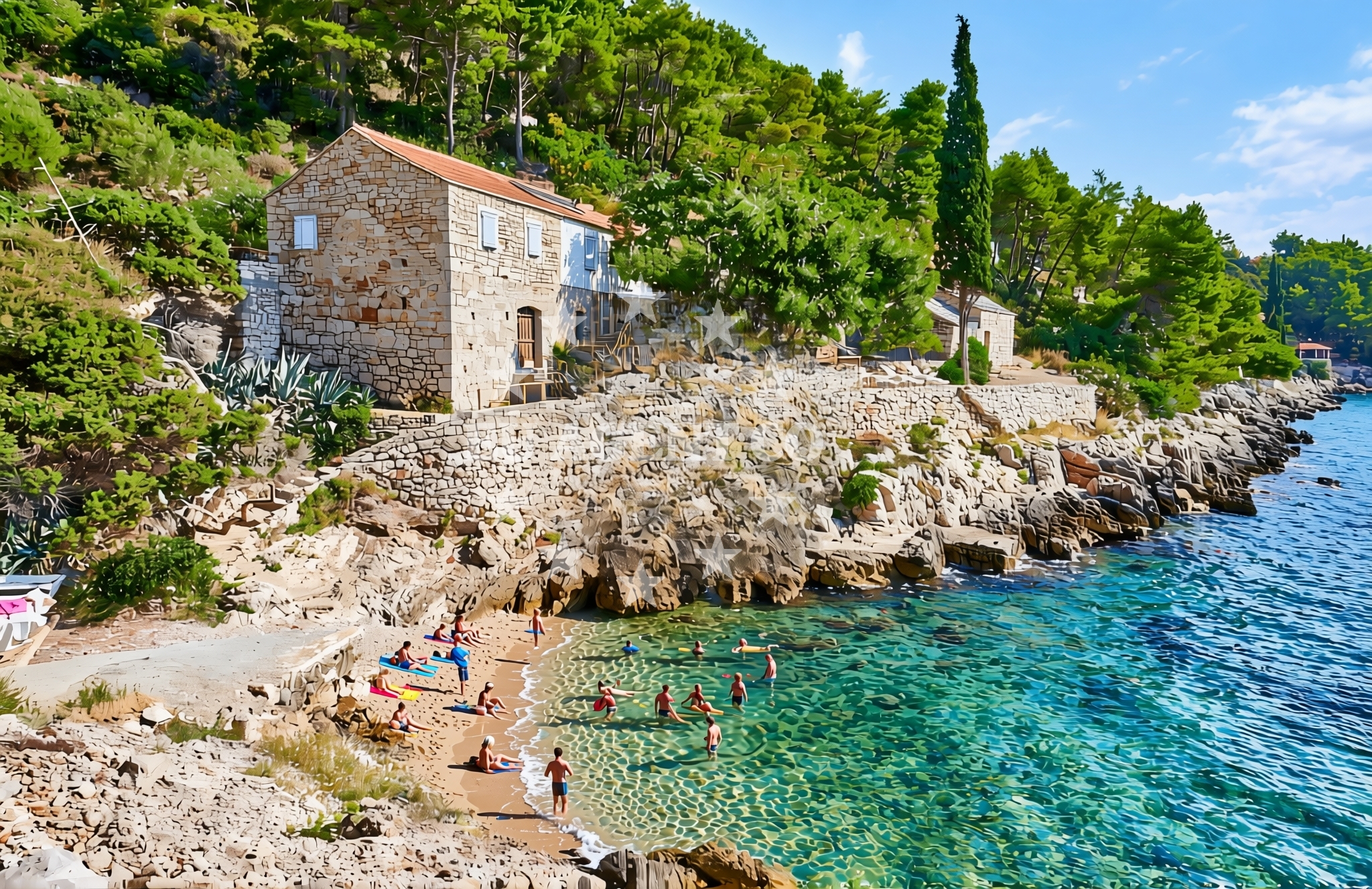
The beach’s composition of pebbles and gravel creates a rugged, natural shoreline that reflects the island’s geological character. While not ideal for sunbathing, this terrain offers a unique texture for walking and exploring. The beach’s proximity to the sea allows for direct access to the Adriatic, where the water meets the rocky shore in a dynamic interplay of waves and currents. The area is relatively undeveloped, preserving its raw coastal aesthetic.Swimming and shore
Swimming conditions at Lučica Zapad are influenced by the pebble shore, which can make entry into the water less comfortable. The sea here is typical of the Adriatic, with clear waters and moderate wave activity. The beach’s orientation toward the open sea means it may experience stronger winds and swells compared to more sheltered Hvar shores.Facilities and activities
There are no formal facilities or amenities at Lučica Zapad Beach. The absence of infrastructure aligns with its character as a natural, unspoiled coastline. Activities here are limited to coastal walking and photography, leveraging the beach’s striking geological features and panoramic views of the surrounding sea and cliffs.Access and location
Lučica Zapad is located in the village of Gdinj, on the southern coast of Hvar. The beach is accessible via local roads connecting Gdinj to Hvar Town and the island’s main ports. Its position near the village makes it a convenient stop for visitors exploring Hvar’s southern coastline, though it remains less frequented than the island’s more famous beaches.What to expect
Visitors should expect a rugged, pebble-strewn shoreline that emphasizes natural coastal formations. The beach lacks amenities such as sunbeds, umbrellas, or restaurants, making it suitable for those seeking solitude and a connection to the island’s untamed landscape. The area’s appeal lies in its simplicity and the opportunity to observe the interplay between land and sea in Hvar’s southern reaches.Practical tips
Wear sturdy footwear to navigate the pebble shore comfortably. The beach’s lack of facilities means visitors should bring their own supplies. Early visits are recommended to avoid crowds, as the area is popular with locals during summer months.Exploring the coast by yacht
Lučica Zapad’s location on Hvar places it within a region highly favored by yacht charter guests. The island’s coastline, including nearby anchorages and marinas, forms part of the Adriatic’s premier sailing routes. Yachts often explore Hvar’s southern shores, with Gdinj serving as a potential stop for those venturing beyond the island’s more crowded western beaches.Hvar’s Cultural and Historical Context
The village of Gdinj, near Lučica Zapad, is part of Hvar’s rich tapestry of settlements that date back to ancient times. The island’s history as a center of Greek and Roman influence is evident in its archaeological sites and medieval architecture. Nearby, Hvar Town offers a contrast to the beach’s natural setting, with its Venetian-era fortifications, bustling harbor, and vibrant nightlife.Anchorages in the surrounding area
Anchorages in Gdinj and Dugi Dolac on Hvar offer nearby mooring options.
- Anchorage — gdinj — hvar — 0.1 NM from beach
- Anchorage — dugi dolac — hvar — 0.3 NM from beach
- Anchorage — gdinj — hvar — 0.5 NM from beach
- Anchorage — gdinj — hvar — 0.6 NM from beach
- Anchorage — gdinj — hvar — 0.9 NM from beach
- Anchorage — dugi dolac — hvar — 0.9 NM from beach
- Anchorage — gdinj — hvar — 1.2 NM from beach
- Anchorage — dugi dolac — hvar — 1.3 NM from beach
Distances are straight-line geographic distances, not sailing routes.
Mooring buoys in the surrounding area
- Quay — hvar — 2.3 NM from beach
- Restaurant Preza quay — pokrivenik — hvar — 3.1 NM from beach
- Quay — bogomolje — hvar — 3.7 NM from beach
- Jetty — velika stiniva — hvar — 6.0 NM from beach
- Restaurant Korkyra xyz buoys — loviste — 6.3 NM from beach
Distances are straight-line geographic distances, not sailing routes.
Marine fuel stations
Marine fuel stations in Sumartin, Makarska, and Korcula serve the surrounding regions.
- Fuel station — sumartin — brac — 10.9 NM from beach
- Ina — makarska — 11.4 NM from beach
- Ina — vrboska — hvar — 12.2 NM from beach
- Fuel station — korcula — 13.3 NM from beach
Distances are straight-line geographic distances, not sailing routes.
Harbours in the surrounding area
- Lovište — loviste — 6.6 NM from beach
- Račišće — racisce — korcula — 9.1 NM from beach
- Čaklje — caklje — podgora — 9.6 NM from beach
- Drašnice — drasnice — 9.7 NM from beach
- Podgora — 9.8 NM from beach
- Igrane — 10.1 NM from beach
Distances are straight-line geographic distances, not sailing routes.
Marinas in the surrounding area
Marinas in Tučepi and Vrboska provide nearby mooring options.
- Marina Tučepi — marina tucepi — 10.4 NM from beach
- ACI Marina Vrboska — hvar — 12.1 NM from beach
- Marina Ramova — krvavica — 12.7 NM from beach
- ACI Marina Korčula — korcula — 12.8 NM from beach
- Marina Korkyra — vela luka — korcula — 13.5 NM from beach
Distances are straight-line geographic distances, not sailing routes.
Restaurants near the beach
Restaurants in Hvar, such as Pakomina and Restaurant Timun, are close to the beach.
- Pakomina — hvar — 2.3 NM from beach
- Restaurant Timun — pokrivenik — hvar — 3.1 NM from beach
Distances are straight-line geographic distances, not sailing routes.
Navigation guides for the surrounding area
Navigation guides for Uvala Pokrivenik and nearby areas assist in local sailing routes.
- Uvala Pokrivenik — 3.0 NM from beach
- Uvala Duboka — 4.8 NM from beach
- Uvala Kozja — 5.0 NM from beach
- Luka Racisce — 9.3 NM from beach
- Uvala Kneza — 9.7 NM from beach
Distances are straight-line geographic distances, not sailing routes.
Yachts from nearby departure bases
Sailing yachts
- Bavaria 40 Cruiser (LADY BUTTERFLY) — Tučepi Port — 10.4 NM from departure base to beach
- Bavaria 44 (Infinity) — Baška Voda — 14.6 NM from departure base to beach
- Bavaria 46 Cruiser (Silvanac) — Baška Voda — 14.6 NM from departure base to beach
Catamarans
- Lagoon 450 (LAMANTIN) — Baška Voda — 14.6 NM from departure base to beach
Motor yachts
- Princess V53 (Chablis) — Makarska Port — 11.3 NM from departure base to beach
- Canados 86 (Karisma) — Baška Voda — 14.6 NM from departure base to beach
Motor boats
- Galeon 430 Skydeck (Bellagio) — Makarska Port — 11.3 NM from departure base to beach
- Jeanneau NC 37 (Black Pearl) — Makarska Port — 11.3 NM from departure base to beach
- Jeanneau NC 37 (Black Pearl) — Makarska Port — 11.3 NM from departure base to beach
- Galeon 430 Skydeck (BELLAGIO) — Makarska Port — 11.3 NM from departure base to beach
Distances are straight-line geographic distances, not sailing routes.