Lučica sredina, Vir (Vir) Beach, Croatia
About this beach
Lučica sredina, Vir (Vir)
Beach: Lučica sredina
Location: Vir (Vir)
Characteristics and facilities
Gravel, concrete / stone slabs
110 m
Caffe bar / Drinks stand
Natural shade
Beach character
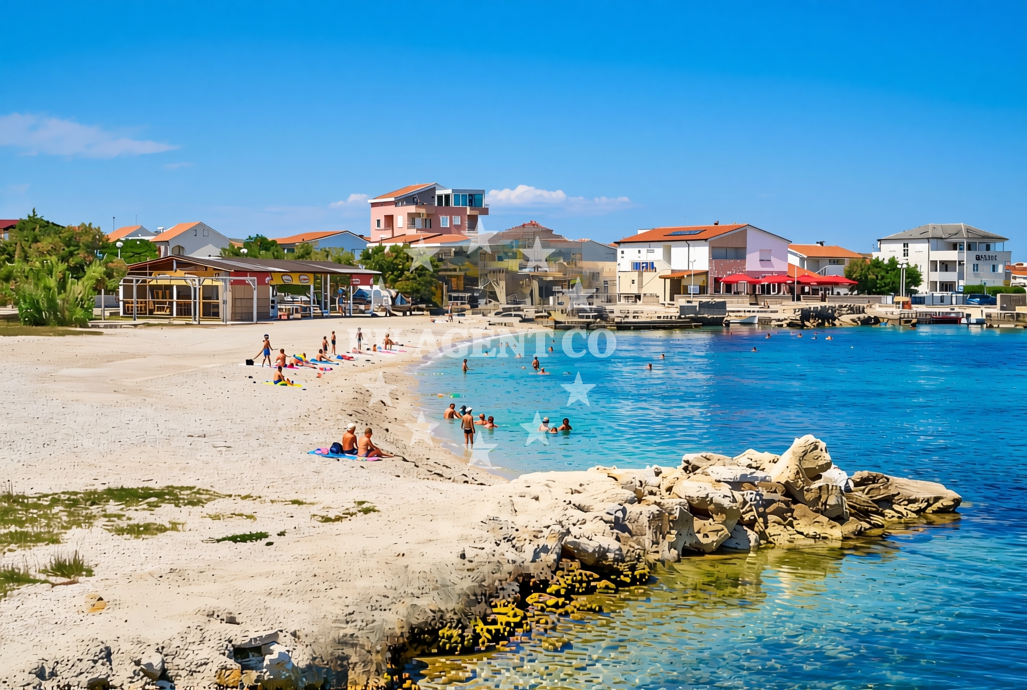
The beach’s surface consists of gravel and stone slabs, creating a distinct texture compared to typical sandy shores. Natural shade is available from vegetation along the shoreline, providing respite from the sun. A caffe bar/drinks stand is present, offering visitors a place to enjoy beverages while taking in the coastal views. The beach’s compact size and composition make it suitable for casual strolls and photography, though not ideal for swimming due to the rocky terrain.Swimming and shore
While the beach’s gravel and stone slabs may not be optimal for swimming, the shoreline’s natural contours create sheltered areas that could be suitable for wading or snorkeling during calm conditions. The absence of explicit water quality data means visitors should exercise caution, particularly near the rocky sections. The beach’s proximity to the open sea ensures clear views of the Adriatic, though the lack of designated swimming zones means safety is not guaranteed.Facilities and activities
The primary facility at Lučica sredina is a caffe bar/drinks stand, which serves as a focal point for visitors seeking refreshments. There are no explicit mentions of showers, toilets, or parking in the catalog, so these amenities cannot be confirmed. The beach’s activities are limited to walking along the shoreline and enjoying the caffe bar, with no structured recreational programs or rental services listed.Access and location
Lučica sredina is situated on the island of Vir, part of the Dubrovnik-Neretva County in Croatia. The island is accessible via ferry services from the mainland, connecting to nearby settlements such as Cavtat and Šipovo. Vir’s location in the Adriatic Sea places it within reach of major sailing routes along the Dalmatian coast, including routes to Dubrovnik, Korčula, and the Elafiti Islands. The beach’s proximity to these areas makes it a potential stop for yacht charters exploring the region’s coastal towns and islands.What to expect
Lučica sredina offers a unique coastal experience defined by its gravel and stone slab shoreline. Visitors can expect a caffe bar for drinks and natural shade from vegetation. The beach’s compact size and rocky terrain make it more suited for leisurely walks and photography than swimming. Its location on Vir, near the mainland, connects it to the broader Dalmatian coast, where yacht charters and ferry routes provide access to nearby islands and cultural sites.Practical tips
Visitors should consider bringing comfortable footwear for the gravel and stone slabs. The caffe bar is a convenient spot for refreshments, but there are no confirmed facilities for food storage or waste disposal. Due to the beach’s rocky nature, sun protection and hydration are recommended, especially during extended stays.Exploring the coast by yacht
Lučica sredina’s position on Vir places it within the sailing region of the Dalmatian coast, a popular area for yacht charters. Yacht owners exploring the Adriatic may use nearby marinas in Cavtat or Šipovo as bases for trips to Vir and surrounding islands. The beach’s proximity to ferry routes and sailing trails makes it a potential waypoint for those combining land and sea exploration in the region.Regional Context: Vir Island and the Dalmatian Coast
Vir is one of the Šipovo Islands, located near the mainland settlement of Šipovo and the coastal town of Cavtat. The island’s small size and quiet character contrast with the bustling ports of Dubrovnik and Split. The Dalmatian coast, where Vir is situated, is renowned for its clear waters, historic towns, and yacht-friendly anchorages. Sailing from Vir, charters can access the Elafiti Islands, the Pelješac Peninsula, and the UNESCO-listed Old City of Dubrovnik.Anchorages in the surrounding area
Several anchorages are located near Vir, including those in Lozice and Povljana.
- Anchorage — vir — 0.1 NM from beach
- Anchorage — vir — 0.7 NM from beach
- Anchorage — vir — 1.3 NM from beach
- Anchorage — vir — 1.5 NM from beach
- Anchorage — lozice — vir — 1.6 NM from beach
- Anchorage — povljana — pag — 2.0 NM from beach
- Anchorage — povljana — pag — 2.3 NM from beach
- Anchorage — vir — 2.6 NM from beach
Distances are straight-line geographic distances, not sailing routes.
Mooring buoys in the surrounding area
- Vir — 0.7 NM from beach
- Punta Skala — petrcane — 7.3 NM from beach
- Jetty — ljubac — 9.1 NM from beach
- Buoy field — muline — ugljan — 10.1 NM from beach
- Jetty — ugljan — 10.2 NM from beach
Distances are straight-line geographic distances, not sailing routes.
Marine fuel stations
- Ina — zadar — 12.8 NM from beach
- Ina — preko — ugljan — 14.6 NM from beach
- Fuel station — sukosan — 17.7 NM from beach
- Ina — zaglav — dugi otok — 21.6 NM from beach
Distances are straight-line geographic distances, not sailing routes.
Harbours in the surrounding area
Harbors in Pag, Privlaka, and Nin are positioned within the nearby coastal region.
- Povljana — pag — 2.2 NM from beach
- Privlaka — 2.8 NM from beach
- Košljun — kosljun pag — 5.3 NM from beach
- Nin — 5.4 NM from beach
- Mulo — nin — 5.9 NM from beach
- Miškovići — miskovici — pag — 6.1 NM from beach
Distances are straight-line geographic distances, not sailing routes.
Marinas in the surrounding area
- ACI Marina Šimuni — simuni — pag — 11.4 NM from beach
- Marina Borik — zadar — 11.8 NM from beach
- Vitrenjak Zadar — 12.1 NM from beach
- Marina Zadar — 12.8 NM from beach
- Olive Island Marina — sutomiscica — ugljan — 13.2 NM from beach
Distances are straight-line geographic distances, not sailing routes.
Restaurants near the beach
Restaurants in Vir and Povljana offer dining options close to the beach.
- Restaurant — vir — 0.5 NM from beach
- Viranka — 0.5 NM from beach
- Restaurant — vir — 0.6 NM from beach
- Monica — vir — 0.6 NM from beach
- Grill Marion — vir — 1.0 NM from beach
- Restaurant — vir — 1.5 NM from beach
- Nirvana — povljana — pag — 2.5 NM from beach
Distances are straight-line geographic distances, not sailing routes.
Navigation guides for the surrounding area
Navigation guides for Otok Pag, Privlaka, and Muline provide route information in the vicinity.
- OTOK PAG — 1.2 NM from beach
- Privlaka — 2.9 NM from beach
- Muline — 10.1 NM from beach
- KrusCica and Uvala KrusCica Duboka — 10.2 NM from beach
- Uvala Bliznica — 10.2 NM from beach
Distances are straight-line geographic distances, not sailing routes.
Yachts from nearby departure bases
Sailing yachts
- First 45 (Egeria) — Šimuni Kolan ACI Marina — 11.5 NM from departure base to beach
- Bavaria 44 (Tummy fish) — Zadar Marina Borik — 11.8 NM from departure base to beach
Catamarans
- Sunreef 60 (SINATA) — Zadar Marina Borik — 11.8 NM from departure base to beach
Motor yachts
- Prestige 460 (Adudu 2) — Zadar Marina Borik — 11.8 NM from departure base to beach
Motor boats
- Merry Fisher 895 — Povljana Marina — 2.5 NM from departure base to beach
- BWA Sport 22GT (BWA ) — Pag City Port — 8.4 NM from departure base to beach
- Rancraft RM19 (Daycruiser) — Zadar Diklo Port — 10.5 NM from departure base to beach
- Rancraft RS Cinque.5 — Zadar Diklo Port — 10.5 NM from departure base to beach
- Rancraft RM21 (Dugi otok) — Zadar Diklo Port — 10.5 NM from departure base to beach
- Merry Fisher 1095 (Pepa) — Zadar Marina Borik — 11.8 NM from departure base to beach
Distances are straight-line geographic distances, not sailing routes.