Lučica, Lokva Rogoznica Beach, Croatia
About this beach
Lučica, Lokva Rogoznica
Beach: Lučica
Location: Lokva Rogoznica
Characteristics and facilities
Gravel, rocks
50 m
Natural shade
Beach character
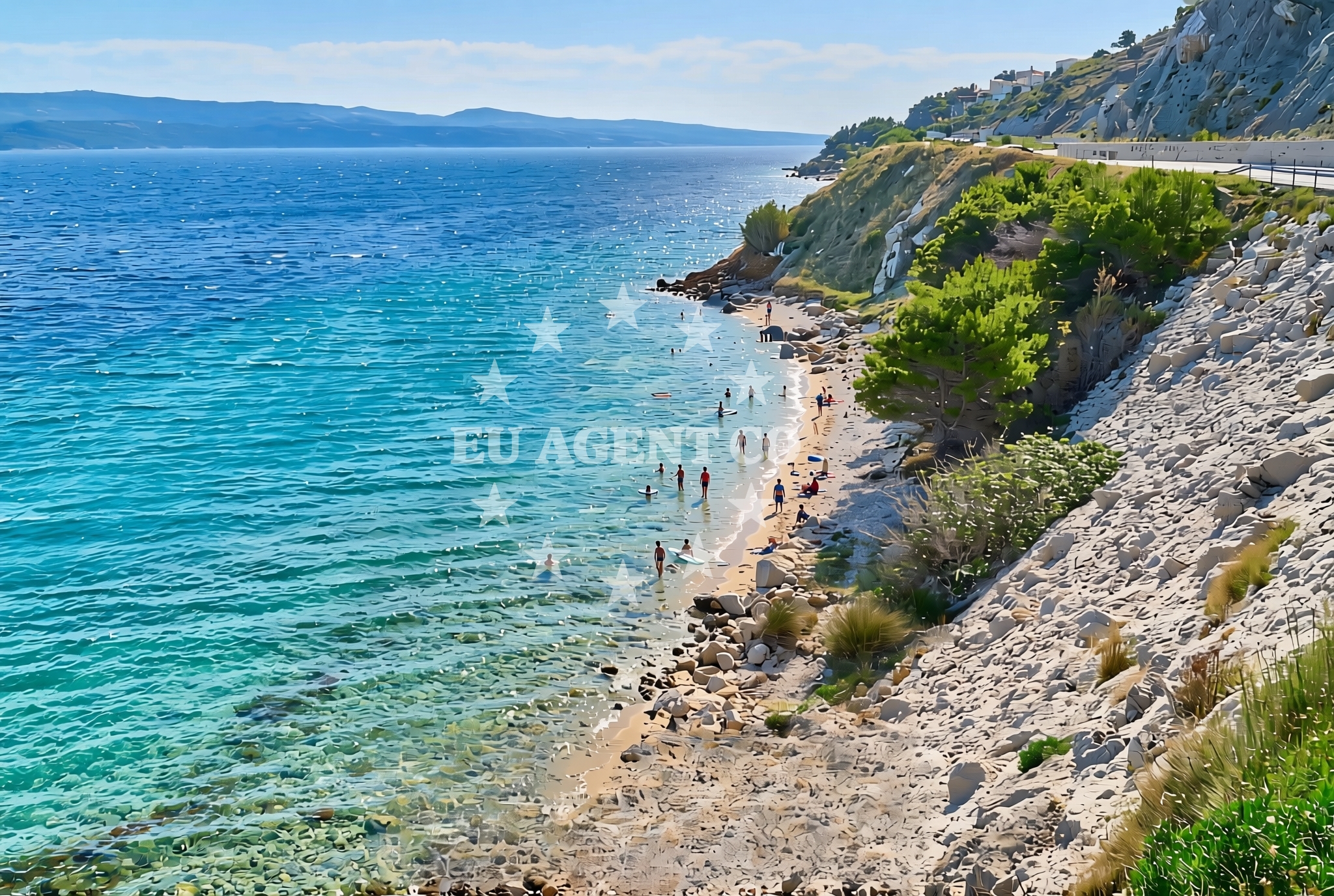
The beach's surface is composed primarily of gravel and rocky outcrops, creating a rugged shoreline that contrasts with the soft sands of more typical Mediterranean beaches. Its short length (around 50 meters) means it remains relatively untouched by mass tourism. Natural shade is available from the landward side, offering respite from direct sunlight. The area's geology suggests it may be part of a broader coastal formation shaped by the Adriatic Sea's long-term erosion patterns.Swimming and shore
The gravel and rock composition of the beach makes it less ideal for swimming compared to sandy shores. The shoreline is uneven, with exposed stones that could pose challenges for barefoot wading. The beach's orientation and surrounding topography suggest it may face the open sea, though specific wave conditions are not documented. The lack of artificial amenities means visitors should prepare for a more primitive coastal experience.Facilities and activities
No official facilities or services are listed for this beach. The absence of structured amenities aligns with its character as a natural, unspoiled shoreline. Activities appear limited to passive enjoyment of the landscape, though the nearby region of Lokva Rogoznica may offer broader recreational opportunities in its surrounding settlements.Access and location
Located in the village of Lučica, the beach is part of the Lokva Rogoznica area, a coastal stretch in Croatia's Split-Dalmatia County. The region is known for its mix of rugged coastline and traditional Dalmatian villages. Proximity to the main road network suggests accessibility by car, though specific road names or distances are not detailed in available records. The beach's coordinates place it near the broader Adriatic sailing routes that connect the Pelješac Peninsula to the central Dalmatian coast.What to expect
Visitors should expect a short, gravelly beach with natural shade from the landward side. The lack of artificial amenities means this is not a destination for sunbathing or water sports. The beach's character is defined by its rocky shoreline and limited length, making it more suitable for those seeking solitude or a geological study of the Adriatic coast. The surrounding area's traditional Dalmatian settlements may offer additional points of interest for visitors.Practical tips
Wear sturdy footwear for the gravel and rocky terrain. The beach's short length means it is best suited for brief visits. Consider exploring nearby villages in the Lokva Rogoznica area for additional coastal experiences.Exploring the coast by yacht
For yacht charter guests, the beach's location along the Dalmatian coast offers proximity to established sailing routes. The Adriatic Sea's calmer waters in this region make it suitable for motor yacht exploration, with nearby marinas in Split and the Pelješac Peninsula providing convenient bases. Charterers may find this area appealing for its combination of natural beauty and access to traditional Croatian coastal culture.Regional Context
The beach lies within a region of Croatia known for its historic vineyards and coastal fortifications. The nearby village of Lučica is part of a network of small settlements that maintain traditional Dalmatian architecture. The broader area's maritime history includes medieval shipbuilding traditions that influenced Adriatic trade routes.Anchorages in the surrounding area
Anchorages in Postira and Povlja on Brac provide nearby mooring options.
- Konopjikova — postira — brac — 4.4 NM from beach
- Tri luke — povlja — brac — 4.4 NM from beach
- Anchorage — postira — brac — 4.8 NM from beach
- Anchorage — povlja — brac — 4.9 NM from beach
- Anchorage — povlja — brac — 5.0 NM from beach
- Anchorage — povlja — brac — 5.0 NM from beach
- Anchorage — povlja — brac — 5.3 NM from beach
- Anchorage — povlja — brac — 5.3 NM from beach
Distances are straight-line geographic distances, not sailing routes.
Mooring buoys in the surrounding area
- Restaurant Pipo buoys — povlja — brac — 4.3 NM from beach
- Quay — postira — brac — 4.4 NM from beach
- Restaurant Pipo jetty — povlja — brac — 4.4 NM from beach
- Konoba Rojen jetty — povlja — brac — 4.5 NM from beach
- Baško Polje — basko polje — baska voda — 9.2 NM from beach
Distances are straight-line geographic distances, not sailing routes.
Marine fuel stations
Marine fuel stations in Sumartin, Bol, and Ina serve the surrounding regions.
- Fuel station — sumartin — brac — 8.5 NM from beach
- Fuel station — bol — brac — 10.1 NM from beach
- Ina — makarska — 13.0 NM from beach
- Ina — vrboska — hvar — 14.3 NM from beach
Distances are straight-line geographic distances, not sailing routes.
Harbours in the surrounding area
Harbours in Mimice, Omiš, and Pučišća on Brac are within close proximity.
- Mimice — 2.0 NM from beach
- Omiš — omis — 3.6 NM from beach
- Pučišća harbour — pucisca — brac — 3.9 NM from beach
- Pisak — 4.3 NM from beach
- Dugi Rat — 5.8 NM from beach
- Postira — brac — 6.2 NM from beach
Distances are straight-line geographic distances, not sailing routes.
Marinas in the surrounding area
Marinas in Baška Voda and Ramova cater to yachts in Brac and nearby areas.
- Marina Baška Voda — marina baska voda — 8.6 NM from beach
- Marina Ramova — krvavica — 10.8 NM from beach
- Marina Lav — podstrana — 11.0 NM from beach
- ACI Marina Vrboska — hvar — 14.3 NM from beach
- ACI Marina Milna — milna brac — 14.6 NM from beach
Distances are straight-line geographic distances, not sailing routes.
Restaurants near the beach
Restaurants in Omiš and Pučišća on Brac offer dining near the beach.
- Konoba Milo — omis — 3.7 NM from beach
- Pizzeria Marin — pucisca — brac — 3.9 NM from beach
- Lado — pucisca — brac — 3.9 NM from beach
- Hideaway Pipo — povlja — brac — 4.4 NM from beach
- Konoba Rojen — povlja — brac — 4.5 NM from beach
- Restaurant — postira — brac — 4.8 NM from beach
Distances are straight-line geographic distances, not sailing routes.
Navigation guides for the surrounding area
Navigation guides for Mi mice, Omis, and Pucisca assist with local sailing routes.
- Mi mice — 2.1 NM from beach
- Omis — 3.3 NM from beach
- Pucisca — 3.7 NM from beach
- Uvala Luka — 4.5 NM from beach
- Dugi Rat (Uvala Orisac) — 5.6 NM from beach
Distances are straight-line geographic distances, not sailing routes.
Yachts from nearby departure bases
Yachts departing from Omiš City Port and Sumpetar Port operate near the beach.
Sailing yachts
- Elan Impression 40 (KARLETA) — Baška Voda Port — 8.5 NM from departure base to beach
- Oceanis 45 (FORTUNE) — Baška Voda — 8.6 NM from departure base to beach
Catamarans
- Lagoon 450 Fly (Falco) — Sumpetar Port — 6.5 NM from departure base to beach
Gulets / Cruisers
- Gulet (Primorac) — Omiš City Port — 3.6 NM from departure base to beach
- Gulet (Trebenna) — Omiš City Port — 3.6 NM from departure base to beach
- Gulet (PATRONICE) — Omiš City Port — 3.8 NM from departure base to beach
- Gulet (Cataleya) — Sumpetar Port — 6.5 NM from departure base to beach
- Gulet (Altair) — Sumpetar Port — 6.5 NM from departure base to beach
- Gulet cruiser (AGORA) — Dugi Rat Luka Krilo — 7.8 NM from departure base to beach
Motor boats
- Pearl Sea 31 Hard Top (Aero) — Baška Voda Port — 8.5 NM from departure base to beach
Distances are straight-line geographic distances, not sailing routes.