Lučica istok, Vir (Vir) Beach: A Natural Shoreline in Croatia's Adriatic Coast
About this beach
Lučica istok, Vir (Vir)
Beach: Lučica istok
Location: Vir (Vir)
Characteristics and facilities
Gravel, concrete / stone slabs
210 m
Natural shade
Beach character
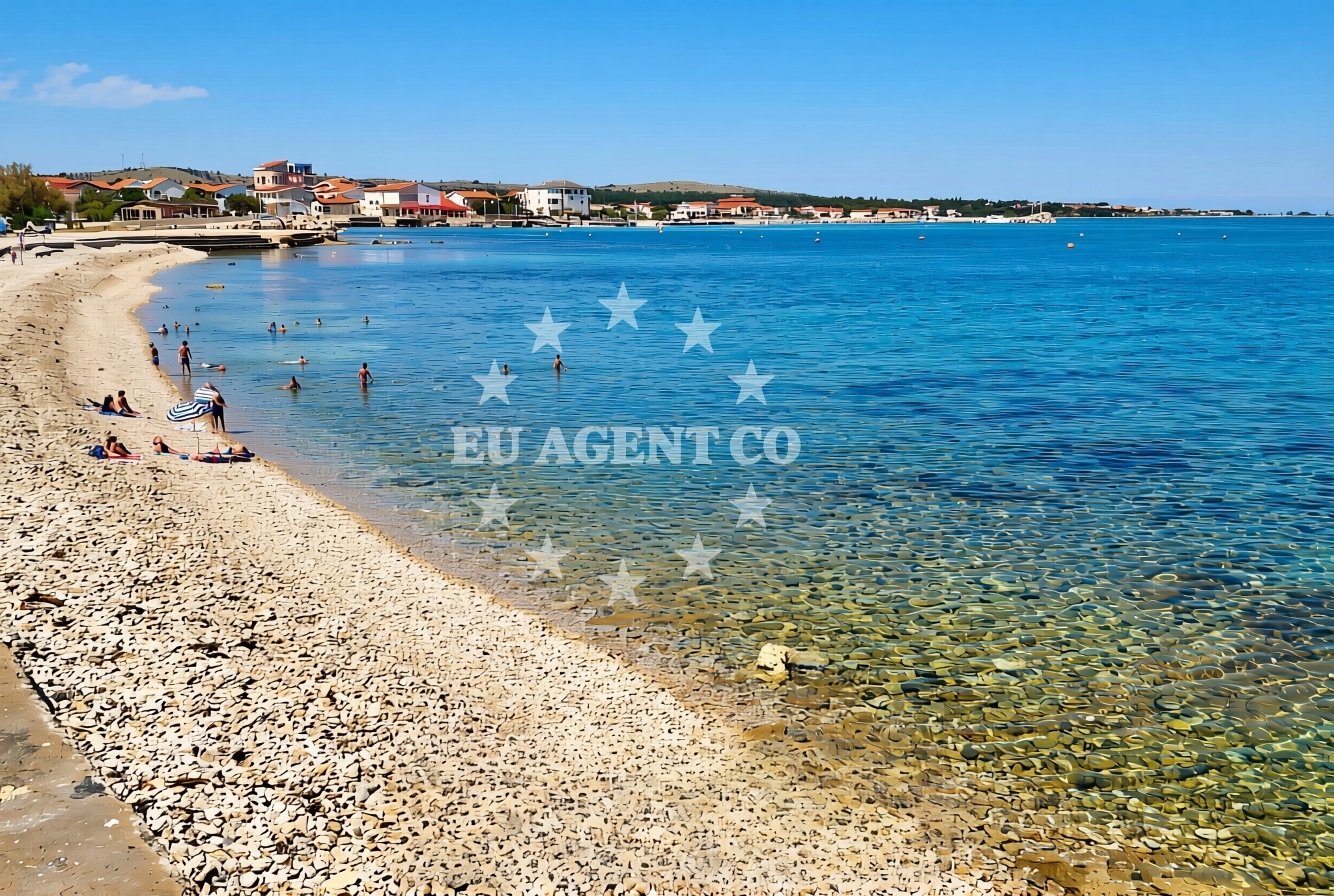
The beach's surface consists of gravel and concrete/stone slabs, creating a firm and uneven terrain that contrasts with typical sandy shores. This composition suggests a naturally formed shoreline, likely shaped by tidal and wave action. The 210-meter length provides a modest stretch for visitors, though the lack of soft sand may influence its appeal for sunbathing or swimming. Natural shade is a notable feature, likely offered by the beach's rocky outcrops or nearby vegetation, providing respite from the sun during peak hours.Swimming and shore
The gravel and stone-slab surface may present challenges for swimming, as such terrain can be uncomfortable for prolonged water activities. However, the beach's proximity to the Adriatic Sea's open waters suggests potential for short swims or wading in shallower areas. The natural shade from rocky formations could be a practical advantage for visitors seeking shelter during hot afternoons, though the lack of explicit facilities means preparation for basic needs (e.g., water, footwear) is advisable.Facilities and activities
The beach does not list explicit facilities in its authoritative records, indicating minimal infrastructure. Activities are not specified, though the shoreline's natural character may support low-impact pursuits such as rock-hopping or coastal walking. The absence of structured amenities means visitors should plan for self-sufficiency, particularly regarding restrooms, showers, or food services.Access and location
Lučica istok is situated on Vir Island, a part of Croatia's Dalmatian coast known for its rugged beauty and maritime heritage. The beach's coordinates (44.308021°N, 15.093809°E) place it within the broader Adriatic sailing network, where Vir is a recognized waypoint for yachts exploring the region. Access likely involves local boat routes or ferries connecting to nearby settlements, though specific transportation details are not outlined in the beach's records.What to expect
Visitors to Lučica istok should expect a gravel and stone-slab shoreline with limited soft sand, ideal for those seeking a rugged coastal experience. The 210-meter stretch offers a modest area for exploration, with natural shade from rocky formations providing relief from the sun. As part of Vir Island, the beach is situated in a region renowned for its Adriatic sailing routes, making it a potential stop for yacht charter guests navigating the area. No structured facilities are available, so self-sufficiency is recommended.Practical tips
Given the gravel and stone-slab surface, sturdy footwear is advisable for walking on the beach. Sun protection is essential, though natural shade from rocks can offer periodic relief. Visitors should bring water and snacks, as no amenities are available on-site. Those planning to swim should check local conditions for safety.Exploring the coast by yacht
Lučica istok's location on Vir Island situates it within a key area of the Adriatic Sea, a popular sailing destination for yacht charter guests. Vir's coastal waters are part of a network of anchorages and marinas that cater to both motor and sailing yachts. While the beach itself is not a marina or anchorage, its proximity to the open sea and surrounding islands makes it a potential vantage point for sailors exploring the region. Yacht charter guests may find the area appealing for its combination of natural beauty and accessibility to broader Adriatic routes.Vir Island: A Maritime and Cultural Hub
Vir Island, home to Lučica istok, is a historically significant location in the Adriatic. Known for its medieval fortifications and traditional fishing communities, the island has long been a focal point for maritime activity. Its rugged coastline and strategic position between the mainland and the open sea have made it a favored stop for sailors and yachtsmen. The island's cultural heritage, combined with its natural landscapes, offers a unique blend of history and environment for visitors.Anchorages in the surrounding area
Anchorages in Vir and nearby areas including Lozice and Povljana.
- Anchorage — vir — 0.1 NM from beach
- Anchorage — vir — 0.7 NM from beach
- Anchorage — vir — 1.3 NM from beach
- Anchorage — vir — 1.5 NM from beach
- Anchorage — lozice — vir — 1.7 NM from beach
- Anchorage — povljana — pag — 1.9 NM from beach
- Anchorage — povljana — pag — 2.2 NM from beach
- Anchorage — lozice — vir — 2.7 NM from beach
Distances are straight-line geographic distances, not sailing routes.
Mooring buoys in the surrounding area
Mooring buoys in Vir, Punta Skala, Ljubac, Muline, and Ugljan.
- Vir — 0.8 NM from beach
- Punta Skala — petrcane — 7.3 NM from beach
- Jetty — ljubac — 9.0 NM from beach
- Buoy field — muline — ugljan — 10.1 NM from beach
- Jetty — ugljan — 10.2 NM from beach
Distances are straight-line geographic distances, not sailing routes.
Marine fuel stations
Marine fuel stations in Zadar, Preko, Sukosan, and Dugi Otok.
- Ina — zadar — 12.8 NM from beach
- Ina — preko — ugljan — 14.5 NM from beach
- Fuel station — sukosan — 17.6 NM from beach
- Ina — zaglav — dugi otok — 21.6 NM from beach
Distances are straight-line geographic distances, not sailing routes.
Harbours in the surrounding area
Harbours in Povljana, Privlaka, Kosljun, Nin, and Mulo.
- Povljana — pag — 2.2 NM from beach
- Privlaka — 2.8 NM from beach
- Košljun — kosljun pag — 5.3 NM from beach
- Nin — 5.3 NM from beach
- Mulo — nin — 5.8 NM from beach
- Miškovići — miskovici — pag — 6.0 NM from beach
Distances are straight-line geographic distances, not sailing routes.
Marinas in the surrounding area
Marinas in Šimuni, Zadar, and Ugljan.
- ACI Marina Šimuni — simuni — pag — 11.4 NM from beach
- Marina Borik — zadar — 11.8 NM from beach
- Vitrenjak Zadar — 12.1 NM from beach
- Marina Zadar — 12.7 NM from beach
- Olive Island Marina — sutomiscica — ugljan — 13.2 NM from beach
Distances are straight-line geographic distances, not sailing routes.
Restaurants near the beach
Restaurants in Vir and Pag.
- Restaurant — vir — 0.6 NM from beach
- Viranka — 0.6 NM from beach
- Restaurant — vir — 0.6 NM from beach
- Monica — vir — 0.7 NM from beach
- Grill Marion — vir — 0.9 NM from beach
- Restaurant — vir — 1.4 NM from beach
- Mornar — povljana — pag — 2.5 NM from beach
Distances are straight-line geographic distances, not sailing routes.
Navigation guides for the surrounding area
Navigation guides for Otok Pag, Privlaka, Muline, and Uvala Bliznica.
- OTOK PAG — 1.1 NM from beach
- Privlaka — 2.8 NM from beach
- KrusCica and Uvala KrusCica Duboka — 10.1 NM from beach
- Muline — 10.1 NM from beach
- Uvala Bliznica — 10.2 NM from beach
Distances are straight-line geographic distances, not sailing routes.
Yachts from nearby departure bases
Yachts departing from Povljana Marina, Pag City Port, and Zadar ports.
Sailing yachts
- First 45 (Egeria) — Šimuni Kolan ACI Marina — 11.5 NM from departure base to beach
- Dufour 560 (Tara) — Zadar Marina Borik — 11.8 NM from departure base to beach
Catamarans
- Sunreef 60 (SINATA) — Zadar Marina Borik — 11.8 NM from departure base to beach
Motor yachts
- Ferretti 780 (TESORO) — Zadar Marina Borik — 11.8 NM from departure base to beach
Motor boats
- Merry Fisher 895 — Povljana Marina — 2.4 NM from departure base to beach
- BWA Sport 22GT (BWA ) — Pag City Port — 8.4 NM from departure base to beach
- Rancraft RM21 (Dugi otok) — Zadar Diklo Port — 10.5 NM from departure base to beach
- Rancraft RM19 (Daycruiser) — Zadar Diklo Port — 10.5 NM from departure base to beach
- Rancraft RS Cinque.5 — Zadar Diklo Port — 10.5 NM from departure base to beach
- Merry Fisher 895 — Zadar Marina Borik — 11.8 NM from departure base to beach
Distances are straight-line geographic distances, not sailing routes.