Lučica istok, Gdinj (Hvar) Beach, Croatia
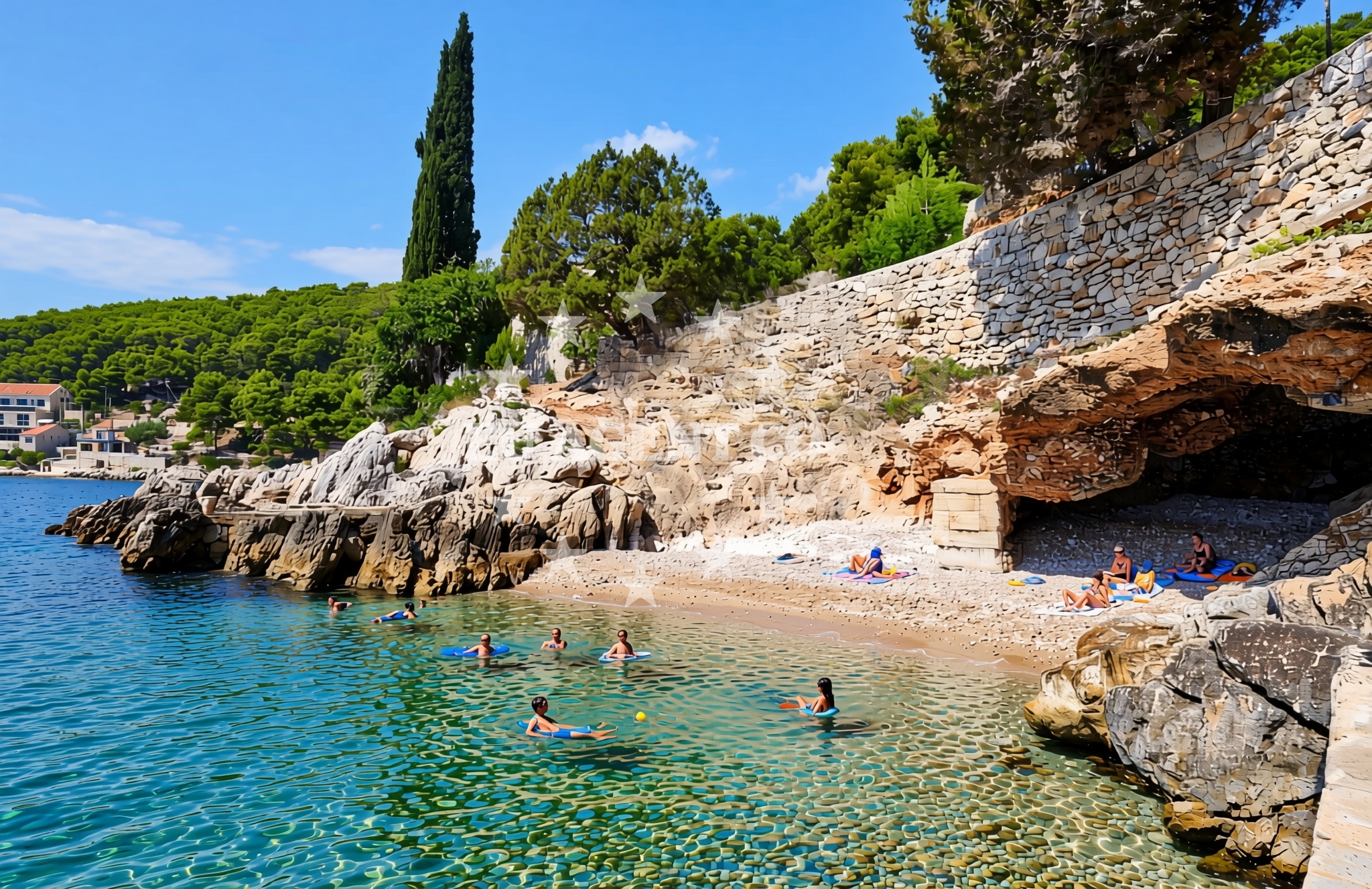
Lučica istok, located in Gdinj on the island of Hvar, is a beach characterized by gravel, concrete/stone slabs, and rocky terrain. Situated along the southern Dalmatian coast, it offers a rugged shoreline that contrasts with the more developed beaches of the region. The beach's proximity to Hvar Town and its position on the island's western coast make it a unique spot for those seeking a less conventional coastal experience.
About this beach
Lučica istok, Gdinj (Hvar)
Beach: Lučica istok
Location: Gdinj (Hvar)
Characteristics and facilities
Gravel, concrete / stone slabs, rocks
Beach character
The beach's surface is composed primarily of gravel and rocky outcrops, with sections of concrete/stone slabs. This terrain suggests a natural, minimally altered coastline, typical of Hvar's more secluded areas. The absence of sandy stretches means the beach is better suited for activities like walking, rock exploration, or casual sunbathing on flat slabs rather than traditional swimming. The rocky shoreline may offer opportunities for snorkeling in shallower areas, though swimmers should be mindful of uneven footing.
Swimming and shore
Swimming conditions at Lučica istok depend on the tide and wave action. The rocky shoreline creates a dynamic environment where water movement can be more pronounced than on sandy beaches. While the beach itself lacks designated swimming zones, the surrounding waters of Hvar's coast are generally safe for swimmers during calm conditions. The gravel and stone surfaces near the water's edge may make entry and exit more challenging compared to sandy beaches, though the area's natural character appeals to those seeking a more rugged coastal experience.
Facilities and activities
No formal amenities or facilities are listed for Lučica istok. The beach appears to be a natural, undeveloped shoreline with no infrastructure such as showers, restrooms, or parking. Activities are not explicitly mentioned in the beach's documentation, but the rocky terrain could support low-impact pursuits like hiking along the coast or exploring nearby cliffs. The area's proximity to Hvar's cultural and historical sites, such as the Hvar Fortress and the town's old port, may provide additional context for visitors interested in combining natural and cultural experiences.
Access and location
Lučica istok is located in Gdinj, a small settlement on the island of Hvar. The beach's coordinates (43.114009° N, 16.939593° E) place it along the western coast of Hvar, near the broader Hvar archipelago. Access to the beach likely involves local roads connecting Gdinj to the rest of the island. Hvar itself is a popular destination for yacht charter guests, with its marinas and sailing routes attracting visitors to the Adriatic. The beach's position on the island's periphery means it is less frequented than Hvar Town's main beaches but offers a quieter alternative for those exploring the island's coastline.
What to expect
Lučica istok is a naturally formed beach with a gravel and rocky shoreline. Visitors should expect a rugged, undeveloped coastline with no formal amenities. The beach's terrain is best suited for those seeking a raw, unaltered coastal experience. The area's proximity to Hvar's cultural landmarks and its position on the island's western coast provide opportunities for combining natural exploration with visits to nearby historical sites. Due to the lack of sandy stretches, the beach is not ideal for traditional sunbathing but may appeal to hikers or those interested in coastal geology.
Practical tips
Visitors to Lučica istok should consider wearing sturdy footwear to navigate the gravel and rocky terrain. The beach's lack of formal facilities means provisions for food, water, or shade should be brought from elsewhere. Those planning to swim should check local tide conditions, as the rocky shoreline may create unpredictable water movement. The beach's remote character makes it a good choice for those seeking solitude, though its location on Hvar means it is accessible to visitors exploring the island's western coast.
Exploring the coast by yacht
Hvar is a well-known sailing destination in the Adriatic, with its clear waters and sheltered bays attracting yacht charter guests. While Lučica istok itself is not a formal anchorage, the island's marinas and nearby sailing routes offer opportunities for boating excursions. Yacht charter guests exploring the Hvar region may find the beach's location useful as a reference point for navigating the island's western coastline. The area's proximity to Hvar Town and its connections to other islands in the Dalmatian coast make it a practical stop for those combining sailing with land-based exploration.
Regional Context and Coastal Exploration
The beach's location on Hvar places it within a region renowned for its medieval history, vineyards, and coastal beauty. The island's western coast, where Lučica istok is situated, is characterized by rugged cliffs and smaller settlements that contrast with the more touristic areas of Hvar Town. Visitors interested in broader coastal exploration may find the nearby village of Jelsa or the island of Bramor worth visiting. The area's natural features, combined with Hvar's cultural heritage, create a setting that appeals to both history enthusiasts and nature lovers.
Anchorages in the surrounding area
Anchorages in Gdinj and Dugi Dolac on Hvar offer nearby mooring options.
- Anchorage — gdinj — hvar — 0.1 NM from beach
- Anchorage — dugi dolac — hvar — 0.4 NM from beach
- Anchorage — gdinj — hvar — 0.4 NM from beach
- Anchorage — gdinj — hvar — 0.5 NM from beach
- Anchorage — gdinj — hvar — 0.8 NM from beach
- Anchorage — dugi dolac — hvar — 1.0 NM from beach
- Anchorage — gdinj — hvar — 1.1 NM from beach
- Anchorage — dugi dolac — hvar — 1.4 NM from beach
Distances are straight-line geographic distances, not sailing routes.
Mooring buoys in the surrounding area
- Quay — hvar — 2.3 NM from beach
- Restaurant Preza quay — pokrivenik — hvar — 3.1 NM from beach
- Quay — bogomolje — hvar — 3.7 NM from beach
- Jetty — velika stiniva — hvar — 6.1 NM from beach
- Restaurant Korkyra xyz buoys — loviste — 6.2 NM from beach
Distances are straight-line geographic distances, not sailing routes.
Marine fuel stations
Marine fuel stations in Brac, Makarska, and Korcula serve the surrounding regions.
- Fuel station — sumartin — brac — 10.9 NM from beach
- Ina — makarska — 11.4 NM from beach
- Ina — vrboska — hvar — 12.3 NM from beach
- Fuel station — korcula — 13.3 NM from beach
Distances are straight-line geographic distances, not sailing routes.
Harbours in the surrounding area
Harbours in Loviste, Racisce, and Podgora offer nearby port facilities.
- Lovište — loviste — 6.5 NM from beach
- Račišće — racisce — korcula — 9.1 NM from beach
- Čaklje — caklje — podgora — 9.6 NM from beach
- Drašnice — drasnice — 9.7 NM from beach
- Podgora — 9.7 NM from beach
- Igrane — 10.0 NM from beach
Distances are straight-line geographic distances, not sailing routes.
Marinas in the surrounding area
- Marina Tučepi — marina tucepi — 10.4 NM from beach
- ACI Marina Vrboska — hvar — 12.2 NM from beach
- ACI Marina Korčula — korcula — 12.7 NM from beach
- Marina Ramova — krvavica — 12.7 NM from beach
- Marina Korkyra — vela luka — korcula — 13.6 NM from beach
Distances are straight-line geographic distances, not sailing routes.
Restaurants near the beach
Restaurants in Hvar and Pokrivenik offer dining options close to the beach.
- Pakomina — hvar — 2.3 NM from beach
- Restaurant Timun — pokrivenik — hvar — 3.2 NM from beach
Distances are straight-line geographic distances, not sailing routes.
Navigation guides for the surrounding area
Navigation guides for Uvala Pokrivenik and surrounding areas assist in route planning.
- Uvala Pokrivenik — 3.1 NM from beach
- Uvala Duboka — 4.7 NM from beach
- Uvala Kozja — 4.9 NM from beach
- Luka Racisce — 9.2 NM from beach
- Uvala Kneza — 9.7 NM from beach
Distances are straight-line geographic distances, not sailing routes.
Yachts from nearby departure bases
Sailing yachts
- Bavaria 40 Cruiser (LADY BUTTERFLY) — Tučepi Port — 10.4 NM from departure base to beach
- Bavaria 46 Cruiser (Silvanac) — Baška Voda — 14.6 NM from departure base to beach
- Elan 50 Impression (FINES DE CLAIRES) — Baška Voda — 14.6 NM from departure base to beach
Catamarans
- Lagoon 450 (LAMANTIN) — Baška Voda — 14.6 NM from departure base to beach
Motor yachts
- Princess V53 (Chablis) — Makarska Port — 11.2 NM from departure base to beach
- Canados 86 (Karisma) — Baška Voda — 14.6 NM from departure base to beach
Motor boats
- Galeon 430 Skydeck (BELLAGIO) — Makarska Port — 11.2 NM from departure base to beach
- Jeanneau NC 37 (Black Pearl) — Makarska Port — 11.2 NM from departure base to beach
- Jeanneau NC 37 (Black Pearl) — Makarska Port — 11.2 NM from departure base to beach
- Galeon 430 Skydeck (Bellagio) — Makarska Port — 11.2 NM from departure base to beach
Distances are straight-line geographic distances, not sailing routes.