Lokvišća Sjever Beach, Šilo (Krk), Croatia
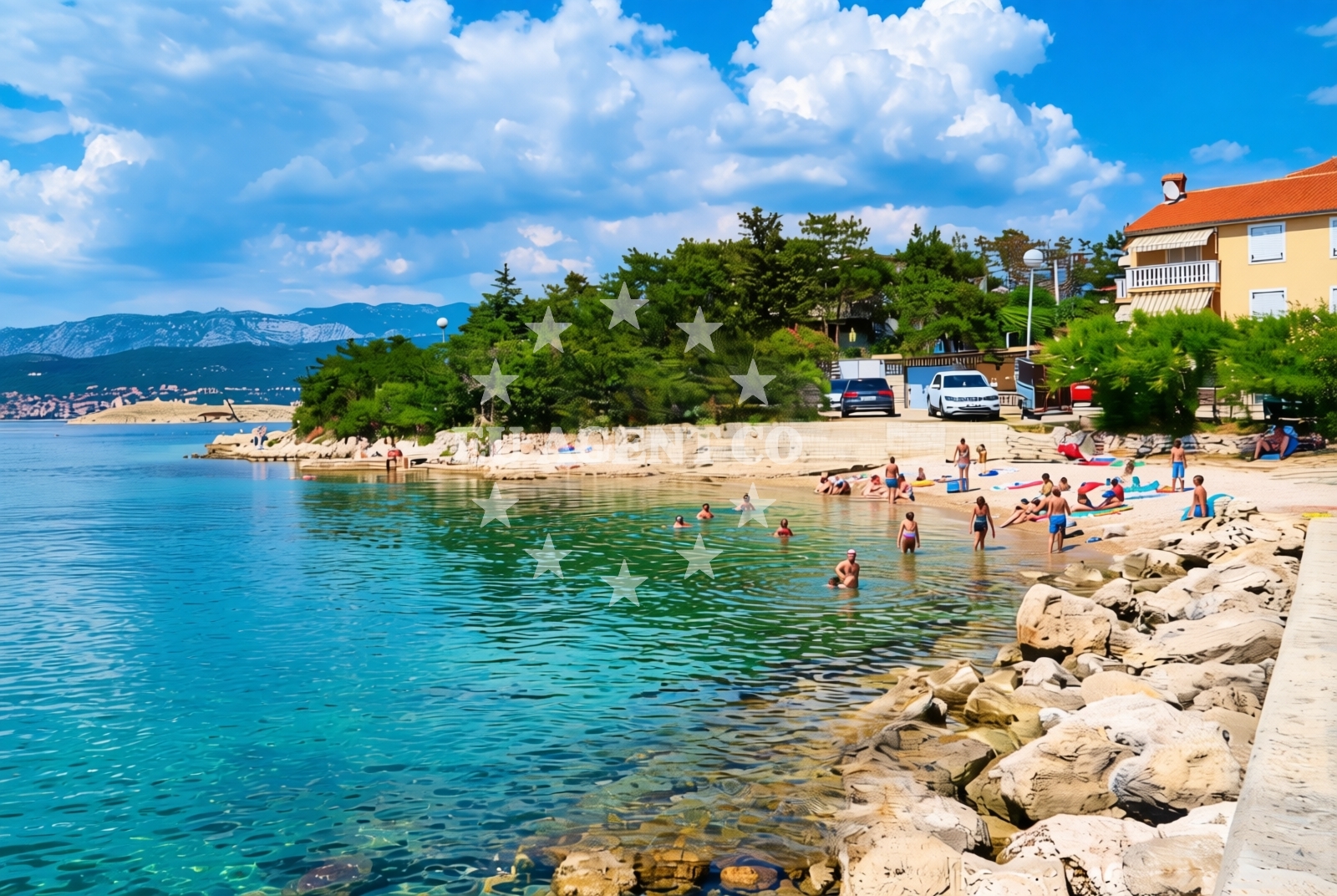
Lokvišća Sjever Beach lies along the northern shore of Šilo, a coastal settlement on Krk Island in Croatia’s northern Adriatic. This gravel beach stretches for 50 meters, offering a quiet stretch of coastline where natural rock formations provide partial shade. The beach’s position on Krk’s western coast places it within reach of the island’s vineyards, historic sites, and the broader Istrian Peninsula, making it a point of interest for both local visitors and those exploring the Adriatic by yacht.
About this beach
Lokvišća sjever, Šilo (Krk)
Beach: Lokvišća sjever
Location: Šilo (Krk)
Characteristics and facilities
Gravel
50 m
Natural shade
Beach character
The beach’s gravel substrate creates a distinct walking surface, ideal for those seeking a more rugged shoreline experience. Natural rock formations along the beachfront offer sporadic shade, though visitors should expect limited tree cover. The beach’s orientation faces the open sea, with views toward the mainland and the islands of Cres and Lošinj. The absence of artificial structures or amenities means the beach retains a raw, unspoiled character, typical of many Croatian coastal locations.
Swimming and shore
Swimming conditions at Lokvišća Sjever depend on wave action and wind direction, which can vary due to the beach’s exposed position. The gravel substrate may make direct entry into the water less comfortable for some, though the shoreline’s gradual slope allows for easier access in certain areas. The beach’s natural contours create sheltered pockets where water is calmer, particularly during periods of light wind.
Facilities and activities
No formal facilities or services are listed for Lokvišća Sjever Beach. The lack of amenities means visitors should plan accordingly, bringing personal items such as sunscreen, water, and beach towels. The beach’s proximity to Šilo’s settlement suggests potential for short walks to nearby villages, where basic services and dining options may be available. Activities are limited to passive enjoyment of the shoreline and coastal scenery.
Access and location
Access to Lokvišća Sjever Beach is via local roads connecting Šilo to Krk’s main routes. The beach lies approximately 12 kilometers from the island’s capital, Krk Town, and within reach of ferry routes linking Krk to the mainland and other islands. For yacht charter guests, the beach’s location on Krk’s western coast places it within sailing distance of popular anchorages such as those near Vrbnik and the northern Adriatic’s broader network of coastal towns.
What to expect
Visitors to Lokvišća Sjever should expect a gravel shoreline with limited shade, suitable for those seeking a more natural beach experience. The beach’s position on Krk’s western coast offers views of the open sea and the surrounding islands, though its lack of amenities means it is best suited for short visits. The area’s rustic character aligns with the broader coastal landscape of Krk, where many beaches retain their traditional, unembellished features.
Practical tips
Footwear with good traction is recommended for the gravel surface. Sun protection is essential, as natural shade is limited to rock formations. Visitors should note that no facilities are available on-site, so provisions should be brought from nearby Šilo or Krk Town.
Exploring the coast by yacht
For yacht charter guests, Lokvišća Sjever’s location on Krk’s western coast provides access to the island’s sailing routes and the broader northern Adriatic. The beach is within reach of anchorages near Šilo and Vrbnik, with sailing distances to Krk Town and the mainland ferry ports measured in nautical miles. The area’s relatively sheltered waters and proximity to Krk’s coastal roads make it a viable stop for those exploring the Adriatic’s western reaches.
Regional Context: Krk Island and Šilo
Krk Island, the largest in the northern Adriatic, is known for its historic sites, including the 12th-century Krk Fortress, and its rolling vineyards. Šilo, a small settlement on the island’s western coast, is a gateway to Krk’s less-developed shores. The area’s combination of coastal scenery and inland landscapes makes it a destination for both cultural and nature-focused visitors.
Anchorages in the surrounding area
Anchorages in the surrounding area include options near Silo and Krk, such as Uvala Stipanja.
- Anchorage — silo — krk — 0.6 NM from beach
- Anchorage — krk — 1.5 NM from beach
- Anchorage — krk — 1.8 NM from beach
- Anchorage — dramalj — 2.5 NM from beach
- Anchorage — krk — 2.6 NM from beach
- Klimno — krk — 2.7 NM from beach
- Anchorage — risika — krk — 2.8 NM from beach
- Anchorage — selce — 2.9 NM from beach
Distances are straight-line geographic distances, not sailing routes.
Mooring buoys in the surrounding area
Mooring buoys in the surrounding area are located in Crikvenica and Selce, with some within two nautical miles of the beach.
- Buoy field — crikvenica — 1.6 NM from beach
- Jetty — selce — 2.0 NM from beach
- Buoy field — selce — 2.1 NM from beach
- Buoy field — selce — 2.1 NM from beach
- Jetty — selce — 2.1 NM from beach
Distances are straight-line geographic distances, not sailing routes.
Marine fuel stations
A marine fuel station in Crikvenica is situated approximately 1.6 nautical miles from the beach.
- Fuel station — crikvenica — 1.6 NM from beach
- INA — novi vinodolski — 5.3 NM from beach
- Flash — krk — 8.6 NM from beach
- Ina — krk — 8.7 NM from beach
Distances are straight-line geographic distances, not sailing routes.
Harbours in the surrounding area
Harbours in the surrounding area include the nearby Šilo Harbour, located just 0.28 nautical miles from the beach.
- Šilo — silo — krk — 0.3 NM from beach
- Crikvenica — 1.5 NM from beach
- Podvorska — crikvenica — 1.9 NM from beach
- Selce — 2.1 NM from beach
- Klimno — krk — 2.1 NM from beach
- Čižići — cizici — krk — 3.0 NM from beach
Distances are straight-line geographic distances, not sailing routes.
Marinas in the surrounding area
Marinas in the surrounding area include the Šilo Marina, situated within 0.04 nautical miles of the beach.
- Šilo — silo — krk — 0.0 NM from beach
- Marina Novi — novi vinodolski — 5.2 NM from beach
- Omišalj Docks — omisalj — krk — 6.1 NM from beach
- Mitan Marina — novi vinodolski — 6.1 NM from beach
- Marina Punat — krk — 7.5 NM from beach
Distances are straight-line geographic distances, not sailing routes.
Restaurants near the beach
Restaurants near the beach are concentrated in Silo and Crikvenica, with several within 1.6 nautical miles.
- Restaurant — silo — krk — 0.3 NM from beach
- Restaurant — silo — krk — 0.3 NM from beach
- Restaurant — silo — krk — 0.3 NM from beach
- Tamaris — crikvenica — 1.6 NM from beach
- Restaurant — crikvenica — 1.6 NM from beach
- Oleander — klimno — krk — 2.1 NM from beach
- Val — klimno — krk — 2.1 NM from beach
Distances are straight-line geographic distances, not sailing routes.
Navigation guides for the surrounding area
Navigation guides for the surrounding area include Uvala Stipanja, a short distance from the beach.
- Uvala Stipanja {Silo) — 0.2 NM from beach
- Crikvenica — 1.7 NM from beach
- Se Ice — 2.3 NM from beach
- Uvala Siana — 2.4 NM from beach
- Uvala Sv. Marak — 2.8 NM from beach
Distances are straight-line geographic distances, not sailing routes.
Yachts from nearby departure bases
Yachts from nearby departure bases include options departing from Crikvenica City Port and Vinodolski Novi Marina, with some within 1.6 nautical miles.
Sailing yachts
- Hanse 458 (DELTA) — Vinodolski Novi Marina — 5.2 NM from departure base to beach
- Sun Odyssey 33i (Paola) — Vinodolski Novi Marina — 5.2 NM from departure base to beach
- Elan Impression 45.1 (SALI) — Vinodolski Novi Marina — 5.2 NM from departure base to beach
- Bavaria C38 (Popaj) — Vinodolski Novi Marina — 5.2 NM from departure base to beach
Catamarans
- Lagoon 40 (Paco) — Vinodolski Novi Marina — 5.2 NM from departure base to beach
- Aventura 37 (THOMAS) — Vinodolski Novi Marina — 5.2 NM from departure base to beach
- Aventura 34 (Marlon) — Vinodolski Novi Marina — 5.2 NM from departure base to beach
Motor boats
- Barracuda 590 (Solta) — Crikvenica City Port — 1.6 NM from departure base to beach
- Barracuda 590 (Barracuda 12) — Crikvenica City Port — 1.6 NM from departure base to beach
- Adriana 36 (Gaja) — Vinodolski Novi Marina — 5.2 NM from departure base to beach
Distances are straight-line geographic distances, not sailing routes.