Lokvišća jug, Šilo (Krk) Beach, Croatia
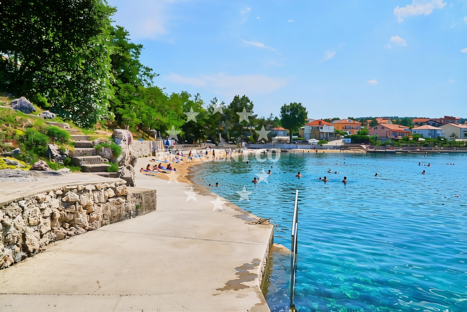
Lokvišća jug lies on the southeastern coast of Šilo, a village on the island of Krk in Croatia’s Kvarner Gulf. This beach stretches 250 meters along a rocky shoreline, featuring concrete and stone slabs that provide stable access to the water. Its proximity to Šilo’s village center and the broader Krk coastline makes it a convenient stop for visitors exploring the island’s natural and cultural landmarks.
About this beach
Lokvišća jug, Šilo (Krk)
Beach: Lokvišća jug
Location: Šilo (Krk)
Characteristics and facilities
Concrete / stone slabs
250 m
Restaurant / snack bar
Caffe bar / Drinks stand
shower
Changing cabin
Beach character
The beach’s character is defined by its rocky terrain and structured shoreline. Concrete and stone slabs line much of the shore, offering a firm surface for walking and sunbathing. The beach is relatively short but well-equipped with essential facilities, including a restaurant, snack bar, and café for refreshments. Showers and changing cabins are available, catering to visitors seeking comfort during their stay. The surrounding area is marked by the typical Adriatic landscape of pine forests and rugged coastlines, with views of the open sea and nearby islands like Cres and Lošinj.
Swimming and shore
The water quality at Lokvišća jug is typical of the northern Adriatic, with clear conditions during the summer months. The beach’s rocky nature means swimming areas are concentrated near the slabs, where the seabed slopes gently. While the beach lacks designated swimming zones, the proximity to the mainland and the absence of strong currents make it a safe option for casual swimmers. The shore’s uneven terrain may require caution, particularly for those with mobility challenges.
Facilities and activities
Lokvišća jug offers a range of amenities to support a day at the beach. A restaurant and snack bar provide meals and light refreshments, while a café serves drinks and snacks. Showers and changing cabins are available for visitors. The beach itself does not host organized activities, but its location near Šilo allows access to hiking trails, fishing spots, and cultural sites on Krk. The nearby village of Šilo also offers traditional Croatian cuisine and local crafts for visitors to explore.
Access and location
Access to Lokvišća jug is straightforward, with the beach located within walking distance of Šilo’s village center. The nearest major road is the A1 motorway, which connects Krk to the mainland and other islands in the Kvarner Gulf. Public transportation options, including buses and ferries, operate seasonally between Krk and nearby islands. For yacht charter guests, the beach’s proximity to Šilo’s harbor and the broader Krk coastline makes it a convenient anchorage point or stopover during a sailing itinerary.
What to expect
Visitors to Lokvišća jug can expect a mix of natural and structured elements. The beach’s rocky shoreline and concrete slabs provide a stable environment for sunbathing and casual swimming. The available amenities—restaurant, café, showers, and changing cabins—support a comfortable visit. The beach is best suited for those seeking a quiet, family-friendly spot with easy access to Šilo’s village and Krk’s coastal routes. The surrounding landscape offers opportunities for hiking, fishing, and exploring the island’s historic sites, including the Šilo fortress and the Krk Monastery.
Practical tips
Bring swimwear, towels, and sunscreen for a day at Lokvišća jug. The restaurant and café operate seasonally, so it’s advisable to confirm hours in advance. Parking is available near the beach, though spaces may be limited during peak season. For yacht charter guests, anchoring near Šilo’s harbor or using the village’s marina provides easy access to the beach and the island’s sailing routes.
Exploring the coast by yacht
Lokvišća jug’s location on Krk places it within one of the Adriatic’s most scenic sailing regions. The Kvarner Gulf offers calm waters and sheltered bays, making it ideal for motor yachts and sailing boats. Charter guests can explore nearby islands like Cres and Lošinj, or head to the mainland via the A1 motorway. Šilo’s harbor and the broader Krk coastline provide multiple docking options, ensuring flexibility for yacht itineraries. The beach itself is not a designated anchorage, but its proximity to Šilo makes it a convenient stop for those exploring the island’s eastern coast.
Cultural and Historical Context
Šilo, the village near Lokvišća jug, is one of Krk’s oldest settlements, with a history dating back to Roman times. The Šilo fortress, a 16th-century structure, overlooks the village and offers panoramic views of the Kvarner Gulf. The nearby Krk Monastery, founded in the 12th century, is a significant religious site on the island. These landmarks reflect Krk’s rich heritage and provide additional reasons for visitors to explore the area beyond the beach itself.
Anchorages in the surrounding area
- Anchorage — silo — krk — 0.4 NM from beach
- Anchorage — krk — 1.3 NM from beach
- Anchorage — krk — 1.6 NM from beach
- Anchorage — risika — krk — 2.6 NM from beach
- Anchorage — dramalj — 2.7 NM from beach
- Klimno — krk — 2.7 NM from beach
- Anchorage — krk — 2.7 NM from beach
- Anchorage — krk — 2.9 NM from beach
Distances are straight-line geographic distances, not sailing routes.
Mooring buoys in the surrounding area
- Buoy field — crikvenica — 1.7 NM from beach
- Jetty — selce — 2.1 NM from beach
- Buoy field — selce — 2.1 NM from beach
- Jetty — selce — 2.1 NM from beach
- Buoy field — selce — 2.1 NM from beach
Distances are straight-line geographic distances, not sailing routes.
Marine fuel stations
- Fuel station — crikvenica — 1.7 NM from beach
- INA — novi vinodolski — 5.2 NM from beach
- Flash — krk — 8.5 NM from beach
- Ina — krk — 8.5 NM from beach
Distances are straight-line geographic distances, not sailing routes.
Harbours in the surrounding area
Harbors such as Šilo and Crikvenica are situated in close proximity to Lokvišća jug, Šilo (Krk) Beach.
- Šilo — silo — krk — 0.2 NM from beach
- Crikvenica — 1.7 NM from beach
- Podvorska — crikvenica — 2.1 NM from beach
- Selce — 2.1 NM from beach
- Klimno — krk — 2.2 NM from beach
- Čižići — cizici — krk — 3.0 NM from beach
Distances are straight-line geographic distances, not sailing routes.
Marinas in the surrounding area
Marinas in Šilo and Novi Vinodolski are nearby departure points for boats visiting the beach.
- Šilo — silo — krk — 0.1 NM from beach
- Marina Novi — novi vinodolski — 5.2 NM from beach
- Mitan Marina — novi vinodolski — 6.1 NM from beach
- Omišalj Docks — omisalj — krk — 6.2 NM from beach
- Marina Punat — krk — 7.3 NM from beach
Distances are straight-line geographic distances, not sailing routes.
Restaurants near the beach
Restaurants in Silo and Crikvenica are located near Lokvišća jug, Šilo (Krk) Beach.
- Restaurant — silo — krk — 0.2 NM from beach
- Restaurant — silo — krk — 0.2 NM from beach
- Restaurant — silo — krk — 0.2 NM from beach
- Tamaris — crikvenica — 1.8 NM from beach
- Restaurant — crikvenica — 1.8 NM from beach
- Oleander — klimno — krk — 2.1 NM from beach
- Val — klimno — krk — 2.1 NM from beach
Distances are straight-line geographic distances, not sailing routes.
Navigation guides for the surrounding area
Navigation guides for Uvala Stipanja near Silo assist with route planning around the beach.
- Uvala Stipanja {Silo) — 0.2 NM from beach
- Crikvenica — 1.8 NM from beach
- Se Ice — 2.4 NM from beach
- Uvala Siana — 2.5 NM from beach
- Uvala Sv. Marak — 2.6 NM from beach
Distances are straight-line geographic distances, not sailing routes.
Yachts from nearby departure bases
Sailing yachts
- Bavaria Cruiser 37 (Maci) — Vinodolski Novi Marina — 5.2 NM from departure base to beach
- Bavaria Cruiser 46 (Alexandra) — Vinodolski Novi Marina — 5.2 NM from departure base to beach
- Bavaria 42 Cruiser (Shiraz) — Vinodolski Novi Marina — 5.2 NM from departure base to beach
- Oceanis 46.1 (ARYA) — Vinodolski Novi Marina — 5.2 NM from departure base to beach
Catamarans
- Aventura 34 (Marlon) — Vinodolski Novi Marina — 5.2 NM from departure base to beach
- Lagoon 40 (Paco) — Vinodolski Novi Marina — 5.2 NM from departure base to beach
- Excess 12 (Kiss Me Twice) — Vinodolski Novi Marina — 5.2 NM from departure base to beach
Motor boats
- Barracuda 590 (Solta) — Crikvenica City Port — 1.8 NM from departure base to beach
- Barracuda 590 (Barracuda 12) — Crikvenica City Port — 1.8 NM from departure base to beach
- Adriana 36 (Gaja) — Vinodolski Novi Marina — 5.2 NM from departure base to beach
Distances are straight-line geographic distances, not sailing routes.