Lokva istok, Mandre (Pag) Beach, Croatia
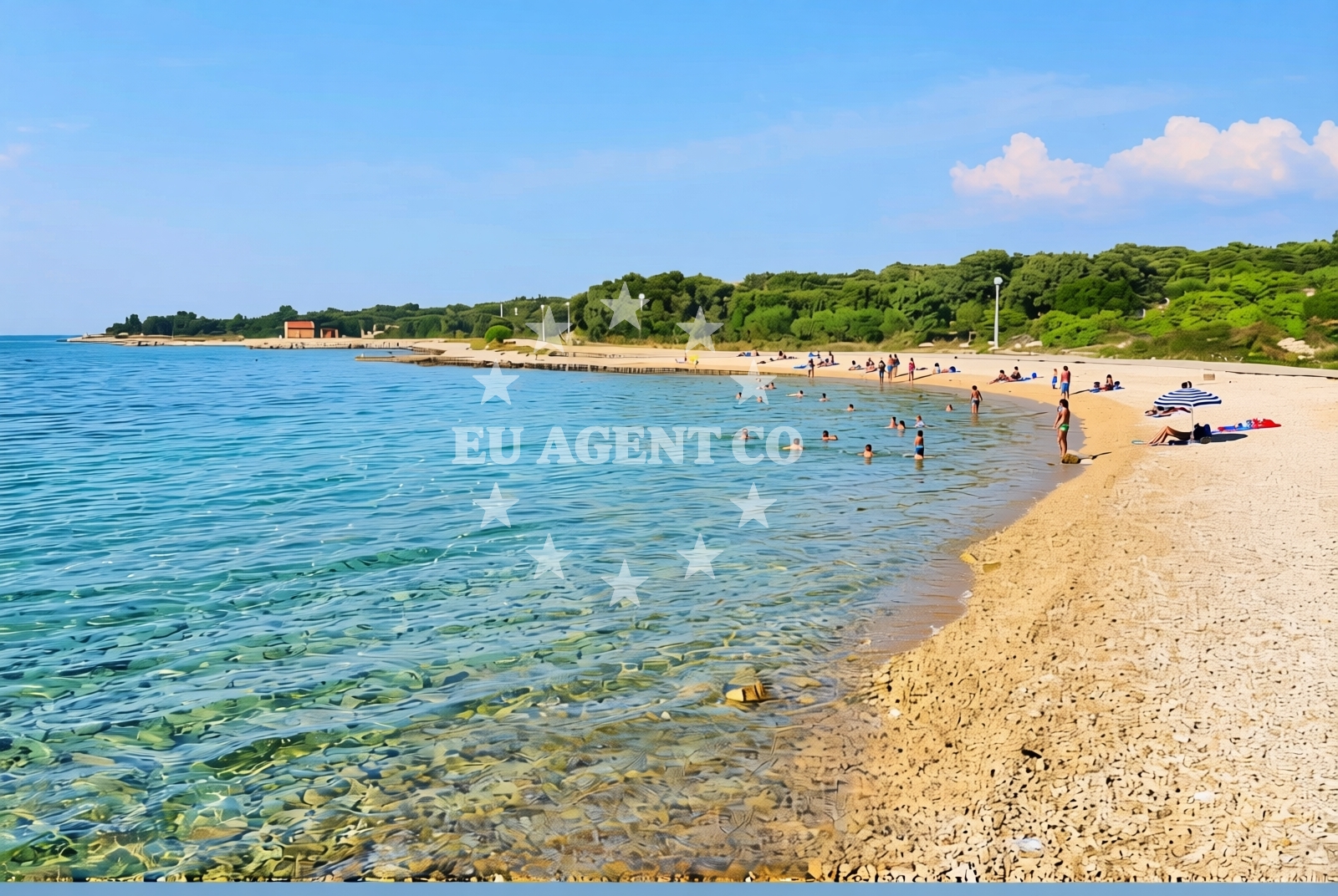
About this beach
Lokva istok, Mandre (Pag)
Beach: Lokva istok
Location: Mandre (Pag)
Characteristics and facilities
Gravel
130 m
Changing cabin
Beach character
The beach consists of gravel rather than sand, creating a distinct textural experience for visitors. This composition is typical of Pag's eastern shores, where the island's karst geology influences the coastal landscape. The 130-meter length makes it a modest stretch of shoreline, ideal for brief exploration or as a stop along a longer coastal walk. The presence of a changing cabin suggests basic infrastructure for beachgoers, though no additional facilities are explicitly documented.Swimming and shore
Swimming conditions at Lokva istok are influenced by the gravel substrate and the open character of the shoreline. The beach lacks protective features like natural rock formations or dunes, meaning wave action may be more direct. The shore itself is marked by the gravel composition, with no indication of sandy areas or sheltered coves. The open exposure to the Adriatic Sea means water temperatures and conditions align with the broader Pag coastline, which is known for its clear waters and moderate currents.Facilities and activities
The beach's primary facility is a single changing cabin, which provides basic amenities for visitors. No other infrastructure such as showers, restrooms, or seating is documented. Activities are limited to the natural setting, with no structured offerings like water sports or guided excursions. The gravel surface may make it more suitable for walking or photography than for sunbathing, though the beach's proximity to Mandre and Pag's broader attractions could support day-trip planning.Access and location
Lokva istok is located on the eastern side of Pag, near the village of Mandre. The island of Pag is part of the Zadar County in Croatia, known for its salt production, lavender fields, and rugged coastline. Access to the beach would likely involve driving along Pag's coastal roads, which connect to the island's main settlements. The beach's coordinates (44.485406° N, 14.907023° E) place it near the northern reaches of Pag's eastern shore, where the island's characteristic limestone cliffs and sea caves are visible.What to expect
Visitors to Lokva istok should expect a gravel shoreline with limited facilities beyond a single changing cabin. The beach's short length and exposed position make it more suitable for brief visits or as part of a longer coastal walk. The surrounding area of Mandre and Pag offers broader opportunities for exploration, including the island's famed lavender fields and historical sites. The beach's character aligns with Pag's natural landscapes, where the sea meets the island's karst topography.Practical tips
Given the gravel composition, visitors may wish to wear sturdy footwear for beach access. The lack of additional facilities means bringing personal items like sunscreen, water, and a towel is advisable. The beach's position on Pag's eastern shore means it may be less crowded than the island's more developed beaches, offering a quieter alternative for those seeking solitude.Exploring the coast by yacht
For yacht charter guests exploring the Adriatic, Lokva istok's location on Pag's eastern coast provides a vantage point for observing the island's distinctive geological features. Pag is a popular sailing destination due to its sheltered bays and clear waters, with nearby marinas in towns like Novalja and Zavižar offering docking options. Charter yachts may use this area as a stop during itineraries that include the northern Dalmatian coast, with sailing routes extending to nearby islands like Šolta and Brač.Pag's Coastal Character
Pag's coastline is defined by its karst landscape, featuring sea caves, cliffs, and gravel beaches like Lokva istok. The island's unique geology, shaped by millennia of erosion, creates a dramatic contrast with the more sandy beaches found elsewhere in the Adriatic. This environment supports a range of marine life and offers opportunities for snorkeling and wildlife observation.Local Settlements and Connectivity
Mandre is a small village on Pag, connected to the island's main settlements via coastal roads. The village's proximity to Lokva istok makes it a potential base for visitors exploring the eastern shore. Pag's road network links to Zadar on the mainland, providing access to cultural attractions and services.Anchorages in the surrounding area
Anchorages near Mandre, Pag, including those at Mandre, Maun, and Novalja.
- Anchorage — mandre — pag — 0.8 NM from beach
- Anchorage — mandre — pag — 1.0 NM from beach
- Anchorage — mandre — pag — 1.7 NM from beach
- Anchorage — maun — 2.2 NM from beach
- Potcrkvine — maun — 2.6 NM from beach
- Anchorage — skrda — 2.6 NM from beach
- Anchorage — maun — 3.3 NM from beach
- Straško — novalja — pag — 3.6 NM from beach
Distances are straight-line geographic distances, not sailing routes.
Mooring buoys in the surrounding area
Mooring buoys and jetties in Pag, including those at Simuni, Zubovici, and Novalja.
- Jetty — simuni — pag — 3.0 NM from beach
- Jetty — zubovici — pag — 3.7 NM from beach
- Jetty — zubovici — pag — 3.9 NM from beach
- Buoy field — novalja — pag — 4.6 NM from beach
- Drljanda — stara novalja — pag — 7.2 NM from beach
Distances are straight-line geographic distances, not sailing routes.
Marine fuel stations
Marine fuel stations in Rab and Losinj, located further from the beach.
- Ina — rab — 17.5 NM from beach
- Ina — mali losinj — 19.2 NM from beach
- Adria Oil — mali losinj — 19.7 NM from beach
- Tifon — nerezine — losinj — 24.5 NM from beach
Distances are straight-line geographic distances, not sailing routes.
Harbours in the surrounding area
Harbors in Pag and nearby areas such as Novalja, Zigljen, and Karlobag.
- Novalja — pag — 4.4 NM from beach
- Žigljen — zigljen — pag — 6.0 NM from beach
- Pag — 6.6 NM from beach
- Stara Novalja — pag — 6.8 NM from beach
- Karlobag — 7.4 NM from beach
- Prizna — 7.5 NM from beach
Distances are straight-line geographic distances, not sailing routes.
Marinas in the surrounding area
Marinas in Simuni, Rab, and Mali Lošinj, with varying proximity to the beach.
- ACI Marina Šimuni — simuni — pag — 2.2 NM from beach
- ACI Marina Rab — 17.4 NM from beach
- Y/C Marina Mali Lošinj — mali losinj — 19.4 NM from beach
- Marina Lošinj — mali losinj — 19.6 NM from beach
- ACI Marina Supetarska Draga — rab — 20.6 NM from beach
Distances are straight-line geographic distances, not sailing routes.
Restaurants near the beach
Restaurants in Simuni and Novalja, offering dining options near the beach.
- Maestral — simuni — pag — 2.2 NM from beach
- Ribarska Koliba Šimuni — simuni — pag — 2.4 NM from beach
- Bistro Šimuni — simuni — pag — 2.4 NM from beach
- Didova Kuča — simuni — pag — 2.5 NM from beach
- Pizzeria Villa Olea — simuni — pag — 2.6 NM from beach
- Margarita — novalja — pag — 3.9 NM from beach
- Restaurant — novalja — pag — 3.9 NM from beach
Distances are straight-line geographic distances, not sailing routes.
Navigation guides for the surrounding area
Navigation guides for areas around Caska, Novalja, and Uvala Prizna.
- Caska — 3.8 NM from beach
- Novalja — 4.3 NM from beach
- Uvala Prizna — 7.5 NM from beach
- Luka Olib — 8.3 NM from beach
- Luka Sv. Nikola — 9.7 NM from beach
Distances are straight-line geographic distances, not sailing routes.
Yachts from nearby departure bases
Yachts departing from nearby bases such as Šimuni, Novalja, and Pag City Port.
Sailing yachts
- First 45 (Egeria) — Šimuni Kolan ACI Marina — 2.2 NM from departure base to beach
- Dufour 412 Grand large (Eva) — Mali Lošinj — 19.4 NM from departure base to beach
- Elan 50 Impression (Vuschi) — Mali Lošinj — 19.4 NM from departure base to beach
Motor yachts
- Absolute 50 Fly (Acrobat) — Rab ACI Marina — 17.4 NM from departure base to beach
Motor boats
- Balt 818 Titanium (Valentina 2) — Novalja — 4.4 NM from departure base to beach
- Balt 818 Titanium (Valentina) — Novalja — 4.4 NM from departure base to beach
- BWA Sport 22GT (BWA ) — Pag City Port — 6.7 NM from departure base to beach
- Merry Fisher 895 — Povljana Marina — 11.8 NM from departure base to beach
- Antares 36 (Joia) — Mali Lošinj — 19.4 NM from departure base to beach
- Galeon Galia 630 (287670ML) — Mali Lošinj — 19.4 NM from departure base to beach
Distances are straight-line geographic distances, not sailing routes.