Ljubovič, Pridraga Beach, Croatia
Ljubovič, Pridraga Beach is a secluded stretch of coastline located in the village of Ljubovič along Croatia’s Adriatic coast. Defined by its rocky shoreline and natural shade, the beach offers a unique contrast to the more typical sandy beaches of the region. Its location within the broader Dalmatian coast places it near several historic settlements and maritime routes, making it a point of interest for both local visitors and those exploring the area by boat.
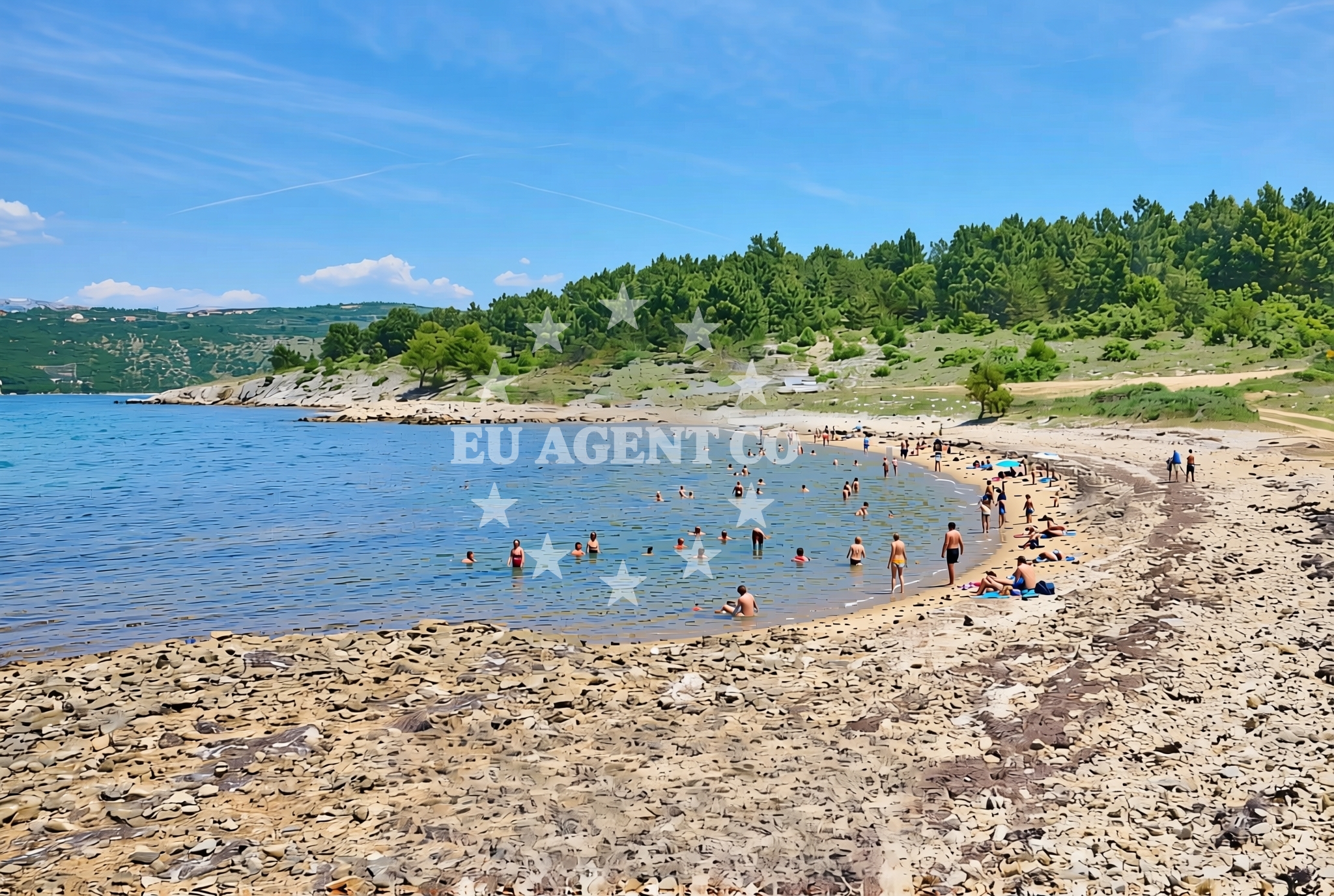
About this beach
Ljubovič, Pridraga
Beach: Ljubovič
Location: Pridraga
Characteristics and facilities
Rocks
110 m
Natural shade
Beach character
The beach’s defining feature is its rocky terrain, which extends along the shoreline for approximately 110 meters. These natural rock formations create a rugged yet scenic landscape, offering visitors a different kind of coastal experience compared to the smooth sands of other beaches. The presence of natural shade, likely provided by overhanging rock formations or nearby vegetation, makes it a potentially pleasant spot during the hottest parts of the day. While no specific amenities are listed in the beach’s catalog, the absence of artificial structures suggests a more untouched, nature-focused environment.
Swimming and shore
The rocky shoreline may present challenges for swimmers, with uneven surfaces and potential gaps between formations that could affect accessibility. However, the natural setting also creates sheltered areas where the water might be calmer, depending on the tide and wave conditions. Visitors should exercise caution when entering the water, as the rocky terrain could make footing unstable. The beach’s orientation and surrounding geography may influence local currents, though specific details about water conditions are not provided in the catalog.
Facilities and activities
No formal facilities such as showers, restrooms, or lifeguard services are mentioned in the beach’s authoritative features. The lack of structured amenities aligns with its description as a more natural, unspoiled location. Activities associated with the beach are not explicitly listed, but the rocky terrain could support low-impact pursuits such as rock climbing or photography. The absence of marked recreational facilities means visitors should prepare for a self-sufficient experience, relying on the beach’s inherent features rather than external services.
Access and location
Ljubovič, Pridraga Beach is situated within the settlement of Ljubovič, a small coastal village in Croatia. Its exact coordinates (44.178351° N, 15.590241° E) place it in a region known for its rugged coastline and historic maritime connections. The beach’s proximity to Ljubovič suggests it may be accessible via local roads, though specific details about parking, walking paths, or road access are not included in the catalog. Visitors are encouraged to consult local maps or navigation tools for precise directions to the site.
What to expect
Visitors to Ljubovič, Pridraga Beach should anticipate a landscape shaped by natural rock formations and limited to a 110-meter stretch along the coast. The absence of artificial structures or amenities means the beach retains a raw, unaltered character. The natural shade provided by the terrain could offer respite from direct sunlight, though the rocky surface may make it less comfortable for prolonged sunbathing. The beach’s location within Ljubovič places it near other coastal landmarks, potentially making it a stop for those exploring the region by boat or on foot.
Practical tips
Given the rocky terrain, visitors should consider wearing sturdy footwear to navigate the shoreline safely. The lack of formal facilities means bringing personal items such as water, snacks, and sun protection is advisable. Those planning to swim should be mindful of the uneven surfaces and potential tide changes. The beach’s natural setting makes it a good spot for photography or quiet reflection, though it may not be suitable for large groups or those seeking extensive amenities.
Exploring the coast by yacht
Ljubovič, Pridraga Beach lies within a region of Croatia that is popular with yacht charter guests due to its combination of historic coastal towns, clear waters, and accessible anchorages. While the beach itself is not marked as a formal marina or anchorage point, its location near Ljubovič places it in proximity to sailing routes that connect to larger ports and yacht-friendly harbors. Charter guests exploring the Dalmatian coast may consider this area as part of a broader itinerary that includes nearby settlements and maritime landmarks.
Regional Context and Nearby Settlements
The area around Ljubovič is part of the broader Adriatic coastline, which features a mix of small villages and larger towns with maritime traditions. Nearby settlements may offer additional services, accommodations, or cultural sites of interest. The rocky coastline of Pridraga Beach is typical of this region, where natural formations often dominate the landscape. Visitors may find it worthwhile to explore neighboring areas for a more comprehensive understanding of the local geography and history.
Anchorages in the surrounding area
Anchorages in the surrounding area include options near Novigrad, Maslenica, and Karin.
- Anchorage — novigrad — 0.7 NM from beach
- Anchorage — maslenica — 1.9 NM from beach
- Anchorage — karin — 2.7 NM from beach
- Karin dock — 3.0 NM from beach
- Anchorage — vinjerac — 7.3 NM from beach
- Anchorage — ljubac — 13.3 NM from beach
- Anchorage — ljubac — 13.5 NM from beach
- Anchorage — rtina — 14.1 NM from beach
Distances are straight-line geographic distances, not sailing routes.
Mooring buoys in the surrounding area
- Jetty — ljubac — 13.7 NM from beach
- Šibuljina Point — sibuljina point — 14.4 NM from beach
- Buoy field — sukosan — 14.4 NM from beach
- Buoy field — sukosan — 14.6 NM from beach
Distances are straight-line geographic distances, not sailing routes.
Marine fuel stations
Marine fuel stations are located in Sukosan, Biograd na Moru, Zadar, and Preko.
- Fuel station — sukosan — 14.7 NM from beach
- Ina — biograd na moru — 15.8 NM from beach
- Ina — zadar — 16.0 NM from beach
- Ina — preko — ugljan — 18.1 NM from beach
Distances are straight-line geographic distances, not sailing routes.
Harbours in the surrounding area
Harbours in the surrounding area include Maslenica, Obrovac, Vinjerac, and Starigrad Paklenica.
- Maslenica — 3.3 NM from beach
- Obrovac — 4.2 NM from beach
- Vinjerac — 7.3 NM from beach
- Seline — 7.7 NM from beach
- Starigrad Paklenica — 9.6 NM from beach
- Ražanac — razanac — 12.2 NM from beach
Distances are straight-line geographic distances, not sailing routes.
Marinas in the surrounding area
Marinas in the surrounding area are situated in Sukosan, Biograd na Moru, and Sveti Filip i Jakov.
- Marina Dalmacija — sukosan — 14.5 NM from beach
- Dry dock marina Biograd — biograd na moru — 14.6 NM from beach
- Molum Marine Club — sveti filip i jakov — 14.9 NM from beach
- Marina Kornati — biograd na moru — 15.6 NM from beach
- Marina Šangulin — marina sangulin — biograd na moru — 15.6 NM from beach
Distances are straight-line geographic distances, not sailing routes.
Navigation guides for the surrounding area
Navigation guides for the surrounding area cover locations such as Posedarje, Starigrad-Paklenica, and Turanj.
- Posedarje (Novigradsko More) — 5.1 NM from beach
- Starigrad-Paklenica {Velebitski Kanai) — 9.4 NM from beach
- VELESITSKI KANAL (S) — 12.9 NM from beach
- Filip Jakov — 14.9 NM from beach
- Turanj — 14.9 NM from beach
Distances are straight-line geographic distances, not sailing routes.
Yachts from nearby departure bases
Yachts from nearby departure bases include options based in Novigrad Dalmatia and Sukošan Brodogradilište Filipi.
Sailing yachts
- Cyclades 50.5 (Principessa) — Sukošan Marina Dalmacija — 14.5 NM from departure base to beach
Catamarans
- Lagoon 50 (HIGH LIFE) — Sukošan Marina Dalmacija — 14.5 NM from departure base to beach
Motor yachts
- Azimut 72 (Relax of Croatia) — Sukošan Marina Dalmacija — 14.5 NM from departure base to beach
Motor boats
- Merry Fisher 795 () — Novigrad Dalmatia — 1.9 NM from departure base to beach
- Merry Fisher 695 — Sukošan Brodogradilište Filipi — 14.3 NM from departure base to beach
- Zar 65 Suite — Sukošan Brodogradilište Filipi — 14.3 NM from departure base to beach
- Elan 650 (Biokovo) — Sukošan Brodogradilište Filipi — 14.3 NM from departure base to beach
- Zar 57 WD — Sukošan Brodogradilište Filipi — 14.3 NM from departure base to beach
- Zar 61 Suite (Tucepi) — Sukošan Brodogradilište Filipi — 14.3 NM from departure base to beach
- Quicksilver Activ 555 — Sukošan Brodogradilište Filipi — 14.3 NM from departure base to beach
Distances are straight-line geographic distances, not sailing routes.