Livade (Meadows) i Obatnice, Povljana (Pag) Beach, Croatia
About this beach
Livade (Meadows) i Obatnice, Povljana (Pag)
Beach: Livade (Meadows) i Obatnice
Location: Povljana (Pag)
Characteristics and facilities
Sand
580 m
Beach character
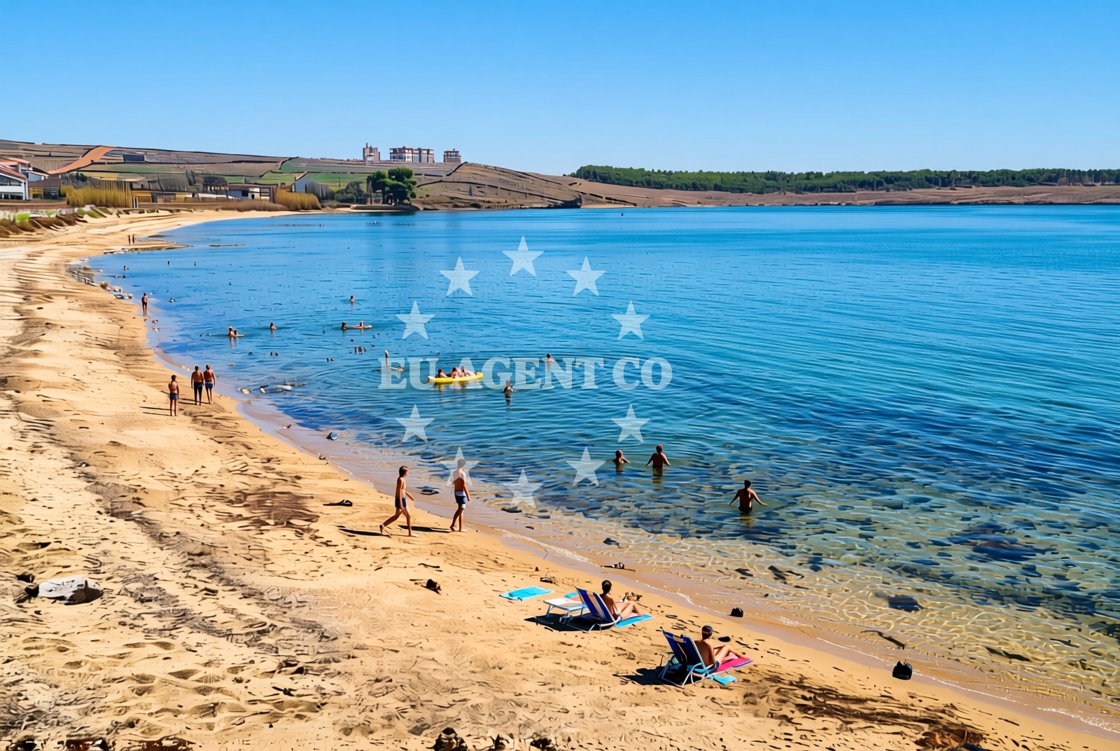
The beach is composed of fine, pale sand that extends in a relatively straight line along the shore. Its length makes it suitable for group activities, though the lack of marked sections or designated zones means visitors must self-regulate space. The sand’s color and texture are typical of the Adriatic’s eastern coast, where erosion from the sea and wind has shaped the shoreline over centuries. The beach is not enclosed by cliffs or rocks, and its orientation faces northeast, meaning it receives direct sunlight in the mornings and afternoons. While no official facilities are listed, the nearby village of Povljana provides basic amenities like restaurants and accommodations, accessible via a short walk or bike ride.Swimming and shore
The water quality around Livade (Meadows) i Obatnice is generally clear, reflecting the Adriatic’s reputation for clean, temperate seas. The beach’s shallow gradient allows easy wading, though swimmers should be mindful of currents that can form near the mouth of the Obatnice stream, which flows inland from the beach. The shore itself is gently sloped, with no significant rock formations or underwater hazards reported. The absence of seaweed or debris is notable, though this may vary seasonally. For those seeking a more secluded experience, the northern end of the beach is less crowded than the southern section, which is closer to Povljana’s main road.Facilities and activities
Official facilities at the beach itself are minimal, with no showers, umbrellas, or lifeguard services listed. However, the nearby village of Povljana offers a range of services, including cafes, taverns serving local fish dishes, and small hotels. The beach is well-suited for sunbathing, light swimming, and walking along the shore. The surrounding area of Pag is known for its cycling trails, which connect to the island’s interior, though these are not directly accessible from the beach. For those interested in cultural exploration, Pag’s historic salt pans and medieval ruins are within a short drive or boat ride.Access and location
Livade (Meadows) i Obatnice Beach is located in Povljana, a coastal village on the island of Pag. The beach is accessible via a dirt road that runs parallel to the shore, making it suitable for cars, bicycles, and motorbikes. The nearest major road is the D8 highway, which connects Pag to Zadar and the mainland. Visitors arriving by boat can anchor in nearby bays such as Vela Luka or Vrana, both of which are within a 10-minute boat ride. Pag’s position in the Adriatic makes it a hub for yachting, with marinas in nearby towns like Novalja and Zadar offering docking options for those exploring the region.What to expect
Visitors to Livade (Meadows) i Obatnice should expect a straightforward, unadorned beach experience. The sand is clean and easy to traverse, though there are no umbrellas, chairs, or rental services available on-site. The beach’s appeal lies in its simplicity and its connection to Pag’s natural and cultural landscape. The nearby village of Povljana provides a base for longer stays, with accommodations ranging from family-run guesthouses to more modern hotels. The beach is best visited during the shoulder season (May or September) to avoid the busiest times, though its relatively low profile means it remains uncrowded even in peak summer.Practical tips
Bring a towel and sunscreen, as there are no umbrellas or shaded areas on the beach. Parking is available along the road leading to the shore, though spaces are limited. For those arriving by boat, anchoring in Vela Luka or Vrana offers easier access to the beach. The nearby salt pans of Pag are worth a visit for their unique landscape, though they are best explored during the day when the sun is lower in the sky.Exploring the coast by yacht
Pag’s coastline is a popular sailing destination, with its shallow bays and sheltered inlets offering safe anchorage for yachts. Livade (Meadows) i Obatnice is positioned near the northern end of the island, making it a convenient stop for those exploring the Adriatic’s eastern routes. Yachts can easily reach the beach from marinas in Zadar or Novalja, with sailing times ranging from 30 minutes to an hour. The surrounding waters are known for their calm conditions, though sailors should monitor local weather forecasts for occasional wind shifts. For those interested in chartering a boat, Euro-Agent’s Yacht Search tool provides real-time availability for motor yachts and sailboats in the region.Pag’s Cultural Heritage
Pag is one of Croatia’s oldest inhabited islands, with evidence of human settlement dating back to prehistoric times. The island’s medieval ruins, including the fortress of St. Michael in Povljana, reflect its strategic importance in the Adriatic. Traditional stone houses in Povljana still stand, their architecture influenced by the island’s history as a center for salt production. The nearby town of Novalja, known for its caves and nightlife, is a short drive from the beach, offering a contrast to Pag’s more rural character.Anchorages in the surrounding area
Anchorages in the surrounding area include options near Povljana and Vir, located within a few nautical miles of the beach.
- Anchorage — povljana — pag — 0.2 NM from beach
- Anchorage — povljana — pag — 1.5 NM from beach
- Anchorage — vir — 1.9 NM from beach
- Mlinica — kosljun pag — 2.2 NM from beach
- Anchorage — lozice — vir — 2.4 NM from beach
- Anchorage — vir — 2.7 NM from beach
- Anchorage — vir — 3.0 NM from beach
- Anchorage — lozice — vir — 3.1 NM from beach
Distances are straight-line geographic distances, not sailing routes.
Mooring buoys in the surrounding area
- Vir — 2.7 NM from beach
- Punta Skala — petrcane — 9.0 NM from beach
- Jetty — ljubac — 9.4 NM from beach
- Jetty — simuni — pag — 9.4 NM from beach
- Šibuljina Point — sibuljina point — 10.0 NM from beach
Distances are straight-line geographic distances, not sailing routes.
Marine fuel stations
Marine fuel stations are located in areas including Zadar and Ugljan, positioned further away from the beach.
- Ina — zadar — 14.3 NM from beach
- Ina — preko — ugljan — 16.2 NM from beach
- Fuel station — sukosan — 19.1 NM from beach
- Ina — zaglav — dugi otok — 23.5 NM from beach
Distances are straight-line geographic distances, not sailing routes.
Harbours in the surrounding area
- Povljana — pag — 0.3 NM from beach
- Košljun — kosljun pag — 3.5 NM from beach
- Privlaka — 4.5 NM from beach
- Miškovići — miskovici — pag — 5.2 NM from beach
- Nin — 6.5 NM from beach
- Mulo — nin — 6.6 NM from beach
Distances are straight-line geographic distances, not sailing routes.
Marinas in the surrounding area
Marinas in the surrounding area include ACI Marina Šimuni and Marina Borik, located further from the beach.
- ACI Marina Šimuni — simuni — pag — 10.2 NM from beach
- Marina Borik — zadar — 13.4 NM from beach
- Vitrenjak Zadar — 13.6 NM from beach
- Marina Zadar — 14.3 NM from beach
- Olive Island Marina — sutomiscica — ugljan — 14.9 NM from beach
Distances are straight-line geographic distances, not sailing routes.
Restaurants near the beach
Restaurants near the beach include Nirvana and Mornar, located in close proximity to Povljana.
- Nirvana — povljana — pag — 0.5 NM from beach
- Mornar — povljana — pag — 0.5 NM from beach
- Lanterna — povljana — pag — 0.7 NM from beach
- Villa Kaštel — povljana — pag — 0.7 NM from beach
- Restaurant — vir — 2.5 NM from beach
- Restaurant — vir — 2.5 NM from beach
- Viranka — 2.5 NM from beach
Distances are straight-line geographic distances, not sailing routes.
Navigation guides for the surrounding area
- OTOK PAG — 1.5 NM from beach
- Privlaka — 4.5 NM from beach
- Uvala Bliznica — 8.2 NM from beach
- KrusCica and Uvala KrusCica Duboka — 9.3 NM from beach
- VELESITSKI KANAL (S) — 11.0 NM from beach
Distances are straight-line geographic distances, not sailing routes.
Yachts from nearby departure bases
Yachts from nearby departure bases include options departing from Povljana Marina and Šimuni, located within a short distance from the beach.
Sailing yachts
- First 45 (Egeria) — Šimuni Kolan ACI Marina — 10.3 NM from departure base to beach
- Oceanis 46.1 (Antonela M.) — Zadar Marina Borik — 13.4 NM from departure base to beach
Catamarans
- Leopard 50 (Solaia) — Zadar Marina Borik — 13.4 NM from departure base to beach
Motor yachts
- Ferretti 780 (TESORO) — Zadar Marina Borik — 13.4 NM from departure base to beach
Motor boats
- Merry Fisher 895 — Povljana Marina — 0.5 NM from departure base to beach
- BWA Sport 22GT (BWA ) — Pag City Port — 6.7 NM from departure base to beach
- Rancraft RM21 (Dugi otok) — Zadar Diklo Port — 12.0 NM from departure base to beach
- Rancraft RM19 (Daycruiser) — Zadar Diklo Port — 12.0 NM from departure base to beach
- Rancraft RS Cinque.5 — Zadar Diklo Port — 12.0 NM from departure base to beach
- Antares 9 OB (Queen Mary) — Zadar Marina Borik — 13.4 NM from departure base to beach
Distances are straight-line geographic distances, not sailing routes.