Levant Beach - Vela Luka, Croatia
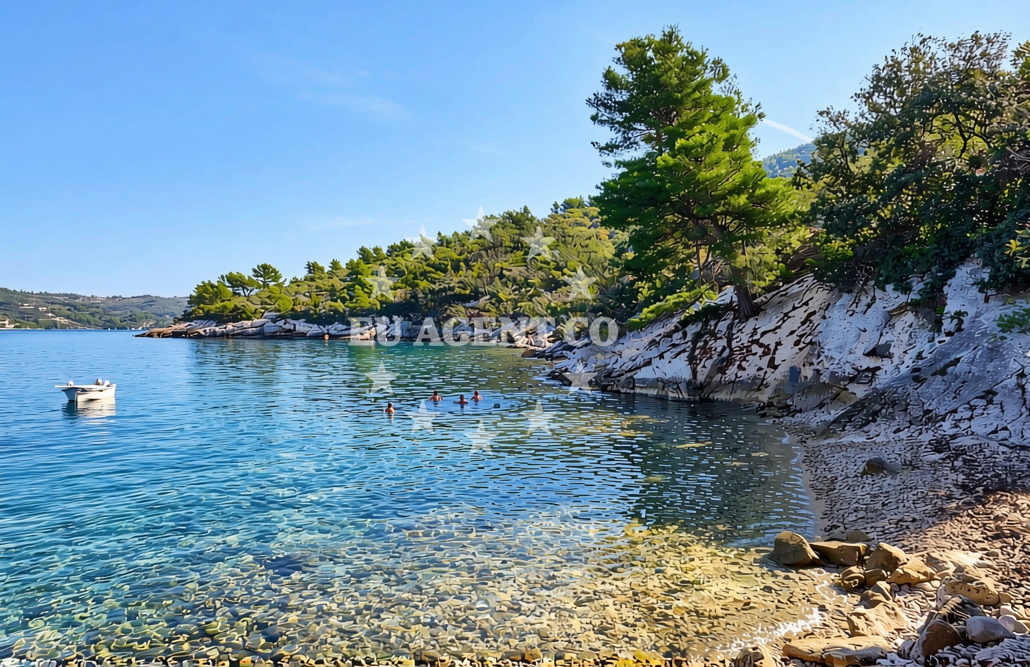
Levant Beach, located at picena 9 in Vela Luka, Croatia, is a small cove beach characterized by its beige pebble shoreline. This secluded spot offers a unique swimming experience with a moderate depth increase and is a popular destination for kayaking enthusiasts. While the beach maintains a moderate crowd level during peak season, visitors should be aware of its very poor cleanliness rating, which may influence preparation for a visit.
Beach character
Levant Beach is a narrow cove measuring approximately 30 meters in length and 10 meters in width. The shoreline is composed of beige pebbles, creating a distinct textural contrast with the surrounding landscape. The sea floor is similarly covered in pebbles, and the depth increases moderately as one moves away from the shore. This configuration makes it a suitable location for kayaking but may present challenges for those seeking a sandy beach experience.
Swimming and shore
The pebble composition of Levant Beach influences both swimming conditions and shore accessibility. While the moderate depth increase allows for safe swimming in shallower areas, the pebbles may make prolonged standing or sunbathing uncomfortable. The beach's natural features are best appreciated by visitors who prioritize activities like kayaking over traditional beach relaxation.
Facilities and activities
Levant Beach lacks formal amenities such as showers, toilets, or seating areas. However, it supports kayaking as a primary activity, making it an appealing destination for active visitors. The absence of structured facilities means the beach retains its natural character, though this also contributes to its very poor cleanliness rating.
Access and location
Located in Vela Luka, a coastal town on the island of Korcula, Levant Beach is part of a region renowned for its Adriatic sailing opportunities. The beach's proximity to Vela Luka's marina infrastructure makes it a convenient stop for yacht charter guests exploring the southern Dalmatian coast. Visitors arriving by road will find the beach accessible via local routes connecting to Korcula's main roads.
What to expect
Visitors to Levant Beach should anticipate a natural, pebble-based shoreline with limited amenities. The beach is best suited for those seeking kayaking opportunities and a more secluded coastal experience. Due to its very poor cleanliness rating, it is advisable to bring personal hygiene supplies. The moderate crowd level during high season suggests that the beach can accommodate visitors without becoming overly congested.
Practical tips
Given the beach's pebble composition, wear water shoes for comfort during walks along the shore. The very poor cleanliness rating means bringing a towel and personal hygiene items is recommended. For kayaking, ensure equipment is properly maintained to navigate the pebble-strewn sea floor.
Exploring the coast by yacht
As part of Vela Luka's coastal network, Levant Beach is situated within a region that attracts yacht charter guests exploring the Adriatic. The proximity to marina facilities and the surrounding coastline's natural beauty make it a strategic location for sailors. Euro-Agent offers yacht charter services that can facilitate visits to Levant Beach and other nearby Adriatic destinations.
Regional Context and Accessibility
Vela Luka, where Levant Beach is located, is a well-known marina town on Korcula Island. The area is accessible via ferry routes from nearby islands and by road connections to mainland Croatia. The beach's position within this network makes it a viable destination for both local and international visitors, particularly those engaged in sailing activities.
Anchorages in the surrounding area
Anchorages in the surrounding area of Levant beach include options in Vela Luka and Korcula.
- Anchorage — vela luka — korcula — 0.8 NM from beach
- Gradina — vela luka — korcula — 1.0 NM from beach
- Anchorage — vela luka — korcula — 1.7 NM from beach
- Anchorage — vela luka — korcula — 1.7 NM from beach
- Anchorage — vela luka — korcula — 1.8 NM from beach
- Anchorage — vela luka — korcula — 2.4 NM from beach
- Anchorage — korcula — 2.5 NM from beach
- Pržnjak Veli and Mali — prznjak veli and mali — 3.1 NM from beach
Distances are straight-line geographic distances, not sailing routes.
Mooring buoys in the surrounding area
Mooring buoys in the surrounding area are located near Vela Luka and Proizd.
- Gradina buoy field — vela luka — korcula — 1.0 NM from beach
- Buoy field — vela luka — korcula — 1.6 NM from beach
- Jetty — vela luka — korcula — 1.6 NM from beach
- Jetty — proizd — 3.1 NM from beach
- Quay — vela luka — korcula — 5.2 NM from beach
Distances are straight-line geographic distances, not sailing routes.
Marine fuel stations
Marine fuel stations include Ina in Vela Luka and other stations in Hvar and Lastovo.
- Ina — vela luka — korcula — 1.7 NM from beach
- Ina — vrboska — hvar — 13.5 NM from beach
- Ina — ubli — lastovo — 14.2 NM from beach
- Fuel station — hvar — 16.3 NM from beach
Distances are straight-line geographic distances, not sailing routes.
Harbours in the surrounding area
Harbours in the surrounding area include Vela Luka and other ports in Korcula and Hvar.
- Vela Luka — korcula — 1.8 NM from beach
- Prigradica — korcula — 5.9 NM from beach
- Brna — korcula — 8.6 NM from beach
- Marina Bilo Idro — sveta nedjelja — hvar — 11.5 NM from beach
- Zavalatica — korcula — 11.6 NM from beach
- Port Jelsa — hvar — 12.5 NM from beach
Distances are straight-line geographic distances, not sailing routes.
Marinas in the surrounding area
Marinas in the surrounding area include Marina Korkyra in Vela Luka and other marinas in Hvar and Lastovo.
- Marina Korkyra — vela luka — korcula — 1.6 NM from beach
- Marina Solitudo — lastovo — 13.1 NM from beach
- ACI Marina Vrboska — hvar — 13.5 NM from beach
- ACI Marina Palmižana — aci marina palmizana — st klement — 17.6 NM from beach
- ACI Marina Korčula — korcula — 20.2 NM from beach
Distances are straight-line geographic distances, not sailing routes.
Restaurants near the beach
Restaurants near the beach include Šiloko, Gulin, and Luky in Vela Luka.
- Restaurant Šiloko — vela luka — korcula — 1.0 NM from beach
- Konoba Gulin — vela luka — korcula — 1.5 NM from beach
- Restaurant Luky — vela luka — korcula — 1.6 NM from beach
- Restaurant — vela luka — korcula — 1.6 NM from beach
- Konoba Ribar — vela luka — korcula — 1.7 NM from beach
- Restoran More — vela luka — korcula — 1.7 NM from beach
- Konoba Lucica — vela luka — korcula — 1.8 NM from beach
Distances are straight-line geographic distances, not sailing routes.
Navigation guides for the surrounding area
Navigation guides for the surrounding area include Uvala Poplat and other nearby locations.
- Uvala Poplat — 0.7 NM from beach
- Uvala Sveti Ivan (Uvala Gradina) — 1.0 NM from beach
- Uvala Tri Luke — 1.8 NM from beach
- Uvala Prihonja — 2.3 NM from beach
- Luka Karbuni — 3.7 NM from beach
Distances are straight-line geographic distances, not sailing routes.
Yachts from nearby departure bases
Yachts from nearby departure bases include options from Milna Marina Vlaška and Makarska Port.
Sailing yachts
- Hanse 505 (AVALON) — Milna Marina Vlaška — 24.8 NM from departure base to beach
- Hanse 455 (AURUM 1) — Milna Marina Vlaška — 24.8 NM from departure base to beach
- Hanse 388 (BANJO) — Milna Marina Vlaška — 24.8 NM from departure base to beach
- Bavaria 46 Cruiser (MO) — Milna Marina Vlaška — 24.8 NM from departure base to beach
- Bavaria 40 Cruiser (LADY BUTTERFLY) — Tučepi Port — 24.9 NM from departure base to beach
Motor yachts
- Princess V53 (Chablis) — Makarska Port — 25.2 NM from departure base to beach
Motor boats
- Galeon 430 Skydeck (Bellagio) — Makarska Port — 25.2 NM from departure base to beach
- Jeanneau NC 37 (Black Pearl) — Makarska Port — 25.2 NM from departure base to beach
- Jeanneau NC 37 (Black Pearl) — Makarska Port — 25.2 NM from departure base to beach
- Galeon 430 Skydeck (BELLAGIO) — Makarska Port — 25.2 NM from departure base to beach
Distances are straight-line geographic distances, not sailing routes.