Lanterna, Košljun (Pag) Beach: A Unique Coastal Experience in Croatia
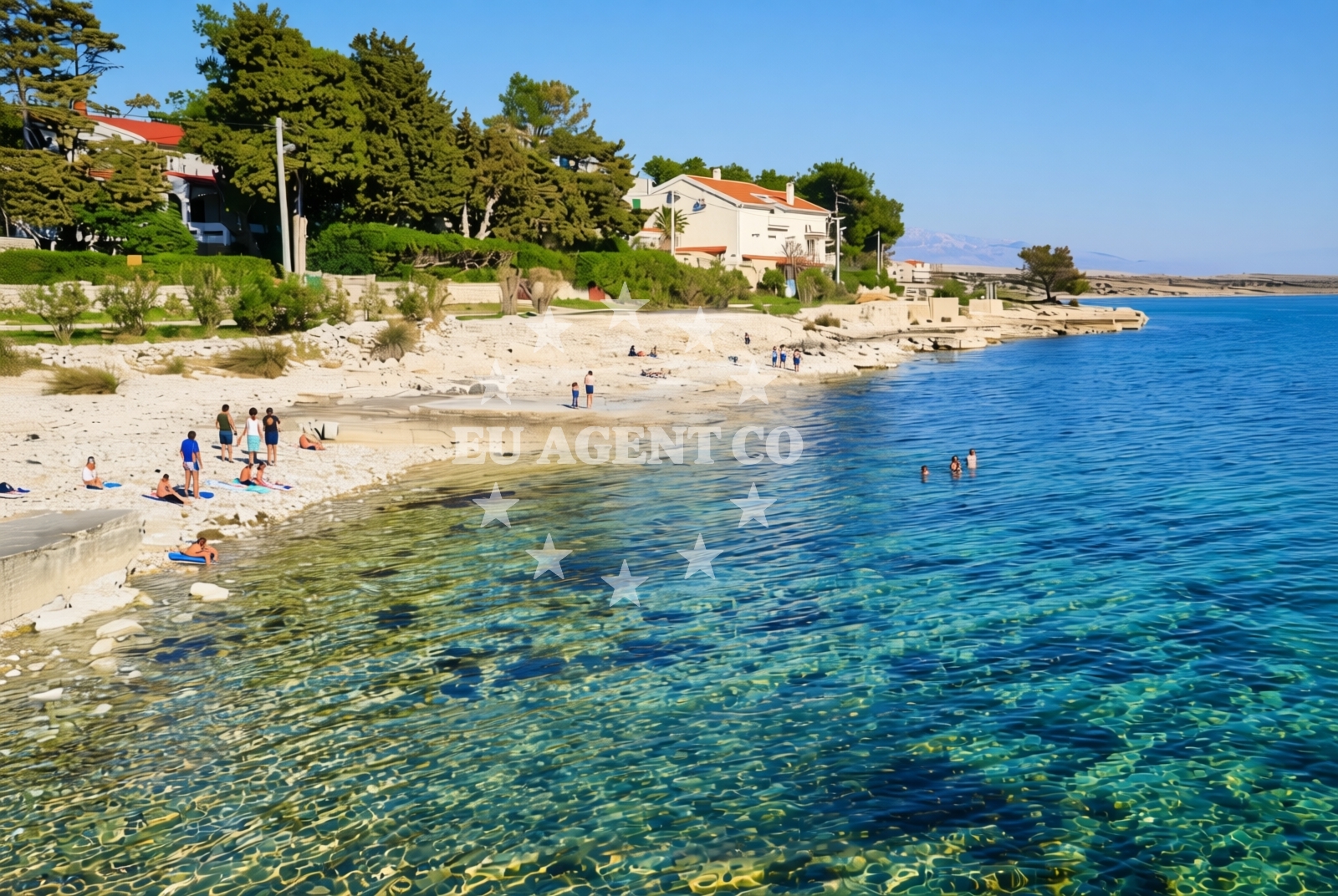
Lanterna, Košljun (Pag) Beach lies on the rugged eastern coast of the island of Pag, a part of Croatia’s Dalmatian coast known for its dramatic landscapes and minimal development. This 80-meter beach combines sand, gravel, and rocky outcrops, reflecting the island’s geology and the Adriatic’s influence on its shores. While not a traditional tourist hotspot, it offers a glimpse into the untamed beauty of Pag’s coastline, where the sea meets the land in a rugged, natural setting.
About this beach
Lanterna, Košljun (Pag)
Beach: Lanterna
Location: Košljun (Pag)
Characteristics and facilities
Sand, gravel, rocks
80 m
Beach character
The beach’s character is defined by its mix of sand, gravel, and rocks, creating a terrain that is as much a part of Pag’s geological story as it is a recreational space. The 80-meter stretch is relatively narrow, with the shoreline shaped by the island’s limestone bedrock and the relentless action of waves. This composition means the beach is not ideal for sunbathing but offers a unique opportunity to explore a coastline that has remained largely untouched by modern infrastructure. The gravel and rocky sections are interspersed with patches of sand, creating a varied surface that can be navigated with care.
Swimming and shore
Swimming conditions here are dictated by the beach’s topography. The rocky and gravelly sections make for challenging entry points, while the sand patches provide more stable footing. The Adriatic Sea’s currents and wave action are consistent with the region’s coastal patterns, meaning swimmers should be mindful of the terrain when entering the water. The shore itself is a study in natural erosion, with the sea gradually reshaping the landscape over time. This dynamic environment is a testament to the island’s resilience against coastal forces.
Facilities and activities
There are no official facilities or services at Lanterna, Košljun (Pag) Beach. The absence of amenities such as showers, restrooms, or parking reflects the beach’s status as a remote, natural site. However, the area’s proximity to Pag’s broader coastline offers opportunities for exploration. Visitors might find value in walking along the shore to observe the interplay between the sea and the land, or in using the beach as a starting point for a broader journey along Pag’s rugged eastern coast.
Access and location
Located in the village of Lanterna on the island of Pag, the beach is accessible via local roads that connect to the island’s main settlements. Its coordinates (44.39803, 15.076316) place it in a region of Croatia where the Adriatic Sea’s influence is strong. Pag itself is a destination for those seeking a more authentic coastal experience, with its famous salt pans and unspoiled beaches. The beach’s position on the island’s eastern edge means it is part of a larger network of coastal landscapes that extend from the northern reaches of the island to its southernmost points.
What to expect
Visitors to Lanterna, Košljun (Pag) Beach should expect a raw, unfiltered coastal experience. The beach’s mix of sand, gravel, and rocks means it is not a place for conventional relaxation but rather for those interested in observing the natural processes that shape the Adriatic coastline. The lack of facilities underscores its remoteness, making it a destination for those seeking solitude and a connection to the island’s geological history. The beach’s short length and rugged terrain mean it is best appreciated as part of a broader exploration of Pag’s eastern coast.
Practical tips
Those planning to visit should consider the beach’s terrain when choosing footwear—sturdy shoes are advisable for navigating the gravel and rocky sections. Sun protection is essential, as the lack of shade means exposure to the sun can be intense. Visitors should also be prepared for the absence of amenities, bringing their own supplies for any extended stay on the beach.
Exploring the coast by yacht
For sailors and yacht charter guests, the area around Lanterna, Košljun (Pag) Beach is part of a broader sailing region that includes the island of Pag and its neighboring waters. The Adriatic’s eastern coast offers a range of anchorages and marinas, with Pag itself serving as a gateway to the wider Dalmatian coast. Yacht charterers exploring this area might consider nearby ports such as Zadar or the islands of Šolta and Brač, all of which are accessible via the same maritime routes. The beach’s location provides a vantage point for observing the sea’s interaction with the land, a feature that is particularly relevant to those navigating the region’s coastal waters.
The Geology of Pag’s Coastline
The island of Pag is renowned for its unique geological formations, shaped by millennia of erosion and the deposition of limestone and other minerals. Lanterna, Košljun (Pag) Beach is a microcosm of this process, with its mix of sand, gravel, and rocks reflecting the island’s geological history. The beach’s composition is a direct result of the Adriatic Sea’s influence, which has gradually worn down the island’s bedrock over time. This natural evolution is a key feature of Pag’s coastline, making it a site of interest for those studying coastal geology or simply appreciating the raw beauty of the landscape.
Anchorages in the surrounding area
Anchorages near Lanterna, Košljun (Pag) Beach include Kosljun Pag and Tihovac, offering nearby mooring options.
- Anchorage — kosljun pag — 0.4 NM from beach
- Tihovac — kosljun pag — 1.0 NM from beach
- Anchorage — proboj — pag — 1.8 NM from beach
- Mlinica — kosljun pag — 2.0 NM from beach
- Anchorage — povljana — pag — 3.7 NM from beach
- Anchorage — lozice — vir — 4.6 NM from beach
- Anchorage — lozice — vir — 4.7 NM from beach
- Anchorage — povljana — pag — 4.9 NM from beach
Distances are straight-line geographic distances, not sailing routes.
Mooring buoys in the surrounding area
- Jetty — simuni — pag — 6.0 NM from beach
- Vir — 6.1 NM from beach
- Jetty — zubovici — pag — 8.4 NM from beach
- Jetty — zubovici — pag — 8.6 NM from beach
- Šibuljina Point — sibuljina point — 11.9 NM from beach
Distances are straight-line geographic distances, not sailing routes.
Marine fuel stations
- Ina — zadar — 18.1 NM from beach
- Ina — preko — ugljan — 19.9 NM from beach
- Fuel station — sukosan — 22.8 NM from beach
- Ina — rab — 25.4 NM from beach
Distances are straight-line geographic distances, not sailing routes.
Harbours in the surrounding area
Harbors near the beach include Košljun Harbor, situated in close proximity, and Pag Harbor further away.
- Košljun — kosljun pag — 0.2 NM from beach
- Pag — 3.0 NM from beach
- Povljana — pag — 3.4 NM from beach
- Lukovo Šugarje — lukovo sugarje — rudelici — 5.3 NM from beach
- Miškovići — miskovici — pag — 7.5 NM from beach
- Karlobag — 7.6 NM from beach
Distances are straight-line geographic distances, not sailing routes.
Marinas in the surrounding area
- ACI Marina Šimuni — simuni — pag — 6.8 NM from beach
- Marina Borik — zadar — 17.1 NM from beach
- Vitrenjak Zadar — 17.3 NM from beach
- Marina Zadar — 18.0 NM from beach
- Marina Veli Rat — dugi otok — 18.2 NM from beach
Distances are straight-line geographic distances, not sailing routes.
Restaurants near the beach
Restaurants near Lanterna Beach include Dubrava and Konoba Bile in Pag, along with options in Povljana.
- Dubrava — pag — 2.9 NM from beach
- Konoba Bile — pag — 2.9 NM from beach
- Villa Kaštel — povljana — pag — 3.0 NM from beach
- Lanterna — povljana — pag — 3.1 NM from beach
- Nirvana — povljana — pag — 3.2 NM from beach
- Mornar — povljana — pag — 3.5 NM from beach
Distances are straight-line geographic distances, not sailing routes.
Navigation guides for the surrounding area
Navigation guides cover Otok Pag, Uvala Bliznica, and Privlaka, aiding in route planning around the beach.
- OTOK PAG — 5.2 NM from beach
- Uvala Bliznica — 5.3 NM from beach
- Privlaka — 8.2 NM from beach
- KrusCica and Uvala KrusCica Duboka — 10.9 NM from beach
- Caska — 11.0 NM from beach
Distances are straight-line geographic distances, not sailing routes.
Yachts from nearby departure bases
Yachts departing from nearby bases such as Pag City Port and Povljana Marina offer access to the beach area.
Sailing yachts
- First 45 (Egeria) — Šimuni Kolan ACI Marina — 6.9 NM from departure base to beach
- Dufour 560 (Tara) — Zadar Marina Borik — 17.1 NM from departure base to beach
Catamarans
- Leopard 50 (Solaia) — Zadar Marina Borik — 17.1 NM from departure base to beach
Motor boats
- BWA Sport 22GT (BWA ) — Pag City Port — 2.9 NM from departure base to beach
- Merry Fisher 895 — Povljana Marina — 3.2 NM from departure base to beach
- Balt 818 Titanium (Valentina) — Novalja — 12.7 NM from departure base to beach
- Balt 818 Titanium (Valentina 2) — Novalja — 12.7 NM from departure base to beach
- Rancraft RS Cinque.5 — Zadar Diklo Port — 15.8 NM from departure base to beach
- Rancraft RM19 (Daycruiser) — Zadar Diklo Port — 15.8 NM from departure base to beach
- Rancraft RM21 (Dugi otok) — Zadar Diklo Port — 15.8 NM from departure base to beach
Distances are straight-line geographic distances, not sailing routes.