Lanterna II Beach, Croatia
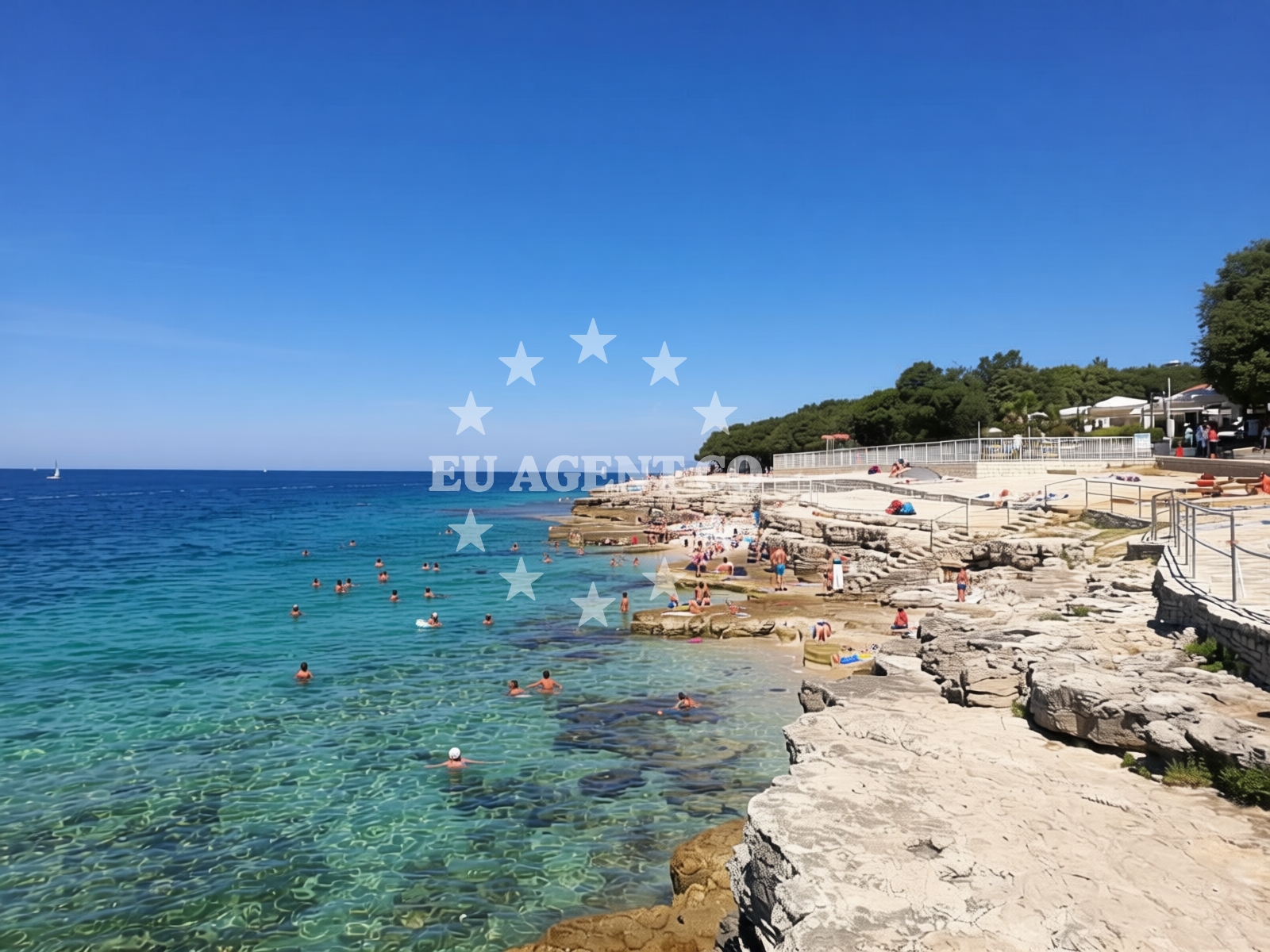
Beach character
The beach's predominant surface is brown pebbles, creating a distinctive texture underfoot. Its moderate depth increase makes it suitable for swimmers, though the pebbles may require caution. The shoreline is 30 meters wide, with a linear profile that extends along the coast. While no formal amenities are listed, the beach's natural setting supports activities like snorkeling and jetskiing.Swimming and shore
Swimming conditions are generally favorable, with pebbles forming the sea floor. The moderate depth increase suggests safe conditions for most swimmers, though the pebble surface may affect comfort. The beach's straight shoreline offers unobstructed views of the Adriatic, making it a visually striking location for leisure activities.Facilities and activities
Lanterna II Beach supports several recreational activities, including snorkeling, beach volleyball, and jetskiing. The absence of formal amenities means visitors should prepare for a natural, unstructured environment. Snorkeling opportunities may be enhanced by the pebbles, which can indicate areas of marine life. Beach volleyball is playable on the open shoreline, and jetski rentals are available for those seeking water-based entertainment.Access and location
Located in Tar, a coastal settlement on the Adriatic, Lanterna II Beach is part of a region known for its accessible coastline and sailing opportunities. The beach's proximity to the broader Tar area connects it to nearby towns and maritime routes. Visitors arriving by land may find access via local roads, though specific parking details are not documented in the beach's authoritative features.What to expect
Lanterna II Beach is characterized by its 1.2 km stretch of brown pebbles and moderate depth increase, creating a natural environment suitable for swimming and water sports. The beach is noted for its accessibility and is recommended for partygoers and leisure seekers. While no formal amenities are listed, the area supports activities such as snorkeling, beach volleyball, and jetskiing. Its location in Tar places it within reach of the Adriatic's sailing routes, offering potential connections to yacht charter experiences in the region.Practical tips
Visitors should consider wearing water shoes to navigate the pebble surface comfortably. The beach's natural setting means facilities like showers or restrooms are not available on-site. Those planning to swim should be mindful of the pebble-covered sea floor, and sun protection is advisable given the open exposure to the Adriatic sun.Exploring the coast by yacht
Lanterna II Beach lies within the Adriatic sailing region, a popular area for yacht charters. The surrounding waters are well-suited for motor yacht and sailboat excursions, with opportunities to explore nearby islands and coastal towns. For those interested in chartering a yacht, Euro-Agent provides access to boats operating in this area, with options to start from nearby marinas and bases.Regional Context
Tar is part of the Split-Dalmatia County in Croatia, a region renowned for its Mediterranean landscapes and historical sites. The area is served by ferry routes connecting to nearby islands such as Brač and Hvar, enhancing its appeal for both land and sea travelers.Anchorages in the surrounding area
Anchorages in the surrounding area include options near Novi grad and Luka Crvar, useful for route planning.
- Anchorage — novigrad istarski — 1.0 NM from beach
- Anchorage — cervar porat — 1.3 NM from beach
- Anchorage — crvar — 1.9 NM from beach
- Anchorage — novigrad istarski — 2.0 NM from beach
- Anchorage — crvar — 2.7 NM from beach
- Anchorage — dalja — 3.9 NM from beach
- Anchorage — lovrecica — 5.2 NM from beach
- Anchorage — porec — 5.5 NM from beach
Distances are straight-line geographic distances, not sailing routes.
Mooring buoys in the surrounding area
Mooring buoys in the surrounding area are located near Novigrad Istarski and Dalja, with references to navigation guides.
- Quay — cervar porat — 1.3 NM from beach
- Buoy field — novigrad istarski — 1.5 NM from beach
- Buoy field — novigrad istarski — 1.8 NM from beach
- Buoy field — dalja — 3.9 NM from beach
- Jetty — dalja — 4.0 NM from beach
Distances are straight-line geographic distances, not sailing routes.
Marine fuel stations
Marine fuel stations in Novigrad Istarski and Porec support refueling near the beach.
- Crodux — novigrad istarski — 1.5 NM from beach
- Fuel station — porec — 4.3 NM from beach
- Ina — porec — 4.3 NM from beach
- Crodux — vrsar — 8.9 NM from beach
Distances are straight-line geographic distances, not sailing routes.
Harbours in the surrounding area
- Novigrad — novigrad istarski — 1.7 NM from beach
- Mirna — novigrad istarski — 1.8 NM from beach
- Harbour Poreč — harbour porec — 4.2 NM from beach
- Jedro — porec — 5.0 NM from beach
- Marina Servis Plava — porec — 5.4 NM from beach
- Hotel Delphin — porec — 6.1 NM from beach
Distances are straight-line geographic distances, not sailing routes.
Marinas in the surrounding area
Marinas in Novigrad Istarski and Porec offer departure bases for yachts near the beach.
- Marina Nautica — novigrad istarski — 1.5 NM from beach
- Marina Červar Porat — marina cervar porat — 1.6 NM from beach
- Marina Poreč — marina porec — 4.4 NM from beach
- Marina Parentium — porec — 5.5 NM from beach
- Marina Funtana — 7.1 NM from beach
Distances are straight-line geographic distances, not sailing routes.
Restaurants near the beach
Restaurants in Cervar Porat and Novigrad Istarski provide dining options near the beach.
- Santa Marina — cervar porat — 1.2 NM from beach
- MaDaLu — cervar porat — 1.3 NM from beach
- Luna — novigrad istarski — 1.3 NM from beach
- Čok — cok — novigrad istarski — 1.3 NM from beach
- Sidro — novigrad istarski — 1.4 NM from beach
- Navigare — novigrad istarski — 1.6 NM from beach
- Ribarica 2 — cervar porat — 1.6 NM from beach
Distances are straight-line geographic distances, not sailing routes.
Navigation guides for the surrounding area
Navigation guides for Novi grad and Poree assist in planning routes from the beach.
- Luka Crvar and Marina Crvar-Porat — 1.3 NM from beach
- Novi grad — 1.5 NM from beach
- Poree — 4.2 NM from beach
- Umag — 8.9 NM from beach
- Limski Kanai — 9.9 NM from beach
Distances are straight-line geographic distances, not sailing routes.
Yachts from nearby departure bases
Sailing yachts
- Bavaria 32 (Wally) — Poreč Marina Funtana — 7.2 NM from departure base to beach
- Bavaria 46 Cruiser (Hansi) — Poreč Marina Funtana — 7.2 NM from departure base to beach
- Bavaria 46 Cruiser (Barbados) — Poreč Marina Funtana — 7.2 NM from departure base to beach
- Bavaria 44 (Franzi) — Poreč Marina Funtana — 7.2 NM from departure base to beach
- Gib Sea 43 (Leonardo) — Poreč Marina Funtana — 7.2 NM from departure base to beach
Catamarans
- Lagoon Power 44 (Monteki) — Poreč Marina Funtana — 7.2 NM from departure base to beach
Motor boats
- Maiora 20 (Sea Heaven) — Marina Novigrad — 1.6 NM from departure base to beach
- AC DC Daycruiser 12.0 — Marina Novigrad — 1.6 NM from departure base to beach
- Prestige 46 Fly (Anima Maris) — Marina Novigrad — 1.6 NM from departure base to beach
- Maiora 20 (Sea Heaven) — Marina Novigrad — 1.6 NM from departure base to beach
Distances are straight-line geographic distances, not sailing routes.