Lanterna Beach, Croatia
Lanterna Beach stretches along the northern coast of the Istrian Peninsula, situated in the village of Vir, Croatia. This 560-meter-long beach features a distinctive shoreline composed of boulders, creating a rugged yet striking natural landscape. While the beach is marked as 'Busy' during high season, its good cleanliness index and proximity to underwater attractions make it a compelling destination for leisure seekers.
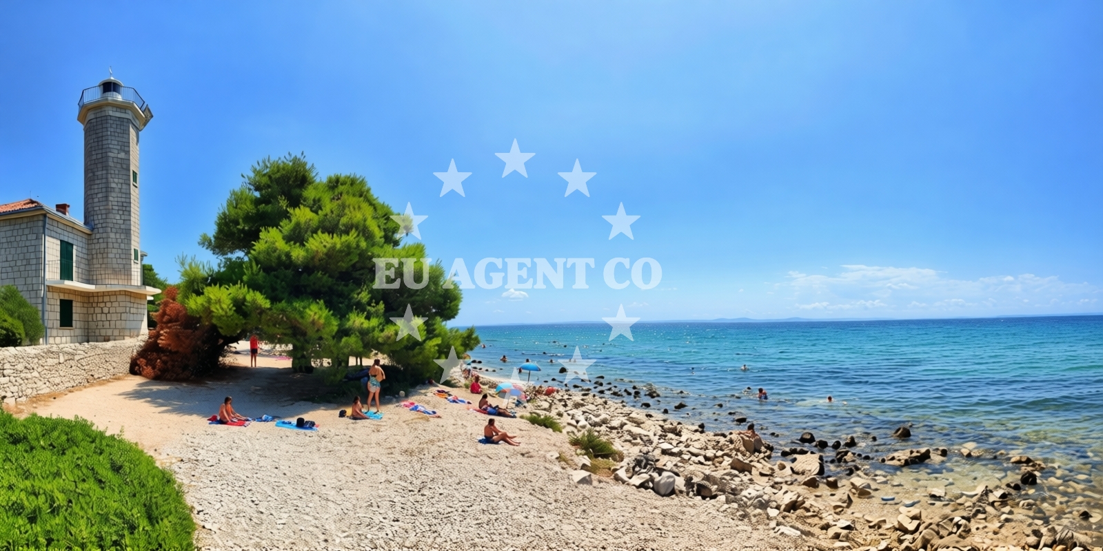
Beach character
The beach's defining characteristic is its straight shoreline, flanked by boulders that extend into the sea. The sea floor mirrors this rocky composition, with a smooth gradient in depth that transitions from the shore to deeper waters. This geological profile creates a unique environment for marine life, which visitors have noted during snorkeling and diving excursions. The beach's natural features, while not accommodating traditional sunbathing setups, provide a raw, unaltered coastal experience.
Swimming and shore
The rocky seabed may present challenges for swimmers seeking shallow, sandy areas. However, the smooth depth increase allows for gradual entry into deeper waters. Visitors have reported using the beach as a starting point for snorkeling and diving trips, suggesting that the shoreline's character complements rather than detracts from water-based activities.
Facilities and activities
No structured amenities are listed for Lanterna Beach itself. However, visitor accounts highlight the beach's association with diving and snorkeling activities. The surrounding area of Vir offers infrastructure for these pursuits, with local operators providing guided excursions to sites like the Wreck Coriolanus, a notable dive destination mentioned in reviews.
Access and location
Lanterna Beach is located at Ulica Radnjača I, Vir, in the Istrian region of Croatia. The exact coordinates (44.30285° N, 15.02628° E) place it along the Adriatic coast, within reach of several coastal towns. For detailed directional guidance, visitors can use the static beach page or explore the beaches map for regional context.
What visitors say
Reviewers have consistently highlighted Lanterna Beach as a destination for water-based adventures. Gerrit Huurman noted a well-organized snorkeling trip with a relaxed atmosphere, while Adrian Ferdinand Meyer praised the opportunity to dive at the Wreck Coriolanus at 29 meters depth. Maximilian Jalea emphasized the quality of service from divemasters, describing the experience as 'really nice' with 'perfect service.'
Practical tips
Given the beach's association with diving, visitors interested in underwater activities may want to contact local operators in advance. The rocky shoreline suggests caution when entering the water, and those seeking sunbathing areas might consider nearby beaches with more sandy expanses.
Exploring the coast by yacht
The Istrian Peninsula, where Lanterna Beach is located, is a well-known sailing destination in the Adriatic. Yacht charter guests exploring this region may find the surrounding waters particularly appealing for diving excursions and coastal cruising. For those interested in anchoring or mooring nearby, the harbors map provides information on local marinas and facilities.
Underwater Exploration Opportunities
Lanterna Beach's proximity to the Wreck Coriolanus, a popular dive site, makes it a strategic location for underwater enthusiasts. Reviews indicate that guided dives to this wreck, located at 29 meters depth, offer encounters with marine life and historical artifacts. The beach serves as a convenient access point for these excursions, which are facilitated by local diving operators.
Anchorages in the surrounding area
Anchorages in the surrounding area include Vir and Lozice.
- Anchorage — vir — 0.5 NM from beach
- Anchorage — lozice — vir — 1.5 NM from beach
- Anchorage — lozice — vir — 1.7 NM from beach
- Anchorage — vir — 2.4 NM from beach
- Anchorage — vir — 2.7 NM from beach
- Anchorage — vir — 2.9 NM from beach
- Anchorage — vir — 3.9 NM from beach
- Anchorage — povljana — pag — 3.9 NM from beach
Distances are straight-line geographic distances, not sailing routes.
Mooring buoys in the surrounding area
Mooring buoys in the surrounding area include Vir and Molat.
- Vir — 2.5 NM from beach
- Jetty — molat — 8.1 NM from beach
- Punta Skala — petrcane — 8.4 NM from beach
- Jetty — sestrunj — 9.2 NM from beach
- Buoy field Brgulje — molat — 9.4 NM from beach
Distances are straight-line geographic distances, not sailing routes.
Marine fuel stations
Marine fuel stations are located in Zadar and Ugljan.
- Ina — zadar — 14.1 NM from beach
- Ina — preko — ugljan — 15.4 NM from beach
- Fuel station — sukosan — 19.0 NM from beach
- Ina — zaglav — dugi otok — 21.8 NM from beach
Distances are straight-line geographic distances, not sailing routes.
Harbours in the surrounding area
Harbours in the surrounding area include Povljana and Privlaka.
- Povljana — pag — 4.1 NM from beach
- Privlaka — 4.5 NM from beach
- Košljun — kosljun pag — 6.0 NM from beach
- Nin — 7.5 NM from beach
- Mulo — nin — 8.4 NM from beach
- Pag — 8.5 NM from beach
Distances are straight-line geographic distances, not sailing routes.
Marinas in the surrounding area
Marinas in the surrounding area include ACI Marina Šimuni and Marina Borik.
- ACI Marina Šimuni — simuni — pag — 10.5 NM from beach
- Marina Veli Rat — dugi otok — 12.3 NM from beach
- Marina Borik — zadar — 13.1 NM from beach
- Vitrenjak Zadar — 13.3 NM from beach
- Olive Island Marina — sutomiscica — ugljan — 13.9 NM from beach
Distances are straight-line geographic distances, not sailing routes.
Restaurants near the beach
Restaurants near the beach include Viranka and Monica in Vir.
- Restaurant — vir — 2.6 NM from beach
- Viranka — 2.6 NM from beach
- Monica — vir — 2.6 NM from beach
- Restaurant — vir — 3.0 NM from beach
- Grill Marion — vir — 3.5 NM from beach
- Restaurant — vir — 4.1 NM from beach
- Lanterna — povljana — pag — 4.2 NM from beach
Distances are straight-line geographic distances, not sailing routes.
Navigation guides for the surrounding area
Navigation guides for the surrounding area include Otok Pag and Privlaka.
- OTOK PAG — 4.0 NM from beach
- Privlaka — 4.7 NM from beach
- Luka Jazi — 7.8 NM from beach
- Uvala Lucina (Molat) Fl.R.3s6m4M — 8.6 NM from beach
- Brguljski Zaljev — 9.5 NM from beach
Distances are straight-line geographic distances, not sailing routes.
Yachts from nearby departure bases
Yachts from nearby departure bases include Povljana Marina and Pag City Port.
Sailing yachts
- First 45 (Egeria) — Šimuni Kolan ACI Marina — 10.6 NM from departure base to beach
- Oceanis 46.1 (Sevid) — Zadar Marina Borik — 13.1 NM from departure base to beach
Catamarans
- Sunreef 60 (SINATA) — Zadar Marina Borik — 13.1 NM from departure base to beach
Motor yachts
- Prestige 460 (ADUDU 2) — Zadar Marina Borik — 13.1 NM from departure base to beach
Motor boats
- Merry Fisher 895 — Povljana Marina — 4.3 NM from departure base to beach
- BWA Sport 22GT (BWA ) — Pag City Port — 8.6 NM from departure base to beach
- Rancraft RS Cinque.5 — Zadar Diklo Port — 11.8 NM from departure base to beach
- Rancraft RM19 (Daycruiser) — Zadar Diklo Port — 11.8 NM from departure base to beach
- Rancraft RM21 (Dugi otok) — Zadar Diklo Port — 11.8 NM from departure base to beach
- Merry Fisher 795 — Zadar Marina Borik — 13.1 NM from departure base to beach
Distances are straight-line geographic distances, not sailing routes.
Frequently asked questions
Are there diving opportunities at Lanterna Beach?
Yes, visitor reviews confirm that Lanterna Beach is a starting point for diving excursions, including trips to the Wreck Coriolanus at 29 meters depth. Local operators provide guided dives to this site.Nearby beaches
Reviews
We did a snorkeling trip. Well organized, nice and relaxed with the booking. Had a nice time
Great Dives to Wreck Coriolanus at 29m and nice reef spots on the coast. Good equipment, experienced guides and very friendly staff!
Good place to go diving. Really nice divemaster with perfect service! I had a really good time diving here. Istria