Kutleša Zapad, Mimice Beach, Croatia
About this beach
Kutleša zapad, Mimice
Beach: Kutleša zapad
Location: Mimice
Characteristics and facilities
Gravel, concrete / stone slabs
30 m
Natural shade
Beach character
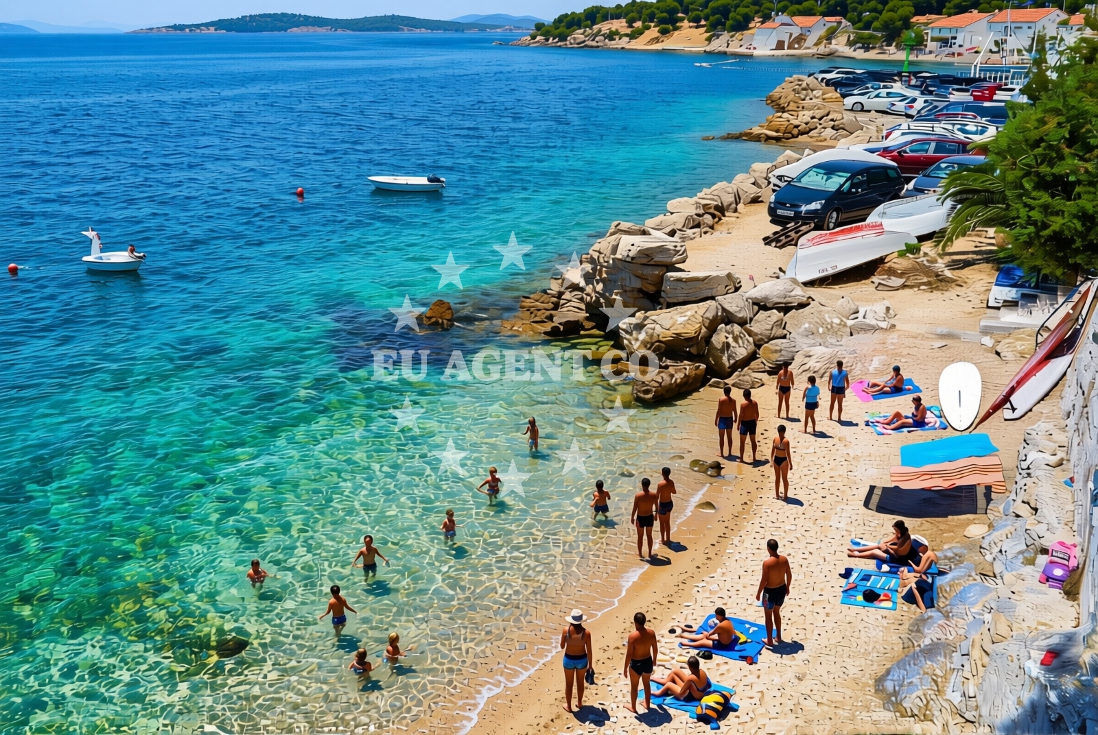
The beach surface consists primarily of gravel and concrete/stone slabs, creating a firm and stable walking area. Natural shade is available along parts of the shore, offering respite from direct sunlight. The beach's straightforward topography makes it particularly suitable for those prioritizing ease of movement over soft sand. No structured facilities or amenities are reported in the beach's authoritative records.Swimming and shore
The shoreline presents a direct access point to the Adriatic Sea, with no specific water depth or swimming conditions documented in the beach's records. The gravel and stone composition of the beach may affect the immediate shoreline's texture but does not appear to impact overall water access.Facilities and activities
No structured facilities, amenities, or activities are explicitly listed in the beach's authoritative records. The absence of formal infrastructure suggests a focus on natural access rather than developed recreational offerings.Access and location
Mimice Beach is positioned on the western side of Kutleša, with coordinates 43.404034°N, 16.809835°E. Its location places it within the broader Adriatic coastline, connecting to the wider Dalmatian coast's network of settlements and maritime routes. The beach's proximity to Mimice suggests potential links to local transportation networks, though specific access details are not documented.What to expect
Visitors should anticipate a beach experience defined by its gravel and stone slab surface, with natural shade available along parts of the shore. The beach appears to prioritize direct access to the sea over developed amenities. Its characteristics make it particularly suitable for those seeking a straightforward shoreline experience rather than a traditional sandy beach environment.Practical tips
Comfortable footwear is recommended due to the gravel and stone slab surface. The natural shade features may provide limited relief from direct sunlight, but visitors should still prepare for exposure in open areas. As no specific facilities are documented, it is advisable to bring personal items for comfort.Exploring the coast by yacht
Mimice Beach's location on the Adriatic coast places it within a region renowned for its sailing opportunities. The nearby waters are part of the broader Adriatic sailing network, which connects to numerous marinas and anchorages along the Dalmatian coast. Yacht charter guests exploring this area may find the surrounding coastline offers opportunities for coastal cruising, though specific marina connections are not detailed in the beach's records.Regional Context
The beach's location in Mimice places it within the municipality of Supetar on the island of Brac. This area is known for its mix of traditional coastal settlements and modern yacht charter infrastructure. The surrounding coastline features a range of beaches, from sandy shores to rocky coves, reflecting the island's diverse coastal geography.Anchorages in the surrounding area
Anchorages in the surrounding area include options in Povlja, Brac, offering nearby mooring points.
- Tri luke — povlja — brac — 3.9 NM from beach
- Anchorage — povlja — brac — 4.0 NM from beach
- Anchorage — povlja — brac — 4.0 NM from beach
- Anchorage — povlja — brac — 4.1 NM from beach
- Anchorage — povlja — brac — 4.1 NM from beach
- Anchorage — povlja — brac — 4.1 NM from beach
- Anchorage — povlja — brac — 4.4 NM from beach
- Anchorage — povlja — brac — 4.4 NM from beach
Distances are straight-line geographic distances, not sailing routes.
Mooring buoys in the surrounding area
Mooring buoys in the surrounding area feature Restaurant Pipo buoys and jetty in Povlja, Brac, along with Quay in Postira.
- Restaurant Pipo buoys — povlja — brac — 3.9 NM from beach
- Restaurant Pipo jetty — povlja — brac — 3.9 NM from beach
- Konoba Rojen jetty — povlja — brac — 4.0 NM from beach
- Quay — postira — brac — 6.0 NM from beach
- Baško Polje — basko polje — baska voda — 7.3 NM from beach
Distances are straight-line geographic distances, not sailing routes.
Marine fuel stations
- Fuel station — sumartin — brac — 7.4 NM from beach
- Fuel station — bol — brac — 11.0 NM from beach
- Ina — makarska — 11.1 NM from beach
- Ina — vrboska — hvar — 14.7 NM from beach
Distances are straight-line geographic distances, not sailing routes.
Harbours in the surrounding area
Harbours in the surrounding area include Mimice Harbour, just 0.07 nm away, alongside Pisak and Pučišća in Brac.
- Mimice — 0.1 NM from beach
- Pisak — 2.2 NM from beach
- Pučišća harbour — pucisca — brac — 4.7 NM from beach
- Stomarica — 4.8 NM from beach
- Omiš — omis — 5.6 NM from beach
- Brela — 5.8 NM from beach
Distances are straight-line geographic distances, not sailing routes.
Marinas in the surrounding area
Marinas in the surrounding area include Marina Baška Voda, Ramova, and Tučepi, with distances ranging from 6.6 nm to 14.73 nm.
- Marina Baška Voda — marina baska voda — 6.6 NM from beach
- Marina Ramova — krvavica — 8.9 NM from beach
- Marina Lav — podstrana — 13.0 NM from beach
- Marina Tučepi — marina tucepi — 13.7 NM from beach
- ACI Marina Vrboska — hvar — 14.7 NM from beach
Distances are straight-line geographic distances, not sailing routes.
Restaurants near the beach
Restaurants near the beach include Hideaway Pipo and Konoba Rojen in Povlja, Brac, and Pizzeria Marin in Pučišća.
- Hideaway Pipo — povlja — brac — 4.0 NM from beach
- Konoba Rojen — povlja — brac — 4.0 NM from beach
- Kala — povlja — brac — 4.4 NM from beach
- Stara Uljara — povlja — brac — 4.4 NM from beach
- Pizzeria Marin — pucisca — brac — 4.7 NM from beach
- Lado — pucisca — brac — 4.8 NM from beach
Distances are straight-line geographic distances, not sailing routes.
Navigation guides for the surrounding area
Navigation guides for the surrounding area cover nearby points such as Uvala Luka, Pucisca, and Dugi Rat (Uvala Orisac).
- Mi mice — 0.1 NM from beach
- Uvala Luka — 3.9 NM from beach
- Pucisca — 4.4 NM from beach
- Omis — 5.3 NM from beach
- Dugi Rat (Uvala Orisac) — 7.6 NM from beach
Distances are straight-line geographic distances, not sailing routes.
Yachts from nearby departure bases
Yachts from nearby departure bases include gulets departing from Omiš City Port and sail boats, motor boats, and catamarans based at Baška Voda Port.
Sailing yachts
- Elan Impression 40 (KARLETA) — Baška Voda Port — 6.5 NM from departure base to beach
- Bavaria Cruiser 37 (AURORA) — Baška Voda — 6.6 NM from departure base to beach
- Sun Odyssey 39i (Mia Pia) — Baška Voda — 6.6 NM from departure base to beach
- Bavaria 50 (Marastina) — Baška Voda — 6.6 NM from departure base to beach
Catamarans
- Lagoon 450 (LAMANTIN) — Baška Voda — 6.6 NM from departure base to beach
Motor yachts
- Canados 86 (Karisma) — Baška Voda — 6.6 NM from departure base to beach
Gulets / Cruisers
- Gulet (Trebenna) — Omiš City Port — 5.5 NM from departure base to beach
- Gulet (Primorac) — Omiš City Port — 5.5 NM from departure base to beach
- Gulet (PATRONICE) — Omiš City Port — 5.7 NM from departure base to beach
Motor boats
- Pearl Sea 31 Hard Top (Aero) — Baška Voda Port — 6.5 NM from departure base to beach
Distances are straight-line geographic distances, not sailing routes.