Kraj Zapad, Zaostrog Beach, Croatia
About this beach
Kraj zapad, Zaostrog
Beach: Kraj zapad
Location: Zaostrog
Characteristics and facilities
Pebbles, gravel, concrete / stone slabs
170 m
Natural shade
Beach character
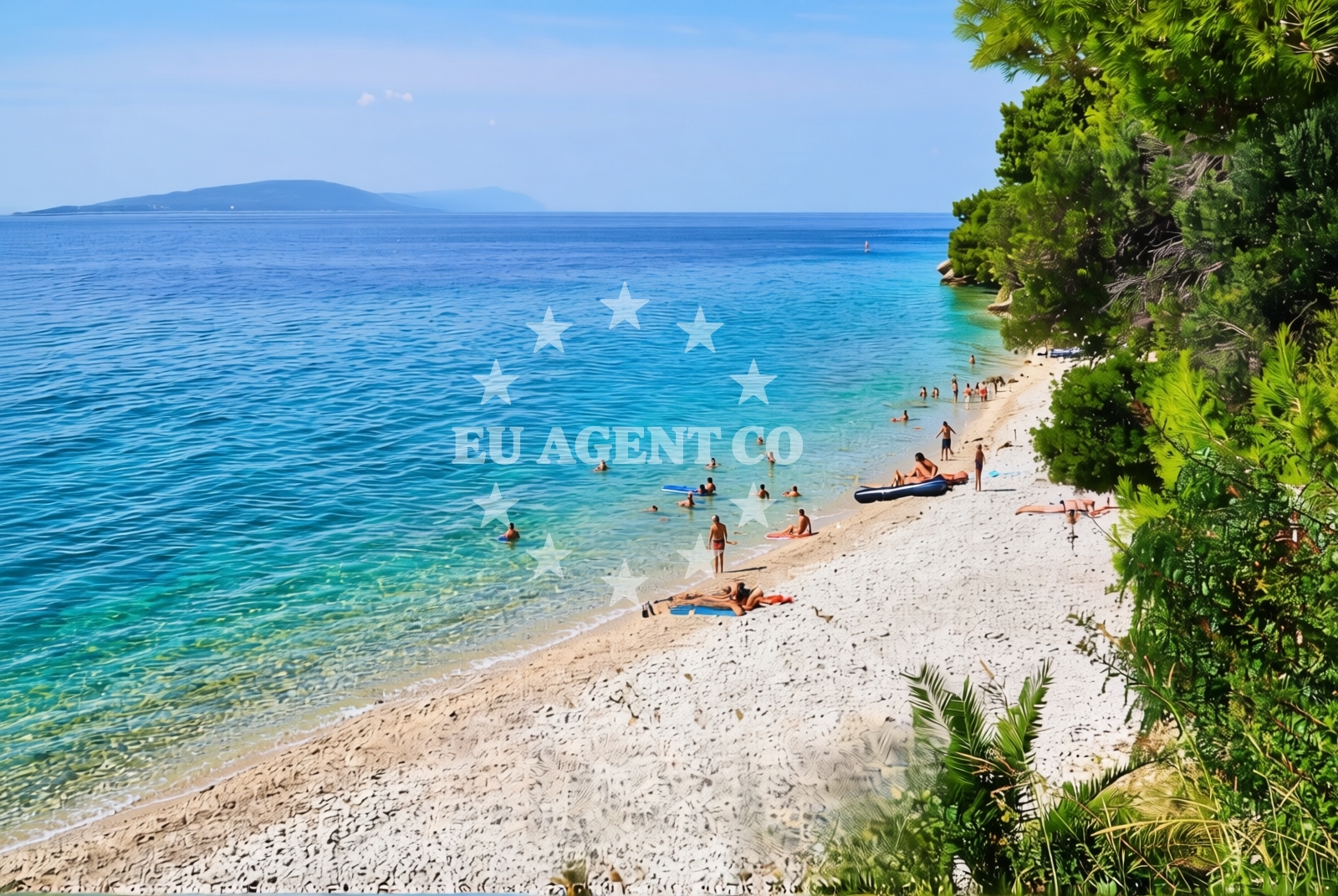
The beach's composition of pebbles and gravel creates a textured walking surface, ideal for those seeking a more rugged coastal experience. The 170-meter length offers a modest stretch of shoreline, with natural shade emerging from the rocky outcrops and vegetation along the coast. The absence of artificial structures or beachside infrastructure preserves the area's authenticity, though visitors should note the lack of facilities such as restrooms, showers, or designated parking areas.Swimming and shore
Swimming conditions at Kraj Zapad depend on tidal movements and wave action, with the pebbly seabed offering a stable but uneven entry point. The shore's natural contours create pockets of sheltered water, though swimmers should exercise caution near the rocky sections. The beach's orientation provides partial protection from prevailing winds, making it a viable option for short swims during calmer periods.Facilities and activities
No formal facilities are present at Kraj Zapad Beach. The shoreline lacks amenities such as lifeguard services, umbrellas, or sunbeds. However, the surrounding area of Zaostrog offers access to local restaurants, shops, and cultural sites. Activities centered on the beach include coastal walking, photography, and exploring the rocky shoreline. The beach's proximity to Zaostrog's historic architecture and the broader Dalmatian Coast provides opportunities for cultural and maritime exploration.Access and location
Kraj Zapad Beach is situated on the western side of Zaostrog, a village in the Split-Dalmatia County of Croatia. The beach is accessible via local roads connecting to Zaostrog's main settlement. While specific parking details are not documented, visitors are advised to follow local signage and respect any informal access agreements with nearby residents. The beach's location places it within reach of Split's maritime infrastructure, including marinas and yacht charter bases.What to expect
Visitors to Kraj Zapad Beach should anticipate a natural, minimally developed shoreline with a pebbly and gravelly composition. The 170-meter stretch offers a quiet, uncommercialized environment, ideal for those seeking solitude or a connection to the region's rugged coastal character. The beach's natural shade provides limited relief from direct sunlight, and visitors are encouraged to bring water, snacks, and appropriate footwear for the uneven terrain. The absence of facilities means self-sufficiency is required for extended stays.Practical tips
Sturdy footwear is recommended for navigating the pebbly shoreline. Sun protection and hydration are essential, given the lack of shaded seating areas. Visitors should respect local guidelines regarding waste disposal and environmental preservation. For those interested in nearby amenities, Zaostrog's village center offers dining and cultural experiences.Exploring the coast by yacht
Kraj Zapad Beach lies within the broader sailing region of the Dalmatian Coast, a popular area for yacht charters. The proximity to Split and the nearby marinas of the region make it a potential stop for sailors exploring the Adriatic. Euro-Agent's yacht search platform can help locate motor yachts and sailing boats operating in this area, with options available for charters departing from Split or nearby bases. The beach's location offers a chance to combine coastal exploration with yacht-based travel along Croatia's southern coast.Historical Context of Zaostrog
Zaostrog is a historic village with roots dating back to the medieval period, known for its fortifications and strategic position along the Adriatic. The village's architecture reflects centuries of Venetian and Ottoman influence, with stone buildings and narrow streets forming a distinct character. Visitors can explore Zaostrog's cultural heritage before heading to Kraj Zapad Beach.Anchorages in the surrounding area
Anchorages near Drvenik and Sucuraj on Hvar offer nearby mooring options.
- Anchorage — drvenik — 1.4 NM from beach
- Anchorage — sucuraj — hvar — 4.1 NM from beach
- Anchorage — sucuraj — hvar — 5.0 NM from beach
- Anchorage — sucuraj — hvar — 5.6 NM from beach
- Anchorage — sucuraj — hvar — 5.8 NM from beach
- Anchorage — selca kod bogomolja — hvar — 5.9 NM from beach
- Anchorage — selca kod bogomolja — hvar — 6.0 NM from beach
- Anchorage — ploce — 6.6 NM from beach
Distances are straight-line geographic distances, not sailing routes.
Mooring buoys in the surrounding area
- Drvenik - Ferry dock — drvenik ferry dock — 1.3 NM from beach
- Brist — 2.5 NM from beach
- Jetty — sucuraj — hvar — 3.9 NM from beach
- Konoba Gambo buoys — selca kod bogomolja — hvar — 7.7 NM from beach
- Kraj - Soline — kraj soline — drasnice — 8.6 NM from beach
Distances are straight-line geographic distances, not sailing routes.
Marine fuel stations
Fuel stations in Ploce and Korcula ensure refueling options for vessels traveling to and from the area.
- Fuel station — ploce — 8.9 NM from beach
- Fuel station — korcula — 12.5 NM from beach
- Ina — makarska — 14.6 NM from beach
- Fuel station — sumartin — brac — 20.0 NM from beach
Distances are straight-line geographic distances, not sailing routes.
Harbours in the surrounding area
- Zaostrog — 0.3 NM from beach
- Drvenik — 1.5 NM from beach
- Gradac — 3.7 NM from beach
- Sućuraj — sucuraj — hvar — 3.9 NM from beach
- Živogošće — zivogosce — 5.8 NM from beach
- Igrane — 6.6 NM from beach
Distances are straight-line geographic distances, not sailing routes.
Marinas in the surrounding area
Marinas in Tučepi and Korcula provide facilities for boat owners exploring the surrounding waters.
- Marina Tučepi — marina tucepi — 11.9 NM from beach
- ACI Marina Korčula — korcula — 12.5 NM from beach
- Marina Lumbarda — korcula — 13.8 NM from beach
- Marina Ramova — krvavica — 16.8 NM from beach
- Marina Baška Voda — marina baska voda — 19.3 NM from beach
Distances are straight-line geographic distances, not sailing routes.
Restaurants near the beach
Restaurants in Sucuraj on Hvar offer dining options for visitors near the beach.
- Riblji Restoran — sucuraj — hvar — 3.9 NM from beach
- Restaurant — sucuraj — hvar — 3.9 NM from beach
Distances are straight-line geographic distances, not sailing routes.
Navigation guides for the surrounding area
Navigation guides for Uvala Drvenik and Otok Hvar assist in planning routes around the area.
- Uvala Drvenik (Donja Vala) — 1.1 NM from beach
- OTOK HVAR — 3.2 NM from beach
- Gradac — 3.9 NM from beach
- Trpanj — 7.8 NM from beach
- Uvala Divna — 7.9 NM from beach
Distances are straight-line geographic distances, not sailing routes.
Yachts from nearby departure bases
Yachts departing from Ploče City Port and Tučepi Port provide access to the surrounding waters and nearby destinations.
Sailing yachts
- Elan 40 Impression (Karleta) — Ploče City Port — 8.8 NM from departure base to beach
- Salona 44 (SAMOA) — Ploče City Port — 8.8 NM from departure base to beach
- More 55 (MRS. ROBINSON) — Ploče City Port — 8.8 NM from departure base to beach
- Sun Odyssey 349 (Porto Tolero) — Ploče City Port — 8.8 NM from departure base to beach
- Elan 514 Impression (Cesarica III) — Ploče City Port — 8.8 NM from departure base to beach
- Sun Odyssey 419 (Luka Ploce) — Ploče City Port — 8.8 NM from departure base to beach
- Sun Odyssey 349 (Visnjica) — Ploče City Port — 8.8 NM from departure base to beach
- Bavaria 40 Cruiser (LADY BUTTERFLY) — Tučepi Port — 12.0 NM from departure base to beach
Catamarans
- Lagoon 450 Fly (Alba Mouse) — Ploče City Port — 8.8 NM from departure base to beach
Motor yachts
- Princess V53 (Chablis) — Makarska Port — 14.3 NM from departure base to beach
Distances are straight-line geographic distances, not sailing routes.