Kotlina, Sveti Juraj Beach, Croatia
Kotlina, Sveti Juraj Beach lies along the Adriatic coast in Croatia, offering a compact shoreline characterized by gravel and concrete/stone slabs. The beach is situated within the settlement of Kotlina, a coastal area known for its proximity to maritime routes and traditional Croatian coastal culture. While the beach itself is short at 50 meters, it is flanked by a restaurant, snack bar, and caffe bar, providing immediate access to refreshments and meals for visitors. The beach’s location makes it a convenient stop for those exploring the region’s coastal towns and sailing routes.
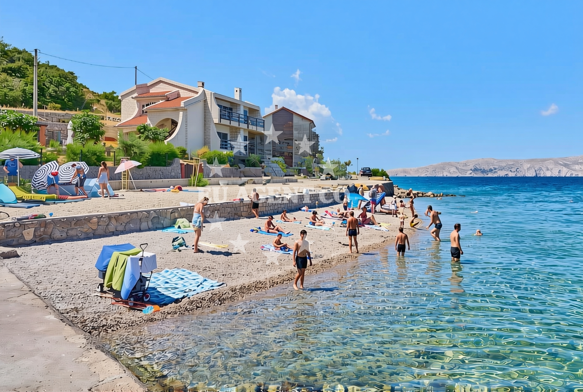
About this beach
Kotlina, Sveti Juraj
Beach: Kotlina
Location: Sveti Juraj
Characteristics and facilities
Gravel, concrete / stone slabs
50 m
Restaurant / snack bar
Caffe bar / Drinks stand
Beach character
The beach surface consists of gravel and concrete/stone slabs, creating a firm and accessible shoreline. Its length of 50 meters is modest, making it suitable for a brief visit or as a resting point during longer excursions. The immediate vicinity includes a restaurant, snack bar, and caffe bar, which cater to visitors seeking light meals, drinks, or snacks. These facilities are positioned within close proximity to the beach, though specific details about their operating hours or seasonal availability are not provided in the catalog.
Swimming and shore
While the beach’s characteristics are described in the catalog, specific details about swimming conditions, water clarity, or shore depth are not included. The gravel and stone-slab surface may influence the swimming experience, but visitors are encouraged to assess conditions directly upon arrival. The beach’s compact size suggests it may be more suited for casual use rather than extended aquatic activities.
Facilities and activities
The beach is accompanied by a restaurant, snack bar, and caffe bar, which are positioned within 50 meters of the shoreline. These facilities provide basic amenities for visitors, though the catalog does not specify whether they offer additional services such as seating, umbrellas, or shade structures. No structured activities are listed in the catalog, indicating that the beach is primarily a passive recreational space.
Access and location
Kotlina, Sveti Juraj Beach is located in the settlement of Kotlina, a coastal area in Croatia. The beach’s coordinates (44.928707°N, 14.917879°E) place it within a region that is part of the broader Adriatic sailing network. While the catalog does not provide explicit details about road access, parking, or pedestrian pathways, the beach’s proximity to dining options suggests it is accessible to visitors traveling by car or on foot from nearby settlements.
What to expect
Visitors to Kotlina, Sveti Juraj Beach should expect a short shoreline composed of gravel and concrete/stone slabs, with immediate access to a restaurant, snack bar, and caffe bar. The beach is best suited for brief stops, casual relaxation, or as a complement to longer excursions along the Adriatic coast. The absence of detailed information about seasonal variations or crowd levels means visitors should prepare for conditions that may change depending on the time of year.
Practical tips
Given the beach’s gravel and stone-slab surface, visitors may wish to wear comfortable footwear. The proximity to dining options suggests that meals and drinks can be obtained on-site, though specific hours of operation are not provided. As with any coastal destination, visitors are advised to check local guidelines regarding environmental protection or seasonal closures.
Exploring the coast by yacht
The beach’s location in Kotlina places it within a region that is popular among sailors and yacht charter guests exploring the Adriatic. Euro-Agent’s yacht charter services operate in this area, connecting visitors to nearby marinas, anchorages, and coastal destinations. While the beach itself is not marked as an anchorage or marina in the catalog, its proximity to Kotlina makes it a potential stop for those traveling along the coast. Yacht charter guests may find the beach useful as a reference point for navigation or as a brief landing spot during longer voyages.
Regional Context and Coastal Exploration
Kotlina is part of a coastal region that blends traditional Croatian settlement with maritime activity. The area is accessible via nearby roads and is within range of several Adriatic sailing routes. Visitors interested in exploring further may find the surrounding coastline to be dotted with similar beaches, marinas, and cultural landmarks. Euro-Agent’s yacht charter services can facilitate travel to these locations, offering access to the broader Adriatic experience.
Anchorages in the surrounding area
Anchorages near St. Juraj and Senj provide nearby mooring options.
- Anchorage — st juraj — 0.2 NM from beach
- Anchorage — zrnovnica — 1.4 NM from beach
- Anchorage — senj — 2.7 NM from beach
- Anchorage — lukovo — 4.5 NM from beach
- Anchorage — senj — 5.3 NM from beach
- Vela Luka — krk — 5.9 NM from beach
- Anchorage — senj — 6.0 NM from beach
- Mala Luka — krk — 6.2 NM from beach
Distances are straight-line geographic distances, not sailing routes.
Mooring buoys in the surrounding area
- Quay — zrnovnica — 1.5 NM from beach
- Quay — zrnovnica — 2.0 NM from beach
- Jetty — krk — 5.8 NM from beach
- Jetty — krk — 6.0 NM from beach
- Quay — goli otok — 7.2 NM from beach
Distances are straight-line geographic distances, not sailing routes.
Marine fuel stations
Fuel stations in Rab, Novi Vinodolski, and Krk serve the surrounding area.
- Ina — rab — 12.2 NM from beach
- INA — novi vinodolski — 13.1 NM from beach
- Flash — krk — 15.7 NM from beach
- Ina — krk — 15.8 NM from beach
Distances are straight-line geographic distances, not sailing routes.
Harbours in the surrounding area
Harbors at St. Juraj and Senj offer direct access to the region.
- St. Juraj — st juraj — 0.1 NM from beach
- Senj — 3.8 NM from beach
- Lukovo — 4.5 NM from beach
- Melna — goli otok — 7.0 NM from beach
- Baška — baska — krk — 7.1 NM from beach
- Starigrad — starigrad senj — 8.0 NM from beach
Distances are straight-line geographic distances, not sailing routes.
Marinas in the surrounding area
Marinas in Rab, Novi Vinodolski, and Krk cater to nearby yachts.
- ACI Marina Supetarska Draga — rab — 11.2 NM from beach
- ACI Marina Rab — 12.2 NM from beach
- Mitan Marina — novi vinodolski — 12.5 NM from beach
- Marina Novi — novi vinodolski — 13.1 NM from beach
- Marina Punat — krk — 13.8 NM from beach
Distances are straight-line geographic distances, not sailing routes.
Restaurants near the beach
A restaurant in Senj is situated near the beach area.
- Riva — senj — 3.8 NM from beach
Distances are straight-line geographic distances, not sailing routes.
Navigation guides for the surrounding area
Navigation guides for Jurjevo, Senj, and Uvala Sv. Jelena aid route planning.
- Jurjevo (Luka Sv. Juraj) — 0.3 NM from beach
- Senj — 3.7 NM from beach
- Uvala Sv. Jelena — 5.3 NM from beach
- Uvala Vela Luka — 5.6 NM from beach
- Baška — 6.9 NM from beach
Distances are straight-line geographic distances, not sailing routes.
Yachts from nearby departure bases
Sailing yachts
- Bavaria C38 (Popaj) — Vinodolski Novi Marina — 13.1 NM from departure base to beach
- Elan 494 Impression (LUCIJA I) — Vinodolski Novi Marina — 13.1 NM from departure base to beach
- Bavaria Cruiser 46 (Alexandra) — Vinodolski Novi Marina — 13.1 NM from departure base to beach
- Hanse 458 (DELTA) — Vinodolski Novi Marina — 13.1 NM from departure base to beach
Catamarans
- Bali 4.6 (MY QUEEN) — Vinodolski Novi Marina — 13.1 NM from departure base to beach
- Aventura 37 (THOMAS) — Vinodolski Novi Marina — 13.1 NM from departure base to beach
- Bali 5.4 (Joza) — Vinodolski Novi Marina — 13.1 NM from departure base to beach
Motor yachts
- Absolute 50 Fly (Acrobat) — Rab ACI Marina — 12.2 NM from departure base to beach
- Galeon 700 (Obsession two) — Vinodolski Novi Mitan Marina — 12.5 NM from departure base to beach
Motor boats
- Adriana 36 (Gaja) — Vinodolski Novi Marina — 13.1 NM from departure base to beach
Distances are straight-line geographic distances, not sailing routes.