Kotice Jug, Pag (Pag) Beach, Croatia
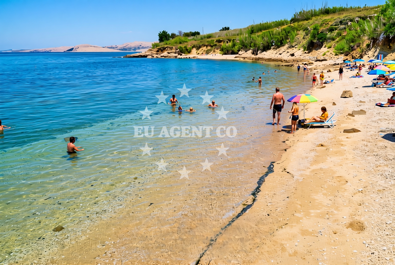
Kotice Jug Beach lies on the rugged southern coast of Pag Island, a windswept stretch of the Dalmatian coast known for its dramatic cliffs, salt pans, and ancient fortifications. This 100-meter-long shore is composed of gravel and rocky outcrops, offering a stark contrast to Pag’s more famous sandy beaches. While not a place for sunbathing on soft sand, it provides a unique vantage point for those seeking solitude or a closer look at the island’s raw natural landscape.
About this beach
Kotice jug, Pag (Pag)
Beach: Kotice jug
Location: Pag (Pag)
Characteristics and facilities
Gravel, rocks
100 m
Beach character
The beach’s gravel and rock composition defines its character. Unlike the fine sands of Pag’s northern shores, Kotice Jug is a more rugged experience, with uneven terrain that may challenge barefoot walkers. The shoreline is interspersed with boulders and shallow pools, creating a mosaic of textures that shift with the tide. This beach is not marked by amenities, but its isolation makes it a quiet refuge, far from the crowds that gather at Pag’s more accessible coves.
Swimming and shore
Swimming conditions here are dictated by the rocky seabed and the island’s exposure to the Adriatic’s currents. The water, however, is typically clear and cool, reflecting Pag’s reputation for pristine marine environments. The shore’s uneven surface may make it difficult for young children or those unaccustomed to rocky terrain, but it offers opportunities for exploring tide pools and spotting marine life such as sea urchins and small fish. The beach’s orientation toward the open sea means it is more exposed to wind and waves than sheltered coves, making it a less predictable spot for swimming.
Facilities and activities
No formal facilities are listed for Kotice Jug Beach, aligning with Pag’s trend of minimal infrastructure in its more remote coastal areas. Activities here are limited to walking along the shore, exploring the rocky terrain, and admiring the unobstructed views of the Adriatic. The beach’s proximity to Pag’s salt pans and historical sites like the Pag Fortress may offer indirect opportunities for cultural exploration, though these are not directly accessible from the shore.
Access and location
Located on the southern tip of Pag Island, Kotice Jug is accessible by car via the island’s main road, which connects to the mainland through the narrowist point of the island. The beach is part of a coastline that is less frequented by tourists, making it a secluded option for visitors seeking privacy. Pag itself is reachable by ferry from Zadar, Šibenik, or Split, with car ferries available for those wishing to explore the island independently. The beach’s position on the island’s southernmost point means it is often the last stop for drivers arriving from the mainland.
What to expect
Visitors to Kotice Jug should expect a beach that prioritizes natural beauty over comfort. The gravel and rock terrain requires sturdy footwear, and the lack of amenities means this is not a place for extended stays. The beach is best suited for those who appreciate solitude, dramatic coastal vistas, and the opportunity to observe Pag’s untouched landscapes. Its remoteness ensures a peaceful atmosphere, though it may not appeal to those seeking modern conveniences or family-friendly facilities.
Practical tips
Bring a towel or mat to sit on the gravel, and wear closed-toe shoes to navigate the rocky shore. The beach’s exposure to wind means it can be cooler than other spots on Pag, even in summer. Arrive early to enjoy the quietest hours before the rare visitors who make the journey to this remote stretch of coastline.
Exploring the coast by yacht
For yacht charter guests, Pag’s southern coast offers a dramatic sailing backdrop. The area around Kotice Jug is part of a broader sailing region that includes the islands of Hvar, Brac, and Solta, all accessible via short yacht trips. Euro-Agent’s yacht search page can help identify vessels suited for exploring Pag’s rugged coastline, with options ranging from motor yachts to sailboats. Anchorages near the island’s southern tip provide a convenient base for exploring both the beach and the surrounding waters, though marina facilities are limited to the island’s northern and central areas.
Historical Context of Pag Island
Pag’s history is deeply tied to its natural environment. The island has been inhabited since prehistoric times, with evidence of ancient Illyrian and Roman settlements. The salt pans that dominate much of the island’s interior have been in operation for centuries, shaping both the landscape and the local economy. Kotice Jug, while not a historical site itself, lies near the remnants of Pag’s medieval fortifications, which were built to defend against invasions by Venetian and Ottoman forces.
Anchorages in the surrounding area
Anchorages in the surrounding area include Proboj, Mazurani, Kosljun Pag, and Tihovac.
- Anchorage — proboj — pag — 3.5 NM from beach
- Anchorage — mazurani — 3.9 NM from beach
- Anchorage — mazurani — 3.9 NM from beach
- Anchorage — kosljun pag — 4.2 NM from beach
- Tihovac — kosljun pag — 4.3 NM from beach
- Anchorage — maun — 5.1 NM from beach
- Mlinica — kosljun pag — 5.8 NM from beach
- Anchorage — cesarica — 6.0 NM from beach
Distances are straight-line geographic distances, not sailing routes.
Mooring buoys in the surrounding area
Mooring buoys in the surrounding area include Simuni, Zubovici, and Novalja.
- Jetty — simuni — pag — 3.4 NM from beach
- Jetty — zubovici — pag — 4.6 NM from beach
- Jetty — zubovici — pag — 4.8 NM from beach
- Buoy field — novalja — pag — 9.5 NM from beach
- Vir — 9.9 NM from beach
Distances are straight-line geographic distances, not sailing routes.
Marine fuel stations
- Ina — rab — 21.6 NM from beach
- Ina — zadar — 22.0 NM from beach
- Ina — preko — ugljan — 23.9 NM from beach
- Ina — mali losinj — 25.4 NM from beach
Distances are straight-line geographic distances, not sailing routes.
Harbours in the surrounding area
Harbours in the surrounding area include Pag, Karlobag, Košljun, Lukovo Šugarje, Povljana, and Žigljen.
- Pag — 1.0 NM from beach
- Karlobag — 4.0 NM from beach
- Košljun — kosljun pag — 4.1 NM from beach
- Lukovo Šugarje — lukovo sugarje — rudelici — 5.7 NM from beach
- Povljana — pag — 7.3 NM from beach
- Žigljen — zigljen — pag — 8.4 NM from beach
Distances are straight-line geographic distances, not sailing routes.
Marinas in the surrounding area
Marinas in the surrounding area include ACI Marina Šimuni, Marina Veli Rat, and Marina Borik.
- ACI Marina Šimuni — simuni — pag — 4.0 NM from beach
- Marina Veli Rat — dugi otok — 20.9 NM from beach
- Marina Borik — zadar — 21.0 NM from beach
- Vitrenjak Zadar — 21.3 NM from beach
- ACI Marina Rab — 21.6 NM from beach
Distances are straight-line geographic distances, not sailing routes.
Restaurants near the beach
Restaurants near the beach include Konoba Bile, Dubrava, and Pizzeria Villa Olea in Simuni.
- Konoba Bile — pag — 1.0 NM from beach
- Dubrava — pag — 1.0 NM from beach
- Pizzeria Villa Olea — simuni — pag — 3.7 NM from beach
- Didova Kuča — simuni — pag — 3.8 NM from beach
- Bistro Šimuni — simuni — pag — 3.9 NM from beach
- Ribarska Koliba Šimuni — simuni — pag — 3.9 NM from beach
- Maestral — simuni — pag — 4.1 NM from beach
Distances are straight-line geographic distances, not sailing routes.
Navigation guides for the surrounding area
Navigation guides for the surrounding area include Uvala Bliznica, Caska, and Novalja.
- Uvala Bliznica — 4.0 NM from beach
- Caska — 7.4 NM from beach
- Novalja — 8.9 NM from beach
- Uvala Prizna — 9.1 NM from beach
- OTOK PAG — 9.1 NM from beach
Distances are straight-line geographic distances, not sailing routes.
Yachts from nearby departure bases
Yachts from nearby departure bases include those from Pag City Port, Šimuni Kolan ACI Marina, and Zadar Diklo Port.
Sailing yachts
- First 45 (Egeria) — Šimuni Kolan ACI Marina — 4.1 NM from departure base to beach
- Dufour 450 Grand (Tibitoo) — Zadar Marina Borik — 21.0 NM from departure base to beach
Catamarans
- Leopard 50 (Solaia) — Zadar Marina Borik — 21.0 NM from departure base to beach
Motor boats
- BWA Sport 22GT (BWA ) — Pag City Port — 1.0 NM from departure base to beach
- Merry Fisher 895 — Povljana Marina — 7.2 NM from departure base to beach
- Balt 818 Titanium (Valentina 2) — Novalja — 9.2 NM from departure base to beach
- Balt 818 Titanium (Valentina) — Novalja — 9.2 NM from departure base to beach
- Rancraft RS Cinque.5 — Zadar Diklo Port — 19.7 NM from departure base to beach
- Rancraft RM21 (Dugi otok) — Zadar Diklo Port — 19.7 NM from departure base to beach
- Rancraft RM19 (Daycruiser) — Zadar Diklo Port — 19.7 NM from departure base to beach
Distances are straight-line geographic distances, not sailing routes.