Koromačina, Cesarica Beach, Croatia
6 photos
About this beach
Koromačina, Cesarica
Beach: Koromačina
Location: Cesarica
Characteristics and facilities
Gravel, rocks
Beach character
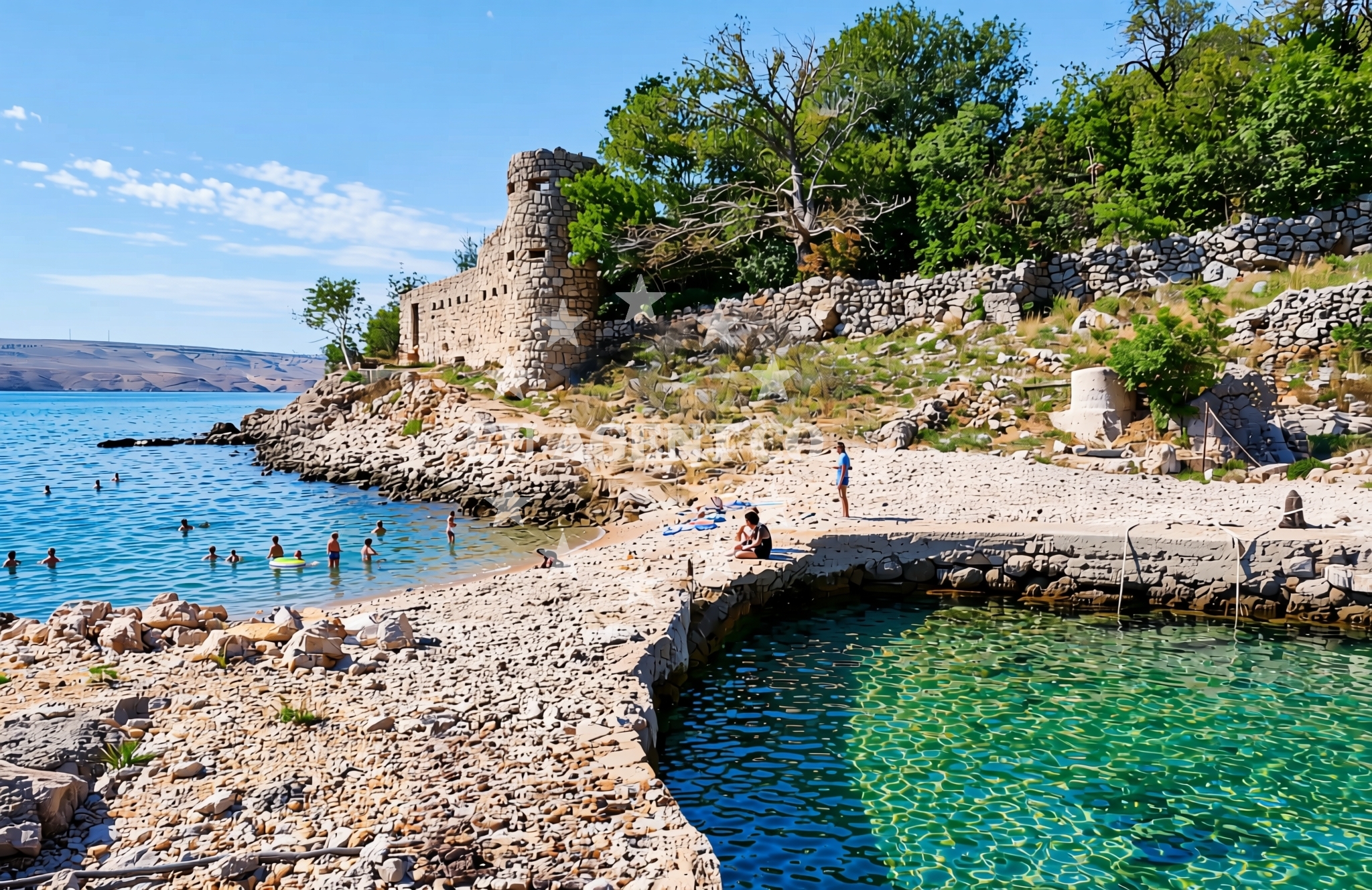
The beach is defined by its gravel and rocky composition, a feature common to many shores in this part of Croatia. This terrain suggests a shoreline that is less suited for traditional sunbathing but more appealing to those seeking a rugged, untamed coastal experience. The absence of sand and the presence of stones indicate a beach that may be more accessible during low tide, when the gravel beds are exposed. Visitors should expect a landscape that prioritizes natural beauty over convenience, with the potential for unique rock formations and tidal pools to explore.Swimming and shore
Swimming conditions at Koromačina, Cesarica Beach are influenced by its rocky shoreline. While the beach may not offer extensive shallow areas for swimming, the surrounding waters are known for their clarity and moderate currents. The gravel beds could provide stable footing for wading or exploring tidal pools, though caution is advised during high tide. The lack of formal swimming facilities means visitors should approach the water with awareness of the natural terrain and local weather conditions.Facilities and activities
There are no formal facilities or structured activities listed for this beach. The gravel and rock composition suggests a focus on passive enjoyment of the natural landscape rather than organized recreation. However, the broader Koromačina area may offer opportunities for hiking, cycling, or exploring nearby settlements. The absence of listed amenities means visitors should plan accordingly, bringing their own supplies and expecting a beach experience centered on natural scenery rather than infrastructure.Access and location
Koromačina, Cesarica Beach is located in the village of Koromačina, a small coastal settlement on the island of Brač. The coordinates (44.581849, 14.985827) place it near the northern coast of Brač, a region known for its limestone cliffs and traditional fishing villages. Access to the beach likely involves a combination of road travel to Koromačina and a short walk or local transport to the shoreline. The village itself is part of a network of coastal towns that serve as starting points for yacht charters, sailing excursions, and land-based exploration of the Adriatic.What to expect
Visitors to Koromačina, Cesarica Beach should prepare for a landscape dominated by gravel and rock, with minimal formal infrastructure. The beach is best suited for those seeking a connection to the natural coastline rather than a traditional sandy shore. The surrounding area offers opportunities to explore Brač’s rugged terrain, including its famous Zlatni Rat beach and the island’s vineyards. While the beach itself lacks amenities, the broader region supports yacht charter operations, with nearby marinas and sailing routes that cater to both experienced sailors and charter guests.Practical tips
Due to the gravel and rocky nature of the beach, visitors should wear sturdy footwear for walking along the shoreline. The absence of formal facilities means bringing personal supplies for meals, shade, and hydration is essential. The beach’s location near Koromačina village provides access to local services, though amenities may be limited compared to larger coastal towns.Exploring the coast by yacht
For yacht charter guests, the proximity of Koromačina to Brač’s marinas and sailing routes offers a strategic base for exploring the central Dalmatian coast. The area is part of a popular sailing region, with routes extending to nearby islands such as Hvar, Vis, and the Pelješac Peninsula. Yacht charter companies operating in this area often highlight the region’s combination of sheltered bays, open sea sailing, and cultural landmarks. While the beach itself is not a docking point, its location provides a reference point for navigating the coastline and planning excursions to other destinations.Regional Context and Coastal Features
The beach lies within a stretch of coast that is part of Brač’s northern shoreline, a region characterized by limestone cliffs, olive groves, and traditional stone houses. The island of Brač itself is a hub for both land and sea-based tourism, with its famous white stone used in construction across the Adriatic. The surrounding waters are part of a larger sailing area that includes the Split archipelago and the islands of Šolta and Čiovo, offering diverse sailing conditions from sheltered bays to open sea routes.Anchorages in the surrounding area
- Anchorage — cesarica — 0.9 NM from beach
- Anchorage — prizna — 1.1 NM from beach
- Anchorage — cesarica — 1.9 NM from beach
- Anchorage — cesarica — 2.2 NM from beach
- Anchorage — pag — 3.1 NM from beach
- Anchorage — prizna — 3.1 NM from beach
- Anchorage — pag — 3.3 NM from beach
- Anchorage — novalja — pag — 3.5 NM from beach
Distances are straight-line geographic distances, not sailing routes.
Mooring buoys in the surrounding area
- Jetty — zubovici — pag — 3.6 NM from beach
- Jetty — zubovici — pag — 3.6 NM from beach
- Buoy field — novalja — pag — 4.9 NM from beach
- Drljanda — stara novalja — pag — 5.0 NM from beach
- Jetty — simuni — pag — 7.3 NM from beach
Distances are straight-line geographic distances, not sailing routes.
Marine fuel stations
- Ina — rab — 14.2 NM from beach
- Ina — mali losinj — 22.5 NM from beach
- Adria Oil — mali losinj — 22.8 NM from beach
- Tifon — nerezine — losinj — 25.7 NM from beach
Distances are straight-line geographic distances, not sailing routes.
Harbours in the surrounding area
- Prizna — 1.4 NM from beach
- Žigljen — zigljen — pag — 1.6 NM from beach
- Stara Novalja — pag — 4.8 NM from beach
- Novalja — pag — 4.9 NM from beach
- Karlobag — 5.0 NM from beach
- Jablanac — 8.3 NM from beach
Distances are straight-line geographic distances, not sailing routes.
Marinas in the surrounding area
- ACI Marina Šimuni — simuni — pag — 6.8 NM from beach
- ACI Marina Rab — 14.2 NM from beach
- ACI Marina Supetarska Draga — rab — 17.3 NM from beach
- Y/C Marina Mali Lošinj — mali losinj — 22.6 NM from beach
- Marina Lošinj — mali losinj — 22.8 NM from beach
Distances are straight-line geographic distances, not sailing routes.
Restaurants near the beach
- Konoba Antika — novalja — pag — 4.6 NM from beach
- Restaurant — novalja — pag — 4.6 NM from beach
- Restaurant — novalja — pag — 4.6 NM from beach
- No. 5 — novalja — pag — 4.6 NM from beach
- Moby Dick — novalja — pag — 4.6 NM from beach
- La Paloma — novalja — pag — 4.6 NM from beach
- Konoba 85 — novalja — pag — 4.6 NM from beach
Distances are straight-line geographic distances, not sailing routes.
Navigation guides for the surrounding area
- Uvala Prizna — 1.3 NM from beach
- Caska — 3.4 NM from beach
- Novalja — 4.5 NM from beach
- Uvala Zavratnica — 7.9 NM from beach
- Jablanac — 8.3 NM from beach
Distances are straight-line geographic distances, not sailing routes.
Yachts from nearby departure bases
Sailing yachts
- First 45 (Egeria) — Šimuni Kolan ACI Marina — 6.7 NM from departure base to beach
- First 31.7 (Ruta) — Mali Lošinj — 22.6 NM from departure base to beach
- Elan 50 Impression (Vuschi) — Mali Lošinj — 22.6 NM from departure base to beach
Motor yachts
- Absolute 50 Fly (Acrobat) — Rab ACI Marina — 14.2 NM from departure base to beach
Motor boats
- Balt 818 Titanium (Valentina) — Novalja — 4.7 NM from departure base to beach
- Balt 818 Titanium (Valentina 2) — Novalja — 4.7 NM from departure base to beach
- BWA Sport 22GT (BWA ) — Pag City Port — 8.7 NM from departure base to beach
- Merry Fisher 895 — Povljana Marina — 14.9 NM from departure base to beach
- Galeon Galia 630 (287670ML) — Mali Lošinj — 22.6 NM from departure base to beach
- Invictus 200FX (1255ML) — Mali Lošinj — 22.6 NM from departure base to beach
Distances are straight-line geographic distances, not sailing routes.
Frequently asked questions
Is Koromačina, Cesarica Beach suitable for swimming?
The beach’s gravel and rocky terrain suggests swimming may be limited to tidal pools and shallow areas. Visitors should assess conditions carefully and be mindful of the natural landscape.Are there nearby marinas or yacht charter services?
Yes, the village of Koromačina and nearby areas on Brač offer marinas and yacht charter services, making it a convenient base for exploring the central Dalmatian coast.Nearby beaches
Dražica, Prizna Beach
Dražica
0.3 km
Žalce, Prizna
Žalce
0.3 km
Jurišnica, Cesarica Beach
Jurišnica
0.9 km
Sveti Antun, Prizna Beach
Sveti Antun
2.5 km
Cesarica: beaches and coves (13)
Cesarica
3.4 km
Cesarica, Cesarica Beach
Cesarica
3.4 km
Sveta Jelena, Cesarica Beach
Sveta Jelena
3.5 km
Cesarica beach
Cesarica, Cesarica
4.1 km