Komodor sredina, Kučište Beach, Croatia
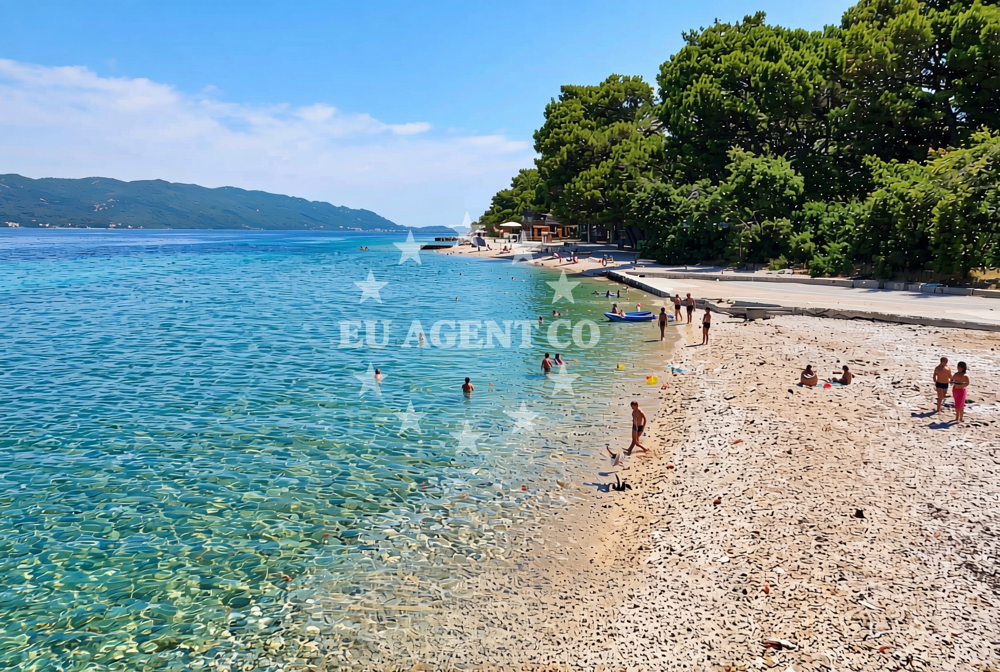
About this beach
Komodor sredina, Kučište
Beach: Komodor sredina
Location: Kučište
Characteristics and facilities
Pebbles, gravel, concrete / stone slabs
50 m
Restaurant / snack bar
Caffe bar / Drinks stand
Natural shade
Children's playground
Beach character
The beach's shoreline is composed of pebbles, gravel, and concrete/stone slabs, typical of the region's coastal geology. The 50-meter length provides a modest area for visitors, though the presence of natural shade and a nearby children's playground adds functional appeal. The absence of sand means visitors should consider footwear suited for rocky terrain. The beach is served by a restaurant and snack bar, offering basic refreshments, while a café bar and drinks stand cater to casual needs.Swimming and shore
Swimming conditions at Kučište Beach depend on tidal movements and wave action, which can make the pebble shore less ideal for prolonged water activities. The beach's short length and rocky composition mean it is better suited for brief dips or wading than for swimming. The shore's natural contours provide some shelter from direct wind exposure, though larger waves may affect comfort during peak hours.Facilities and activities
Facilities at the beach include a restaurant and snack bar for meals, a café bar and drinks stand for refreshments, and a children's playground for younger visitors. There are no explicit mentions of showers, toilets, or parking in the catalog, so these should not be assumed. The beach does not list structured activities beyond the playground, though the surrounding area may offer opportunities for coastal walks or boat access.Access and location
Kučište Beach is located in Komodor sredina, a coastal settlement on the Croatian Adriatic. The area is part of a broader region with limited road infrastructure, meaning access may require local transportation or walking from nearby settlements. The beach's proximity to maritime routes suggests it could be reachable by boat, though specific anchorage or marina details are not provided in the catalog.What to expect
Visitors should expect a compact beach with a pebble and gravel shoreline, suitable for brief water interactions but not for extended swimming. The beach includes a restaurant, café bar, and children's playground, making it a functional spot for short stays. The lack of detailed amenities means visitors should plan for basic facilities. The beach's location in Komodor sredina positions it near coastal routes, though specific access details for yachts or vehicles are not outlined in the catalog.Practical tips
Consider wearing sturdy footwear for the pebble shoreline. The beach's limited size means it may become crowded during peak hours. Check local hours for the restaurant and café bar, as these may influence visit timing.Exploring the coast by yacht
The proximity of Kučište Beach to maritime routes suggests it may be accessible to yachts exploring the southern Adriatic. For detailed sailing information, including nearby anchorages or marinas, visitors can consult Euro-Agent's beaches map or yacht search tools. The surrounding coast offers opportunities for coastal cruising, though specific distances or routes are not detailed in this beach's catalog.Regional Context
Komodor sredina is part of the Dubrovnik-Neretva County, an area known for its historical sites and coastal trails. The beach's location near the Pelješac Peninsula may connect it to broader Adriatic sailing routes, though specific maritime details require further exploration.Anchorages in the surrounding area
- Anchorage — korcula — 1.1 NM from beach
- Anchorage — korcula — 1.4 NM from beach
- Anchorage — korcula — 1.4 NM from beach
- Anchorage — korcula — 1.6 NM from beach
- Anchorage — korcula — 1.7 NM from beach
- Anchorage — badija — 2.0 NM from beach
- Anchorage — lumbarda — korcula — 3.0 NM from beach
- Anchorage — korcula — 3.8 NM from beach
Distances are straight-line geographic distances, not sailing routes.
Mooring buoys in the surrounding area
- Jetty — korcula — 1.4 NM from beach
- Fuel jetty — korcula — 1.4 NM from beach
- Restaurant Moro buoys — stupe — 2.6 NM from beach
- Vrnik Arts Club buoys — 2.6 NM from beach
- Quay — vrnik — 2.7 NM from beach
Distances are straight-line geographic distances, not sailing routes.
Marine fuel stations
- Fuel station — korcula — 1.4 NM from beach
- Fuel station — ploce — 14.0 NM from beach
- Ina — vela luka — korcula — 18.4 NM from beach
- Ina — ubli — lastovo — 19.4 NM from beach
Distances are straight-line geographic distances, not sailing routes.
Harbours in the surrounding area
- Korčula W harbour — korcula — 0.8 NM from beach
- Kučišće — kucisce — 0.9 NM from beach
- Korčula E harbour — korcula — 0.9 NM from beach
- Viganj — 1.5 NM from beach
- Orebić — orebic — 1.8 NM from beach
- Duba — duba peljeska — 3.4 NM from beach
Distances are straight-line geographic distances, not sailing routes.
Marinas in the surrounding area
- ACI Marina Korčula — korcula — 1.0 NM from beach
- Marina Lumbarda — korcula — 3.5 NM from beach
- Marina Tučepi — marina tucepi — 17.6 NM from beach
- Marina Korkyra — vela luka — korcula — 18.5 NM from beach
- Marina Solitudo — lastovo — 18.6 NM from beach
Distances are straight-line geographic distances, not sailing routes.
Restaurants near the beach
- Restaurant — korcula — 0.8 NM from beach
- Restaurant — korcula — 0.8 NM from beach
- Adio Mare — korcula — 0.8 NM from beach
- Restaurant Filippi — korcula — 0.8 NM from beach
- Restaurant Lesic Dimitri — korcula — 0.8 NM from beach
- Aterina — korcula — 0.8 NM from beach
- Restaurant — korcula — 0.9 NM from beach
Distances are straight-line geographic distances, not sailing routes.
Navigation guides for the surrounding area
- Uvala Banja — 1.1 NM from beach
- Uvala Vrbovica — 1.4 NM from beach
- Otocic Badija — 2.0 NM from beach
- Orebic — 2.1 NM from beach
- Uvala Racisce — 3.2 NM from beach
Distances are straight-line geographic distances, not sailing routes.
Yachts from nearby departure bases
Sailing yachts
- Elan 40 Impression (Karleta) — Ploče City Port — 13.9 NM from departure base to beach
- Sun Odyssey 349 (Porto Tolero) — Ploče City Port — 13.9 NM from departure base to beach
- Salona 44 (SAMOA) — Ploče City Port — 13.9 NM from departure base to beach
- Sun Odyssey 419 (Luka Ploce) — Ploče City Port — 13.9 NM from departure base to beach
- Elan 514 Impression (Cesarica III) — Ploče City Port — 13.9 NM from departure base to beach
- More 55 (MRS. ROBINSON) — Ploče City Port — 13.9 NM from departure base to beach
- Sun Odyssey 349 (Visnjica) — Ploče City Port — 13.9 NM from departure base to beach
- Bavaria 40 Cruiser (LADY BUTTERFLY) — Tučepi Port — 17.6 NM from departure base to beach
Catamarans
- Lagoon 450 Fly (Alba Mouse) — Ploče City Port — 13.9 NM from departure base to beach
Motor yachts
- Princess V53 (Chablis) — Makarska Port — 19.7 NM from departure base to beach
Distances are straight-line geographic distances, not sailing routes.